Experience the natural beauty and rich history of Timucuan Ecological and Historic Preserve, a U.S. National Preserve. In fact we learned, there are many fascinating facts about Timucuan Ecological Historic Preserve. The reserve safeguards valuable natural habitats in northeastern Duval County, including coastal dunes, salt marshes, and waterways. For us, it was a trip back in time as we discover 6,000 years of human history. “Where the Waters Meet” is what the indigenous peoples called it. The Nassau and St Johns River join to make one of the largest saltwater estuaries.

Often overlooked, Timucuan Ecological and Historic Preserve is a patchwork of public lands dotted with a variety of historic and cultural sites. This diverse park appeals to outdoor enthusiasts. Often they are looking for solitude, kayaking Simpson Creek, boating or fishing the marshy shoreline. Others venture for the unspoiled nature, hoping to glimpse migratory birds or native wildlife that find sanctuary here.

This post may contain affiliate links, meaning if you purchase something through one of these links, we may earn a small commission at no extra cost to you! Read the full disclosure policy here.
Table of Contents
Where is the Timucuan Ecological and Historic Preserve?
Timucuan Ecological And Historic Preserve is a simple day trip from Orlando. Just outside Jacksonville, along the St. John’s River in North Florida, this park covers 46,000 acres of wetland marsh, tidal waterways, and upland forest habitat. Bordered to the north by Amelia Island and to the south by Jacksonville Beach. It covers 46,000 acres and was established in 1988. Specifically, over 300 private properties make up the Preserve, which protects important wetland habitat. The northern side of the preserve is Kingsley Plantation, Big and Little Talbot Island, and Cedar Point. The south side of the preserve is home to the Fort Caroline National Memorial and a variety of hiking trails.

About the Timucuan Ecological and Historic Preserve
They found several historic sites in the Timucuan Preserve, including the Fort Caroline National Memorial and Kingsley Plantation, the state’s oldest plantation. Jacksonville Department of Parks and Recreation, the Florida Department of Environmental Protection, and the National Park Service work cooperatively to maintain the Preserve. Archaeologists have found artifacts in the region date to 2500 B.C. At the time of Spanish colonization, the Timucua were a tribe of eastern Indians who had 35 chiefdoms. Their chiefdom extended from the St. Johns River to St. Simons Island, Georgia.
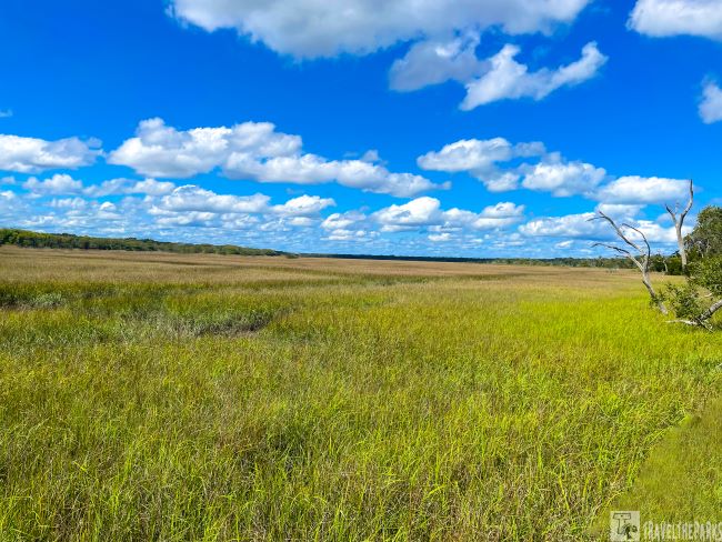
Interesting Fact: The preserve is one of the largest contiguous salt marsh ecosystems in the United States

Key Facts You Should Know About Fort George Island Cultural State Park
Indigenous people have inhabited these barrier islands for 5000 years. Data shows the pristine salt marshes provided all that the Timucuan people needed to live. A sanctuary for wildlife, it first became a vacation destination in 1875 when John Rollins built the Fort George Island Hotel. Sadly, the hotel burned to the ground 4 years later.
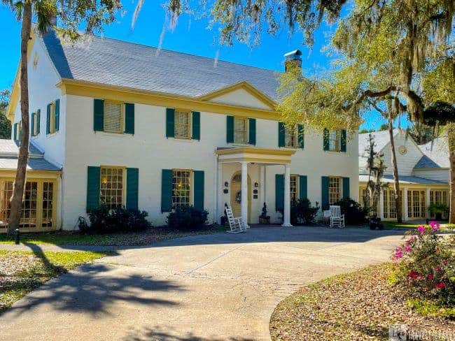
The Exclusive Ribault Club
A historic landmark, the waterfront Ribault Club serves as the Fort George Island State Park visitor center. Originally built in 1928 on the original site of the hotel, it housed the Ft. George Club during the roaring ‘20s & ‘30s. Touted as a playground for socializing with outdoor activities such as bocce, tennis, golf, and even its own marina. They placed it on the National Register of Historic Places in 1989 when the island was purchased by the Florida Park Service. Renown as a wedding and events venue, the visitor center is open Wednesday through Sunday from 9 AM to 5 PM. The museum exhibit is worth the 30 minutes to learn about the cultural and natural history of Fort George Island.
TIP: Don’t forget to bring your bug spray! For maximum protection, use it in combination with permethrin-treated clothing.
Driving Audio Tour on the Saturiwa Trail: Explore at Your Own Pace
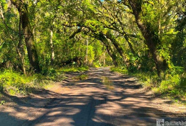
Named after Chief Saturiwa, the 4.4-mile loop trail begins just off A1A on Fort George Road. It paved the main road it up to the Ribault Club Visitor Center. After leaving the visitor center, much of the road is narrow and rough dirt. Under certain circumstances, the road will require drivers to take it at a slower pace.
At the Ribault Club, we picked up our CD to enhance our time on the trail using the narrated audio tour. The tour provides great insight into the culture and history of the area. You can visit the website link or use the downloadable brochure. If you prefer, you can walk the 2-mile Fairway Loop. The guided driving tour takes about 2-hours to complete.
The road to the Kingsley Plantation is “old Florida.” It seems miles from the main road. You almost feel you are lost or going the wrong way. Stops that are highlighted along the way include shell middens, Point Isabel, the white tabby ruins of the Muncillna-McGundo House, Mt. Cornelia (an ancient dune) and the Kingsley Plantation Complex.

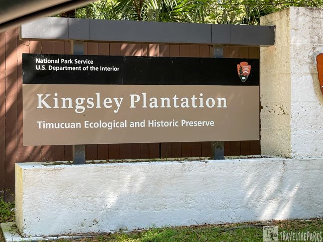
Journey into the Past at the Kingsley Plantation
Kingsley Plantation is on the north side of the St. Johns River, hidden away in Fort George Island Cultural State Park. You are welcome to visit Kingsley Plantation Wednesday through Sunday between 9 am and 4:30 pm, except on Thanksgiving Day, Christmas Day, and New Year’s Day. The well-maintained plantation buildings and grounds are free admission.
Visits to the Planters or main house on Saturdays and Sundays. Reservation is required. Ranger-guided tours are available at 11:00, 1:00, 2:00, and 3:00, for approximately 30 minutes.

Note: The plantation home is only open at certain times. Check the visitor center for times.
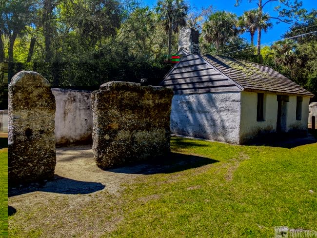
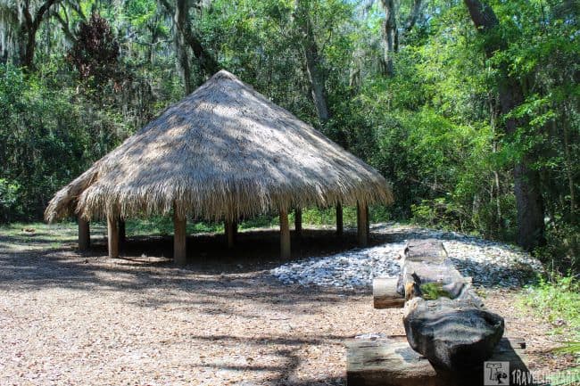
Visitors can explore the grounds at Kingsley Plantation. This includes the slave quarters, barn, waterfront, plantation house, kitchen house, and interpretive garden. There are interpretive signs everywhere detailing the history of the plantation. We learned about the history of Kingsley Plantation when taking a self-guided audio tour, “Lion’s Story Teller.” A map of the grounds and access to the tour by scanning a QR code at the visitor’s center. The tour brings to life this historic place. Imagine yourself in the past. Actors who portray key figures who lived and worked during the plantation era narrate each of the 17 stops.

Interesting Historical Facts about Kingsley Plantation
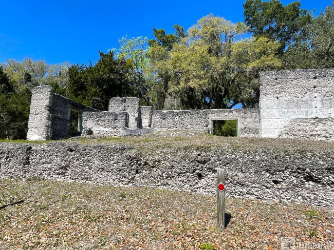
Zephaniah Kingsley, his wife Anna Madgigine Jai occupied the oldest plantation on George’s Island from 1814 to 1837. Fort George Island’s isolation resulted from its accessibility only by water. They built the Kingsley Plantation in 1798. Florida’s Kingsley Plantation is the oldest surviving plantation remaining today. The historic tale of this plantation is eye-opening. Anna, Zephaniah’s wife and a former slave, played a major role in the operations of the plantation. Having her freedom in 1811 by her husband, she became a landowner in her own right. Kingsley’s relatives held the property until the 1850s. The Florida state government operated the park from the 1950s until 1989. As part of the Timucuan Ecological and Historical Preserve, the property is now managed by the National Park Service.
Kingsley Plantation Crops: A Look at the Agricultural History
Sea cotton, a prized variety that contains very long fibers capable of being spun into a fine, sturdy thread, was the principal cash crop. As far as the eye could see, land was cleared to grow this valuable crop. Today much of the land has reverted to thick wood hammock.

The plantation also grew indigo. A high value as a trading commodity, the dye was extracted from the plants to produce the unique blue color. It took 100 pounds of leaves and stems to make 4 ounces of indigo dye. The steaming vats contained added lime (urine) to extract the dye. The process took weeks to complete. Most of the wastewater was detrimental to the environment.
The well-preserved remnants of 32 laborers’ residences are on the grounds. They constructed the “quarters” from tabby. An interesting mixture made from oyster shells, sand, and water used to make concrete. They arranged the 32 quarters in a semicircle behind the plantation house. A printed plantation guide is available for download.
Reminder: The National Park cancellation stamps are in the kitchen exhibit. As of August 2021, there are two stamps to collect here.
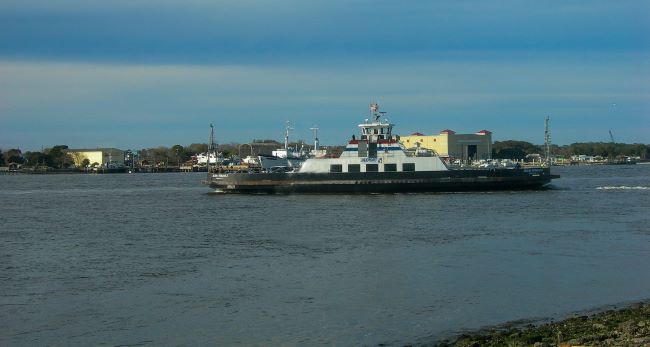
Journey Across the St. Johns River with the St. Johns River Ferry
Love this, what a time saver for us. Using the St. Johns River Ferry is the easiest way to cross the river to enjoy both sides of the preserve’s attractions. Fees are only $8 to ride on the weekends with a car, $7 during the week, and $1 to walk or ride a bike. If you use the Jacksonville Transportation Authority (JTA) app, it saves you a dollar. The trip is approximately 5 minutes and departs every half hour. Luckily, we got the third vehicle loaded and unloaded. Quick and easy!
Singleton’s Seafood Shack is the perfect place to stop for lunch on the Mayport side. A delicious assortment of fresh seafood dishes. Love the rustic feel-this is our go-to whenever we are in Jacksonville.
Safe Harbor Seafood Market & Restaurant– another alternative to Singleton’s is Safe Harbor just a few steps down the road. Right out of the water, they offer fresh seafood. Usually there is a brief wait, but it is worth it.

Uncover the interesting facts about Fort Caroline National Memorial
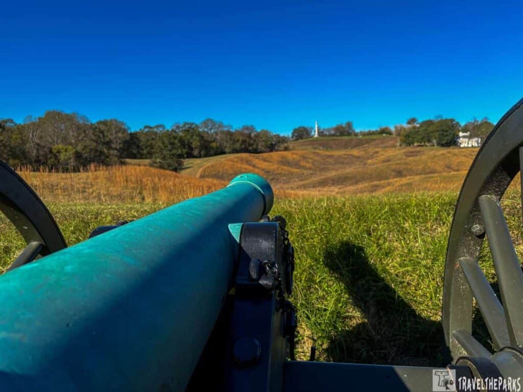
So much history still lives here. René de Laudonnire was the leader of the French expedition that built Fort Caroline. The colonists, mostly Huguenots, named their colony “la Caroline” in honor of King Charles IX. Sadley the fort only lasted one year. The French expedition led by René de Laudonnière built Fort Caroline near the mouth of the St. Johns River in June 1564. Build as a refuge for the Huguenots, it only lasted a year. It did not take long before the Spanish took notice of Fort Caroline invading their territory.

On September 15, 1565, Spanish soldiers commanded by Pedro Menéndez de Avilés defeated the French, forcing them to flee. In the aftermath of the French defeat, the Spanish founded St. Augustine, the oldest permanent settlement in North America. A replica of the French fort is on display at the site today, maintained by the National Park Service.
The replica fort overlooks the St. Johns River. The park visitor center is at Fort Caroline, open 9 AM to 4:30 PM daily. I’m always looking for a beautiful location to photograph when I’m traveling, and this was a great one.

Timucuan Ecological and Historic Preserve Visitor Center
There is a small gift/bookstore at the Visitor Center, staffed by knowledgeable volunteers. ‘Where the Waters Meet’ highlights the abundance of Northeast Florida and how it has been a natural habitat for humans for thousands of years. The exhibits showcase artifacts many dating from the 700 and 1500 C.E. I can only imagination what their life must have been like. Specifically, the history between when the Spanish/French occupied the area is detailed in the informational kiosks.
Discover the Hammock Trail at Fort Caroline
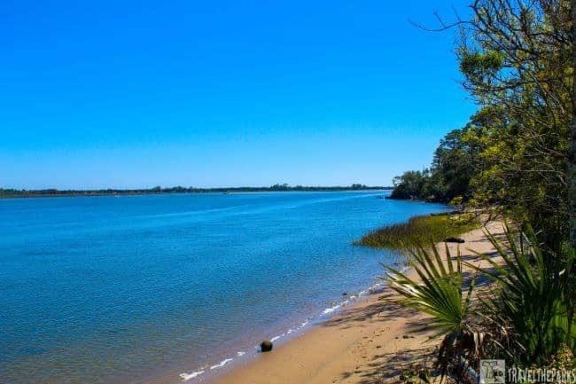
An easy 1.4 mile loop trail traverses past the replica fort through the maritime hammock forest. This well-maintained pathway passed an old replica Timicuan indigenous hut and dugout canoe in an open clearing. An informational placard detailed the conflicts that they faced with the Spanish and French settlers. Just before reaching the actual fort, we detoured to the pier observation deck overlooking the St. Johns River. The tide was transitioning from high to low, and the rushing water was impressive. You can get spectacular views of the tidal marsh and the naval base. Watch for large container ships in the channel.
The trail loops through the fort-follow the signs for the nature trail (roadway) to the bridge crossing the creek. The trail then becomes narrower before returning to the visitor’s center.

Discover Ribault’s Monument: Honoring the Legacy of Jean Ribault
Just a short 0.1 mile drive from Fort Caroline. There is a small parking lot below the monument, and it’s a short walk on a handicapped-accessible boardwalk up the St. Johns River bluff. This is the highest point in Jacksonville. At the top, we found a single memorial column. They erected the monument to honor the French explorer Jean Ribault. Ribault was the military leader of a group of French Huguenots seeking freedom from religious persecution in France. He landed on the banks of the St. Johns River in 1562 as part of an exploratory expedition to the Americas.

Off the Beaten Path-Spanish Pond Trail
There were stately live oak trees covered in Spanish moss surrounding the small parking lot. We spent a few hours hiking the different trails. It’s a great place to relax and decompress. The trails are perfect for families and dogs. If you plan to spend the day hiking, pack plenty of water, snacks, sunscreen, bug spray, sunglasses, beach towels, and remember your camera.

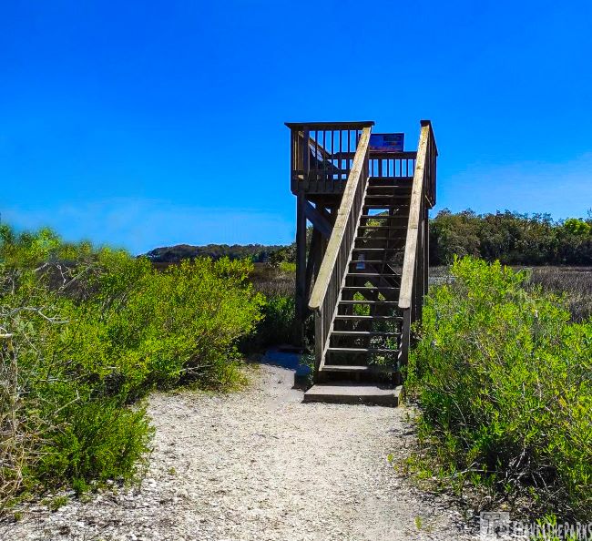
We found that the tree canopy keeps it cooler. Constant breezes off the inter-coastal waters of the St. Johns River often help to lower the humidity. The trail is well-maintained, comprised hard-packed dirt with some areas of loose dirt. The park has recently installed more sections of newly elevated boardwalk. Along the trail, there are benches every quarter-mile or so. Interactive placards give you the natural history of the area. We took the right-hand turns to make a large loop. It took us about 50-minutes to make a loop from the parking lot to the Round Marsh bird observation deck. The trail connects with the Timucuan Trail and the Willie Browne Trail (3-mile loop).

Theodore Roosevelt Area Hiking
Just off Mount Pleasant Road is the Theodore Roosevelt section of the park. This natural area comprises 600 acres that were bequeathed to the park by Willie Browne. He often told developers interested in building on his land that he told them, “Money can’t buy happiness, and this place makes me happy.” With the condition that the land be preserved in its natural state, he gave it to the Nature Conservancy in 1969. The area overflows with “old Florida” charm with its 5-miles of trails through hardwood hammock forest, salt marshes and bluffs made from ancient middens.
Exploring the Willie Browne Trail
The well-travelled trails are marked and easy to follow. We meandered along the old road that is the Willie Browne Trail. It leads to the old homestead cabin. However, all that remains today are the foundation posts. Nearer to the end of the trail, an observation deck provides excellent views of the estuary. The trail follows the Colorinda Creek Salt Marsh.
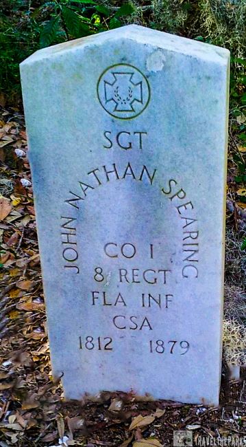
Just a little further beyond the Timucuan Trail starts at the base of the midden, zigzagging its way across the raised oyster pile. Shell mounds called “middens” were discarded oyster shells-essential the trash heap. Just before the trail intersection with the Willie Browne trail, there is a grave marker. This is where they laid Fort Caroline soldiers, Sgt. John Nathan Spearing to rest in 1879. Continuing the trail becomes narrower and steeper. You will need to watch for the many tree roots as they are a tripping hazard. I highly recommend proper walking or hiking shoes. Overall, this is a pleasant 3-mile loop hike.
Interesting Fact-An archeological site consisting of shell middens, or disposal mounds, surrounded by a clear area is called a shell ring. Shellfish populations were abundant in estuaries where the rings were found. They left behind many shell middens across the Southeast United States starting as early as 4000 BCE. The question whether shell rings are just disposal sites or monuments intentionally erected remains unresolved.
Scenic Hiking Trails at Cedar Point
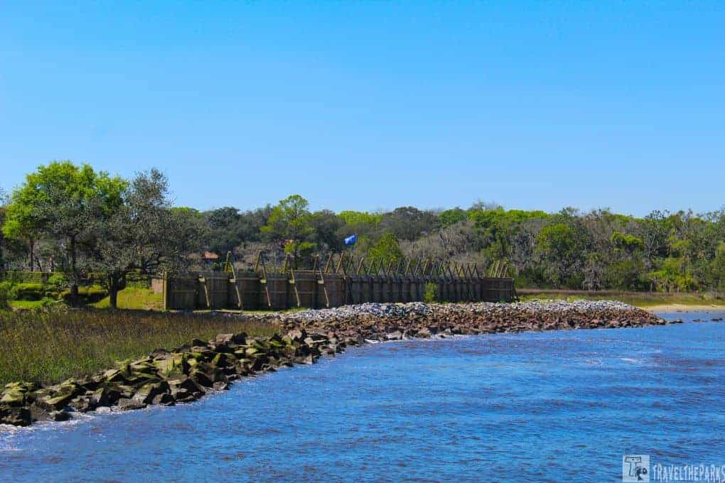
Cedar Point covers 400 acres and is on the south tip of Black Hammock Island. It is also part of the 7 Creeks Recreation Area. This was the site of a Spanish Mission, the former Spanish Mission Santa Cruz y San Bueneventura de Guadalquini. Today the site is an archeological dig with the University of North Florida (UNF). The ruins of the Fitzpatrick Plantation tabby buildings (circa 1795) can be seen on the blue hiking trail. The plantation produced salt by boiling saltwater using plantation labor systems.

Cedar Point Loop Trail is an easy 2.1-mile lollipop loop that is relatively flat. The trail begins at the end of Cedar Point Road. Just walk through the gate. You can also access the trail at the boat ramp. We followed the blue trail markers. Today the track is fairly muddy because of the heavy rain the evening before. Most of this wide track trail meanders through maritime hammock and salt marsh. I would suggest bug spray for the ticks and mosquitoes.
Pinelands Trail-a short 1.1 mile out and back trail loops off the Cedar Point trail through a heavily wooded hammock. Quite wide, it connects to different trails that branch off from this trail. Easy to explore and just follow the red trail markers. One side trail diverts to Pumpkin Hill Creek. The bridge connects the trail to Cedar Point Preserve. It is a great place to find waterfowl to photograph.

Final Thoughts: Fascinating Facts About the Timucuan Ecological and Historic Preserve
There is something for everyone here. So much so, in fact, you’ll find it to be a five-star attraction if you visit several units in the Timucuan Ecological & Historic Preserve. We found the park beautifully untouched and learned the interwoven history of this North Florida area. A hidden gem, take the time to a journey into the past. You will not regret the time spent at this national monument.
Did you like this post about the Timucuan Ecological and Historical Preserve? Leave a comment below-sharing is caring. Please be sure to Like, Share, or Tweet this post if you found it helpful or interesting.