Driving on Trail Ridge Road in Rocky Mountain National Park is indeed an epic experience. If you plan to drive amazing Trail Ridge Road, you will find that it affords breathtaking views over the stunning Rocky Mountains! Take a Colorado Rockies tour to over 12,000 feet high, get rewarded with incredible scenery while making amazing memories. This road is the highest continuous paved road in the United States and recognized as scenic byway connecting the towns of Estes Park and Grand Lake.
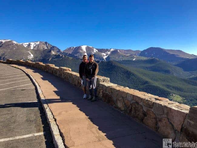
Have you ever driven on the Trail Ridge Road in Colorado’s Rocky Mountain National Park? For us, this was a memorable ride. We felt like we could almost touch the sky reaching the snow-covered peaks. There are many pull-offs on the road, and you will want to stop at every one of them to look out over the mountains, highland meadows, and hopefully catch some wildlife sightings. At each stop, we found interesting interpretive information giving us new insight into the wonders of this road. It is really hard to explain the elation you feel standing on the edge of the mountaintop, a sheer cliff practically dropping off below you. Looking over a serene green valley reminded us that this is what it is all about.

This post may contain affiliate links, meaning if you purchase something through one of these links, we may earn a small commission at no extra cost to you! Read the full disclosure policy here.
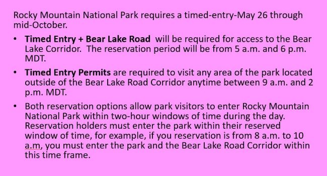
Table of Contents
Are reservations required to drive Trail Ridge Road?
Timed entry permit reservations to enter the park will be available through www.recreation.gov beginning at 8 a.m. MDT on Monday, May 1.
- This round of reservations will be available for entering the park from May 26 through June 30.
- June 1 is the date set for the next release, covering July and any open days in June.
- On July 1, customers can make reservations for the month of August and any days in July that are still available for booking.
- On August 1, you can make reservations for the month of September and any remaining days in August.
- On September 1, you can make reservations for October and any days in September that are still available.

High in the Colorado Rockies
Trail Ridge Road is a popular destination for sightseers, photographers, and nature enthusiasts who want to enjoy the park’s remarkable beauty from the convenience of their car. The road features multiple scenic overlooks and picnic areas along its 48-mile stretch. Crossing the Continental Divide at Milner Pass, Trail Ridge Road reaches an elevation of 12,183 feet. Depending on the number of stops, the trip along this road typically takes 2 to 4 hours to complete. Our journey began at the Fall River entrance near Estes Park and ended at the Kawuneeche Visitor Center near Grand Lake, Colorado. Travelers have the option of exploring the road from east to west or vice versa.
Trail Ridge Road is typically open from late May to mid-October, depending on the weather. During the winter months, it is closed because of heavy snowfall. The road develops icy conditions because of melting snow in early spring and late fall. It’s important to be ready to adapt your travel plans during these times. Always check the road conditions before embarking on the Trail Ridge Road. You can find more information about Trail Ridge Road on the National Park website.

What will we see on the Trail Ridge Road?
U.S. Highway 34 between Estes Park on the east and Grand Lake on the west is about 48 miles long. It crosses large mountain meadows and takes you through montane forests of ponderosa pines and through the subalpine forest. Standing in the alpine meadows makes you feel as if you are on top of the world. Much of the road winds through the birch and aspen trees, and then, just below the tree line, you will find subalpine fir and spruce habitat. Above the treeline is alpine tundra. The highest point on Trail Ridge Road is near Fall River Pass, at an elevation of 12,183 feet. It is between Lava Cliffs Overlook and Gore Range Overlook. The Alpine Visitor Center is just across the parking lot at an elevation of 11,796 feet.
NOTE: While traveling this road, visitors should know that high elevations can cause altitude sickness and that the road is steep and winding in places.

Preparing to Drive the Scenic Trail Ridge Road
If you have a rental vehicle, I recommend upgrading for driving this National Scenic Byway. We upgraded to a Ford Edge as it handled the twists, steep gradients, and switchbacks fairly well, especially when we did Pike’s Peak later on our trip.
In some places, there are no guardrails, so be aware of that. For the ultimate Rocky Mountain high road trip, purchase the $2 pamphlet ‘Guide to Trail Ridge Road’ at one of the visitor centers before you go on your way. It would be a good idea to get two maps, laminate them, and highlight the things you want to stop at before you head to the park. Get an early start to avoid traffic.
Essential Tips for Driving Trail Ridge Road
Here are some tips for traveling the Trail Ridge Road
- The Trail Ridge Road is only 48 miles long, but it’s a slow and winding drive. Plan for at least two to three hours to drive the road, and more if you want to stop at viewpoints or take hikes.
- Even in the summer, temperatures at the higher elevations can be chilly. Bring warm layers, including a hat and gloves.
- There are limited services along the Trail Ridge Road, so it’s important to bring water and snacks with you.
- The Trail Ridge Road offers stunning views of the Rocky Mountains, so take your time and enjoy the scenery. There are many pullouts and viewpoints along the road, so be sure to stop and take in the sights.
- Rocky Mountain National Park is home to a variety of wildlife, including elk, bighorn sheep, and marmots. Keep your eyes peeled and be prepared to stop for wildlife sightings.
- The higher elevation of the Trail Ridge Road can cause altitude sickness in some people. If you experience symptoms such as headache, nausea, or dizziness, stop and rest or descend to a lower elevation.
What are the best stops on the Trail Ridge Road?
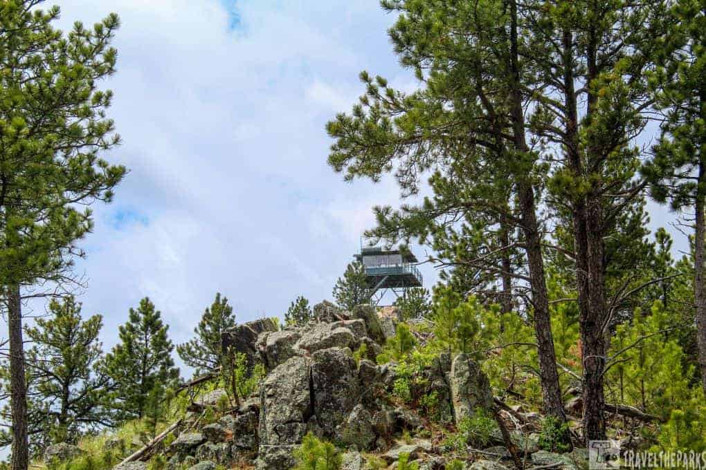
We did the road driving from east to west, beginning at the Fall River Visitor Center. This is a significant high point on the road, a good place to stop for a quick photo op.

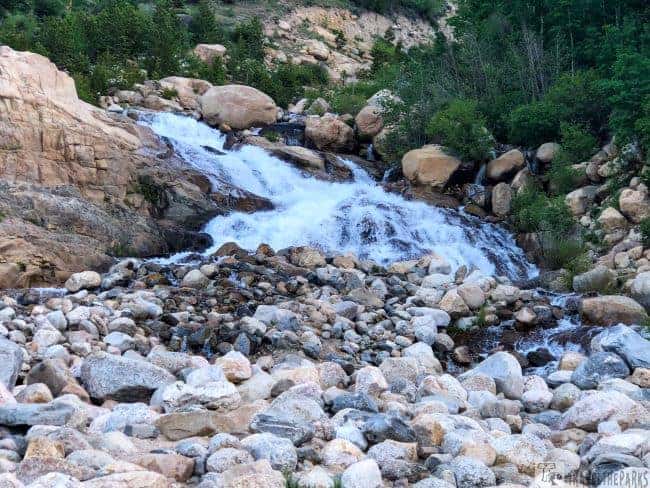
Stop #1: The Alluvial Fan Trail
This serene early morning trail offers an easy 0.8-mile (1.3 km) hike suitable for families with young children. The trailhead is at the Endovalley Picnic Area on Fall River Road, where you can access the trail from the east or west parking lot, whichever is most convenient. The trail leads to the Alluvial Fan, which sits at an elevation of 8,610 feet. Typically, this trail is accessible from late spring to early fall, weather permitting. To avoid walking through the rushing creek, we opted to use the new 56-foot bridge instead.

Exploring the Trail to the Top
We followed the trail through a lovely landscape of mountain meadows, pine forests, and rocky outcrops. The most captivating part for us was the alluvial fan, a vast collection of boulders and debris deposited by a flood in 1982. This flood was the result of a dam failure at Lawn Lake, situated at the peak of the mountain overlooking the trail.
The Fall River Road offers excellent views of the Sheep Lake Valley. We had a great time hiking and scrambling over the river rocks to get more dramatic views of the falls. It’s important to wear good hiking boots to navigate the rocky boulders. The trail is open year-round, but the best time to visit is in the summer and early fall when the weather is mild and the wildflowers are in bloom.
How the Lawn Lake Flood in Rocky Mountain National Park
On July 15, 1982, a devastating flood occurred because of the failure of the Lawn Lake Dam. We learned valuable insights about the disaster from the educational kiosk on the east side of the alluvial fan. The kiosk informed us that the dam was constructed in 1903 and was owned by the Lawn Lake Lodge and Resort. Apparently, the dam crumbled because of various factors, including its age, lack of upkeep, and heavy rainfall, which led to a sudden increase in the water level within the reservoir. The collapse resulted in the incredible discharge of over 30 million cubic feet of water when a significant portion of the earthen dam collapsed. It’s hard to comprehend the immense volume of water cascading down the mountainside within minutes.
Significant environmental impact was caused by the disastrous flood downstream, which destroyed or severely damaged many homes, cottages, and campgrounds. Sadly, the accident claimed three lives, and the damage exceeded $31 million.
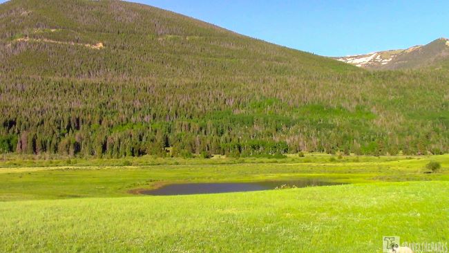
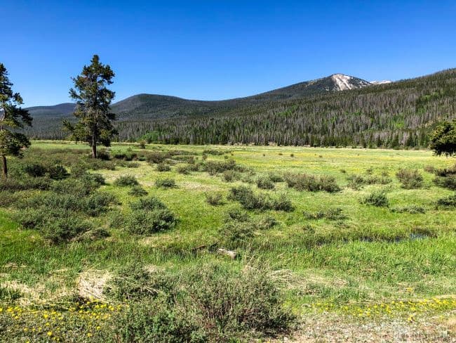
Stop #2: Green Meadows of the Sheep Lakes Pullout
Just past the Fall River Visitor Center, you will see the pullout for Sheep Lakes. It is at the base of the Alluvial Falls. Against the mountain backdrop, the lakes are surrounded by open, green meadows. The pullout also has interpretive signs and displays that provide educational information about the local wildlife and its habitat.
Bighorn sheep often graze near the pullout in this valley. Thus the name. Park rangers say they know this area is best for bighorn sheep viewing because of the minerals found in the two ponds. Besides bighorn sheep, visitors may also see elk, mule deer, coyotes, and a variety of bird species, including golden eagles and red-tailed hawks. We saw elk when we arrived. However, they quickly made for the thick woods once they saw us.

The Sheep Lakes Trailhead is relatively easy and takes you through meadows, forests, and along streams and rivers. Although a popular place to see bighorn sheep, we did not see any this morning. However, I’d still suggest taking the trail if there’s time.
NOTE: Feeding or approaching wildlife is prohibited in the park, and visitors should always respect the animals’ space and behavior.

Stop #3: The Twisting Hairpin Turn at Still Many Parks Curve Overlook
This is one of the best stops going east to west on Trail Ridge Road. This overlook is on a sharp hairpin curve of the Trail Ridge Road. It is best to park above the hairpin curve. It is easier to see oncoming traffic crossing the road before walking down to the boardwalk. The boardwalk cantilevers over the cliff, giving you the feeling of being suspended in mid-air.

At an elevation of 9640 feet, the lookout offers panoramic views of the park’s mountainous landscape, including several of the park’s peaks and valleys. From this vantage point, you can immerse yourself in the park’s natural beauty. Looking over several prominent mountain peaks, including Longs Peak, and unsurpassed valley views of Beaver Meadows, Horseshoe Park, Moraine Park, and Estes Park in the distance. An informational placard will point out the names of the prominent mountain peaks. Honestly… everywhere you look from here is just absolutely breathtaking!
Stop #4: Rainbow Curve Viewpoint High in the Colorado Rockies
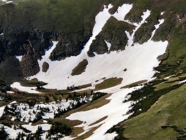
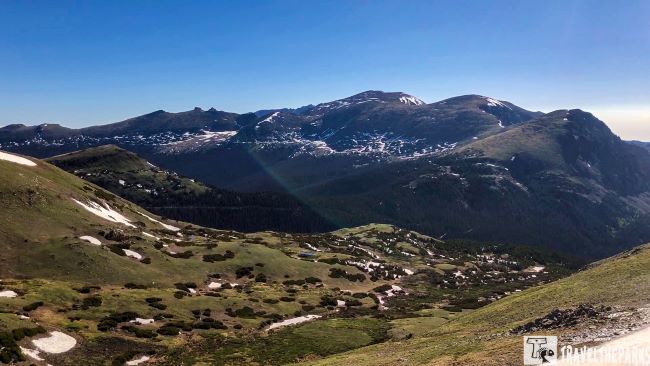
For us, this was by far the most memorable overlook along the Trail Ridge Road. The name is based on the rainbow-like appearance of the surrounding mountains when viewed in the right lighting conditions. Sitting at an elevation of 10,829 feet, you can see the entire Hidden Valley, including the Alluvial Fan, Sheep Lakes, and Horseshoe Park. It is a little unnerving for those with a fear of heights. Carved by ancient glaciers many years ago, the valley is impressive. The land was shaped by glaciers carving through freezing and thawing rock. There are interpretive signs with information about the different forest ecosystems that exist within the park. The valley is a sub-alpine forest.
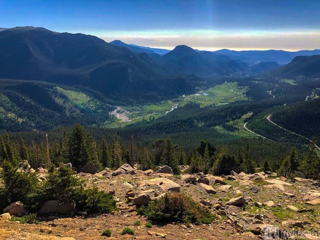
Looking down the valley of the damage from the Lawn Lake dam break in 1982, the rubble field is considerable. The sheer force of water moving giant-sized boulders down the mountainside, it is easy to take in the entire debris field from this vantage point. The Trail Ridge Road continues gaining elevation towards Lava Cliffs. Here, the landscape transforms dramatically. You are leaving the timberline and now looking at alpine tundra. The flower-covered meadow comprised mostly alpine flowers and low grasses that can survive the harsh winters.

Stop #5: Forest Canyon Overlook-Eagle’s Eye View
From this viewpoint, we enjoyed panoramic views of the park’s Forest Canyon, as well as the surrounding mountain peaks and alpine tundra. At an elevation of over 11,700 feet, it is an in demand destination for many visitors and photographers. The overlook is accessible by car, and there is a parking area and a picnic area nearby. It’s a brilliant spot to enjoy a scenic break and take in the beauty of the surrounding landscape.

Stop #6: Above the Clouds: Rock Cut Overlook
This rock formation is at an elevation of over 12,100 feet, making it one of the highest viewpoints accessible by car in the park. It highlights the unique geology, flora & fauna of the park. Views of the sub-alpine ecosystem that protects vital habitat for elk, bighorn sheep, and microorganisms living in the short grasses/lichens. The overlook is named after the rock cut that was created during the construction of the road, which allowed it to wind its way through the steep terrain of the park. The Big Thompson River carves these mountains as it descends through to the valley below on its trek to Estes Park. Glaciers eroded much of what you see from this viewpoint.
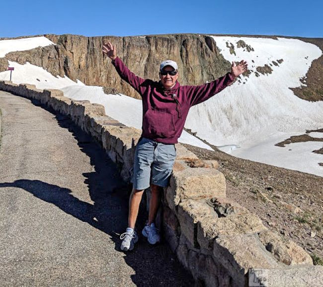
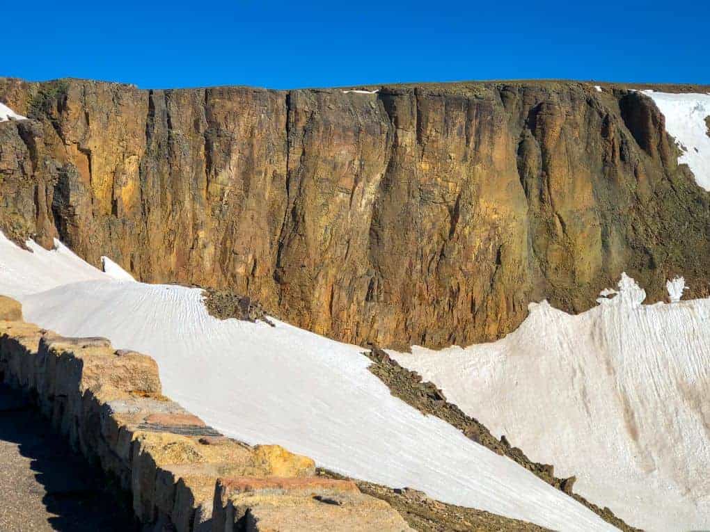
Stop #7: Lava Cliff-Highest Point on the Trail Ridge Road
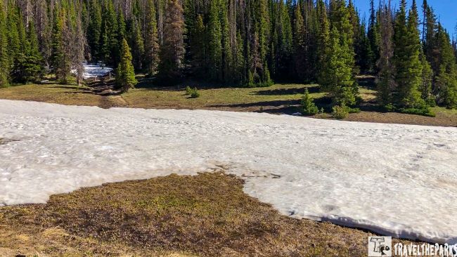
Before reaching the Lava Cliffs, you pass through the Rock Cut. They blasted this area to make way for the road. The rock on either side usually remains snow-covered from most of the spring into the early summer. From this lookout, you can see the switchbacks in the distance as the road snakes its way towards the Gore Mountain Range.
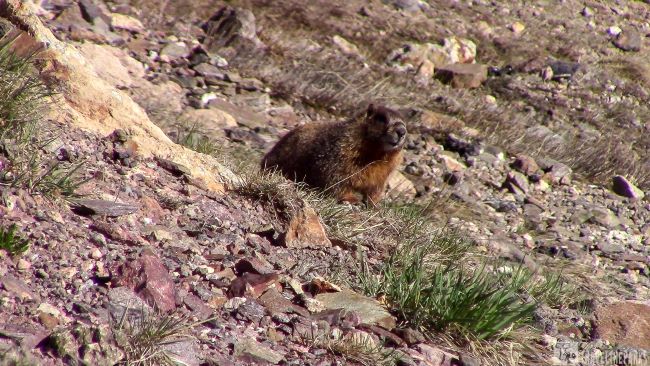
This lava wall is at an elevation 12,080 feet. Formed 24 billion years ago from volcanic rifts and uplifting that occurred miles away in the Never Summer Mountains. These lava flows of volcanic rock, etched and carved by glaciers, formed the sheer cliff face you see today. They offer a unique and dramatic landscape. In the distance, you can see Desolation Peaks (12,949), Ypsilon Mountain (13,514), Mount Chiquita (13,069), and Mount Chapin (12,454). The day we visited the ground was still predominantly a winter landscape, lending to fantastic photographs. Just seeing the sunlight reflecting off the snow made the cliff colors appear more vivid.
The highlight for us was the many yellow-bellied marmots. We observed them scurrying through the snow, searching for food in the meadow.
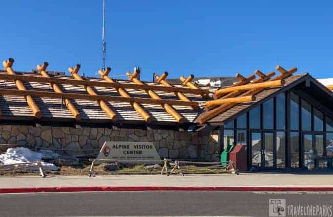
Stop #8: The Alpine Visitor Center Trail — a Real Rocky Mountain High!
The center serves as the park’s main visitor center and provides information and resources for visitors, including maps, brochures, and educational exhibits about the park’s history, geology, and wildlife.
Located inside, at the rear of the Alpine Visitors Center, is a restaurant with a snack area. Large windows in the seating area enhance the view of the valley, a great place to have lunch. There are restrooms and a gift shop. At the interpretive desk, consider inquiring about a ranger-led tour. Remember to get your passport stamped here at the visitor center desk. We found the staff to be very knowledgeable, giving us tips on what to see from each viewpoint. An interesting fact is that the logs on top of the visitor’s center protect the shingles, stopping them from blowing off in the strong winds. Snow completely buries this area in the winter. The log provides relief from the snow load.
Back in Time: Exploring the Historic Old Fall River Road Drive
There is a large parking area with plenty of parking. Stepping onto the balcony at the back of the visitor center, we found ourselves staring at magnificent 360 degrees views of Mount Chapin, Fall River Canyon, Old Fall River Road, and the green alpine valley that lies below. Engineers built it between 1913 and 1920, and was the first automobile route that allowed visitors to drive from the east side of the park up to the alpine tundra.
The Fall River Road is a narrow, winding dirt road that climbs steeply up a mountainside and features many switchbacks, tight turns, and gorgeous views of the surrounding mountains and valleys. The road starts at the Old Fall River Road, just west of the Alluvial Fan in Estes Park. It continues through to this point (Alpine Visitor Center). It is a one-way road, with traffic allowed to travel uphill only, and is typically open to vehicles from July through September, depending on weather conditions.
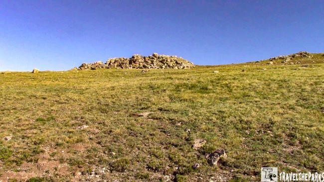
Elevate Your Adventure: Tundra Communities Trail above the Alpine Visitor’s Center
This is one of the must-do trails on your Colorado Rockies escape. This trail is a relatively easy and accessible trail, suitable for visitors of all ages and abilities. Sitting at an elevation of 11,796 feet, we got sweeping views that were phenomenal! The air is definitely thinner this high up, so be prepared. The trail begins at the Alpine Visitor Center parking lot and is approximately half a mile (0.8 kilometers) long.
Take it slow if you decide to climb the 1/4 mile trail to the top. The high altitude and wind made it chilly as you gained 300+ feet in elevation. Weather changes are frequent, so be prepared by having a windbreaker and a hat, and something to cover your ears. Long pants are a must in the often windy conditions. We packed some snacks and water before hiking up the trail. Take it slow on the stairs and take deep breaths to lessen the impact of the altitude. The breathtaking views from the Alpine Ridge Overlook, makes the effort so worthwhile. You can still see snow most times of the year. In the early spring, we saw lupine and bluebells — alpine wildflowers. You may also spot wildlife such as marmots, pikas, and bighorn sheep.
Stop #9 – Medicine Bow Curve: A Scenic Stop on Trail Ridge Road
Medicine Bow hairpin curve is another overlook at 11,640 feet elevation. On a sharp curve in the road, the viewpoint gave us scenic views of the Never Summer Mountains all the way into Wyoming (35 miles). In the valley below, we could see the Cache Poudre River weaving its way through the valley. From here, the Trail Ridge Road begins to descend back into the treeline.
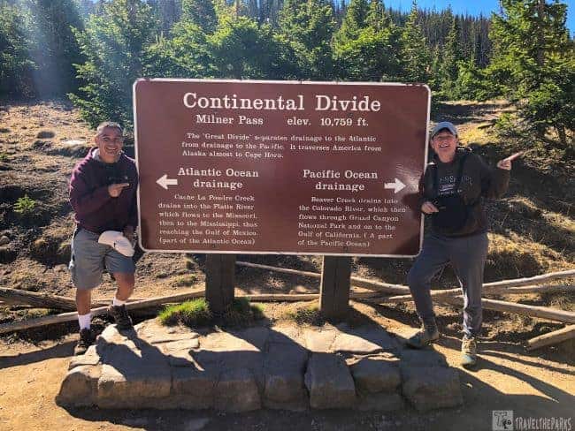
Stop #10: Milner’s Pass: A Pinnacle Moment at the Continental Divide
As we crossed the pass, we also crossed the Continental Divide, which is the line that separates the flow of water across the continent. From this point, the water on the west side of the divide flows towards the Pacific Ocean, while water on the east side of the divide flows towards the Atlantic Ocean. Milner Pass sits at an elevation of 10,758 feet (3,279 meters) above sea level and is one of the highest points on the Continental Divide. The pass is named after Enos Mills’ friend, F. O. Stanley, who helped Mills in his efforts to establish Rocky Mountain National Park.
Poudre Lake & Trails: Exploring Serenity in Rocky Mountain National Park
The key feature at the pass is Poudre Lake, an alpine lake created by meltwater. This lake gets its name from the nearby Cache la Poudre River, which flows through Poudre
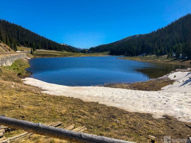
Remember to take a photograph at the Continental Divide sign. There are hiking trails that begin at the pass. Want to go for a hike? There’s a nature trail around the Lake and it’s less than one mile! Remember, being at this high elevation in Rocky Mountain National Park, you may encounter snow covering some trails. In the early spring, it may require waterproof footwear.
NOTE: Remember when choosing a hike, always look at the distance and the elevation. Even a short hike can be really difficult in the mountains.
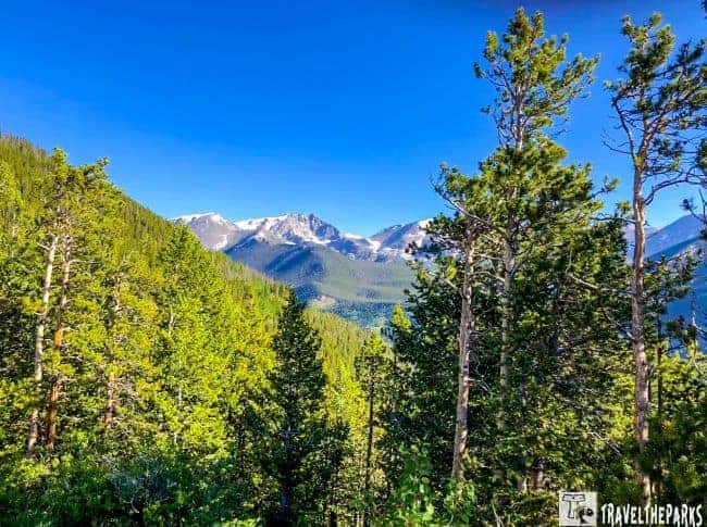
Stop #11: Oh, the Views at Farview Curve Overlook
From the overlook, we so enjoyed breathtaking panoramic views of the Kawnueeche Valley with the majestic Never Summer Mountain range in the background. According to an informational placard, the range was named after the Never Summer snowfield, which retains its snow cover even during the peak of summer. An essential and captivating part of the Rocky Mountains, the Never Summer Mountains showcase rugged beauty and challenging backcountry terrain. The Never Summer Mountains are safeguarded by the Arapaho National Forest as part of the designated Never Summer Wilderness area. The Kawnueeche Valley encompasses a variety of habitats, including subalpine forests, wetlands, and meadows, creating a diverse and special environment for wildlife to thrive.
Stop # 12 – Colorado River Trailhead: Exploring the Headwaters
The Colorado River Trailhead is a starting point for outdoor activities such as hiking, fishing, rafting, and camping, as well as stunning scenery and wildlife viewing. It begins as a small stream, fed by snowmelt and precipitation in the tall mountain peaks, and eventually grows into one of the most significant rivers in the western United States. Many Native American indigenous clans consider the Colorado River headwaters a sacred site and hold great spiritual and cultural significance. The river, from its headwaters to its confluence with the Gulf of California, is approximately 1,450 miles long. A short 0.5-mile trail leads to the river views.
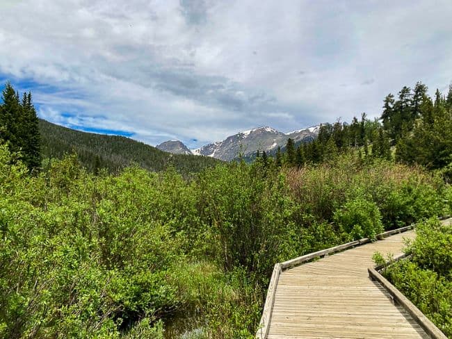
Stop # 13 – Hidden Valley Beaver Ponds on Trail Ridge Road
Have you heard about the Beaver Ponds Boardwalk? It’s a brief 0.2-mile trail leading to the Hidden Valley Beaver Ponds. These ponds are actually a collection of ponds made by beavers, and they’re home to a wide variety of wildlife, such as beavers, waterfowl, and other aquatic animals. What’s really interesting is that the beaver ponds create a special and picturesque habitat within the park. It is truly fascinating to observe these amazing animals in their natural habitat, providing an unforgettable experience.
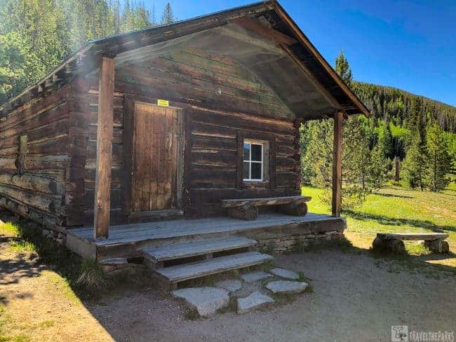
Stop #14: Holzwarth Historic Site
As we continued our journey along Trail Ridge, we made a stop at the Horowitz Site, situated at an elevation of 8,884 feet. Have you heard about the Holzwarth Historic Site? Legend has it that in 1917, Holzwarth brought his family to the upper Colorado River near the Never Summer Mountains to establish their homestead.
You can reach the Holzwarth Historic Site and its cabins on a flat, accessible nature trail. It is an easy 0.75-mile hike along a boardwalk over the Colorado River. You can get to the homestead site by taking the path across the flat meadow. Wandering the restored Holzwarth Historic Site cabins gave us a glimpse into the challenges of surviving in this isolated location. Keep an eye out for the resident elk in the open meadow, as spotting them can be quite wonderful, especially the younger ones. It’s important to be cautious during the early spring and late fall, as mother elk can be very protective of their calves.

Step Back in Time in the Never Summer Mountains
We spent some time exploring the original cabins, barns, and other buildings, as well as viewing exhibits and artifacts that showcase the history of the area and the Holzwarth family. The Holzwarth Historic Site is open to visitors from late May to early October, and ranger-led tours and interpretive programs are available throughout the season. The site is a great place to learn about the history and culture of this area of the park.
Travel Tip: Always stay at least 25 yards (75 feet) away from elk and other animals in our national park. No photograph is worth getting injured.
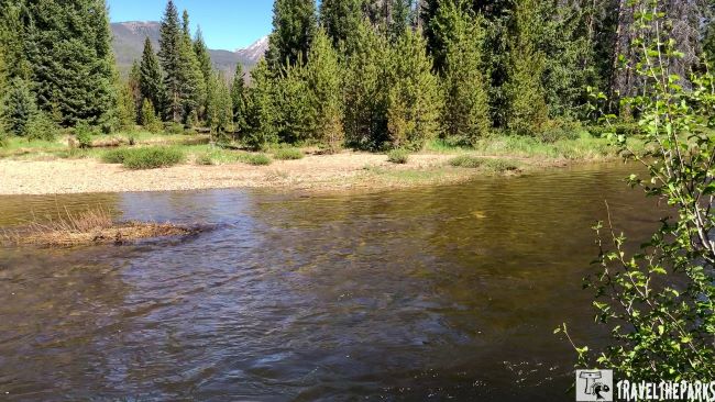
Stop #15: Coyote Valley Trailhead along the Colorado River
You can stroll along the headwaters of the Colorado River and enjoy distant views of the Never Summer Mountains. The Rockies boast one of the most stunning and unspoiled valleys in the area. The trail offers a level, hard-packed dirt/sand surface and includes a small bridge crossing over the Colorado River, followed by a scenic route along its shoreline through a meadow in the Kawuneeche Valley. If you’re on the lookout for excellent spots for trout fishing, this is the place to be. Unfortunately, we could not fish today, as our final destination is Arches National Park.
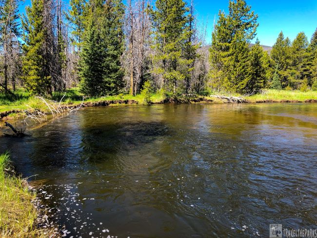
Stop #16: Kawuneeche Visitor Center: Your Gateway to the Westside of Trail Ridge Road
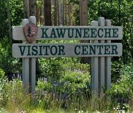
This is one of the nicest visitor centers on the western side of Rocky Mountain National Park. This can be at the beginning (or end, depending on where you start) of Trail Ridge Road on Hwy 34. Open daily in the summer through September, 8 a.m. to 4:30 p.m.
The theater loops the park film, “Spirit of the Mountains,” throughout the day. The park video was very interesting. There are picnic tables, clean restrooms, and a bookstore/gift shop. The rangers are very friendly and always helpful with trail information and closures. We learned from the rangers that Kawuneeche means “valley of the coyote” in the Arapaho language. The informational displays and exhibits detail the history of the park, with interesting facts on native wildlife, indigenous people, and the Colorado River.

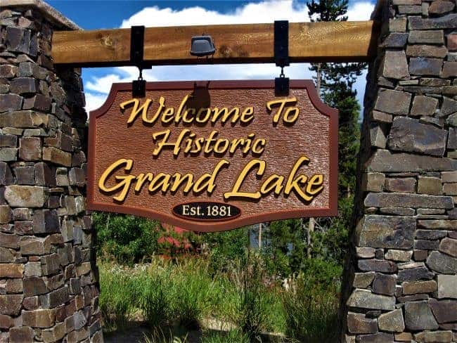
Stop #17: Adams Falls Trail: A Side Trip Adventure
The Trail Ridge Road continues to Grand Lake with fewer elevation changes. The area is not as dramatic as Estes Park. We made a side trip to Adams Falls to do the short hike, 0.6 miles up to the falls. Download the trail map here. We found the trailhead near the town of Grand Lake. The trail follows the East Inlet Creek and leads to Adams Falls. A beautiful waterfall that is about 55 feet (17 meters) high. You can get wonderful photos from the observation platform above the falls. Hikers of all ages and levels can hike this well-maintained trail.
Note: It is important to mention that the trail tends to get crowded during peak season, so it is advisable to arrive early to avoid the crowds.
The falls are a refreshing respite on a hot summer day. You can scramble down the trail that parallels the gorge for better photos. If you continue on the trail past the falls, it rewards you with beautiful streams. A gorgeous meadow with a meandering stream flowing through it and tall mountains in the background. The trailhead map showed further down the path is Spirit Lake. I wish we had time to continue. However, we still have a long drive today. Our next destination is a stay at Red Cliffs Lodge in Moab.
Trail Ridge Road: Fascinating Facts
- Trail Ridge Road starts at Deer Ridge Junction (Hwy 36 and Hwy 34) on the east side of the park to the Colorado River Trailhead on the western side of the park. Closed from mid-October to June.
- Fall River Pass is the highest point along the Trail Ridge Road, with an elevation of 12,180 feet.
- They added the road to the National Register of Historic Places in 1984.
- Gore Range Overlook: We missed this stop. This overlook provides stunning views of the Gore Range, a mountain range located to the west of Rocky Mountain National Park.
- I would recommend taking a half-day to drive this road. Consider stopping at the most scenic overlooks.
- Weather in the high country is notoriously unpredictable. Sudden summer thunderstorms bring dangerous lightning, and snow can fall during any month of the year. Before heading out, always check current conditions, trail updates, and road status at a park visitor center.
Final Thoughts: Epic Drive on the Amazing Trail Ridge Road in Rocky Mountain National Park
Rocky Mountain National Park’s Trail Ridge Road showcases a variety of habitats, allowing visitors to explore the park’s diverse ecosystems. We will always remember the unforgettable experience of driving along Trail Ridge Road. Apart from showcasing breathtaking vistas of the Rocky Mountains and the surrounding landscape, it also facilitates the making of unforgettable memories.

By doing some planning and getting ready, you can fully take advantage of your journey and appreciate everything this picturesque highway has to present. For us, traveling on Trail Ridge Road in the majestic Colorado Rockies was an extraordinary adventure. Consider adding this remarkable drive along Trail Ridge Road to your bucket list for your next Colorado road trip!
What was your experience on the Trail Ridge Road? Did you do any hiking or other activities? Let us know in the comments below. Thanks for sharing!