If you only have a short time in the park to explore, the Rankin Ridge trail is the best option for hiking in Wind Cave National Park. Not only is it the highest point at Wind Cave at 5,013 feet, but Rankin Ridge Trail, as Wind Cave’s highest point, offers a pay-off at the top with magnificent panoramic views of Buffalo Gap and the Black Hills. They are pretty spectacular. This is a popular trail in Wind Cave National Park in South Dakota’s Black Hills. The well-marked 1.1-mile loop path is great for families. Not a challenging hike, it steadily gains 214 feet of elevation. They named it for the park’s first superintendent, William A. Rankin.

This post may contain affiliate links, meaning if you purchase something through one of these links, we may earn a small commission at no extra cost to you! Read the full disclosure policy here.
Table of Contents
How to Get to the Rankin Ridge Trailhead?
Follow the park road north from the Wind Cave Visitor Center until it intersects with Highway 385. Turn left and then right onto Highway 87 (following the signs for Custer State Park). Rankin Ridge Trailhead is located 5-miles up Highway 87-N. The turnoff to Rankin Ridge Road is on your right. Follow the signed road 0.3 miles up the ridge until it dead-ends at the gravel parking lot.
PRO TIP: Download the National Park Service (NPS) app ahead of time so that you can do the self-guided 14 interpretive sites. Also, download the Wind Cave National Park information for offline use.
Learn as You Hike: Interpretive Markers on Rankin Ridge Nature Trail
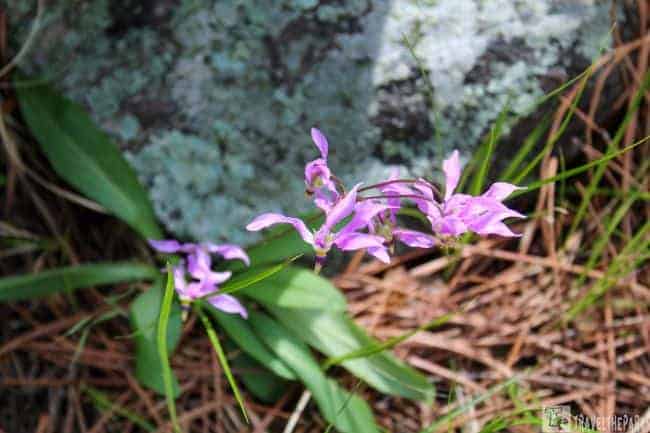
We first snagged a nature brochure from the kiosk at the trailhead. We started out from the left trailhead. through the mature ponderosa pine forest first before rising 0.4 miles to reach the top of the ridge. Wildflowers grow alongside the trail. Early spring we spotted shooting stars. They were an impressive purple color.
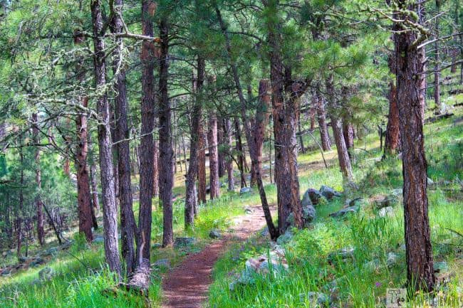
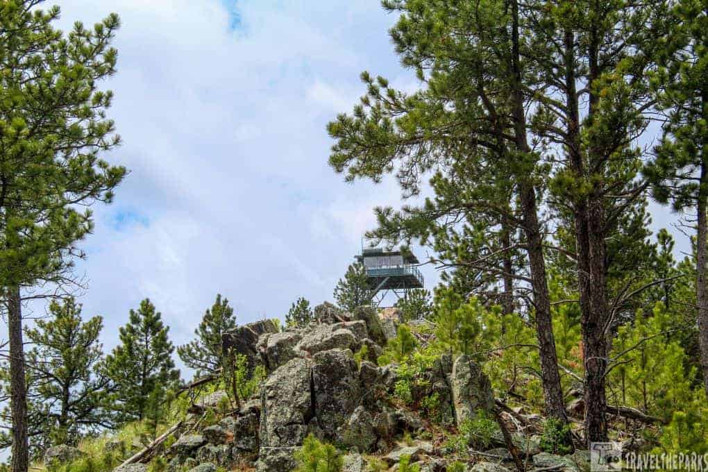
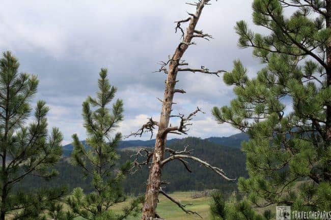
The trail has 14 well-numbered signs, and the brochure includes descriptions for each site. Stop#3 pointed out that in 1994, a forest fire created dead snags that are an integral part of the habitat. Stop#12 highlights how fire plays a natural role in maintaining the forest. The trail follows along the ridgeline before abruptly heading up the hill. The trail is rather steep, and rockier the closer you get to the crest. They build a carved staircase of rock into the hillside. It makes the climb easier. Stop#13 is the fire tower that makes Rankin Ridge Trail the Highest Point in the Wind Cave.
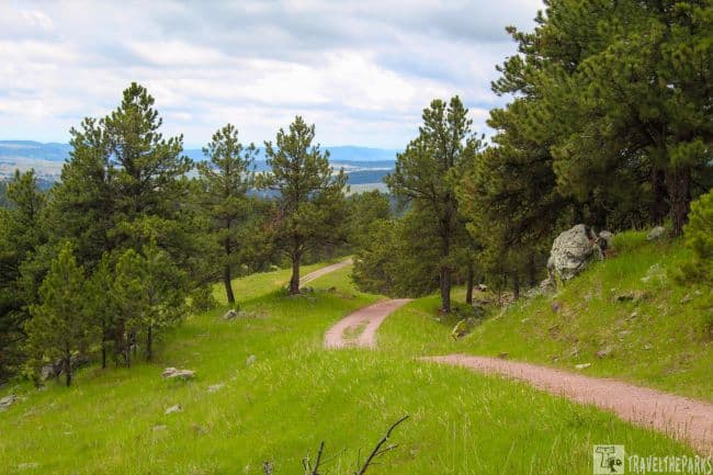
At the top, it is easy to see the many snags and beetle-killed ponderosa pine. The peak of the ridge is mostly open meadow. The views are spectacular. A lone log bench is a welcome reprise to just take it all in. Practically deserted, only one other family was at the lookout tower.

Hiking to the highest point of Wind Cave National Park: Fire Tower
Rankin Ridge Trail is a good place to watch sunrises and sunsets. From the Lookout Tower on top of the ridge there are 360-degrees views. Built in 1956, the abandoned steel tower rises an additional 53 feet above the ridge. It remained in regular use during fire seasons until 1998. Unfortunately, it is not open to the public. Still, it’s occasionally occupied during the summer fire season during extreme drought.
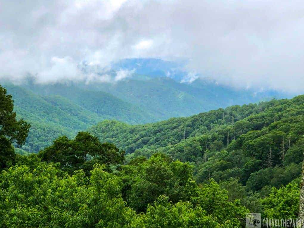
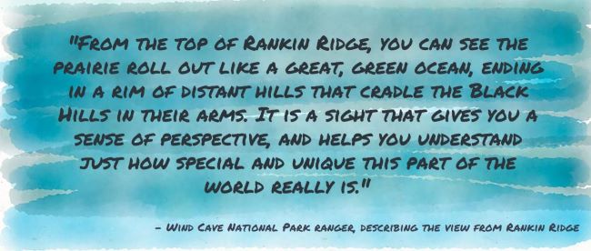
Still, the plains and hills seem endless for miles in every direction just standing on the ridgeline. There are no other structures in the distance to mar the view. On a clear day you can see to the Badlands 40-miles in the distance. The open prairie grasslands, rocky outcroppings and views of the distant forested black hills make this climb so worthwhile.
After spending 20-minutes looking for wildlife from the ridge-top, we turned back to the trail. From the lookout tower, walk south on the dirt access road for 0.2 miles, then turn north and return to the trailhead along the road.
PRO Tip: Stay hydrated! Water bottles come in a wide variety of colors, shapes, and sizes. One gallon of water per person per day is recommended when hiking in the park.

PRO Tip: Bison and other wildlife are dangerous and unpredictable. Do not approach. They strongly recommended that visitors stay at least 25 yards from all wildlife.
Discover Wildlife Along Wind Cave’s Rankin Ridge Trail
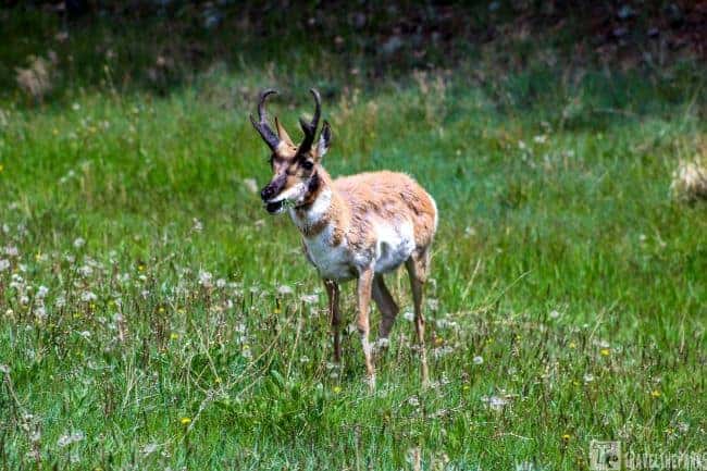
Whenever we travel, seeing wildlife in its natural environment is always a thrill. I spotted a huge bison herd at the turnoff to trail. At the base of Rankin Ridge road, is one of the many prairie dog towns. The bison doesn’t seem to mind the holey landscape, and I’m sure the prairie dogs would prefer the bison move on. While a herd of males grazed, a few were wallowing in the mudholes, warding off the flies. A lone pronghorn is feasting on grass at the side of Rankin Road on the trip to the trailhead.
While on the trail today we spot bison in the valley below, none on the trail. Lots of different birds, including rabbits, chickadees, Northern flickers, and a Red-breasted Nuthatch.


Know Before You Go: Essential Tips to Prepare for Your Rankin Ridge Hike
- They do not permit pets on any trails in Wind Cave.
- Watch your step. Prairie rattlesnakes live amongst the rocky outcroppings and prairie dog burrows.
- Don’t approach or attempt to feed wildlife. Prairie dogs are adorable but should not be fed.
- Follow the Leave No Trace Seven Principles.
- Be prepared and plan for the weather.
- The hiking path is relatively clear, running shoes or hiking boots are the best.
- Always bring plenty of water for your hike.
Final thoughts: Rankin Ridge Trail is Wind Cave’s Highest Point
Take a fresh look at your favorite trail next time you’re out exploring. You might discover something you overlooked previously, something that was always there. Being out in nature, and listening to the sounds, hearing no modern noises, is a special escape. Wind Cave National Park is a contrast in the diversity of its habitats. From the cave below the surface to the wide prairie above ground hiking, the Rankin Ridge Trail will present a different perspective of this park. On a clear day, the views alone are worth the journey.
Check out Jewel Cave National Monument, Custer State Park, the Crazy Horse Memorial, Mt. Rushmore, the Peter Norbeck Scenic Byway and Spearfish Canyon. All these destinations are in proximity to Wind Cave and were all part of our midwestern road trip.
Have you hiked in Wind Cave National Park? Share your thoughts in the comments below.