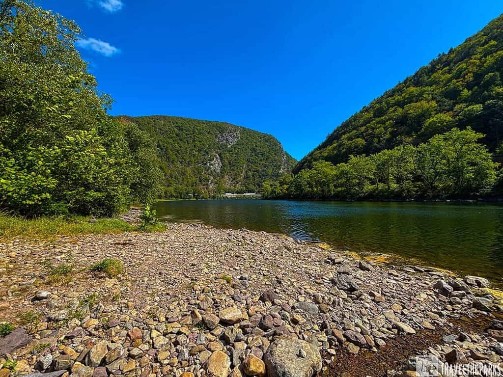
During our road trip along the East Coast from Florida to the Poconos, I was really looking forward to experiencing the Delaware Water Gap National Recreation Area. If you’re in that area, it’s definitely something you have to experience. For those planning a Delaware Water Gap itinerary, it’s fascinating to learn that this park spans over 70,000 acres spread out along the border of New Jersey and Pennsylvania. I was equally astonished to discover it has a great variety of outdoor activities. There are incredible hiking trails to be found, stunning waterfalls, and kayaking in the river. I hadn’t expected to find such a vast amount of things to do. All of this was so close to so many big cities along the East Coast. Yet it felt a world away.
This post may contain affiliate links, meaning if you purchase something through one of these links, we may earn a small commission at no extra cost to you! Read the full disclosure policy here.
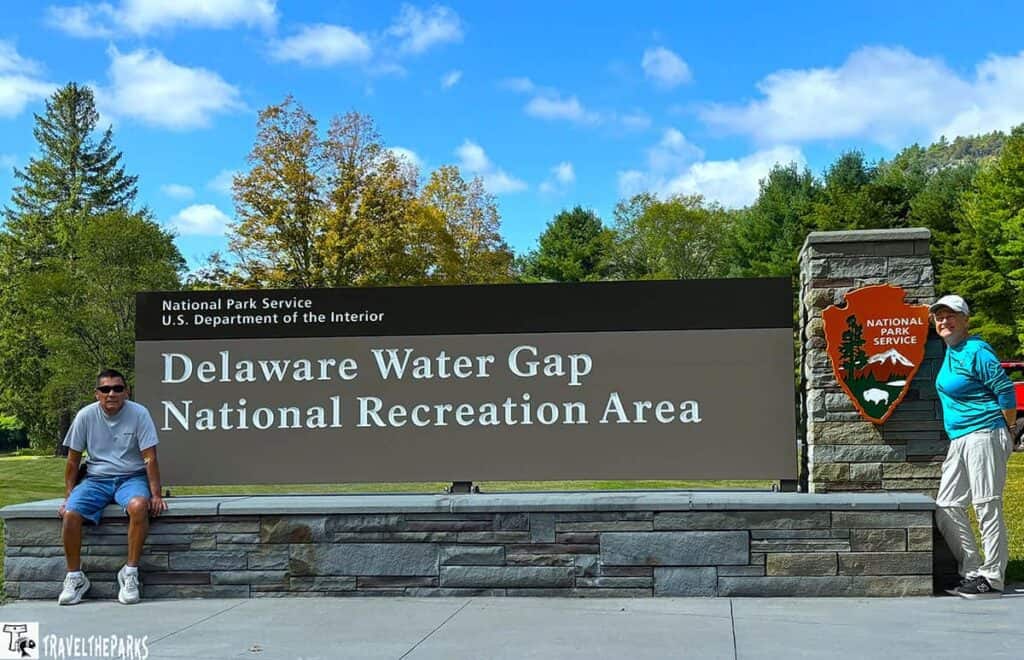
It was pretty soon after we began to create our itinerary at the Delaware Water Gap that we came to a realization that there were a handful of things that we wished to know prior to our visit. Knowing where to find the best trailheads and secret waterfalls and getting to know the park’s layout were the factors that turned our stay into a very nice one. In case you are going to the Delaware Water Gap next, the tips we figured out during our travel will help you double the fun of your trip and find out the top Delaware Water Gap activities.
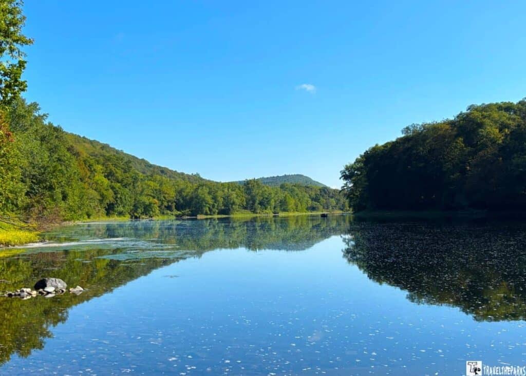
Table of Contents
The Delaware Water Gap: Know Before You Go
- Park Entrance Fee: This park is free! There is a fee to use the beach facilities at Milford Beach, Turtle Beach, and Smithfield Beach. Other activities, such as kayaking, require a fee.
- Best Time to Visit: Spring and Early Summer: Waterfalls are at their strongest flow, and wildflowers bloom along the trails. Fall: The colorful foliage, makes this one of the best hiking seasons in Delaware Water Gap. Winter: Some trails remain open, but be prepared for icy conditions and limited facilities.
- Cell service is spotty; assume you will have no signal. Download offline maps and save this itinerary to your phone.
- Parking is competitive: popular trailheads have limited parking. Arriving early is the single best strategy to avoid frustration.
- Leave No Trace. This is a pristine natural area. Pack out everything you pack in.
- Pets are permitted in most areas of the park, including campgrounds, picnic areas, and on paved or dirt roads. Pets must be restrained on a leash (6 feet or less).
- Check Conditions: Always check the official NPS website for trail closures, river levels, and weather alerts before you depart.
- What to Pack: Refillable water bottle, good hiking shoes or boots, bug spray and sunscreen. A map or GPS (cell service can be spotty). Swimsuit and towel if you plan to swim or kayak.
Where Is the Delaware Water Gap & How to Get There
Carved by the scenic Delaware River, this park is an ideal day trip or weekend getaway from New York City, Philadelphia, or North Jersey. The park’s central location makes it surprisingly accessible from several major metropolitan areas. If you’re coming from New York City, it’s about a 90-minute drive (roughly 75 miles) west via I-80. From Philadelphia, it’s around two hours north via I-476 and I-80. Travelers from northern New Jersey can reach the park in under an hour.
Where there is no single “entrance” because the park is that huge, it will be up to you to decide at which point you will enter the park depending on which activity from your itinerary you will be doing first.
Once you understand the layout and main entrance locations of the park, you will be able to make a good start to your trip and save time in moving around the park instead of enjoying the stunning natural view.
A Park Born from a Failed Dam: A Brief History
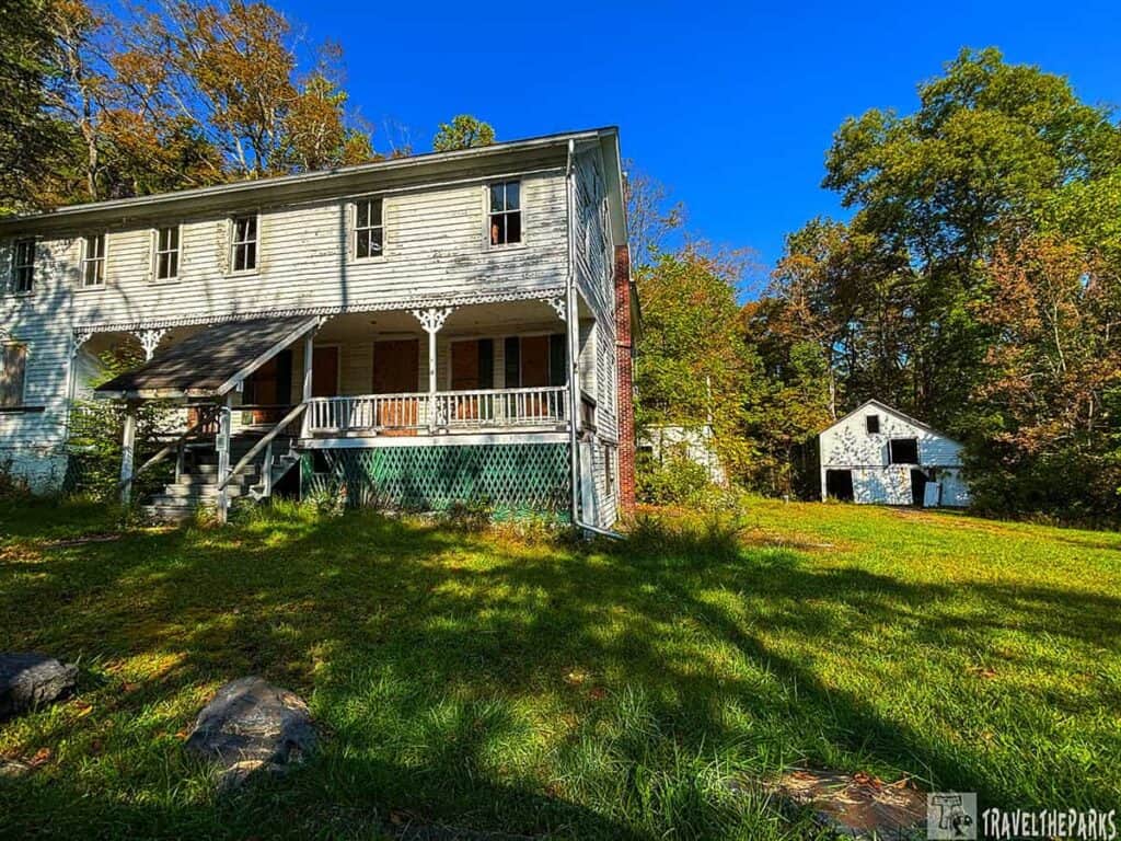
We were completely drawn in by the tale of the park’s beginning at the Bushkill Meeting Center. This area with amazing views is the result of a huge public project that was never realized. During the 1950s and 60s, the U.S. Army Corps of Engineers was working out the Tocks Island Dam Project. The project would control floods, create power, and provide recreation by making a 37-mile-long lake. The government was seizing properties through eminent domain. They would then tear down homes, farms, and even entire towns while preparing for the project. This was a troublesome time for local families. Abandoned properties still litter the park.
Opposition to the dam quickly grew into a potent force. Scientists pointed to fatal flaws in the bedrock, environmentalists decried the destruction of the river valley, and taxpayers questioned the soaring price tag. This effective campaign ultimately succeeded in halting the project in the early 1970s, leaving the government with a vast, newly acquired territory and a need for a new plan. Instead of being flooded, the valley became the Delaware Water Gap National Recreation Area in 1965, saving its rivers and forests for everyone. The river remains free-flowing. The trails enjoyed today are the same valleys that were saved from destruction, a lasting testament to environmental protection.
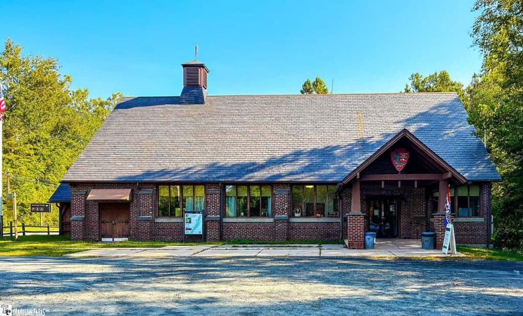
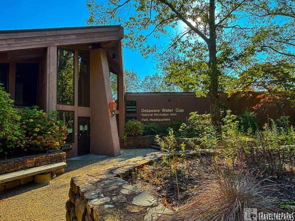
Delaware Water Gap Visitor Centers
Stopping at a visitor center is one of the best ways to start your Delaware Water Gap itinerary. The park spans across two states, so these centers are super helpful for getting maps, trail updates, and insider tips from park rangers.
Must-Do Adventures in the Delaware Water Gap
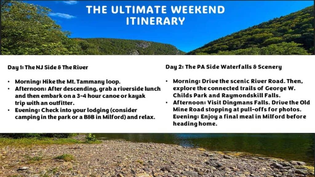
1. Hike to a Summit with a View: Mt. Tammany
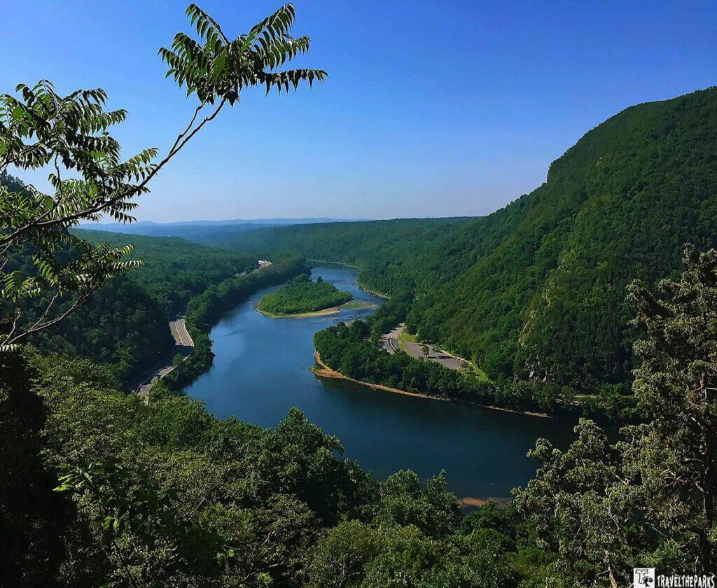
Seriously, if you only do one hike, then it should be the Mt. Tammany (Red Dot Trail) Loop. This tough yet satisfying 3.5-mile loop is basically the perfect hike of the Delaware Water Gap. Along the way, you will be climbing up wooden steps and the rocky trail quite steeply but in the end, you will be rewarded with the stunning and breathtaking view of the Water Gap itself—the Delaware River makes a U-turn between Mt. Tammany and Mt. Minsi on the other side lying in PA.
Pro Tip: The parking lot at the Dunnfield Creek exit off I-80 fills up incredibly fast, especially on weekends. Arrive before 8 AM to secure a spot. Wear proper hiking or water shoes. The trails are rocky and can be slippery.
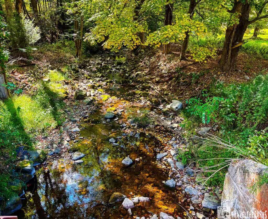
2. Waterfalls You Can’t Miss in the Delaware Water Gap
Of the many amazing things we found to do in Delaware Water Gap, discovering the area’s incredible waterfalls was the highlight of our trip. The itinerary you create should include at least one of these waterfalls. Scattered throughout the park, these cascades range from easy roadside stops to rewarding hikes tucked deep in the forest.
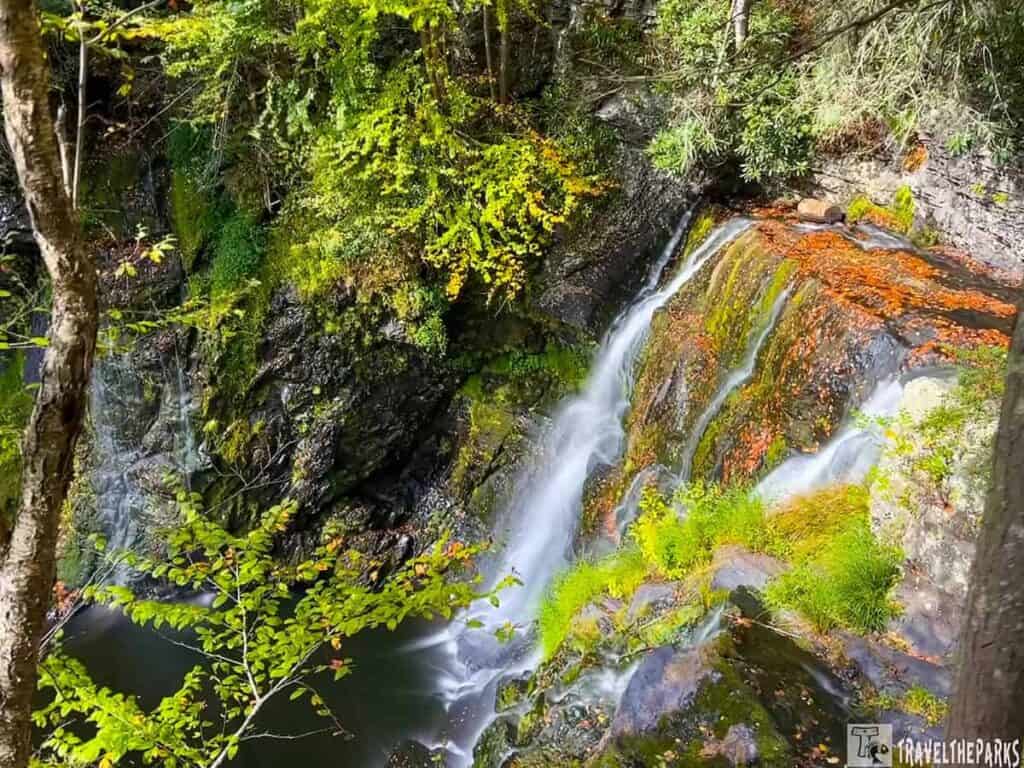
Buttermilk Falls (New Jersey Side)
Get ready for a workout with a view! Buttermilk Falls is the tallest vertical waterfall in New Jersey, and going up the steep staircase right beside its powerful rush is nothing short of breathtaking. It’s a challenging but unforgettable ascent that puts you right in the heart of the action.
The Pennsylvania Waterfall Loop
A short drive connects three of the park’s most beautiful and accessible waterfalls, making it easy to enjoy them in a single trip.
- George W. Childs Park: Begin with a gentler stroll here. This park features a series of smaller waterfalls nestled along a picturesque, easy loop trail. It’s the perfect warm-up.
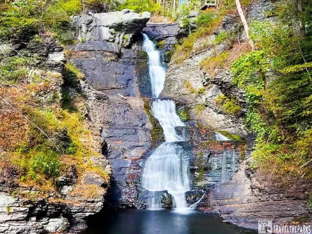
- Raymondskill Falls: Just down the road, Raymondskill Falls is Pennsylvania’s tallest waterfall and our personal favorite. An easy boardwalk with a few stairs leads to multiple viewing platforms, perfect for admiring its multi-tiered cascades from different angles.
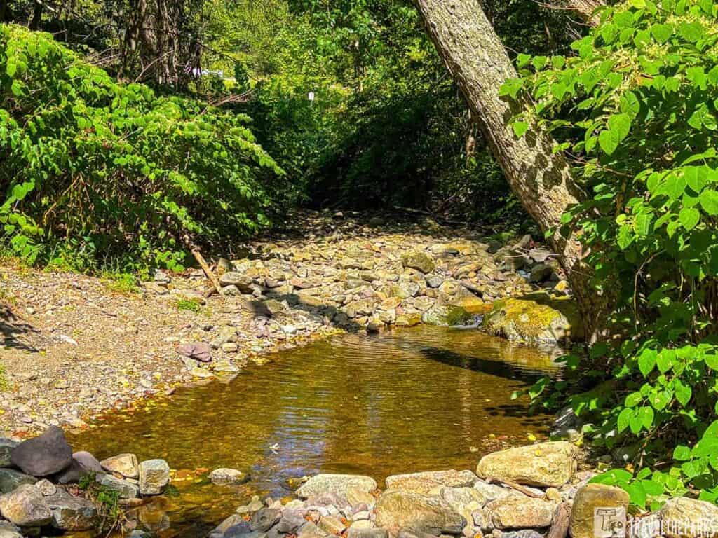
- Tumbling Waters: This is a quieter, off-the-beaten-path experience. We checked out this series of small cascades along a shaded trail. It is perfect for a picnic, or just a moment to enjoy the sound of rushing water away from the crowds.
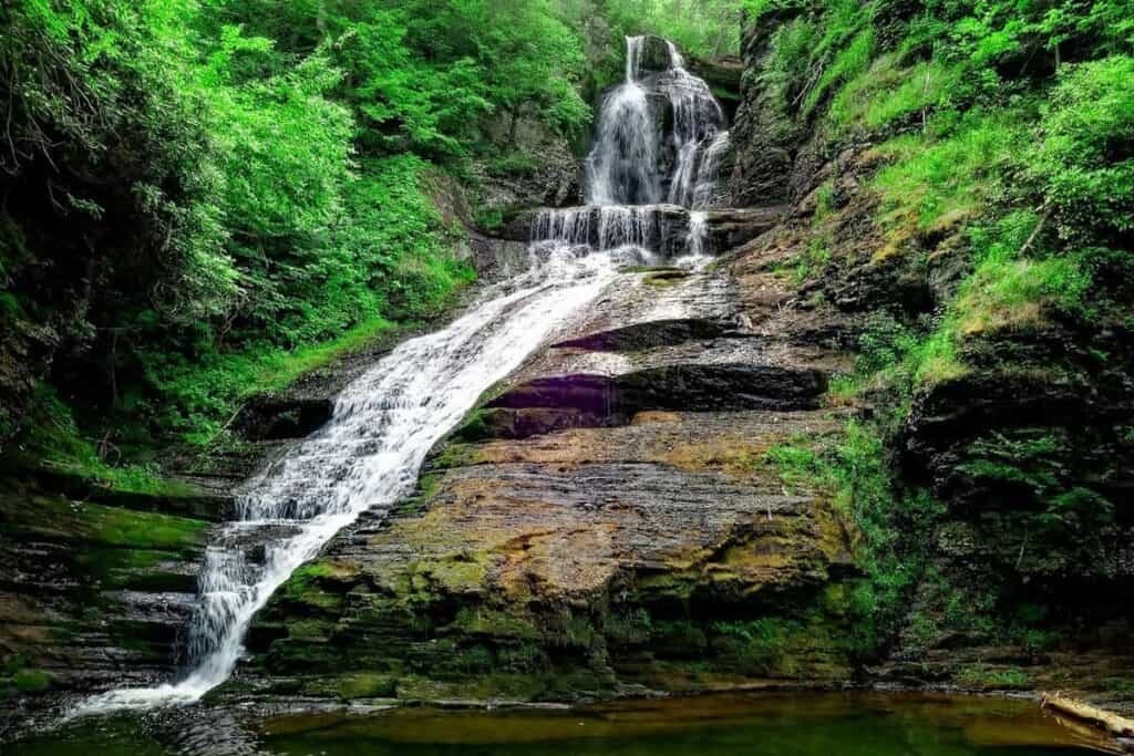
- Dingmans Falls: We ended our loop with Dingmans Falls, a fully wheelchair-accessible boardwalk that winds through a serene hemlock forest. The tall, impressive cascade at the end is a magical reward for visitors of all abilities.
Pro Tip: George W. Childs, Raymondskill, Dingmans Falls, and Tumbling Waters are all located near each other—making it easy to visit multiple waterfalls in one unforgettable afternoon.
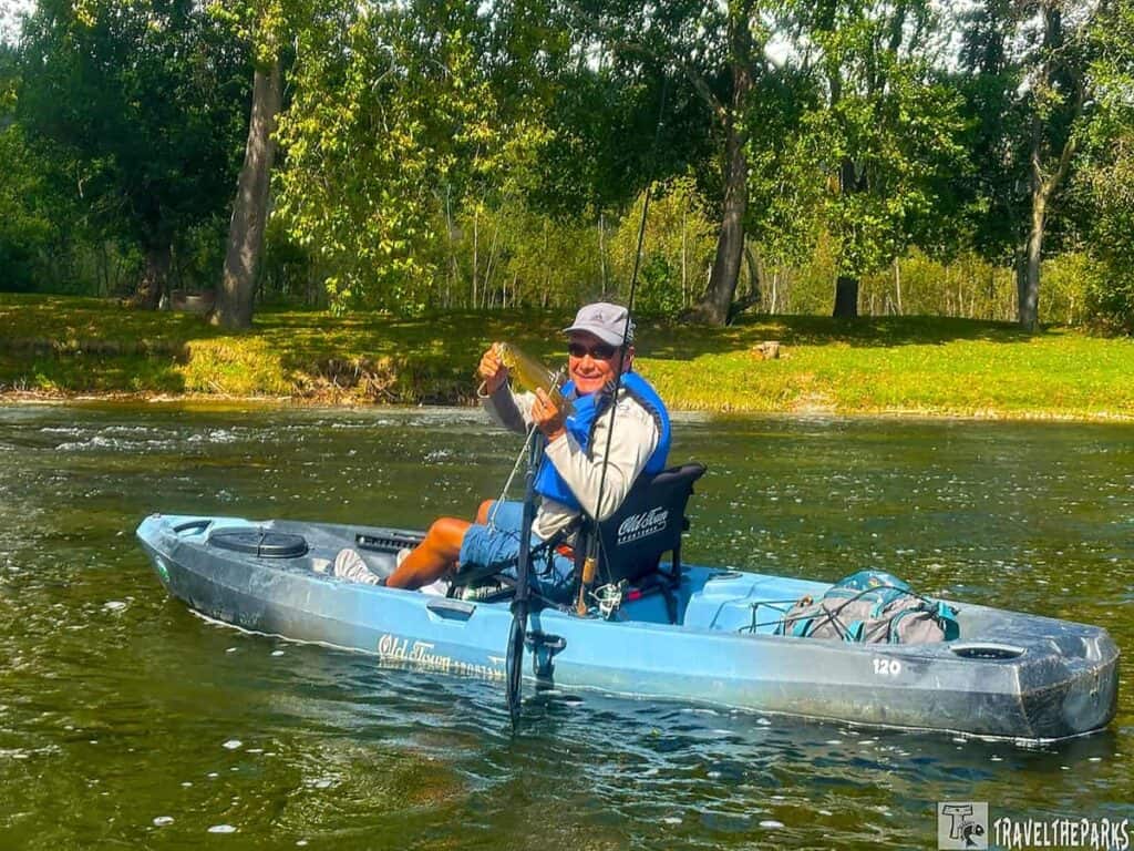
3. Paddle the Delaware River
We knew that to truly experience the Delaware Water Gap, we needed to get out on the water. Our choice? A kayak trip down the Delaware. Launching from Smithfield Beach, we floated gently downstream, casting lines as we went. The excitement of hooking a few feisty smallmouth bass broke the silence. The trip culminated with a stunning view of the forested “Gap,” rising high on either side of us at the takeout.
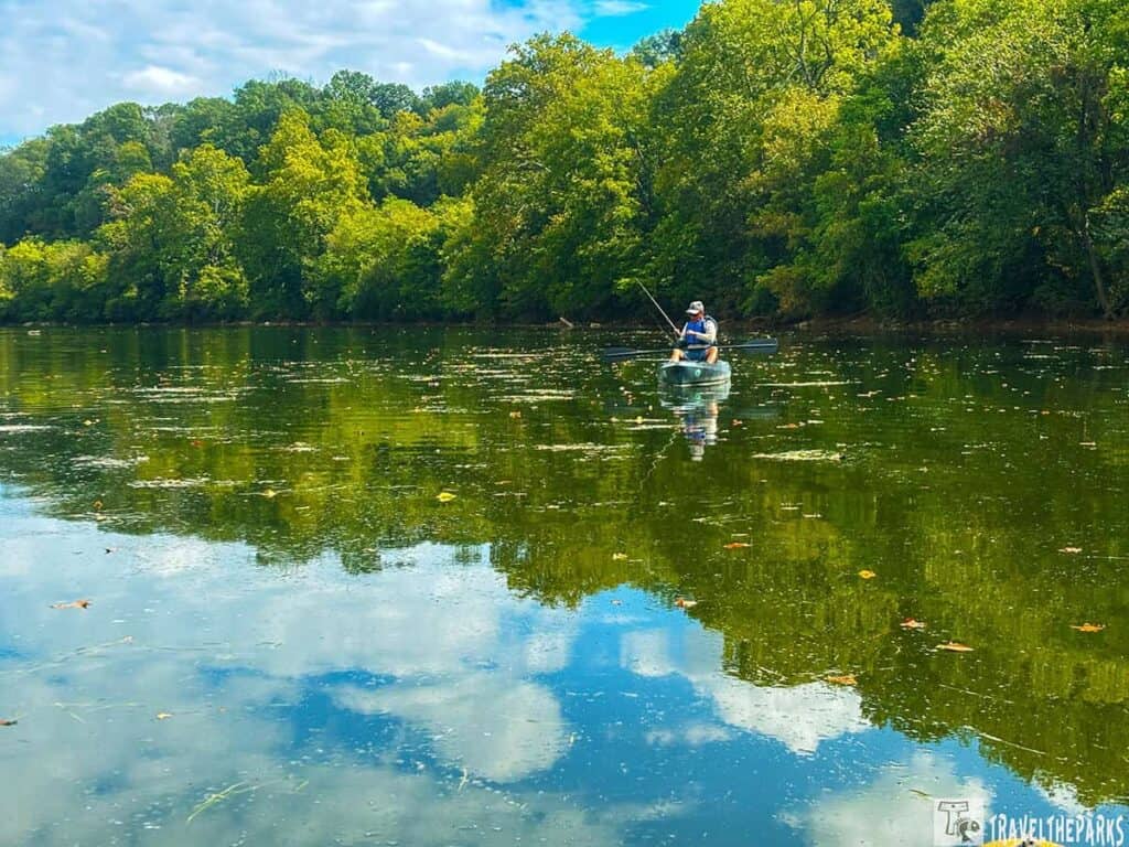
Several outfitters make this a breeze, handling rentals and shuttles. Companies like Edge of the Woods Outfitters and Adventure Sports, Inc. are popular and reliable choices. They provide everything you need—boat, paddles, life jackets, and a ride to/from the launch point. Safety First-The river current can be strong; always wear a life jacket.
PRO TIP: A free, seasonal shuttle service is available for paddlers on the Delaware River. The River Runner Shuttle, operated by the Monroe County Transit Authority in partnership with the National Park Service, runs on weekends and holidays from Memorial Day through Labor Day. The service can transport you, your watercraft, and your gear, and is ADA accessible.
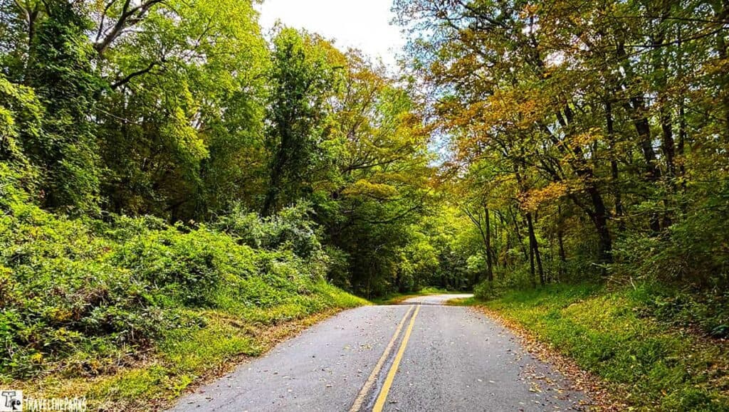
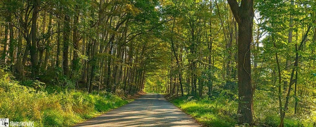
4. Take a Scenic Drive on River Road
Never say no to a quick drive through the park! If you’re short on time, a journey down the Pennsylvania side’s River Road (Route 209) provides beautiful views with minimal effort. The narrow, forested lane is wonderful in the early morning and often teems with wildlife. An incredible sight capped off our morning: a porcupine leisurely strolled right beside the road.

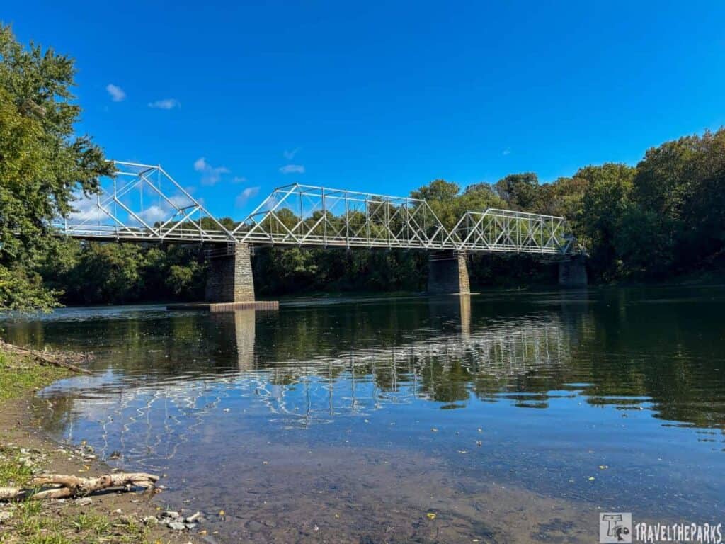
We made two memorable stops along River Road. First, the photographer’s dream at the Hialeah Picnic Area. Later, just off Hwy 209, after a little bit of effort, we located the Marie Zimmermann House. This extraordinary building, the ex-residence and studio of the famous metalworker, is a splendid architectural jewel that reflects the area’s creative past. We ended our drive in Dingmans Ferry with a view of the town’s iconic covered bridge..
5. Scenic Drive (And Survival Test): Conquering Old Mine Road
Brace yourself for a journey that is like learning history while going through an automotive obstacle course! Old Mine Road is not simply a route with beautiful views—it is one of the oldest trading roads in the whole U.S. that can be traced back to the 1600s. The road was initially used to connect the Hudson River with the Pahaquarry Mines and thereafter it was of great help to New Jersey farmers.
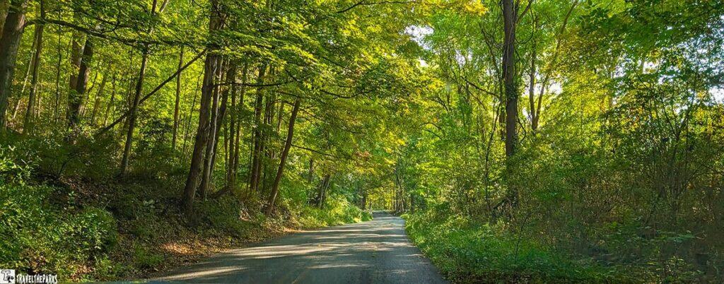
Nowadays, it follows along the Jersey side of the park, providing a historically fascinating route that is… full of potholes. Let’s not kid ourselves: the word “road” is hardly appropriate in this case. Alongside several parts, it is a close, deeply worn trail where the idea of “two lanes” sounds like a great exaggeration.
My main takeaway? I spent parts of this drive gripped by the sheer fear of meeting another car going the opposite way. Pray to the traffic gods that you don’t, because the reverse-of-shame game on this narrow track is a true test of diplomacy and driving skill. You’ll quickly understand why the farmers used wagons and not compact cars. Do yourself a favor: leave the sedan at home and opt for a truck or high-clearance vehicle. Your suspension (and your sanity) will thank you.
Must-See Stops: Scenic Tour, Old Mine Road
- Montague Grange: Active Grange hall, built in 1906, representing a long-standing advocate for rural communities.
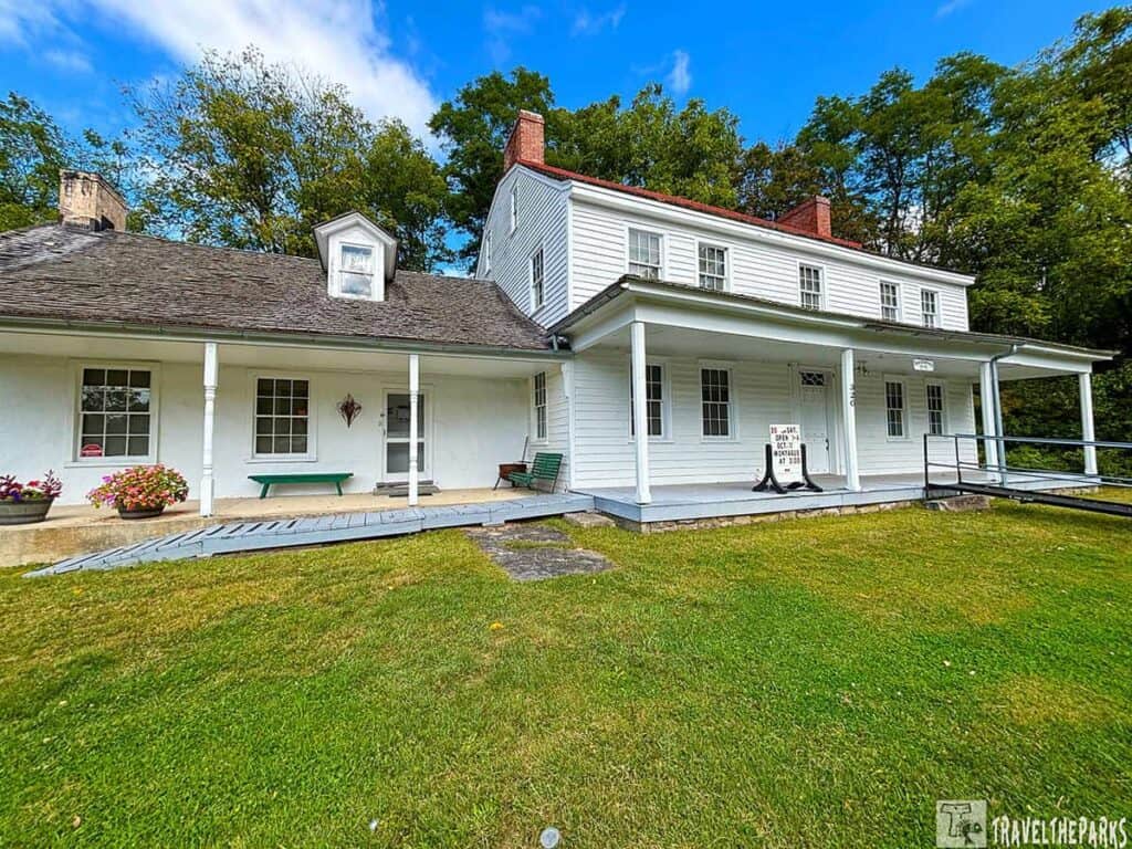
- The Foster-Armstrong House, a former tavern and inn, now a museum, displays the life of a wealthy family from the early 1800s.
- Minisink Dutch Reformed Church: A historic church with a cemetery dating to 1805, home to one of the oldest active congregations in the country.
- Nelden-Roberts Stonehouse: See early farm life at this stone house museum, built around 1820.
- Westbrook-Bell House: Before the government acquired the land, nine generations lived there, making it possibly the oldest house in the park.
- Alonzo Depue House: The home of a dedicated weather observer who recorded data for the U.S. Weather Service for 48 consecutive years.
- Walpack Center: A historic, isolated village with a museum that tells the story of its decline in the early 20th century.
- Van Campen Inn: An early colonial-era “yaugh house” that served to shelter travelers and settlers during the French & Indian War.
- Delaware View House: a building that evolved from a small house into a hunting lodge and boarding house over the years.
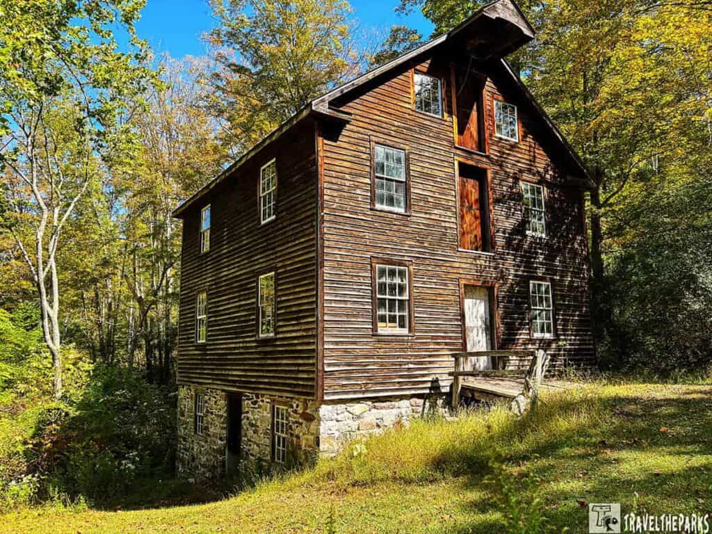
- Millbrook Village: A recreated 19th-century farm village with original and reconstructed buildings depicting period life.
- Calno School: A historic one-room schoolhouse that served the local community in the late 1800s.
Adventure Awaits: Camp, Pedal, and Swim
For those who heed the call of the wild, the Delaware Water Gap answers with a perfect trifecta of adventures. Imagine a day starting with the scent of coffee made on the campfire at your riverside camp—whether you have driven into Dingmans or paddled to a secluded spot accessible only by a boat.

Heading to the Joseph M. McDade Recreational Trail is a great midmorning escape. This 30-mile gravel path is like a beautiful road that winds through the woods. It gave us stunning views of the river and pastures and farm fields. The sound of your tires crunching on the gravel is all the music you need.

After a challenging ride, what better way to reward yourself than with a refreshing swim? We reach the sandy areas of Smithfield Beach or Milford Beach, where you can casually walk into the tranquil water of the Delaware and soak up the sun’s heat. This is the ideal way to end an exciting day—experiencing the Gap’s untouched natural beauty by taking a dip in its clear waters.
Where we stayed on our Delaware Water Gap Adventure Itinerary
While attending a family wedding, our stay at Four Seasons Campground was a solid base for exploring the Delaware Water Gap. The positive reviews are well-earned in many ways: the staff was indeed helpful, the grounds were clean and well-kept, and the wooded setting provided nice shade. We appreciated the good security and the convenience of being close to area attractions like Big Pocono State Park.
It’s important to be prepared, however, for the campground’s layout. As many RVers note, the sites are a bit close together, which can limit privacy. We also found our particular site was quite challenging to level, so come with your leveling blocks ready. There’s a firm presence of seasonal campers, but as travelers just passing through, we still felt welcomed.
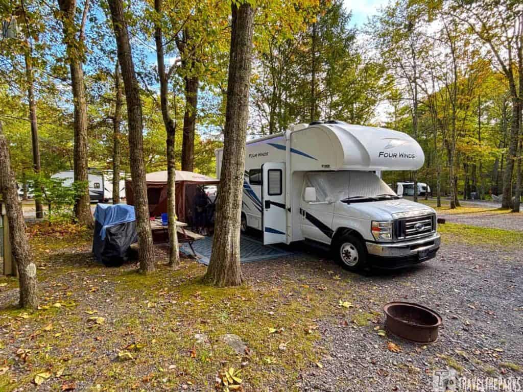
Despite the slightly higher price and the narrow, winding roads leading in, the amenities like the pool, clean restrooms, and reliable Wi-Fi made for a comfortable stay. It’s a well-run campground that delivers a pleasant experience. Just know you’re trading some spaciousness for convenience and community.
Final Thoughts: The Delaware Water Gap: Your Perfect Adventure Itinerary
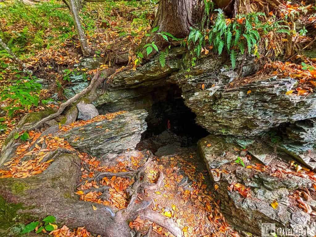
Today, the park’s quiet beauty still holds whispers of its past. If you wander off the main trails, you might stumble upon the ghosts of this history: crumbling stone foundations being reclaimed by the forest, overgrown old farm lanes, and the occasional lonely chimney stack or cellar hole. These abandoned properties are not mere ruins; they are silent reminders of the vibrant communities that were displaced to create the public wilderness we enjoy today. These spots are managed by the park service as part of the historical landscape, allowed to decay naturally as a monument to the area’s complex past. We hope our guided itinerary helps you build the perfect Delaware Water Gap itinerary.
Have you visited the Delaware Water Gap? What was your favorite spot? Share your own tips and stories in the comments below!