

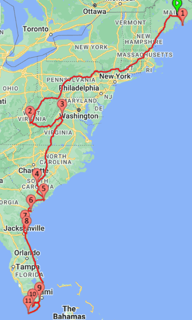
Our East Coast road trip itinerary to explore national parks, beaches, and historic sites was one of the most unforgettable journeys we have taken. Traveling in our camper, we spent several weeks following the Atlantic coast from Acadia National Park in Maine to Dry Tortugas National Park in Florida.
Every park and destination offered something completely different from the last. From rugged coastlines and mountain landscapes to historic landmarks and quiet beaches, the East Coast is filled with endless opportunities for discovery and adventure.
Use our itinerary as a starting point to plan your own East Coast road trip. This guide focuses on the major stops along our route, but it does not include every destination we visited along the way. Adding all the cities, beaches, mountains, and historic sites from 14 Atlantic Coast states would make this post overwhelming.
Our travel style is simple. We usually drive 3–4 hours between destinations, which makes the journey more enjoyable for us and our dog. This road trip reminded us that the best adventures are often the simplest ones—and that you do not need much to be truly happy.

This post may contain affiliate links, meaning if you purchase something through one of these links, we may earn a small commission at no extra cost to you! Read the full disclosure policy here.
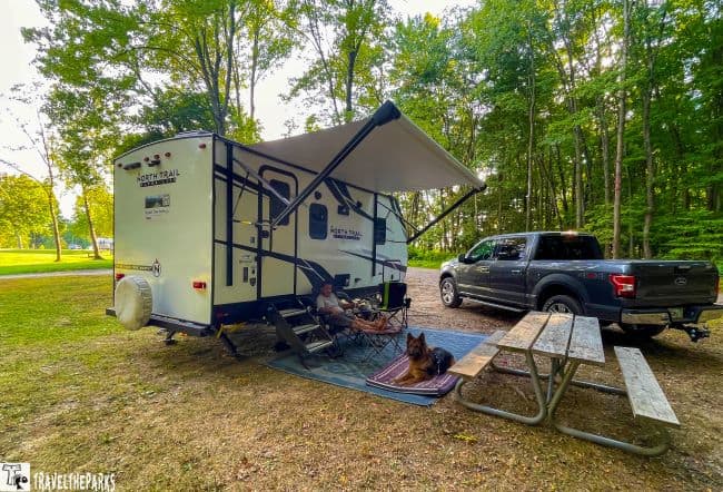
Table of Contents
East Coast National Parks Itinerary for the Perfect Road Trip
- Acadia National Park– 2-3 nights camping at Acadia National Park / Seawall Campground.
- New River Gorge National Park: 2 nights camping at Rifrafters Campground.
- Shenendoah National Park: 2-3 nights camping at Big Meadows Campground.
- Congaree National Park: 2 nights of camping at Santee Cooper State Park.
- Charleston, South Carolina-Fort Sumter and Fort Moultrie National Monument: 3 nights camping at James Island County Park.
- Fort Pulaski National Monument & Fort Frederica National Monument: 3 nights camping at Skidaway Island State Park near historic Savannah, Georgia.
- Cumberland Island National Seashore: 2 nights camping at Crooked River State Park in St. Marys.
- Timucuan Ecological and Historic Preserve: 3 nights camping at Huguenot Memorial Park in Jacksonville, Florida.
- Canaveral National Seashore: 2 nights camping at Jetty Park Beach & Pier in Port Canaveral.
- Biscayne National Park: 2 nights camping at Larry & Penny Thompson Park Campground.
- Everglades National Park: 3 nights camping at Flamingo Campground, 2 nights at Trail Lakes Campground and 1 night at Midway Campground.
- Dry Tortugas National Park: 3 nights of camping at Bahia Honda State Park.
When Is the Best Time to Plan an East Coast Road Trip?
Wondering when to plan an East Coast national parks road trip? The best time depends on which regions you plan to visit. The East Coast stretches through many climates, and each season offers a different experience.
We started our journey in spring at Acadia National Park in Maine and finished in late fall at Dry Tortugas National Park in Florida. Fall is one of the most beautiful times to visit Acadia, New River Gorge, and Shenandoah, but it is also when these parks attract some of the largest crowds.
Summer can be a busy season, especially at popular destinations like Acadia National Park, where parking and attraction wait times can become challenging. During our summer visits to the mid-Atlantic parks, we planned most hikes and activities for early morning or late afternoon to avoid the heat and crowds.
Since we live in Florida, we knew the southern destinations would be much more comfortable in late fall than during the heat and humidity of summer. Cooler temperatures also mean fewer mosquitoes and bugs, making outdoor adventures much more enjoyable.
TIP: Save Money with the America the Beautiful Pass
If you plan to visit multiple national parks and federal recreation sites, the $80 America the Beautiful National Parks and Federal Recreational Lands Pass can be a great value. The pass provides access to more than 2,000 federal recreation sites nationwide, making it especially useful for a long East Coast road trip.
With stops at national parks, national seashores, and national monuments along the route, this annual pass can quickly pay for itself while helping support the continued care of America’s public lands.
Maine’s Coastal Gem: Acadia National Park
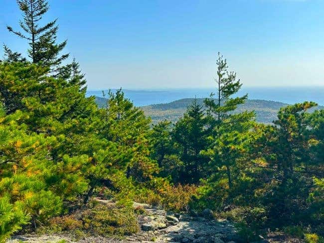
Overview: If possible, begin your journey along the rugged coastline of Acadia National Park in Maine. This park is impressive, covering an area of about 49,000 acres. Its most renowned land feature is Cadillac Mountain, the highest point on the U.S. Atlantic coast. The park also includes historical sites such as the Jordan Pond House and the historic carriage roads, which were built by John D. Rockefeller Jr.
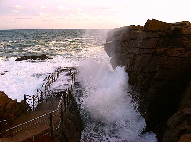
Best Things to Do: For hikers and outdoor lovers, there are over 120 miles of hiking trails in this park. Popular trails include the Jordan Pond Path and the Precipice Trail. Kayaking, paddleboarding, or a boat tour is available for water lovers in the park. This is by far the best way to see the iconic Bass Harbor Head Lighthouse. Whatever you choose to do, we are sure you will have an amazing time at Acadia National Park. One thing to note about Acadia is that if you plan to drive to the top of Cadillac Mountain, a vehicle reservation is required for Cadillac Summit Road from May through October. Cadillac Mountain is famous for being one of the first places in the United States to see the sunrise during certain times of the year.
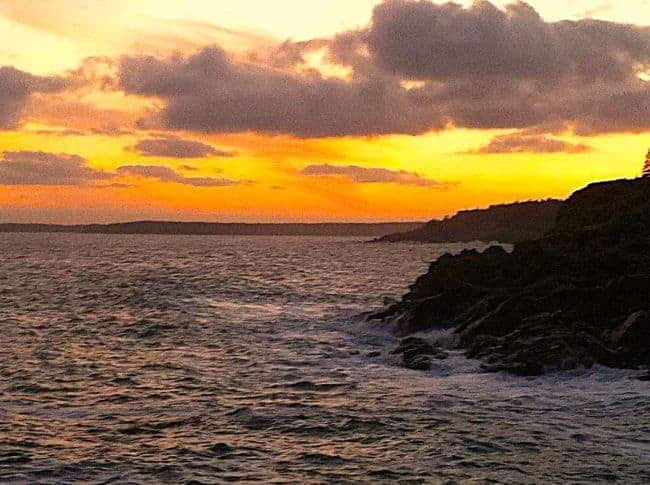
Our favorite memory of Acadia National Park
We started early morning, driving the one-way, 27-mile scenic Park Loop Road. It winds along Acadia’s rugged coastline, guiding visitors past must-see attractions like the dramatic Thunder Hole and towering Otter Cliffs. It was so quiet this early in the spring. All we heard was the sound of the waves crashing on the shoreline. The ever-changing scenery along this road is definitely spellbinding in any season. I can only imagine how beautiful it would be in the fall. The colors would be amazing, but there is something to be said for early spring flowers like the trillium and lady’s slipper.
TIP: Prepare for unexpected delays or roadside emergencies by packing essential items like water, snacks, a first-aid kit, and other emergency supplies.
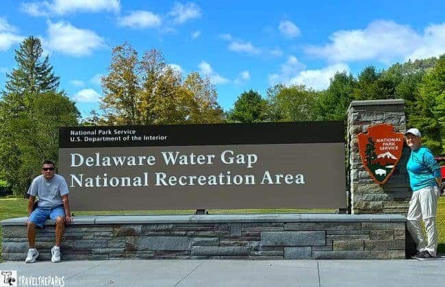
Appalachian Beauty: Delaware Water Gap National Recreation Area
Overview: Located along the border of Pennsylvania and New Jersey, Delaware Water Gap National Recreation Area protects more than 70,000 acres of forests, mountains, rivers, and historic landscapes. The park follows nearly 40 miles of the Delaware River and offers some of the most scenic views along the Appalachian Mountains.
Created to preserve this unique river corridor, the recreation area combines outdoor adventure with fascinating history. Visitors can explore waterfalls, historic villages, scenic overlooks, and miles of trails throughout the park.
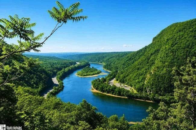
Best Things to Do: Delaware Water Gap is a paradise for outdoor lovers. Hiking is one of the best ways to experience the park, with popular trails leading to waterfalls, mountain viewpoints, and sections of the Appalachian Trail.
The Delaware River is another highlight, offering opportunities for kayaking, canoeing, fishing, and wildlife viewing. Anglers will enjoy the peaceful streams and river areas, which provide excellent opportunities for catching native fish while surrounded by beautiful scenery.
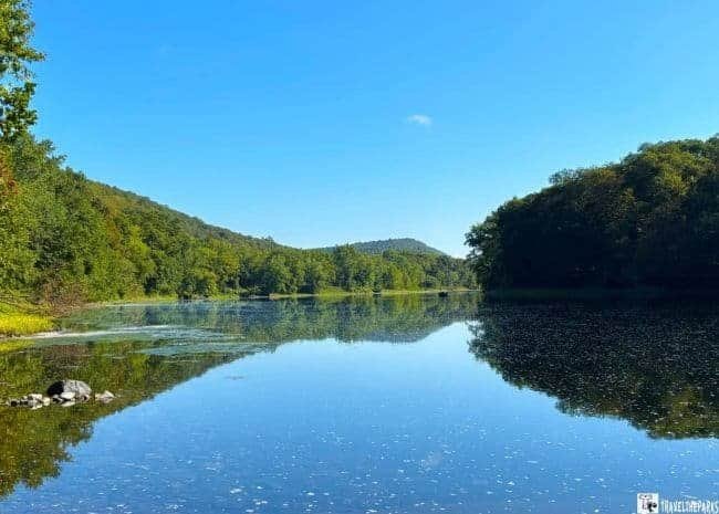
Our Favorite Memory of Delaware Water Gap National Recreation Area
Avid fly fishers will find an abundance of trout in the park’s clear, flowing streams. Fishing is one of our favorite pastimes, and Delaware Water Gap provided the perfect setting. Early mornings along the Delaware River and its quiet tributaries offered peaceful moments surrounded by the Appalachian landscape.
The rhythm of casting into moving water here is something we still remember. The cool mountain air, scenic river views, and the excitement of feeling the line tighten made this one of our favorite fishing destinations along our East Coast road trip.
East Coast Adventure: New River Gorge National Park and Preserve
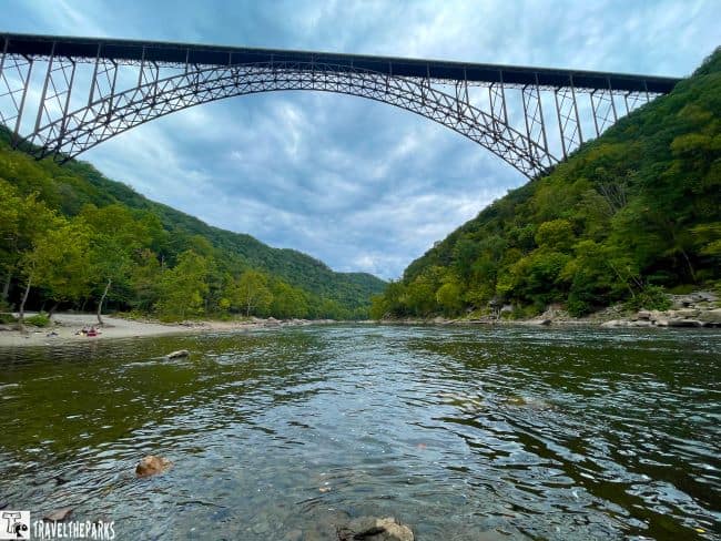
Overview: Established as a national river in 1978 and redesignated as a national park and preserve in 2020, New River Gorge protects more than 70,000 acres of West Virginia’s Appalachian wilderness. The park follows 53 miles of the New River, which has carved an incredible 800-foot-deep gorge through the mountains over millions of years.
The centerpiece of the park is the iconic New River Gorge Bridge. Stretching more than 3,000 feet across the gorge, this engineering marvel offers breathtaking views of the surrounding landscape and has become one of West Virginia’s most recognizable landmarks.

Best Things to Do:New River Gorge National Park and Preserve offers endless opportunities for adventure. Thrill-seekers can walk high above the river on the Bridge Walk catwalk tour, while outdoor enthusiasts can explore hundreds of miles of trails, world-class rock climbing routes, and legendary whitewater rafting.
Avid fly fishers will also find incredible opportunities throughout the park’s clear mountain streams and the New River itself. Fishing is one of our favorite pastimes, and there is no better setting than casting a line at sunrise while surrounded by the quiet beauty of the Appalachian Mountains.
The experience reminded us of other Appalachian fishing destinations we have visited—the cool mountain water, peaceful surroundings, and that unforgettable moment when the line tightens in a wild, scenic river corridor.
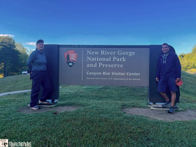
Our favorite memory of New River Gorge National Park
Exploring the historic towns scattered throughout New River Gorge remains one of my favorite memories. Once a bustling railroad community, Thurmond played an important role in the region’s coal industry. By 1910, it had become the Chesapeake & Ohio Railway’s primary railroad hub, generating more revenue than several major cities of the era.
But my favorite was Nuttallburg, a former coal mining town that stopped production in 1958. The company left behind historic buildings and remnants of the mining infrastructure, creating one of the best-preserved examples of a coal mining complex in West Virginia.
Walking through these abandoned communities felt like stepping into the past. Both Thurmond and Nuttallburg had the unmistakable atmosphere of Appalachian ghost towns, offering a fascinating glimpse into the people and industries that shaped this region.
East Coast Panoramas: Shenandoah National Park
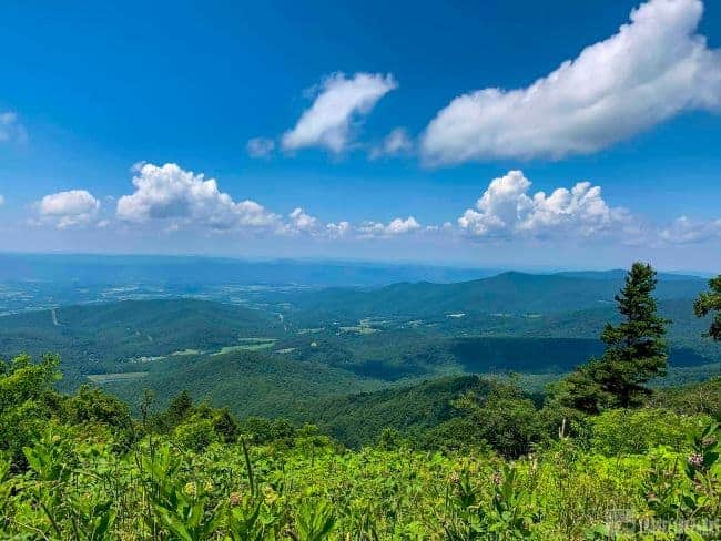
Overview: Shenandoah National Park was an easy side trip we added to our East Coast road trip through Virginia. The rolling Blue Ridge Mountains define this beautiful park. Driving the 105-mile Skyline Drive from one end of the park to the other, we found that around every corner there was another breathtaking vista.
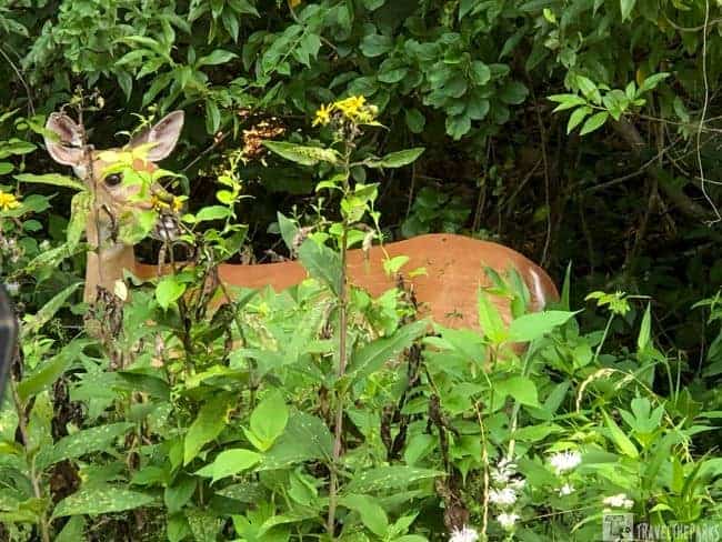
This scenic route is one of Virginia’s most memorable drives and is featured in our Virginia’s Scenic Byways guide, which highlights some of the state’s most beautiful road trips and nearby historic destinations. While visiting Shenandoah, we had many opportunities to spot black bears and white-tailed deer, even from the comfort of our car. Plant lovers will also appreciate the park’s incredible diversity, with more than 1,400 species of wildflowers found throughout the area.
Best Things to Do: Shenandoah National Park
The national park is a haven for outdoor adventures. Whether you enjoy fly fishing the Shenandoah River, exploring mountain trails, or venturing underground at nearby Luray Caverns, the area offers something for everyone.
With more than 500 miles of hiking trails, visitors can choose everything from easy walks to challenging mountain climbs. Some of our favorite hikes included Old Rag Mountain, Bearfence Mountain, Rapidan Camp, and Dark Hollow Falls.
The Bearfence Mountain rock scramble was especially memorable. While climbing over the exposed rocks, we spotted a timber rattlesnake—a reminder that Shenandoah’s wilderness is very much alive.
If you have extra time, consider adding Luray Caverns to your itinerary. Exploring this underground world makes a fascinating addition to a Shenandoah visit. The park also makes an excellent base for exploring some of Virginia and nearby West Virginia’s most significant historic destinations, including Harpers Ferry, Antietam National Battlefield, and Gettysburg.

Our Favorite Memory: Fishing in Shenandoah National Park
I have fond memories of the peaceful moments I spent fly fishing for smallmouth bass along the serene waters of the Shenandoah River. The experience of feeling a fish take the fly, followed by the excitement of the fight, while surrounded by the beauty of the river was truly unforgettable.
On a sweltering summer day, wading through the cool river waters provided a refreshing escape from the heat. The quiet surroundings, flowing water, and scenic Blue Ridge Mountain backdrop made this one of our favorite fishing experiences along the East Coast.
For more about this beautiful river destination, check out our guide to Shenandoah River State Park.
TIP: If your travel schedule allows, consider adding a side trip to Washington, D.C. to explore the nation’s iconic monuments, memorials, and museums. The capital is a great addition to an East Coast road trip, especially when visiting Shenandoah National Park and other nearby historic destinations.

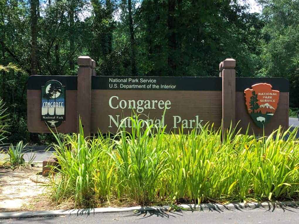
East Coast Old-Growth Trees: Congaree National Park
Overview: Congaree National Park protects one of the largest remaining old-growth bottomland hardwood forests in the United States. Some of the tallest trees on the East Coast tower above the park’s floodplain, providing habitat for a wide variety of wildlife.
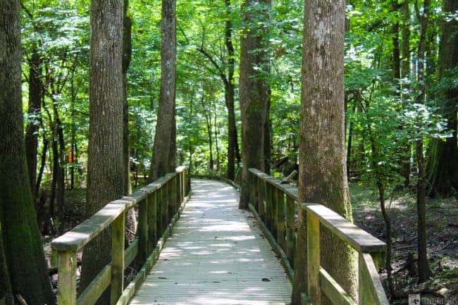
Although Congaree is a relatively small national park at about 27,000 acres, we were amazed by the grandeur of these ancient giants while hiking along the boardwalk. Before becoming a teacher, I studied forestry, so I have always had a deep appreciation for trees and the importance of protecting these incredible ecosystems.
When we visited in July, we found ourselves almost alone in the park. It was the perfect place to reconnect with nature and appreciate the importance of preserving these remarkable forests for future generations.
Best Things to Do
While Congaree National Park may not offer the same number of activities as some larger parks, that is part of its charm. The park features more than 25 miles of hiking trails, including the popular Boardwalk Loop Trail, which allows visitors to experience the towering forest without venturing deep into the floodplain.
Because Congaree is a floodplain forest, trail conditions can change quickly depending on water levels. Summer is also the rainy season, so some trails may become muddy or inaccessible. Despite the challenges, we embraced the peaceful beauty of this hidden gem and spent time exploring several trails throughout the park.
Our Favorite Memory in Congaree National Park
One of the best ways to experience Congaree is from the water. The park’s Cedar Creek Canoe Trail provides a unique perspective of the ancient forest, winding through the floodplain beneath the towering trees.
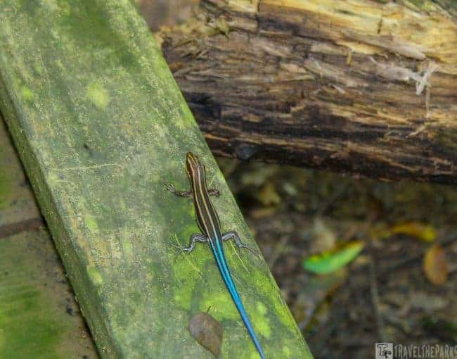
We booked a 3-hour guided trip with J.K. Adventure Guides, and it was one of the highlights of our visit. Our guide shared fascinating stories, especially about his wildlife encounters throughout the park. Along the way, we saw several snakes (but thankfully no moccasins), a raccoon, a barred owl, and a few five-lined skinks.
Even during a hot July visit, the mosquitoes were only about a 3 on our personal mosquito meter!
Exploring History: Fort Sumter and Fort Moultrie National Monument
We have always enjoyed exploring historic forts, especially those built during the Third System of U.S. coastal fortifications, including Fort Pickens, Fort Barrancas and Fort Clinch.
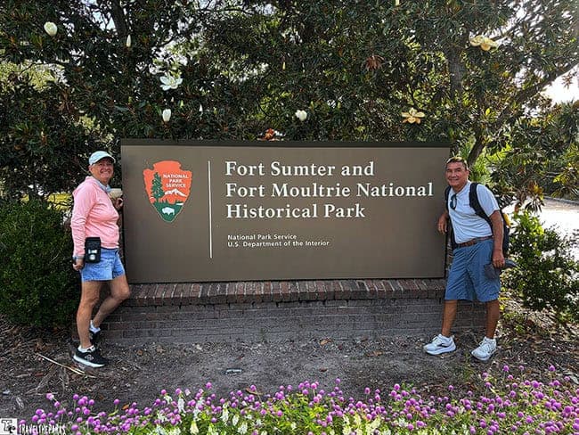
For history lovers, Fort Sumter and Fort Moultrie National Monument offer an incredible opportunity to explore the events that shaped the nation. The Battle of Fort Sumter took place from April 12–14, 1861, marking the beginning of the American Civil War. The conflict would last four years, result in more than 620,000 deaths, and eventually lead to the abolition of slavery and freedom for nearly 4 million enslaved people.
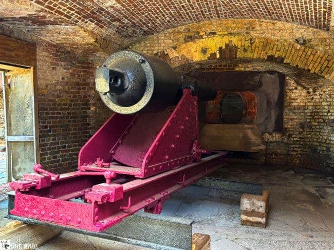
Best Things to Do
Located in the middle of Charleston Harbor, Fort Sumter is accessible by a scenic 20-minute ferry ride. Plan to spend at least 2–3 hours exploring the fort, visiting the museum exhibits, and enjoying beautiful views of Charleston Harbor along the way.
After exploring the fort, take time to appreciate the waterfront views before returning by ferry. Fort Moultrie, located on Sullivan’s Island, is another worthwhile stop and provides a broader look at the coastal defenses that protected Charleston for generations.
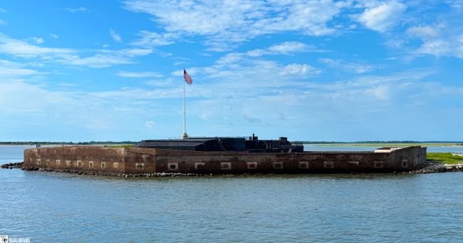
Our Favorite Memory: A Fort Sumter Patriotic Experience
The first ferry of the day was ours, and we were fortunate to arrive early. After climbing the stairs to the top of the fort, we watched the flag-raising ceremony from above.
As the flag rose, a gentle breeze moved across the harbor, and the quiet among the visitors emphasized the significance of the moment. Standing there, reflecting on the events that unfolded at Fort Sumter and the people whose lives were forever changed by the Civil War, was incredibly moving.
The flag raising at Fort Sumter remains one of those unforgettable experiences that connects visitors with the history, struggles, and sacrifices that shaped the United States.
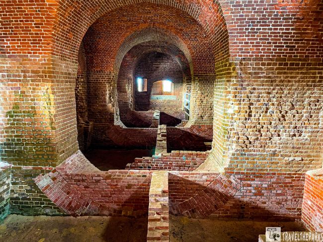
Coastal Georgia History: Fort Pulaski and Fort Frederica National Monuments
Fort Pulaski National Monument near Savannah, Georgia, and Fort Frederica National Monument, on St. Simons Island offer fascinating glimpses into two very different chapters of American history.
Fort Pulaski played an important role during the Civil War. In 1862, Union forces captured the fort after a prolonged siege, demonstrating the effectiveness of new rifled cannon technology against traditional masonry fortifications.
Fort Frederica tells an earlier story. Established by the British in the 18th century, the settlement served as a strategic outpost protecting the southern boundary of the British colony of Georgia. Today, visitors can explore the remaining ruins and archaeological sites while learning about the conflicts that shaped the region.
Together, these two national monuments provide a unique opportunity to experience both colonial and Civil War history along Georgia’s coast.
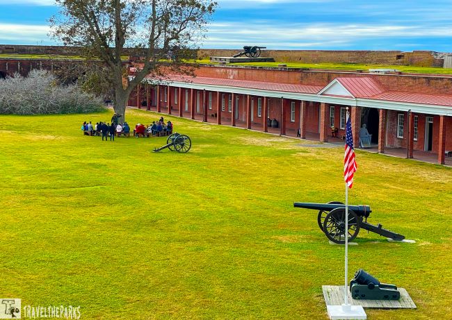
Best Things to Do
Exploring Fort Pulaski is like stepping back into the Civil War era. Visitors can walk along the massive brick walls, explore the interior rooms, and learn about the innovative construction techniques that made the fort one of the most impressive coastal defenses of its time.
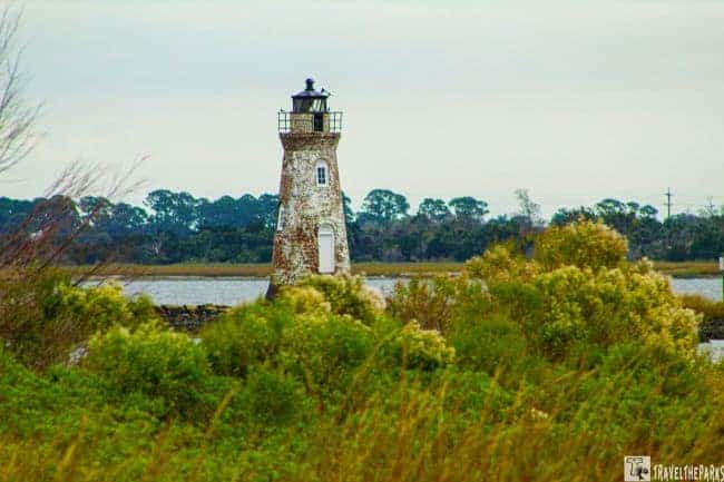
The park also offers trails around Cockspur Island, views of the Savannah River, and a chance to visit the nearby Cockspur Lighthouse. During special events, historical reenactments and cannon demonstrations bring the fort’s history to life.
At Fort Frederica, visitors can wander through the archaeological remains of the colonial settlement, explore walking trails, and imagine the activity that once filled this strategic outpost. Guided tours provide additional insight into the lives of the soldiers, settlers, and families who called this place home.

Our Favorite Memory: The Thrill of Live Cannon Firing
The highlight of our visit was witnessing a live cannon demonstration during a historical reenactment event at Fort Pulaski. The booming sound of the cannon echoing through the fort, followed by the smoke rising into the air, was both startling and mesmerizing.
Seeing the power of these weapons firsthand gave us a greater appreciation for the challenges soldiers faced during battles of the past. It was a thrilling experience and one of those unforgettable moments that brings history to life.
TIP: Add Savannah and Tybee Island: If your schedule allows, a side trip to Savannah’s historic cobblestone streets makes a wonderful addition to this itinerary. You can also climb the 273 steps to the top of Tybee Island Lighthouse for incredible coastal views.

A Coastal Haven: Cumberland Island National Seashore
Overview: Just off the southeastern coast of Georgia lies the impressive Cumberland Island National Seashore, spanning more than 36,000 acres. This remote barrier island features miles of untouched, powdery sand beaches and unspoiled coastal landscapes.
The island is most renowned for its iconic wild horses that roam freely across the landscape. These Cumberland horses are descendants of domesticated horses brought to the island centuries ago.
For travelers seeking an escape from the crowds, Cumberland Island offers a true wilderness experience. The island is accessible only by ferry from St. Marys, and the journey helps preserve its peaceful, untouched atmosphere.

Best Things to Do
What I loved most about Cumberland Island National Seashore was the opportunity to truly immerse ourselves in nature. Our hikes across the island’s trails took us through maritime forests, salt marshes, and quiet stretches of coastline.
Biking along the sandy paths is another popular activity, with rentals available in St. Marys. Reaching Plum Orchard Mansion requires a 5-mile one-way ride, but the journey is part of the experience. The trail winds beneath towering live oaks covered in Spanish moss and offers beautiful views along the way.
The mostly flat route makes biking accessible for many visitors. For an even deeper connection with the island, consider camping beneath a canopy of stars after the crowds have departed.

Our favorite memory: visiting the grand Gilded Age mansions
Taking the Land and Legacies Tour allowed us to experience more than just Cumberland Island’s beaches. Reservations are highly recommended for both the ferry and the tour.
Plum Orchard Mansion was one of the highlights of our visit. Our knowledgeable guide, Mike Fulford, brought the mansion’s history to life through fascinating stories and details about the Carnegie family.
After exploring Plum Orchard, Mike gave us plenty of time to visit Dungeness Mansion. Built by Thomas Carnegie in the 1880s, the estate was once known for its incredible opulence and grandeur. Sadly, fire destroyed the mansion in 1959.
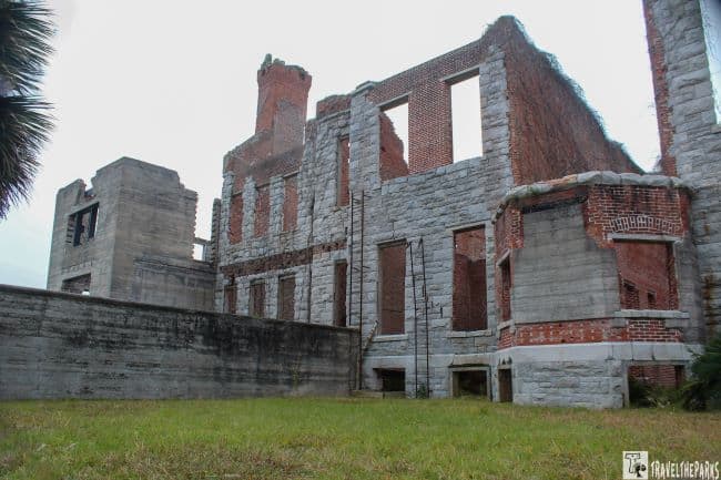
Today, the skeletal ruins of Dungeness stand as a haunting reminder of Cumberland Island’s fascinating past. The remaining stone walls, covered in ivy and surrounded by nature, felt almost otherworldly. Walking through the ruins was one of the most memorable moments of our visit.
Enjoying a picnic lunch while wild horses grazed nearby on the lawn was another unforgettable experience. I would highly recommend the Land and Legacies Tour to anyone wanting to discover the rich history hidden beyond Cumberland Island’s beaches.

Exploring the Timucuan Ecological and Historic Preserve
Overview: Just outside Jacksonville, Florida, along the Buccaneer Trail, lies the Timucuan Ecological and Historic Preserve. Covering more than 46,000 acres, this incredible preserve combines coastal landscapes, wildlife habitats, and important pieces of Florida history.
The preserve includes several significant historic sites, including Fort Caroline National Memorial and Kingsley Plantation. Fort Caroline commemorates the 16th-century French Huguenot settlement and one of the earliest European attempts to establish a colony in North America.
Kingsley Plantation provides a powerful look into Florida’s plantation era and the lives of the people who lived and worked there. The former cotton plantation includes the restored plantation house, historic slave quarters, tabby ruins, and a barn.
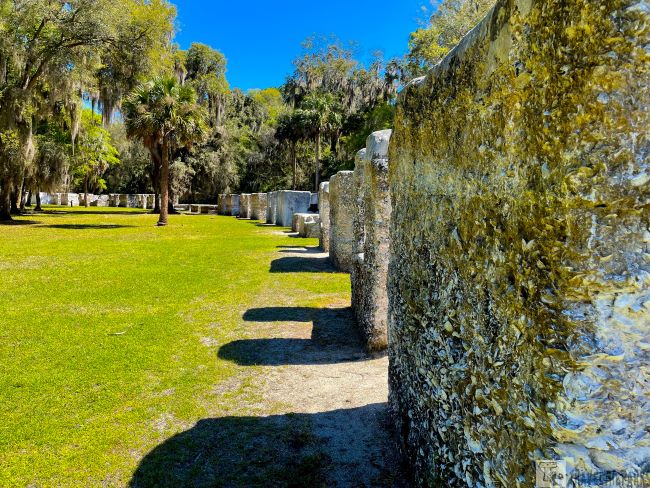
Best Things to Do
Visitors can enjoy a variety of outdoor activities throughout the preserve, including hiking, canoeing, kayaking, and wildlife viewing. We explored the preserve’s network of trails and waterways, which provide access to its diverse coastal environments.
The visitor center offers educational exhibits about the Timucua people, the area’s Indigenous history, and the natural resources that make this region unique. Both Fort Caroline and Kingsley Plantation offer opportunities to explore historic structures and learn about the people who shaped this part of Florida.
For nature lovers, nearby Boneyard Beach on Big Talbot Island is another unforgettable coastal experience. The shoreline is scattered with weathered tree skeletons, creating a landscape unlike anywhere else in Florida.

Our Favorite Memory: A Walk on Boneyard Beach
Walking along Boneyard Beach remains one of our favorite memories from the Timucuan area. The way sunlight shines across the bleached remains of trees lining the shoreline creates a photographer’s dream.
During our visit, the wind was calm, and the gentle sound of waves rolling onto the beach created a peaceful atmosphere. As we wandered along the sandy coastline, I enjoyed searching for shells and pieces of driftwood.
We had this unique landscape almost entirely to ourselves. It was one of those rare places where you can escape the noise of everyday life and simply enjoy the beauty of the coast.
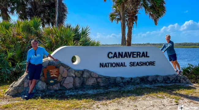
Exploring Canaveral National Seashore: A Hidden Gem of Florida
Overview: Canaveral National Seashore is a fascinating destination where untouched beaches, diverse ecosystems, and Florida history come together. Located along the Space Coast, the park protects more than 24 miles of undeveloped shoreline, coastal dunes, salt marshes, and important wildlife habitats.
This peaceful stretch of coastline offers a different side of Florida away from the crowds. Visitors can experience pristine beaches, abundant wildlife, and historic sites while exploring one of the state’s most unique natural areas.

Best Things to Do
Canaveral National Seashore is a must-visit destination when exploring Florida’s Space Coast. At the Apollo Visitor Center and Eldora State House, both located near Mosquito Lagoon, keep an eye out for dolphins and manatees around the waterways.
Renting a kayak is one of the best ways to experience the park. The calm lagoon waters provide opportunities to see manatees, dolphins, and a variety of bird species in their natural habitat.

Fishing is another popular activity. During our visit, we saw many visitors surf fishing along the beach and casting from the lagoon docks. Some anglers were even catching mullet during the afternoon.
If your schedule allows, combine your visit with nearby attractions such as Kennedy Space Center, Merritt Island National Wildlife Refuge, or Brevard Zoo. These destinations make the Space Coast an excellent addition to an East Coast road trip.

Our Favorite Memory: Exploring Seminole Rest
One of our favorite memories from Canaveral National Seashore was exploring Seminole Rest. Located along the Indian River, this historic site provides a glimpse into Florida’s ancient past.
The preserved shell mounds stand as a reminder of the Indigenous people who lived in this region for thousands of years. Walking through this peaceful landscape, surrounded by river views and coastal vegetation, felt like stepping back through time.
Seminole Rest perfectly captures what makes Canaveral National Seashore special: a place where history, nature, and tranquility come together.
PRO Tip: During the winter months, manatees gather in large numbers around the warmer waters of nearby areas. The Haulover Canal is another excellent location for spotting these gentle giants.

East Coast River of Grass: Everglades National Park
Overview: Everglades National Park, often called the “River of Grass,” protects more than 1.5 million acres of subtropical wilderness. This vast sawgrass marsh ecosystem is unlike any other place in the United States.
The park is recognized as a UNESCO World Heritage Site, an International Biosphere Reserve, and a Wetland of International Importance. Its diverse habitats support an incredible variety of wildlife, including American alligators, West Indian manatees, roseate spoonbills, and the endangered Florida panther.
The Everglades is truly one of Florida’s greatest natural treasures, offering visitors a rare opportunity to experience a wild landscape unlike anywhere else.
Best Things to Do
Everglades National Park offers countless ways to explore its unique ecosystems. Popular activities include hiking, birdwatching, wildlife viewing, paddling, and scenic boat tours.
The Anhinga Trail is one of the best places to experience the park’s wildlife, while Shark Valley offers a unique perspective of the Everglades through its scenic loop road, tram tours, and biking opportunities. The Flamingo area provides access to the park’s coastal wilderness, including mangrove waterways and boat excursions.
With so many different landscapes and experiences, the Everglades deserves more than one visit. We have explored the park multiple times, and it continues to surprise us every time.
For a deeper look at exploring this incredible ecosystem, check out our guides covering the best things to do in Everglades National Park, hiking trails, wildlife viewing, and other unique experiences.
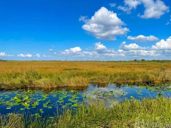
Our Favorite Memory: Everglades Nike Missile Tour
One of our most memorable Everglades experiences was discovering the Nike Missile Site, a hidden piece of Cold War history within the park. Walking through the abandoned military site, surrounded by the peaceful wilderness of the Everglades, created a fascinating contrast between nature and history.
The tour provided a glimpse into a tense period of the 20th century and helped us appreciate the important role this site played during the Cold War. For a deeper look at this unique experience, check out our guide to the Everglades Nike Missile Tour.
East Coast Beach & Reef: Biscayne National Park
Overview: Located just south of Miami, Biscayne National Park protects a stunning underwater world of emerald waters, mangrove islands, and coral reefs. Covering more than 173,000 acres, the park is one of the largest marine protected areas in the National Park System.
Unlike many national parks, most of Biscayne exists beneath the water. Nearly 90 percent of the park consists of marine habitat, including shallow bays, coral reefs, and coastal ecosystems filled with incredible wildlife.
This unique combination of ocean, islands, and history makes Biscayne National Park one of Florida’s most unforgettable destinations.
Best Things to Do
Begin your visit at the Dante Fascell Visitor Center, where exhibits introduce the park’s natural and cultural history. From there, visitors can join a guided boat tour, rent a boat, or take a ferry to explore the park’s islands and surrounding waters.
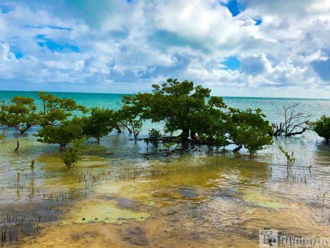
The coral reefs provide excellent opportunities for snorkeling and diving, while the calm waters of Biscayne Bay are perfect for kayaking and paddleboarding through mangrove forests.
During our visit, we put on our snorkeling gear and explored the park’s clear waters. Watching colorful tropical fish swim between the mangrove roots was an incredible experience. The vibrant colors of Biscayne Bay are difficult to describe until you see them yourself.

Our Favorite Memory: Biscayne Bay Boat Cruise
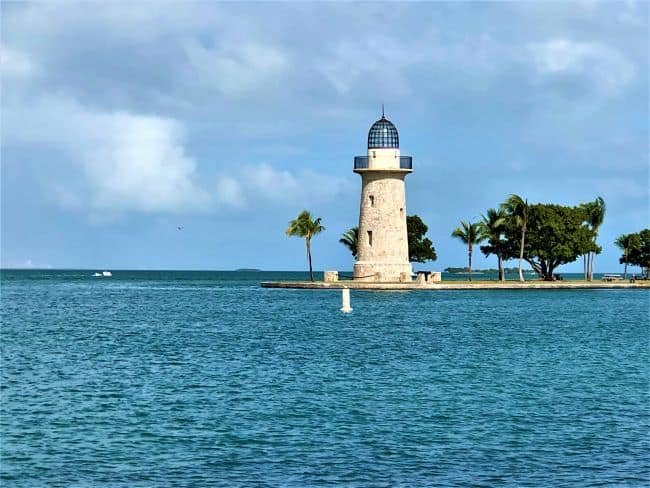
The Boca Chita Key cruise was one of the highlights of our visit to Biscayne National Park. This small island features a historic lighthouse and beautiful views of the Miami skyline.
The knowledgeable guides made the experience even better by sharing fascinating stories about the park’s history and the marine ecosystem. Along the way, we spotted dolphins, birds, and other wildlife.
The only downside was the limited shade along the short hiking trail on the island, so sunscreen is a must. Overall, the cruise was a wonderful way to experience the beauty and history of Biscayne National Park.
East Coast Historic Fort: Dry Tortugas National Park
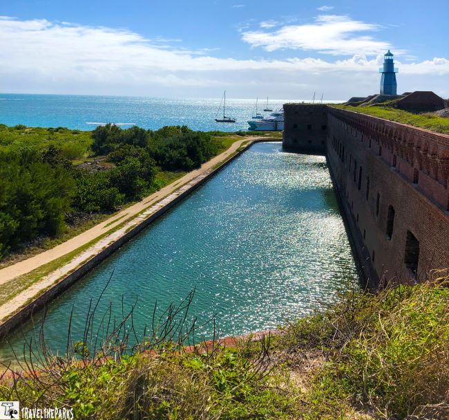
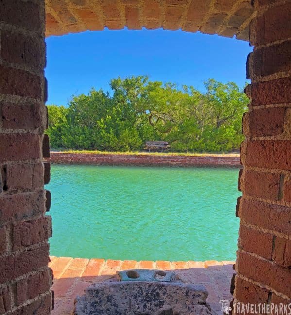
Overview: Dry Tortugas National Park is a hidden gem located about 70 miles west of Key West at the end of the Florida Keys. The park consists of seven small islands, with the massive Fort Jefferson dominating Garden Key.
Reaching this remote paradise requires either a seaplane flight or a ferry ride aboard the Yankee Freedom. While the journey requires some planning and can be expensive, exploring this historic fortress and the surrounding turquoise waters makes the effort worthwhile.
We used Key West, Florida as our base and took the Yankee Freedom Ferry to the park. For us, this was the most affordable option. For adventurous travelers, Dry Tortugas offers a rare combination of history, wildlife, snorkeling, and island solitude.
Best Things to Do
Dry Tortugas National Park is famous for its crystal-clear waters, vibrant coral reefs, and incredible marine life. Snorkeling and swimming in the turquoise waters are among the most popular activities, while scuba diving offers even more opportunities to explore the underwater world.
Birdwatchers will also enjoy the park’s isolated location. Species such as magnificent frigatebirds, brown pelicans, and roseate terns can often be spotted throughout the islands.
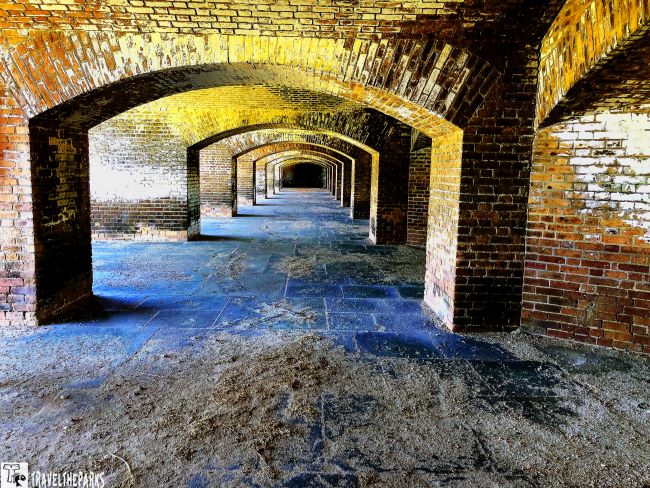
The historic highlight of the park is Fort Jefferson. Built in the 1800s, this massive coastal fortress provides a fascinating glimpse into America’s military history. Visitors can explore the casemates, walk along the walls, and learn about the fort’s role as a military prison.
Camping is also available on Garden Key, offering a unique opportunity to experience the park after the day-trippers leave.
Our Favorite Memory: Discovering Fort Jefferson’s History
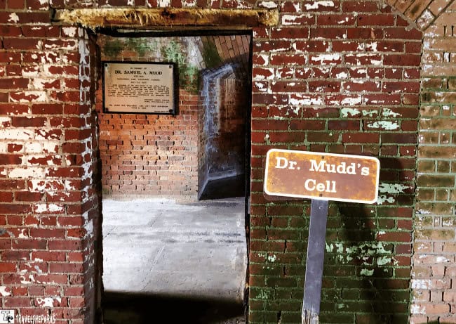
During our tour of the fort, discovering that Fort Jefferson once served as a military prison came as a surprise. Walking through the maze of corridors and spacious casemates, we eventually found the cell of Dr. Samuel Mudd.
Mudd was a physician who treated John Wilkes Booth’s injured leg after President Abraham Lincoln’s assassination. His involvement in the conspiracy remains debated, but he was convicted and sentenced to life imprisonment at Fort Jefferson.
Standing inside the old prison walls and learning this forgotten chapter of history made our visit even more memorable. Dry Tortugas National Park is truly a destination where history and nature come together.
If this remote national park is not already on your radar, it should be. It is a must-visit destination for history lovers, snorkelers, and anyone looking for an unforgettable Florida adventure.

What to Pack for an East Coast National Parks Road Trip
A long-distance road trip along the East Coast requires planning for a variety of landscapes and climates. This route travels from the rocky coastline of Maine to the tropical islands of Florida, so your packing list will need to cover everything from mountain hikes and historic sites to beaches and boat excursions.
Road Trip Essentials
- Reusable water bottles or hydration packs for long days exploring parks
- Cooler or insulated bag for snacks and drinks
- Road trip organization gear for maps, reservations, and park information
- Camera equipment, extra batteries, and memory cards to capture unforgettable moments
- Portable chargers or power banks for phones and electronics
Hiking and Outdoor Gear
- Comfortable hiking shoes or boots for trails throughout the parks
- Lightweight rain jacket for changing weather conditions
- Trekking poles for longer or more challenging hikes
- Daypack for carrying water, snacks, and essentials
- Sunscreen, sunglasses, and a sun hat for outdoor adventures
- Insect repellent, especially for wetlands and coastal areas
- Binoculars for wildlife viewing
Camping and RV Essentials
If you plan to camp along the route, consider bringing:
- Tent or camping gear
- Sleeping bags suitable for changing temperatures
- Camp stove and cooking supplies
- Lanterns or headlamps
- Camp chairs and outdoor essentials
- Dry storage containers to protect food and gear
Beach and Water Adventures
The southern portion of this journey includes some incredible coastal destinations. For places like Biscayne National Park, Everglades National Park, and Dry Tortugas National Park, pack:
- Swimsuit and quick-drying clothing
- Microfiber towel
- Dry bag for boat trips and kayaking
- Reef-safe sunscreen
- Water shoes
- Snorkeling gear if you prefer bringing your own equipment
Plan for Different Seasons
One of the challenges of an East Coast road trip is the variety of weather conditions. Coastal Maine, the Appalachian Mountains, and Florida all have very different climates.
Pack layers, check weather conditions before each destination, and be prepared for everything from cool mornings in northern parks to heat and humidity in the southern states.
Final Thoughts on Our East Coast National Parks Road Trip
As we look back on our East Coast National Parks Road Trip, it is clear this adventure was one of our most unforgettable journeys. From the rugged coastline of Acadia National Park to the peaceful wetlands of the Everglades, every destination offered something completely different.
Although this itinerary highlights many incredible places, there are still countless National Park units, historic sites, and hidden gems waiting to be discovered. It would be impossible to include every stop along the Atlantic coast in one article, but we hope this guide provides inspiration for creating your own adventure.
Ending our journey at Dry Tortugas National Park was the perfect finale. Watching one last spectacular sunset over this remote island paradise was a memory we will never forget.
The open road is waiting. Whether you follow our route or create your own, an East Coast adventure offers endless opportunities for discovery.
What destinations would you add to your East Coast road trip? Share your favorite parks, memories, and hidden gems in the comments below
Cameron Gomez
Bookmarked for future reference. Thanks for writing this.
Evelyn Johnson
Solid recommendations! Definitely implementing these recommendations today.