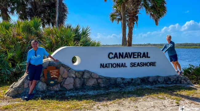
Canaveral National Seashore, a true Florida coastal gem, sits between the Atlantic Ocean and the Indian River Lagoon. This barrier island spans 58,000 acres over 24-miles of pristine, undeveloped beach areas. It creates a serene haven for any visitor. If you are planning a family trip, a romantic vacation, or a solo adventure, our travel guide exploring Canaveral National Seashore provides helpful tips on the best places to visit and all the information you need to fully enjoy your time at Canaveral National Seashore.
Canaveral National Seashore is one of ten National Seashores managed by the U.S. National Park Service. The other National Seashores include Assateague Island, Cape Cod, Cape Hatteras, Cape Lookout, Cumberland Island, Fire Island, Gulf Islands, Padre Island, and Point Reyes.
This post may contain affiliate links, meaning if you purchase something through one of these links, we may earn a small commission at no extra cost to you! Read the full disclosure policy here.

Table of Contents
How to get to Canaveral National Seashore
Canaveral National Seashore, an easy day trip from Orlando, features two distinct beach areas – Apollo Beach and Playalinda Beach. However, since these areas are not connected, visitors need to explore each one separately. Most begin their visit at the Apollo Beach Visitor Center before heading south. Today we began our day on Playalinda Beach, moving northward as part of our ultimate itinerary for Florida’s Canaveral National Seashore.

Apollo Beach Visitor Center: Take exit 249 off I-95 and head east on State Road 44. Continue east for approximately 25 miles, driving over the causeway bridge across the Halifax River. The road will then bend south, becoming South A1A. You will reach the entrance fee station for Canaveral National Seashore, which is at the northern access point in New Smyrna Beach.

Playalinda Beach: Take exit 220 off I-95 and head east on Garden Street. Follow Garden Street east for approximately 15 miles until you reach the park entrance for the southern access of Canaveral National Seashore in Titusville.

Parking: Apollo Beach area on the north end of the park has 5 parking lots. The parking lots along Apollo Beach Road provide dispersed access to the nearby beach and trail system. Turtle Mound, Seminole Rest, and Eldora Loop Road also have individual parking areas. Down in the southern part of the park, Playalinda Beach is set up with 11 different parking lots, each one giving you quick and easy access to the shore and basic facilities. Even though there’s plenty of space overall, those lots tend to fill up fast on weekends and holidays—especially once peak season hits.

Essential Tips for Exploring Canaveral NS: Know Before You Go
- Operating Hours: The national seashore is open year-round from 6:00 AM to 6:00 PM daily. The Apollo Visitor Center is open 9:00 am-5:00 pm daily, except on Christmas Day. To get the latest details on events, accessibility, and safety guidelines, visitors should check the official National Park Service website.
- You can bring pets to the lagoon side (Turtle Mound, Eldora, Seminole Rest), but remember to keep them on a leash no longer than six feet. However, dogs cannot go to the beaches.
- Entrance Fees: An entrance pass is required to access Canaveral National Seashore. Vehicle Pass: $25 per vehicle, valid for 7 consecutive days. Individual Pass: $15 for individuals on foot, a bike, or motorcycle, also valid for 7 consecutive days.
- If you plan to visit multiple national parks, consider purchasing an America the Beautiful Pass for $80, which provides access to all national parks and federal recreation lands for one year.
- Accommodation: For travel planning for Canaveral NS, the park has no lodging accommodations. The charming town of New Smyrna Beach has a variety of accommodations, from beachside inns to vacation rentals, giving you easy access to both the beach and the national seashore. If you have your own boat, canoe or kayak, consider camping at one of the Mosquito Lagoon Islands. These campsites are available by reservation only and require a permit.

When is the best time to visit Canaveral National Seashore?
Regardless of when you go, each season offers its own charm at Canaveral National Seashore.
- Summer (June-August) Hot/humid conditions can make daytime activities challenging, but early mornings and late evenings are ideal for exploring. If you enjoy swimming and water sports, summer is perfect for enjoying the ocean. Just be prepared for afternoon thunderstorms.
- Fall (September-November) Temperatures begin to cool down, especially in late October and November, making outdoor activities more comfortable. Fall often sees fewer visitors compared to spring and summer.
- Spring (March-May) Mild temperatures and low humidity make for pleasant hiking and beach days.
- Winter (December-February) is the least crowded, except during holiday breaks. Mild temperatures make it a great time for hiking and wildlife watching, although it can be cooler.

Indigenous Cultures of the Indian River Lagoon
Archeologists believe that native peoples moved into this region about 10 000 years ago. Mainly the Timucuan and Ais (Ays) communities. I learned a lot about the Timucuan people during our earlier trips along the Buccaneer Trail, which included Amelia Island and Fort Carolina. I was unaware of the background of the Ais people. The Ais depended on fishing, collecting shellfish, and gathering plants for food, while the Timucuan were farmers who grew crops. The Indian River Lagoon, also known as “Rio de Ais,” offered plenty of valuable resources such as fish like mullet and various shellfish.

In his renowned search for the Fountain of Youth, Ponce de León became the first European to set foot in Florida. As he navigated the coastline in 1513, he came across the beach area known today as Canaveral. Soon thereafter, fellow Spanish explorers dubbed this location “Canaveral,” which translates to “place of tall reeds.” There is not much of a written record. However, when the Europeans arrived, historians believe the Ais had a population of around 20,000. They had a strong dislike for the Spanish, and there were good reasons for it. By 1760, sickness, hunger, and battles would completely wiped out their population.

The establishment of a military presence during World War II further transformed the infrastructure of the region, as the U.S. government recognized its potential for defense and training operations. Nearby Cape Canaveral became a crucial site for these military activities, particularly with the construction of a missile base. This development not only facilitated vital military operations but also laid the groundwork for the space exploration programs that would emerge in the subsequent decades.

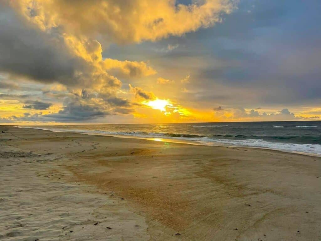
Watch the Sunrise at Playalinda Beach
Rising early one morning, we headed over to Playalinda Beach. Before reaching the beach, we passed through the Merritt Island National Wildlife Refuge. It directly borders the park. I must say this beach is one of the most stunning places in the park, to catch the sunrise over the Atlantic. Armed with my beach blanket and a thermos of coffee in hand, I enjoy the beautiful shades of pink and orange that light up the sky. After taking in the amazing coastal sunrise, I kept walking along the beach, on the lookout for sea turtles and shorebirds.

Playalinda Beach’s soft, workable sand makes it ideal for sandcastle construction. The uncrowded shores allow ample space to build towering turrets and deep, moat-like channels. With its easy-to-shape texture, the beach provides the perfect canvas for elaborate sand creations.
NOTE: Dune plant communities are extremely fragile and play a vital role in maintaining coastal ecosystems. Avoid walking on dunes to prevent damage to sensitive vegetation.

Have you ever dreamed of seeing a rocket launch? Its proximity—just 5-miles from Launch Pad 39A—makes it an excellent spot for space enthusiasts wanting to experience the excitement of a launch. Imagine standing on the beach at the Kennedy Space Center just ahead. The moment the rocket lifts off, the ground shakes and the sound roars like thunder. It’s like a scene from a movie, but it’s real! You’ll feel a rush of excitement that stays with you long after the rocket disappears into the sky.

NOTE: When planning a visit to Canaveral National Seashore, check the NASA launch schedule first. If a launch is scheduled during park hours, NASA might close the roads for safety reasons or restrict visitor access.

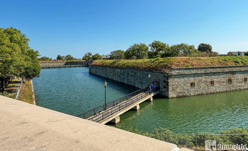
Seminole Rest Historic Site
The centerpiece of the Seminole Rest Historic Site is a prehistoric mound, constructed over centuries by the Timucuan people. From the parking lot, interactive signs guide visitors through the history of the Timucuan Indians. Archeologists believe the Timucuan people gradually built this impressive earthen midden. The midden developed over a period of 4,000 to 500 years. In contrast, the Canaveral mounds are smaller and were not used for ceremonial purposes, unlike the structures found at Ocmulgee National Historic Site or Poverty Point National Historic Site.

Atop the 18-foot-high mound stand two late-19th century residences. The Snyder family lived here from 1911 to 1988. What makes Seminole Rest all the more remarkable is the determination of the family to protect the site’s archaeological treasures, – during the early 1900s, when road construction crews sought to excavate the mound for building materials. Thanks to their foresight and preservation efforts, the mound remains intact today. It is interesting, giving us a peek into their eating habits and lifestyle.

As you continue on the last part of the boardwalk trail, a maritime hammock surrounds you. The gnarled live oak trees draped in Spanish moss create a canopy that filters the sunlight, casting a warm, golden glow. It is hard not to be enveloped in the serene beauty of this homestead.

Climb Turtle Mound
This 0.3-mile recently installed boardwalk trail climbs the remarkable Turtle Mound. A dense thicket of saw palmetto covers this ancient shell midden. Walking on the wooden pathway at Turtle Mound was a fun way to spend our afternoon. Today, even with the stiff breeze, Barry notices a strong “skunk-like” odor produced by the white stopper (Eugenia axillaris). A drought-tolerant plant it grows beside the boardwalk. The fruiting blackberries are a delicacy for the birds and other animals.

Standing over 50 feet tall, Turtle Mound is made up of millions of old oyster shells (33,000 cubic yards). At the top observation platforms, we had incredible views of Mosquito Lagoon to the west and the Atlantic Ocean to the east. They say that this is the tallest mound on the east coast of Florida.

Turtle Mound is another impressive reminder of the deep cultural history of the Timucuan people who lived in this area for thousands of years. This remarkable shell midden was more than just a garbage pile; it also served as a ceremonial site for the Timucuan people.
Note: Remember to pack your sunscreen, snacks, and plenty of water because you’ll want to spend the whole day exploring.

Canaveral National Seashore Apollo Beach Visitor Center
The Visitor Center acts as an educational centerpiece, providing valuable information on the park’s history, wildlife, and recreational activities. Inside, you’ll discover an engaging exhibit that explores the park’s diverse ecosystems, native flora and fauna of the Canaveral National Seashore. Rangers are often available to answer questions, provide park maps, and recommend the best spots for wildlife viewing or hiking. A small theater is worth the stop to view the 17-minute introductory film on the park’s animals. The Visitor Center also has a small gift shop where you can pick up souvenirs, books, and nature-related items, perfect for remembering your visit.

The dock on Mosquito Lagoon, behind the visitor center, offers excellent wildlife viewing opportunities. Herons, egrets, pelicans, and manatees frequently visit this area. For those wishing to further explore the lagoon’s islands or find the perfect camping spot, a convenient kayak and canoe rental shop is available on-site.
NOTE: As a designated national seashore, the park is home to many protected species, so be respectful of all wildlife and avoid disturbing nesting sites, especially for sea turtles.

The Village of Eldora: Scenic Eldora Loop Road
The area remained largely uninhabitable, as the shifting sands and pervasive mosquito populations deterred early settlers from establishing permanent residences. This harsh environment posed significant challenges, making it difficult to cultivate land or build stable structures. The passage of the Homestead Act in the early 20th century drew settlers to the region, leading to the founding of the village of Eldora (1882), a pivotal moment that transformed the area. Lured by the promise of land ownership and the chance to start anew, these pioneers overcame the natural challenges they faced to build new lives.

The Eldora Loop Road offers picturesque views of the maritime landscape and insight into the creation of the small village. Named after two sisters (Ellen and Dora) who grew citrus in the village. At one point, Eldora was a thriving community primarily focused on agriculture and fishing. The village at one time had a population of 200. Hurricanes and severe freezes destroyed the citrus industry, leading to the abandonment of the village. Today what remains is the restored Eldora State House.

The Canaveral seashore protects significant coastal habitats along the Indian River Lagoon. The Eldora Hammock Trail, a 0.5-mile loop, begins to the right of the Eldora Station House. A wooden boardwalk crosses an estuary canal into a coastal hardwood and palm hammock. The flora in the Eldora Hammock Trail range from mangroves, live oaks, and cabbage palms, to name a few, which then harbor countless wildlife species. These types of coastal ecosystems are in dire need of protection to ensure the healthy maintenance of water quality and biodiversity within the Indian River Lagoon.
NOTE: Bring bug spray as mosquitos can be fierce at all times of year.

Eldora State House
The home is all that remains of the community. In 1989, Friends of Canaveral obtained a charter to assist in saving the house. They renovated the structure to its current state. In May 1999, the Eldora State House opened, and it is now listed on the National Registry of Historic Places. Open only on Fridays, Saturdays, and Sundays. Inside, we found artifacts and furnishings from the original homesteaders.

Discovering Canaveral National Seashore’s Castle Windy Trail
This is a 0.8-mile out-and-back trail across from Parking Lot #3 that will take you to a shell mound (1000 AD) and a slight view of Indian Lagoon. I would not recommend this trail in summer as the mosquitoes were atrocious even in the cooler month of November. The well-marked trail is easy to follow through a canopy of oaks. Be sure to pick up a Castle Windy Trail Guide at the visitor center that outlines each of the 14 marker stops. Each stop identifies specific flora.

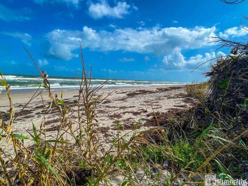
Apollo Beach is renowned for its beautiful, unspoiled coastline. It’s an ideal spot for beachcombing and shelling. People know Apollo Beach for its beautiful, unspoiled coastline, and it’s an ideal spot for beachcombing and shelling. The area is less developed than many other beaches in Florida, so you’ll find an abundance of seashells and driftwood, perfect for collecting or just enjoying the natural beauty of the shoreline. In the early mornings, and with luck, you may even glimpse endangered sea turtles nesting on the beach.
Bring Essentials: Be sure to bring sunscreen, hats, water, and comfortable walking shoes. There are limited services within the park, so it’s best to be prepared.
Final Thoughts: The Ultimate Guide to Exploring Canaveral National Seashore
Canaveral National Seashore is the kind of place you go when what you really need is a little peace and quiet by the ocean. With miles of untouched coastline, it’s perfect for long, unhurried walks on soft sand without the crowds. I loved just standing there, letting the sound of the waves wash over me while the water sparkled under the sun, stretching out beneath a wide blue sky. If you’re lucky, you might spot dolphins playing in the waves or pelicans soaring overhead before plunging into the water. The whole area is alive with wildlife—especially birds. Their bright colors flash through the air, and their songs blend together in a chorus that feels like nature’s own soundtrack.

Canaveral National Seashore invites visitors into a world where time has only two dimensions: slow and slower. No noisy neighbors-but the crashing waves-greet you here, whether as a nature lover or a recluse seeking some respite from worldly din and chaos. This treasure trove of a coastline will not let any visitor forget its sights and views easily.
Where do you like to retreat to for a change of scenery and a break from the daily grind?