Table of Contents
Updated May 2025
The scenic drive to Homer, Alaska—about 200 miles from Anchorage—takes you to what feels like the very edge of the world: the iconic Homer Spit. If it’s not already on your Alaska bucket list, it absolutely should be. While I hoped to catch a glimpse of the Time Bandit from the Deadliest Catch, the real treasures were found along the way. The stretch of the Sterling Highway from Soldotna to Homer is packed with unforgettable sights and experiences—and many of them are completely free. From hiking peaceful trails to spotting wildlife and soaking in jaw-dropping views, the road to Homer is an adventure all its own.
This post may contain affiliate links, meaning if you purchase something through one of these links, we may earn a small commission at no extra cost to you! Read the full disclosure policy here.
Getting to Homer: A Scenic Journey Along Alaska’s Sterling Highway
The road to Homer, Alaska, is one of the most scenic drives in the state, offering sweeping views of the Kenai Peninsula, snow-capped peaks, and the sparkling waters of the Gulf of Alaska. Most travelers begin their journey by flying into Anchorage, the nearest major city. From there, take the Seward Highway (AK-1) south toward the Kenai Peninsula.
After about 80 miles, you’ll connect with the Sterling Highway (AK-1), which leads directly to Homer. From Soldotna, it’s a beautiful 75.8-mile drive to your final destination. The new bypass opened in summer 2024, makes the route even safer and efficient.
Alternatively, for a more scenic detour, consider turning off at Cooper Landing onto AK-9—a stunning drive through the Kenai Mountains that eventually reconnects with the Sterling Highway near Soldotna.
The full drive from Anchorage to Homer typically takes 4 to 5 hours, but you’ll want to allow extra time to enjoy the many breathtaking stops along the way, such as the Soldotna River Walk, wildlife viewing spots, and charming small towns.
Rain or Shine, the Road to Homer Beckons
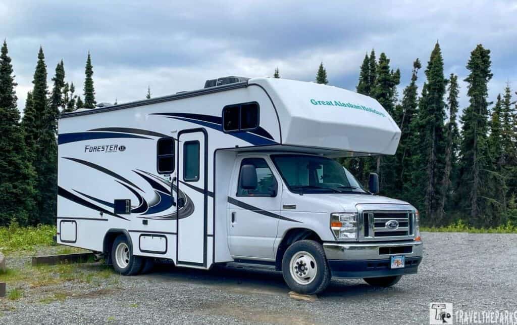
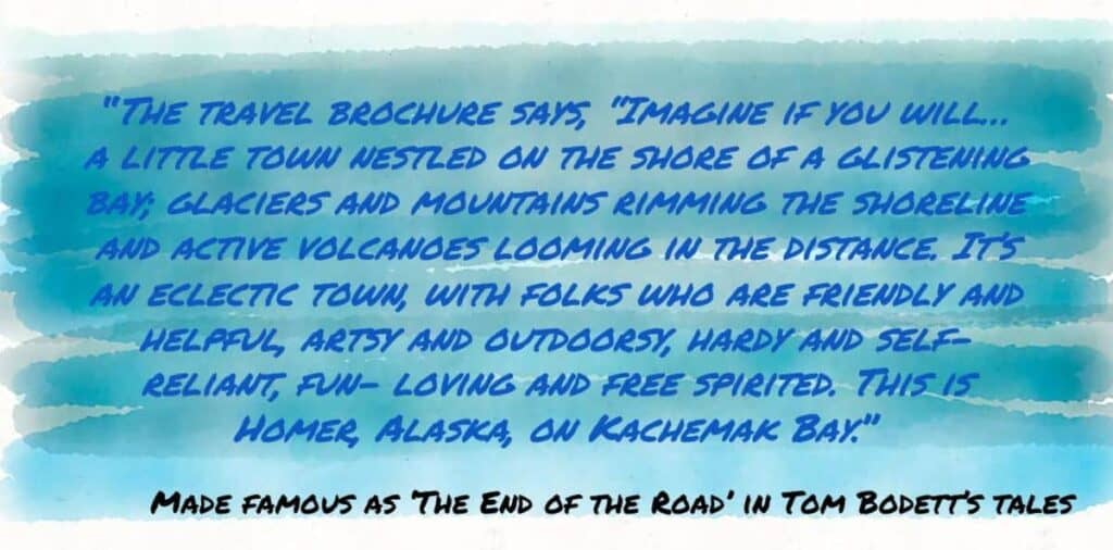
Today may be a bit dreary—gray skies, steady rain, and a chill in the air—but it hasn’t dampened our spirits. This is our dream RV vacation through Alaska, and we’re embracing every mile of it. We rented our RV from Great Alaskan Holidays and have been roaming the highways and byways of the Last Frontier. Our next destination is the charming coastal town of Homer, at the very end of the Sterling Highway. Known for its fishing, art galleries, and laid-back vibe, Homer promises plenty to explore.
Our journey begins in Sterling, just 86 miles—or about two hours—from Homer. After a few restful days camping at Alaska Canoe Creek Campground, it’s time to stock up on groceries and fuel the RV. First up is a stop in Soldotna, the largest town along this stretch of Sterling Highway. It’s the perfect place to stretch our legs, explore, and prepare for the scenic drive ahead.
Stop in Soldotna: A Riverside Gem Before the Road to Homer
Soldotna, perched on the Cook Inlet at the mouth of the Kenai River, is a perfect place to pause before heading south toward Homer. The town’s name may come from the Dena’ina word ts’eldat’nu, meaning “trickling down creek”—a fitting description of the peaceful river that winds through it. Stretch your legs with a stroll along the scenic river boardwalk, or cast a line right from the bank and try your luck at catching a mighty king salmon. The Soldotna Visitor Center offers free Wi-Fi, which is a welcome perk for RV travelers needing to reconnect. Just nearby, the local ranger station—home to a Bell Sea Ranger helicopter used for wildfire prevention—provides helpful maps and insight into exploring the Kenai National Wildlife Refuge.
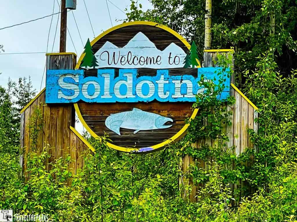
In town, you can visit the Fred Meyer and purchase just about everything you can think of for your RV road trip. Fred Meyer has everything a camper needs. fresh foods, charcoal, fishing tackle, and other camping supplies all in one store.
Watch for Wildlife on the Road to Homer
As you leave Soldotna, you’ll cross the Kenai River—renowned for its world-class salmon fishing. Don’t be surprised if you see anglers lining the banks or drifting quietly in boats. From here, we continue south on the Sterling Highway, pointing our RV toward Homer at the end of the road.
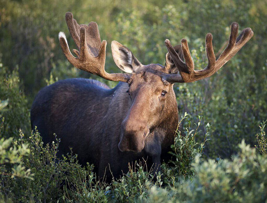
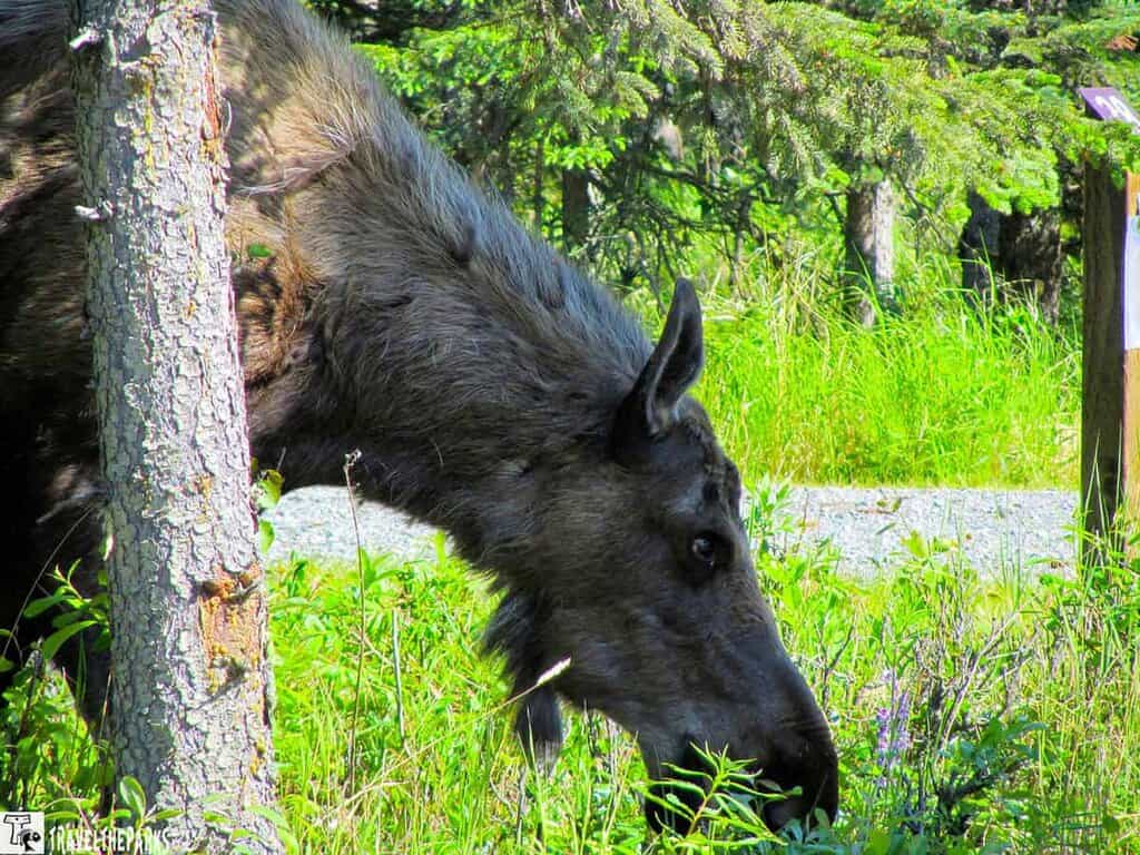
This morning, the fog hangs low over the landscape, creating an eerie beauty—but also a reminder to stay alert. As we climbed the hill out of Soldotna, we passed a sobering sight: a vehicle had collided with a moose. The impact was devastating for both. In Alaska, moose often dart across highways, sometimes fleeing swarms of mosquitoes, and these encounters can happen in an instant. In fact, near Palmer, the number of moose-vehicle collisions is displayed right on highway signs—an ongoing reminder to drive cautiously.
One silver lining of traveling during Alaska’s summer months is the midnight sun. With daylight stretching well into the night, you can take your time and drive later in the evening without ever facing true darkness.
First Stop: Kasilof River State Recreation Site (Mile Marker 109)
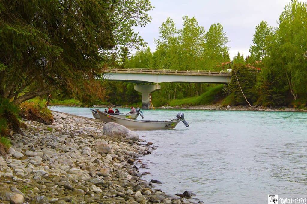
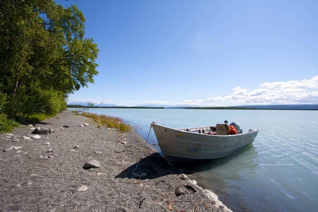
Just 15 miles south of Soldotna, our first stop along the Sterling Highway is the Kasilof River State Recreational site. This peaceful day-use area is a popular boat launch for drift boats putting in or taking out along the Kasilof River. With around 10 campsites nestled near the water, it’s a great spot to stay a few nights—especially if fishing is on your agenda. We didn’t have time to cast a line on this trip, but it’s definitely on our list for next time!
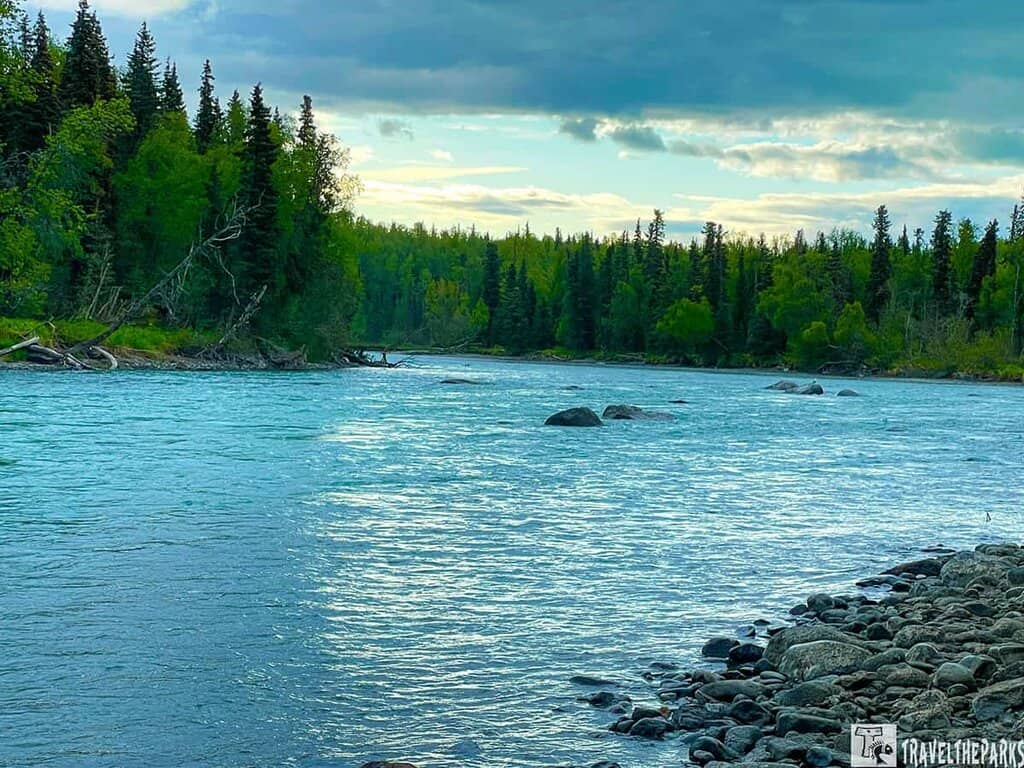
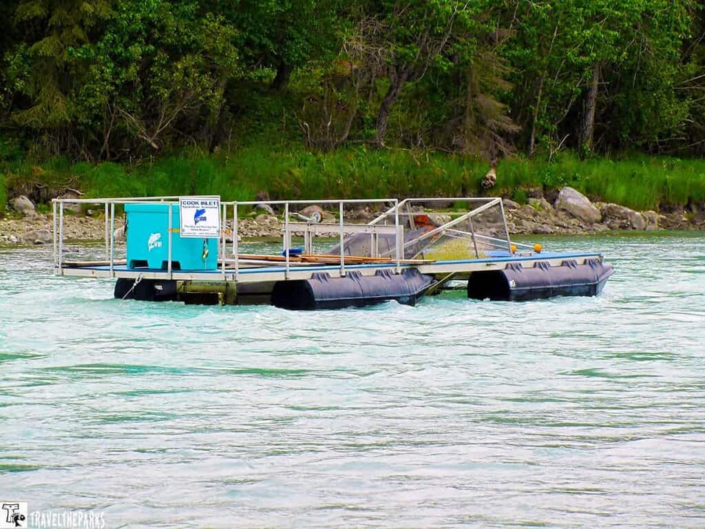
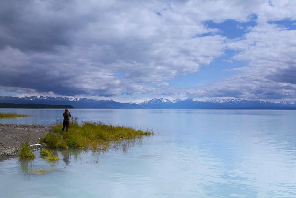
The Kasilof River begins at Tustumena Lake, a large, glacier-fed lake tucked into the heart of the Kenai Peninsula. From there, it flows rapidly toward Cook Inlet, carrying icy waters and—during the right season—plenty of salmon. When we arrived early in the morning, the river was running fast and clear. One unique feature here is the fish wheel, used to sample and count fish species as they migrate. Though it was unoccupied during our visit, biologists often conduct sonar-based fish counts at various times of the year.
Managed by the Alaska Department of Natural Resources, the recreation area is open year-round, though amenities may be limited in the off-season. Even if you’re just passing through, it’s well worth a quick stop to stretch your legs, enjoy the river views, and maybe spot a boat or two drifting by.
Stop #2 – Make the Detour to Tustumena Lake
If you have the time, a detour to Tustumena Lake is well worth the adventure. The lake lies within the Kenai National Wildlife Refuge. It’s the largest lake on the Kenai Peninsula—and it’s massive. Stretching 25 miles, this glacier-fed lake is known for its sudden wind and waves, stirred up by weather systems rolling off the Harding Icefield, so conditions can change quickly.
Access to the lake is limited, and the only road in is Tustumena Lake Road, located off the Sterling Highway near Mile Marker 111. Drive 6.5 miles down this gravel road to reach the Tustumena Lake State Recreation Site, which features a public boat launch. It’s mostly used by drift anglers, but it’s also a great access point for boating, fishing, or simply taking in the quiet beauty of the area.
If you’re up for a hike, the Tustumena Lake Trail is another way to reach the lake. The trailhead is at the end of the same gravel road and offers a rugged, 13-mile trek with breathtaking views of the surrounding mountains and lake. We had hoped to explore the full trail, but after assessing the time and distance, we made the call to turn the RV around and continue our journey toward Homer. Next time, we’ll plan for the hike!
Stop #3 – Explore Clam Gulch Recreational Area
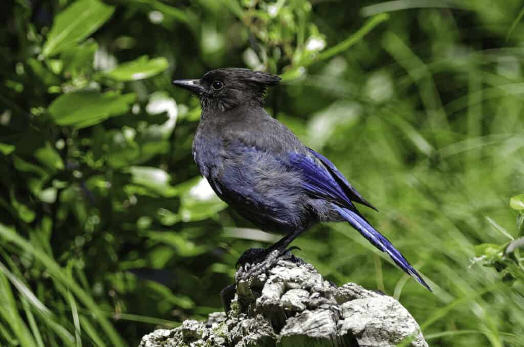
As we pulled into the parking lot at Clam Gulch Recreational Area, we spotted our first Steller’s Jay—a striking bird, much larger and more vibrant than the blue jays we’re used to seeing back in Florida. It was a nice surprise to start our visit. Nearby, a few anglers were launching drift boats, and we stopped to chat. The verdict? Fishing had been slow this June, but the views certainly didn’t disappoint.
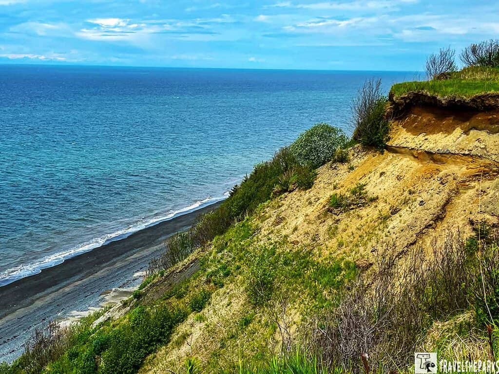
The small town of Clam Gulch lies just a few miles off the Sterling Highway and offers a unique experience shaped by the extreme tides of Cook Inlet. These tides create perfect conditions for razor clamming when open. If you have the time and conditions allow, it’s a fun and hands-on way to enjoy Alaska’s coastline. Don’t have your own gear? No problem—you can often rent a bucket and clam rake for a small fee right on the beach.
Important Note: As of now, the Alaska Department of Fish and Game has closed clam digging in this area until further notice due to conservation efforts. Always check current regulations and secure the proper permits before planning a clamming trip.
Even without digging for clams, Clam Gulch offers beautiful beach walks, birdwatching, and stunning views of the inlet. With its rugged charm and natural beauty, it’s a great stop for soaking in an authentic slice of Alaska’s coastal life.
What Else Can You Do at Clam Gulch?
Clam Gulch isn’t just about razor clamming—this scenic spot along the Cook Inlet offers a range of outdoor activities that make it a worthwhile stop on your way to Homer. Whether you’re after adventure or a quiet moment by the sea, Clam Gulch has something for everyone.
- Fishing: The waters around Clam Gulch offer great opportunities for both salmon and halibut fishing. You can cast a line from the shore or book a local charter boat for deeper waters and a better chance at landing a big one.
- Beachcombing: One of our favorite activities was simply walking the beach. We spent hours exploring the shoreline, collecting colorful rocks, interesting shells, and other ocean treasures. Clam Gulch Beach is especially beautiful at low tide.
- Hiking: Stretch your legs on the Clam Gulch State Recreation Area Trail, a 1.1-mile loop that’s perfect for a quick hike. On a clear day, the views across Cook Inlet are nothing short of stunning—you might glimpse Mount Spurr, Mount Iliamna, and Mount Redoubt rising in the distance.
- Camping: If you’re planning to stay overnight, the Clam Gulch State Recreation Area has a spacious, year-round campground with 120 sites for both tents and RVs. You’ll find picnic tables, fire rings, and restrooms—everything you need for a cozy seaside campsite.
Volcanic Peaks and Wildflower-Filled Meadows
As we continued driving south toward Ninilchik, we spotted several more moose grazing near the highway. One joy of traveling by RV on the Sterling Highway is the elevated view—it makes it easier to take in the vast landscapes and keep an eye out for wildlife along the way.
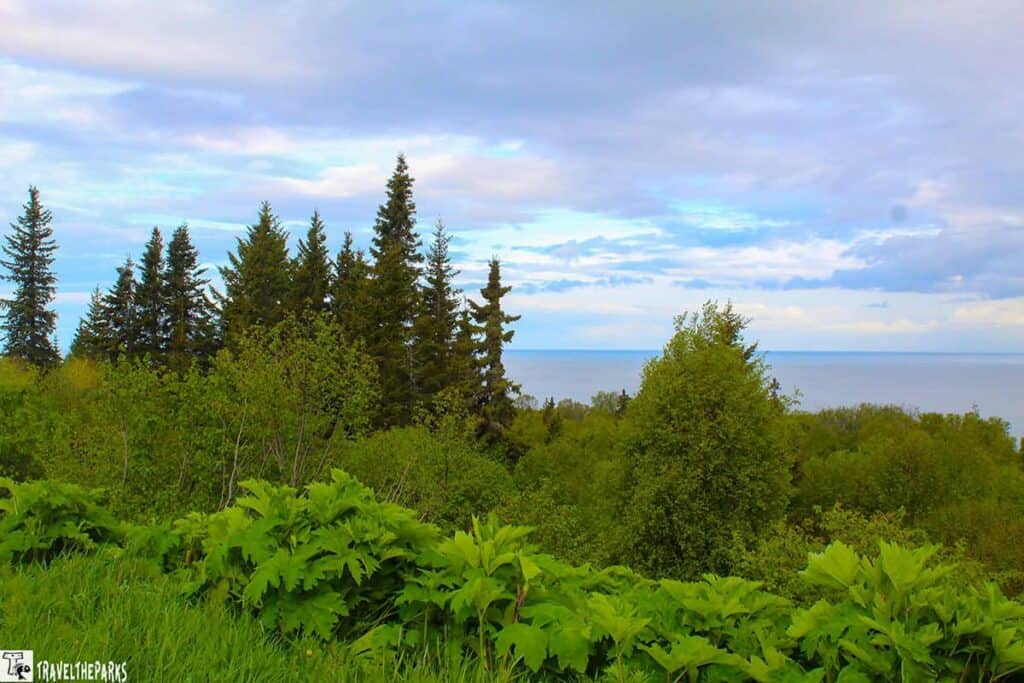
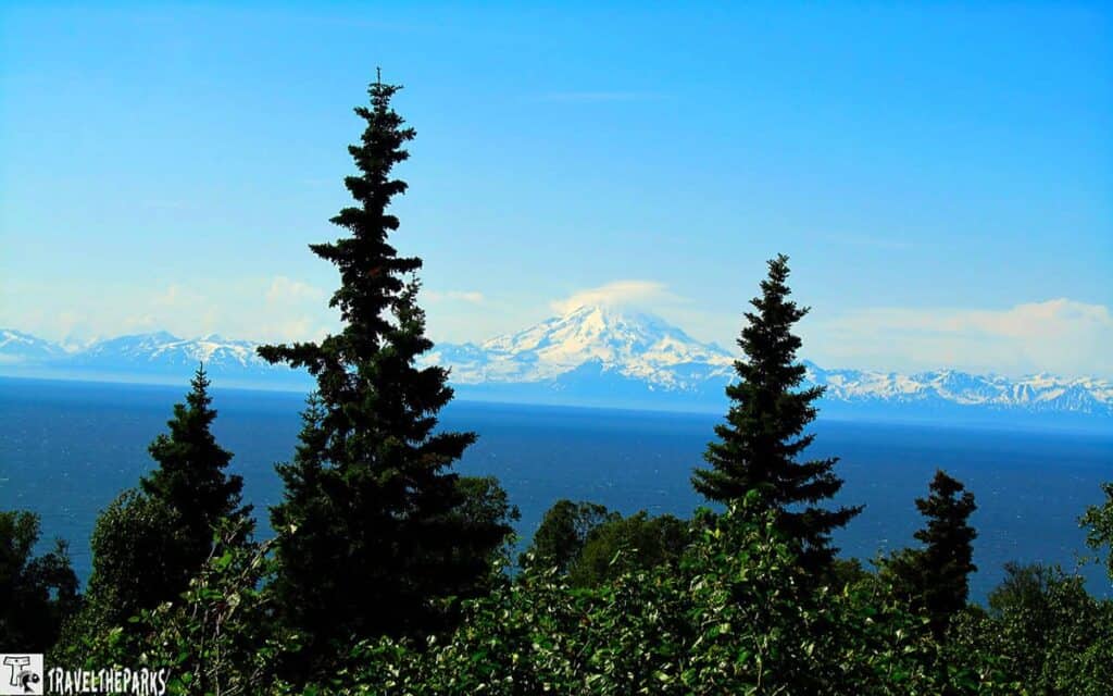
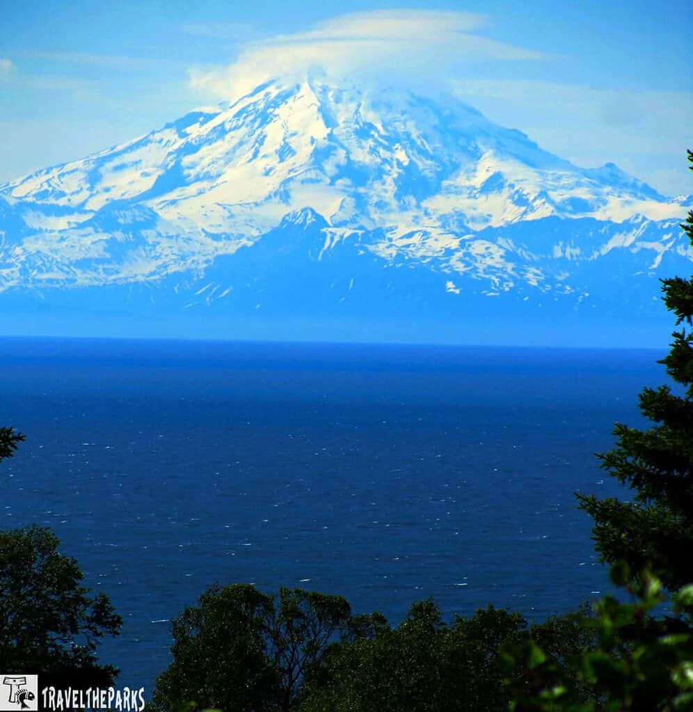
Drive toward Homer, the volcanic peaks of Mount Spurr, Mount Iliamna, Mount Redoubt, and others came into view across Cook Inlet. The Sterling Highway hugs the coastline here, offering breathtaking, uninterrupted vistas of snow-capped summits rising above the water. We couldn’t resist pulling over at several scenic turnouts to snap photos and soak it all in.
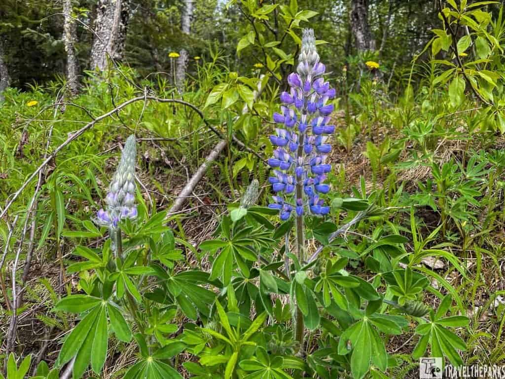
In early June, the meadows along the highway burst into color with gorgeous wildflowers. Fields were blanketed with purple lupines, their tall spires swaying gently in the coastal breeze. The contrast of vibrant blooms against the backdrop of distant volcanoes made this stretch of the drive absolutely unforgettable.
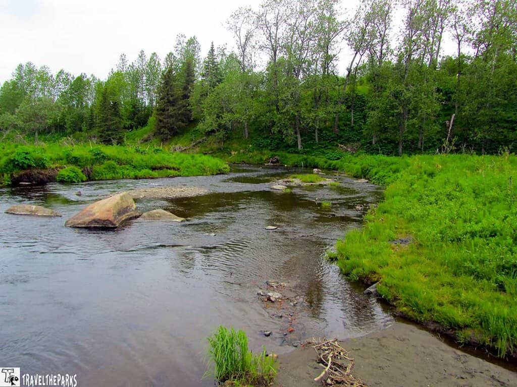
Stop #4-Stretch Our Legs at the Ninilchik River Campground
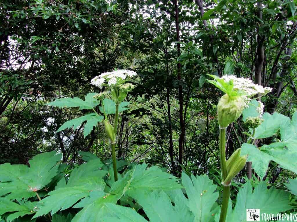
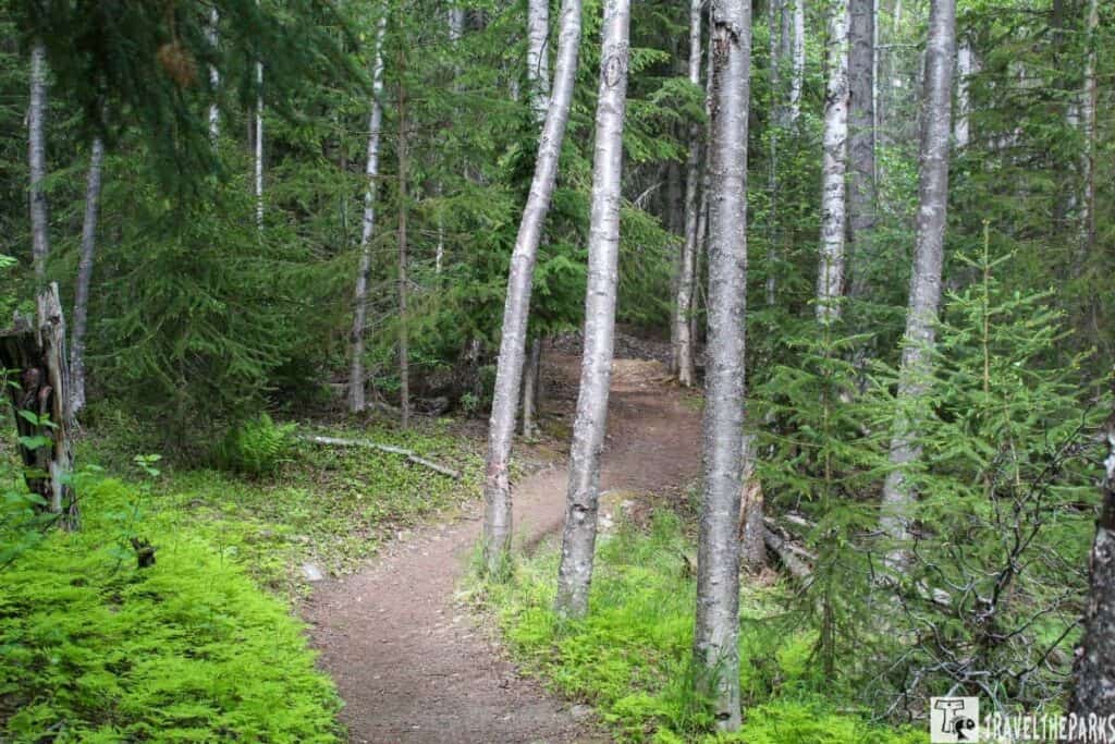
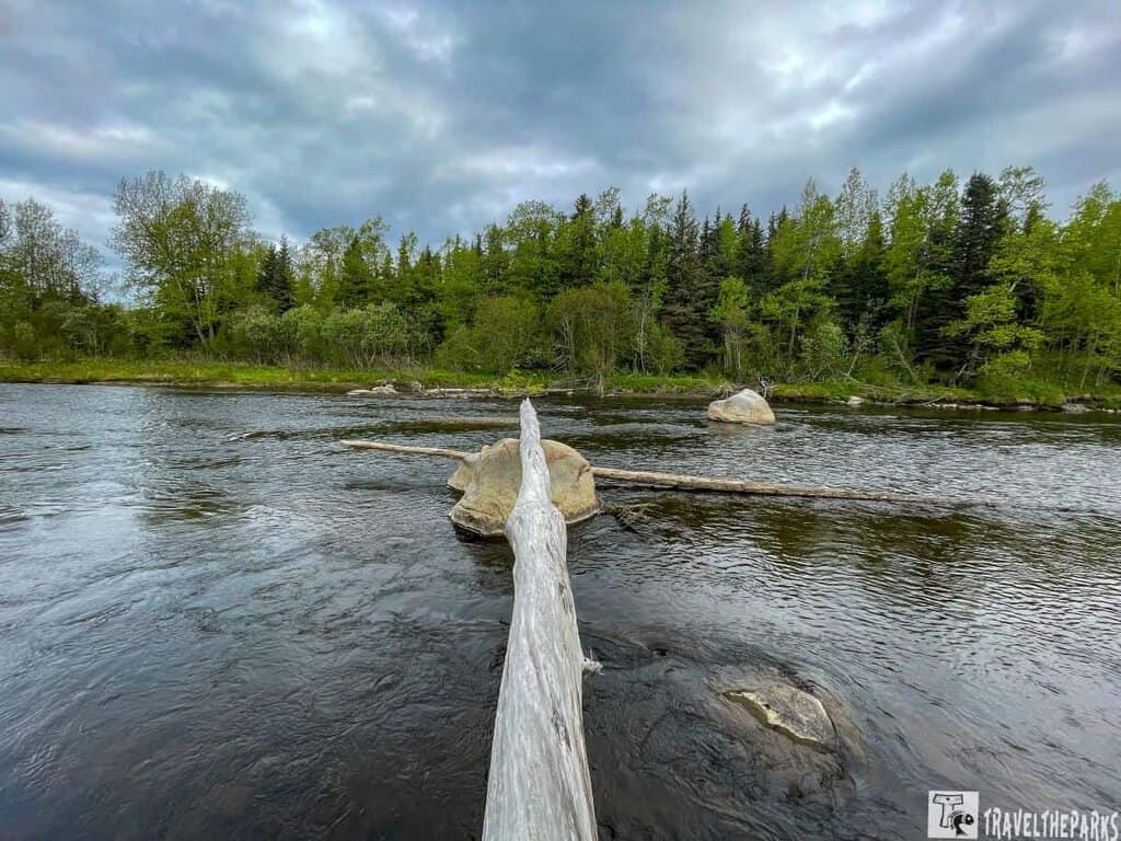
Needing a stretch break, we stopped for a walk along the picturesque Ninilchik River—a serene and scenic spot perfect for a short hike. Towering green foliage lines the trail, creating a lush corridor that feels wild and untouched. As we made our way through a dense patch of Devil’s Club, we were reminded just how easy it would be to surprise a bear in this kind of environment. A little noise as you hike goes a long way to avoid any unexpected encounters with local wildlife.
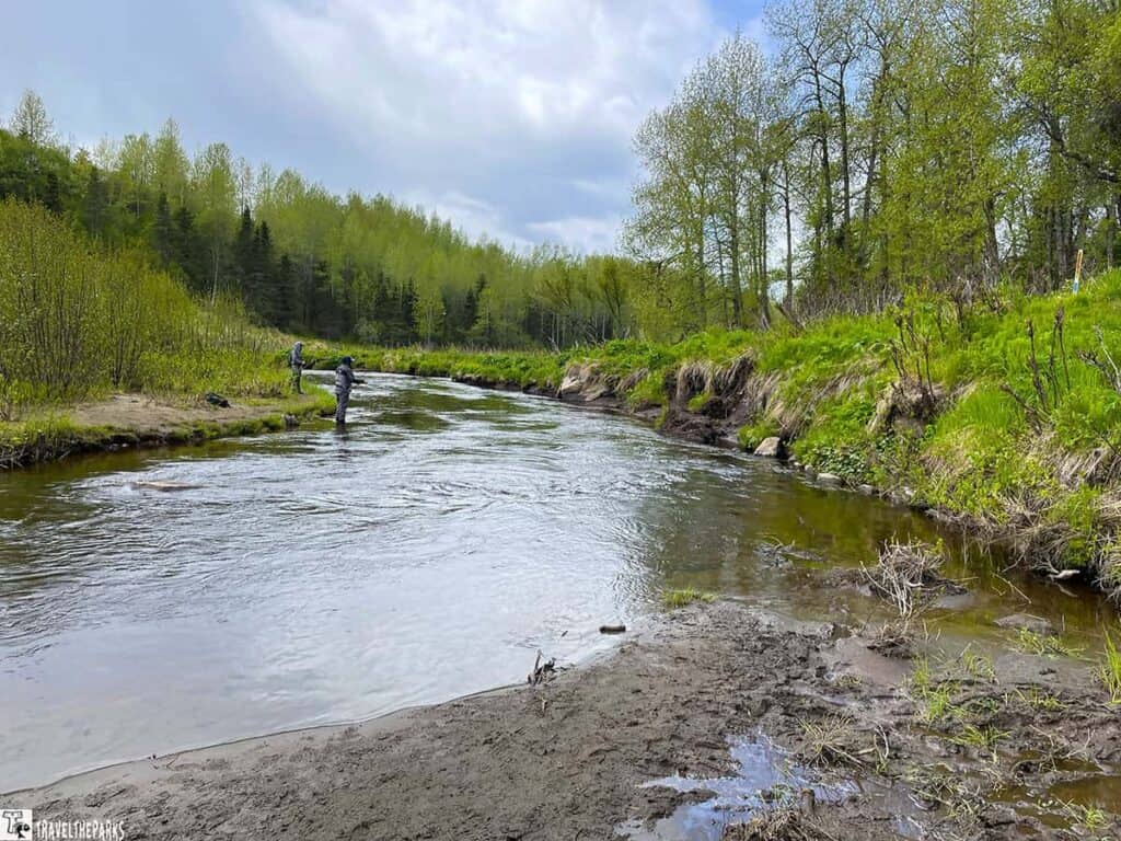
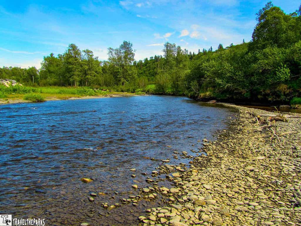
When we reached the tea-colored waters of the river, we paused to see if the fish were running. This 21-mile river is a favorite among anglers, offering opportunities to catch trout, Dolly Varden, and several salmon species throughout the season. At the trailhead parking lot, interpretive signs explain the fascinating life cycle of native salmon and their journey upstream.
Stay Nearby: Ninilchik State Recreation Area
For those looking to stay a little longer, there are several established campgrounds nearby where you can park your RV and enjoy a few quiet days of riverside relaxation and fishing.
Bear Safety Reminder:
Bears are highly active along most trails in Alaska. Always be bear aware—carry bear spray, make noise while hiking, and if possible, travel in a group to reduce the risk of surprise encounters.
Just minutes from the river, the Ninilchik State Recreation Area offers beautiful views of Cook Inlet and the surrounding mountains, making it a great place to stay overnight. The park features three campgrounds:
In total, there are 62 campsites, accommodating both tents and RVs. Some sites offer electric and water hookups, and amenities include restrooms, showers, a dump station, and even a kids’ playground—making it family-friendly and comfortable for longer stays. The park is open year-round, though services may be limited during the winter months.
Stop #5 – Ninilchik Village: A Worthwhile Deviation on the Road to Homer
Ninilchik (Dena’ina Athabascan: Niqnilchint), meaning “peaceful settlement by a river,” is a charming detour off the Sterling Highway that’s rich in history and cultural heritage. The village dates back to the early 1800s, when Russian settlers established a small community here, living off fishing, hunting, fur trapping, and gardening. After the United States purchased Alaska, many of the original Russian families chose to stay—and their descendants still call Ninilchik home today.
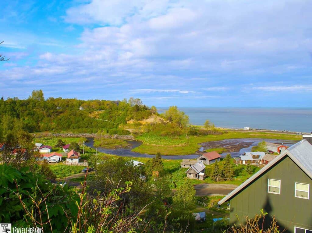
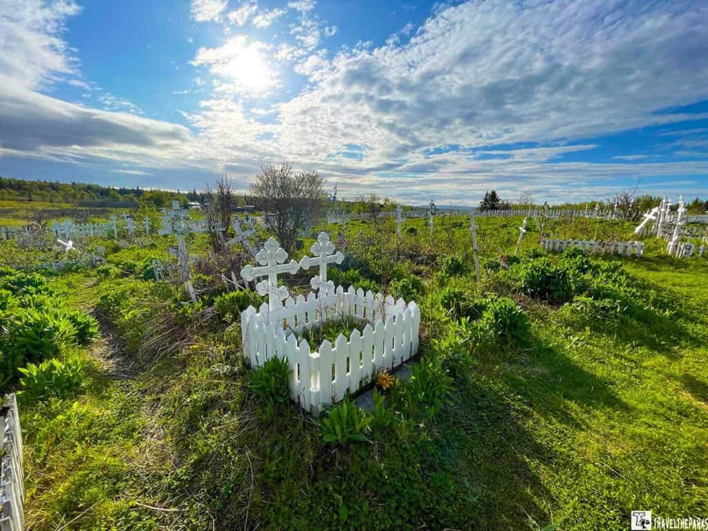
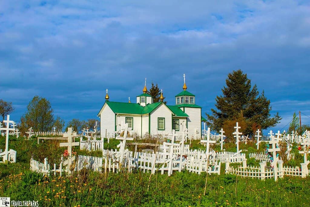
With a population of around 900 people, Ninilchik remains a tight-knit coastal village that welcomes visitors curious about its past and peaceful setting. One of the most notable landmarks is the Russian Orthodox Church and cemetery, located near Mile Marker 135. This historic white church, perched on a bluff, offers not only a glimpse into the area’s Russian heritage but also stunning panoramic views of Cook Inlet.
There are clear signs marking the turnoff, and the site has designated RV parking, making it an easy and rewarding stop on your journey to Homer. Wandering through the old village, with its weathered buildings and scenic backdrop, feels like stepping back in time.
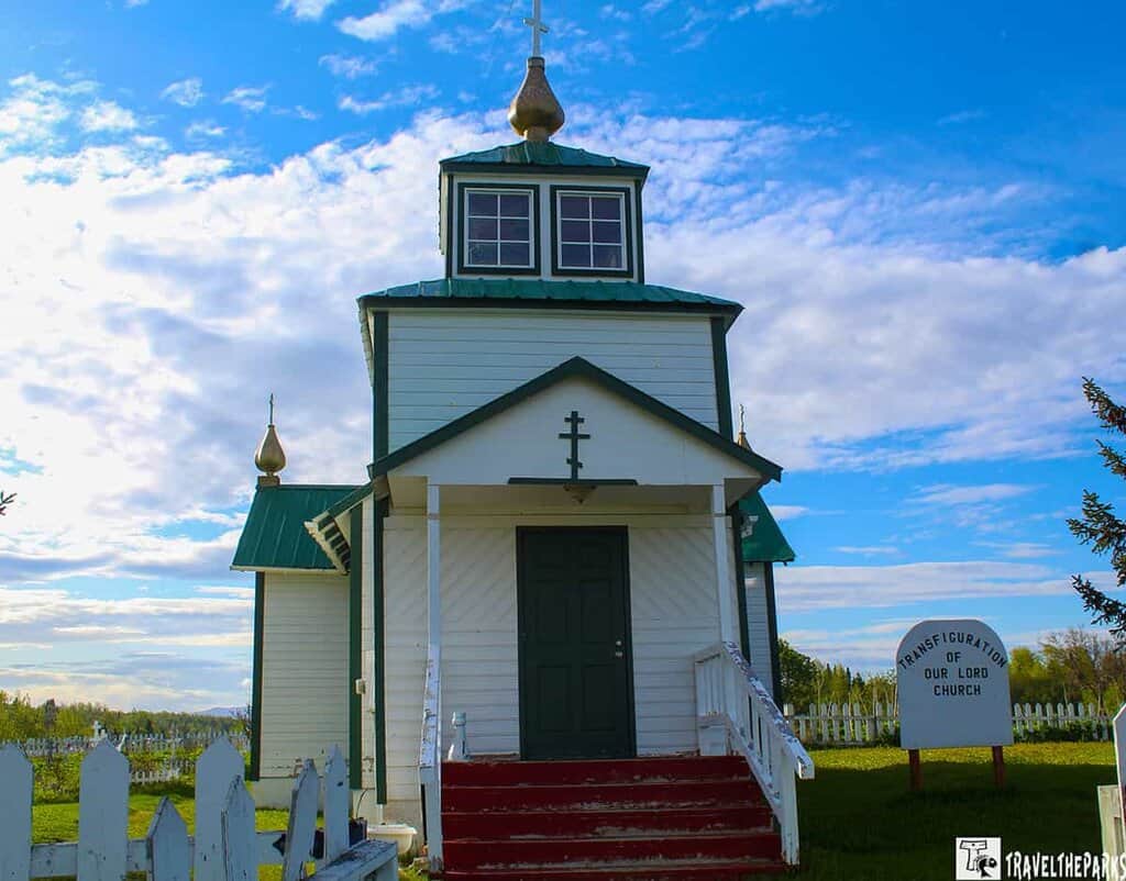
A Cultural Gem: Holy Transfiguration of Our Lord Russian Orthodox Church
Originally built in the early 1900s, the church continues to serve the Russian Orthodox faithful in the area, offering regular services and maintaining traditions that date back centuries. But its role extends beyond religion—it also functions as a cultural hub, helping to preserve and celebrate Russian heritage in Ninilchik.
Stop #6 – Deep Creek: Rugged Beauty and Big Fish on the Road to Homer
Just a few miles closer to Homer, Deep Creek Recreation Area offers another unforgettable stop along the Road to Homer. At Mile 137 on the Sterling Highway, this area is beloved for its world-class fishing, scenic views, and rustic charm.
We spotted fresh bear tracks in the mud during our visit—a thrilling (and humbling) reminder that you’re truly in wild Alaska. With 100 overnight campsites available for both tents and RVs, Deep Creek is a popular destination. Many of the beachfront campsites offer sweeping views of Cook Inlet and the surrounding Aleutian Range volcanoes. Campsites are first-come, first-served, so arriving early is your best bet, especially in peak season.
We took a peaceful stroll along the riverbank, where ample parking made it easy to pull over and explore. The South Overlook may have a smaller lot, but it still accommodates RVs comfortably and provides an excellent vantage point for scenic photos.
Deep Creek is legendary among anglers. The waters here offer excellent fishing opportunities for salmon, particularly king and silver salmon, as well as halibut, depending on the season. Whether you’re here to fish, camp, or simply enjoy the scenery, Deep Creek is a must-visit spot before reaching Homer.

Hiking Deep Creek: Stay Alert and Be Bear Aware on the Road to Homer
If you’re looking to stretch your legs and soak in more scenery along the Road to Homer, Deep Creek Recreation Area offers more than just great fishing—there are hiking trails here that wind through lush, wild landscapes teeming with life.
There are two scenic parking areas at Deep Creek—North and South—both with trail access and interpretive signs detailing local salmon restoration efforts. These displays are worth reading before hitting the trail, offering great insight into the region’s ecology.
As we descended the trail toward the creek, we were immediately surrounded by tall, dense vegetation. It’s beautiful—but it’s also a good reminder to make noise as you hike, especially in bear country. Talking loudly or clapping occasionally lets wildlife know you’re coming and helps prevent surprise encounters.
Trail Tip: Always carry bear spray, bring water and snacks, and travel in groups when possible. Deep Creek’s beauty is wild and untamed—exactly what makes it so memorable.
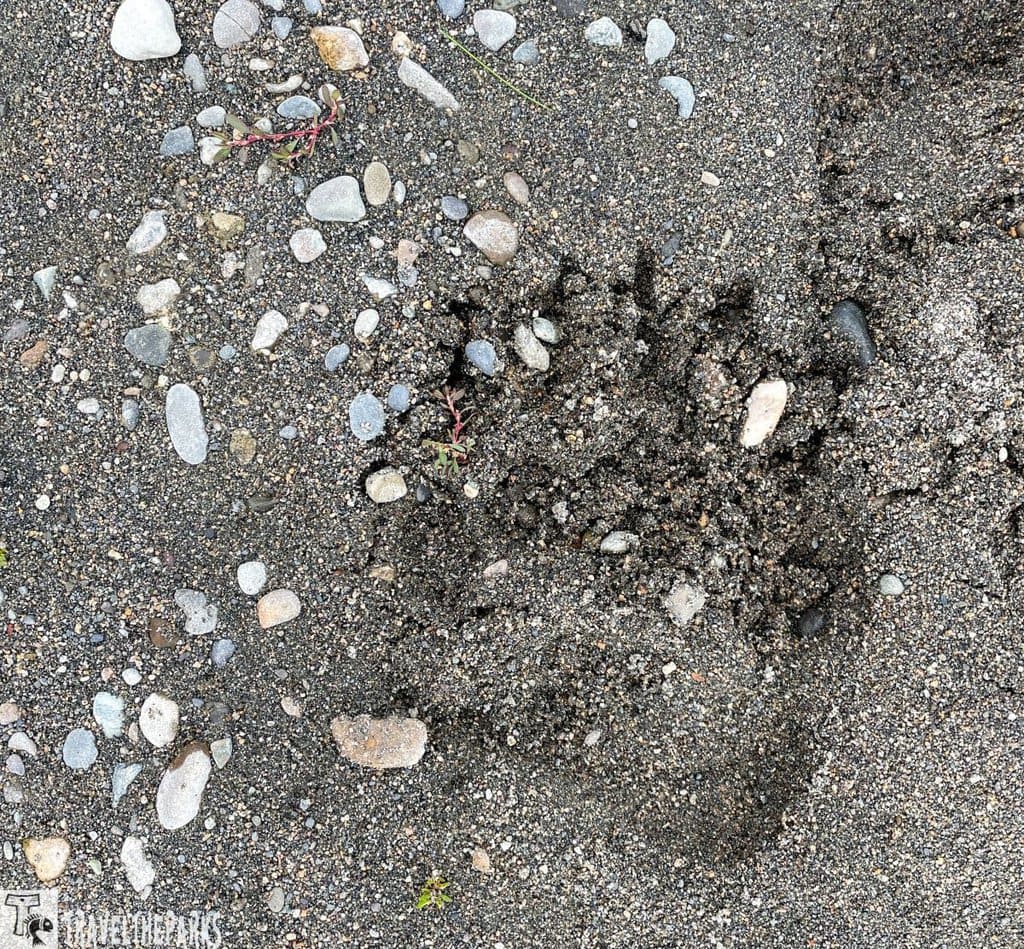
We spotted fresh bear tracks in the mud alongside the creek, a sure sign that bears had been nearby. Although we didn’t see any during our hike, it’s always important to stay alert and be prepared. Bears often bed down in the thick brush, and it can be easy to pass close without realizing it.
Stop #7 – Anchor River: Eagles, History, and Ocean Views on the Road to Homer
As you continue south along the Road to Homer, the Anchor River Recreation Area near the town of Anchor Point offers another memorable stop filled with wildlife, history, and scenic charm.
Ever wonder how Anchor Point got its name? It dates back to May 1778, during Captain James Cook’s expedition to explore and map Alaska’s coastline. While battling the strong tidal currents in the area, Cook’s ship, the HMS Resolution, lost a large kedge anchor—giving rise to the town’s unusual and historically rich name.
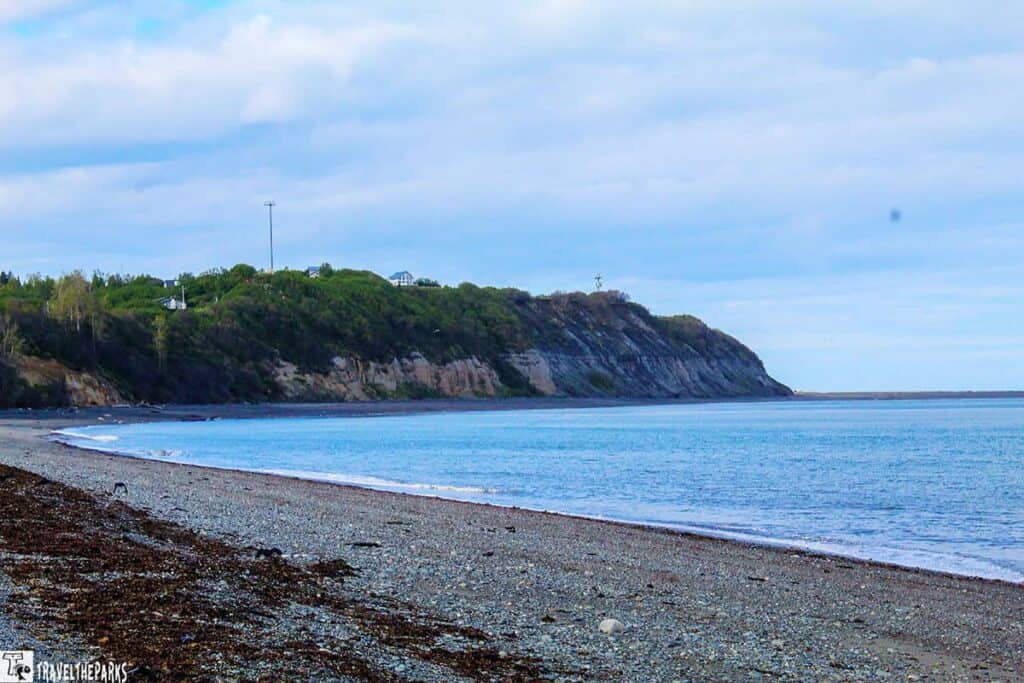
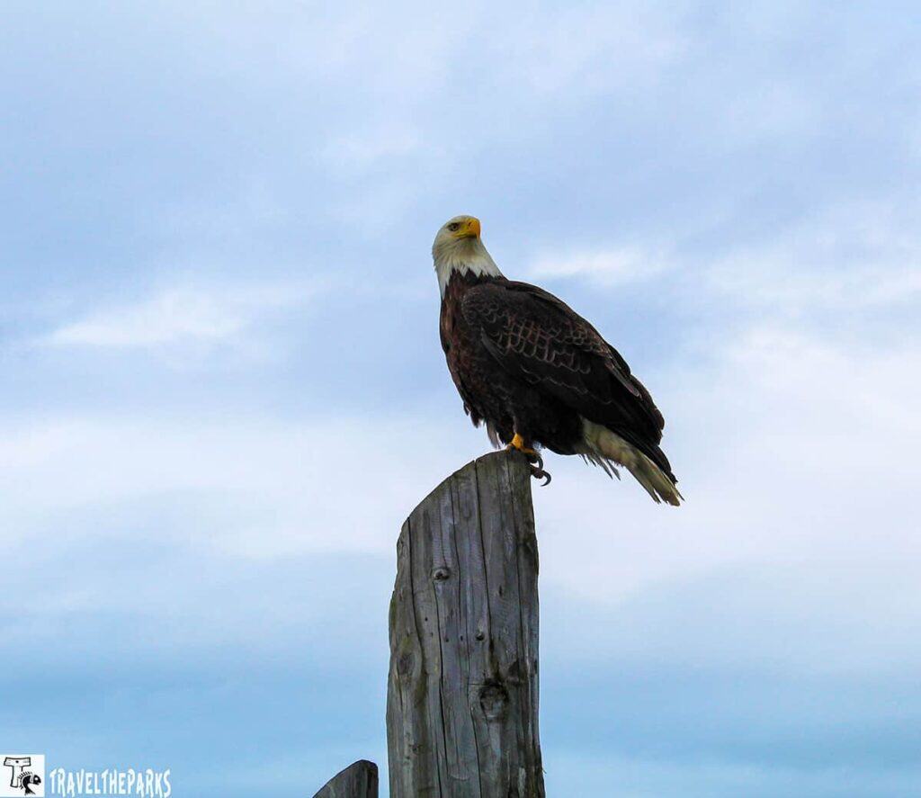
Today, Anchor Point is best known for its incredible bald eagle population. During low tide, vast stretches of beach are exposed, creating perfect conditions for eagle watching and photography. We saw dozens soaring above or perched along the driftwood-strewn shore—an unforgettable sight for any nature lover.
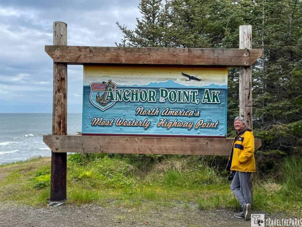
Another fun photo opportunity is at the roadside sign marking the “Most Westerly Highway Point in North America.” It’s a quirky milestone and a must-snap for any road tripper heading toward Homer.
For those headed out to fish or explore Cook Inlet, charter boats and leisure vessels are launched directly from the beach—with the help of a giant tractor operated by a local private service. It’s a unique and fascinating process to witness, especially at low tide when the beach stretches far out into the inlet.
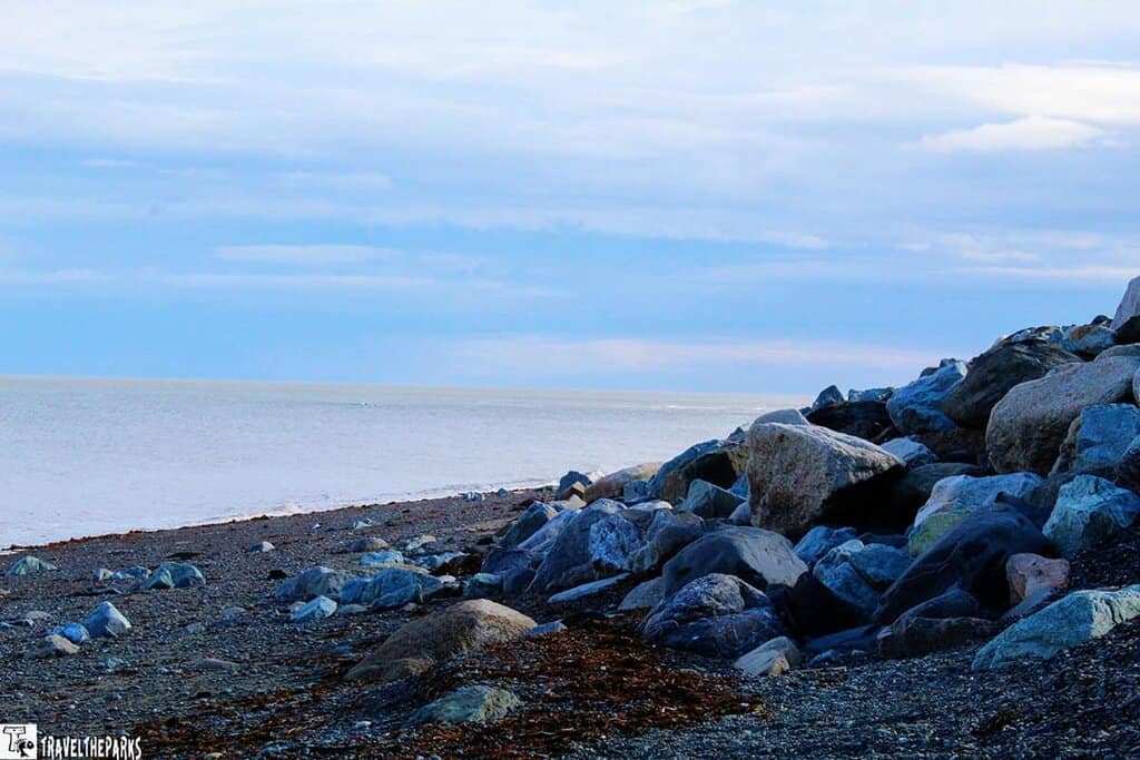
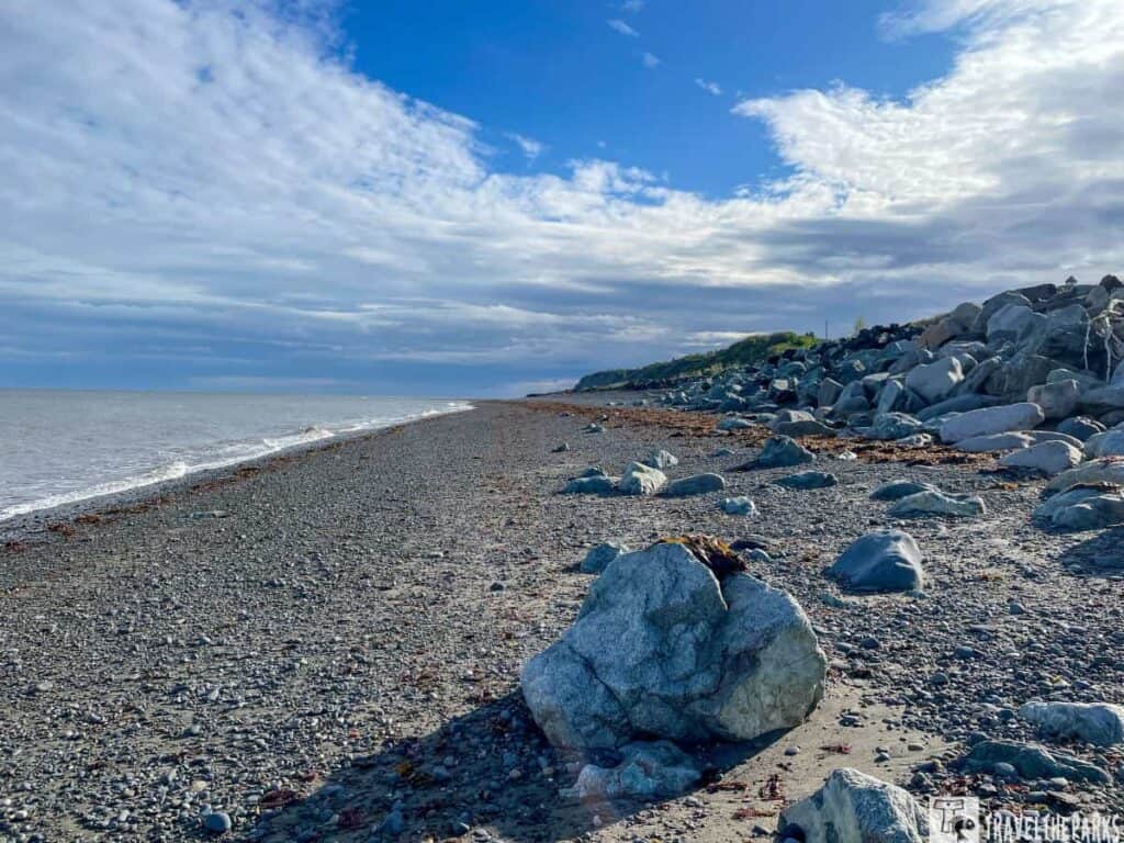
Anchor River is famous for its long, sandy beach, which stretches for miles in each direction along the coast. Again, we found excellent opportunities for beachcombing. There are also plenty of picnic tables to eat lunch, and enjoying the beautiful scenery. The nearby Anchor River is renowned for its salmon runs, attracting anglers who come to try their luck at catching king, silver, and red salmon.
What’s a WaterBoy? A Unique Boat Launch Experience on the Road to Homer
One of the most fascinating and uniquely Alaskan things to witness along the Road to Homer is the launch and retrieval of halibut drift boats at Anchor Point—and it all revolves around a powerful machine known as the “WaterBoy.”
The WaterBoy is a converted log skidder—essentially a rugged, heavy-duty tractor built to tackle Alaska’s rough terrain and wild tides. Watching this machine in action is a show in itself. We stood in awe as it hooked up to massive fishing boats, then slowly backed them down the shoreline into the surf of Cook Inlet. At the right depth, the boat captain throws the engine in reverse, and with the rising water, the vessel lifts off the trailer and motors into the inlet.
Retrieving the boats is equally dramatic. Due to the extreme tidal swings, captains must return at a steady speed of 6 to 12 knots. The boats essentially drive themselves up onto the trailers as the WaterBoy charges back toward the beach, perfectly timed to meet them. It’s a coordinated dance between boat and machine—and something you won’t soon forget.
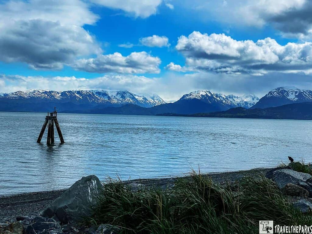
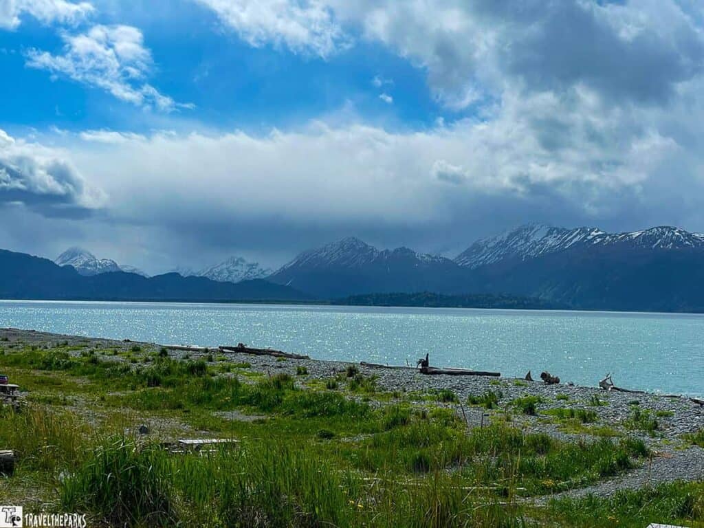
Stop #8 – Baycrest Overlook: Your First Glimpse of Homer on the Road to Homer
Just before descending into the final stretch of your journey, Baycrest Overlook (Mile Marker 196) delivers a jaw-dropping first look at Homer Spit and Kachemak Bay—a panoramic scene that feels like a postcard come to life. If you’re looking to photograph the iconic Spit, this is the place to do it. With 180-degree views, you can see glaciers tucked into the mountains and eagles soaring along the bluff—a true “welcome to Alaska” moment.
The overlook has a large parking area, making it accessible for RVs and larger vehicles, and it’s a perfect stop for that must-have photo with the “Welcome to Homer” sign. A nature trail begins here, lined with native wildflowers in spring and dotted with interpretive panels that detail Homer’s rich natural and human history. One particularly memorable sign told the story of early prospectors stranded here—reminding us just how wild and remote this land once was.
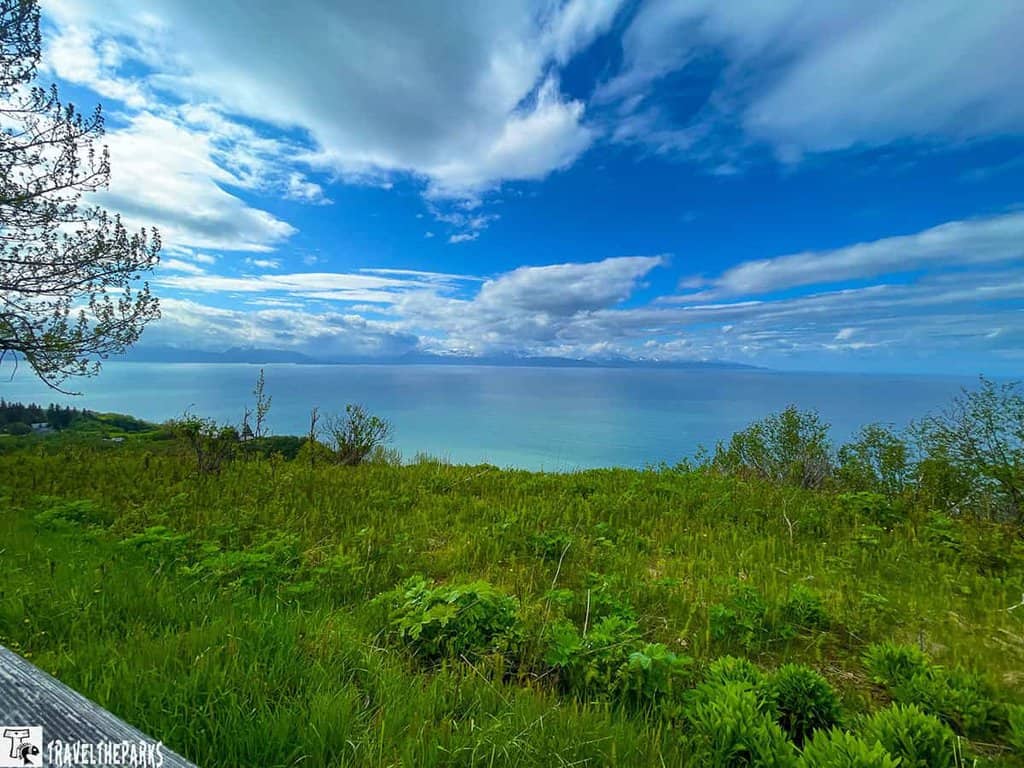
Bring binoculars if you have them. Not only will they help you spot eagles in flight, but they also provide the best up-close views of the Homer Spit, stretching into the shimmering bay below.
Leaving Baycrest behind, we began our descent into Homer, ready to explore the Spit and savor everything this extraordinary coastal town has to offer.
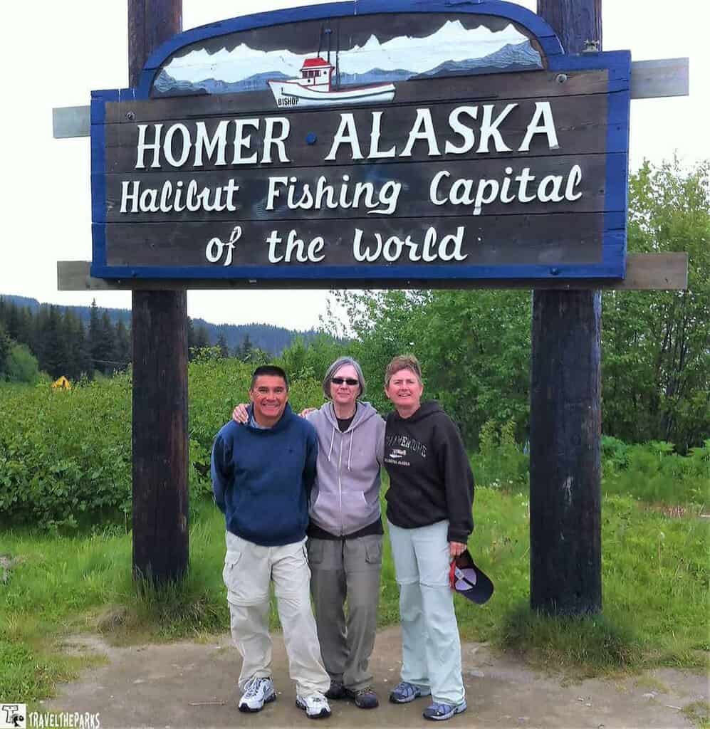
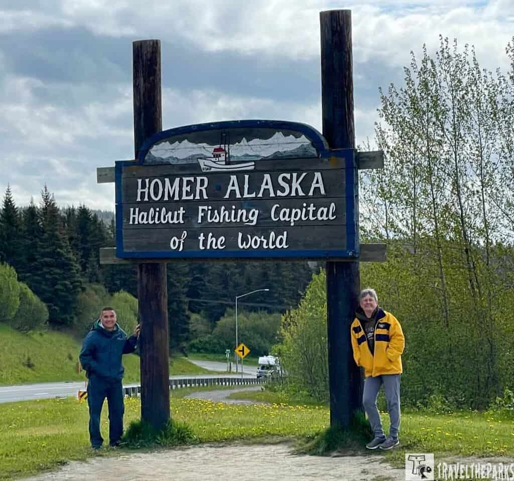
Stop #9-Homer Alaska–At the “End of the Road”–The Adventure Begins!
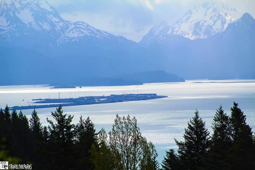
The Homer Spit is a 4.5-mile-long strip of land that extends into Kachemak Bay. It’s a popular spot with visitors who enjoy for fishing, shopping, dining, and wildlife watching. If you have time in your itinerary, the scenic roads around Homer offer endless views of the surrounding mountains, glaciers, and ocean. Drive out to the end of East End Road for some of the best views.
Dead End: The Homer Spit Is the True End of the Road to Homer
Blustery, cold, and wrapped in clouds, our arrival on the Homer Spit felt dramatic—just as it should. This is the true end of the Sterling Highway, where land narrows to a thread and stretches out into the wild waters of Kachemak Bay. With a population of around 5,500, Homer may be small, but it’s rich in character and surrounded by stunning natural beauty.
The Spit itself is a unique experience to drive—just 300 yards wide in some spots, it’s like cruising across a narrow ribbon of sand and gravel, bordered by ocean on both sides. Lined with quaint shops, seafood joints, art galleries, and fishing charters, it’s where the heart of Homer’s salty, free-spirited culture beats.
Before diving into the Spit’s attractions, we recommend a quick stop at the Homer Visitor Center. The staff are friendly and knowledgeable, and they offer up-to-date information on weather, road conditions, and local events. It’s a great way to orient yourself and make the most of your time at the end of the road.
Final Thoughts on the Road to Homer: A Journey Worth Taking
The drive from Soldotna to Homer is more than just a scenic route—it’s an unforgettable journey through some of Alaska’s most stunning landscapes. From rivers teeming with salmon to wildflower-filled meadows, eagle-covered coastlines, and panoramic ocean views, every mile along the Sterling Highway offers something new to discover.
After soaking in the salty sea air at Land’s End on the Homer Spit, we turned the RV around and began the trek back toward Soldotna, with a stop at Johnson’s Lake State Recreation Area for the night. Homer left us with a handful of memories we’ll treasure forever—from wildlife sightings to coastal trails and that iconic view from Baycrest Overlook.
If you haven’t yet made it to the end of the road, we hope this guide inspires you to go. Homer, Alaska, is waiting—and it’s well worth the drive.
Have you visited Homer or driven the Sterling Highway? We’d love to hear about your favorite stops, stories, or tips. Drop a comment below and share your own adventure—or let us know what you’re most excited to see when you make the journey!