
Are you looking to explore the trails? Theodore Roosevelt National Park has over 90-miles of hiking trails, so there is something for everyone. However, which trails are the best to hike? After spending a week checking out the park, these are just a few of our leading suggestions for hiking.
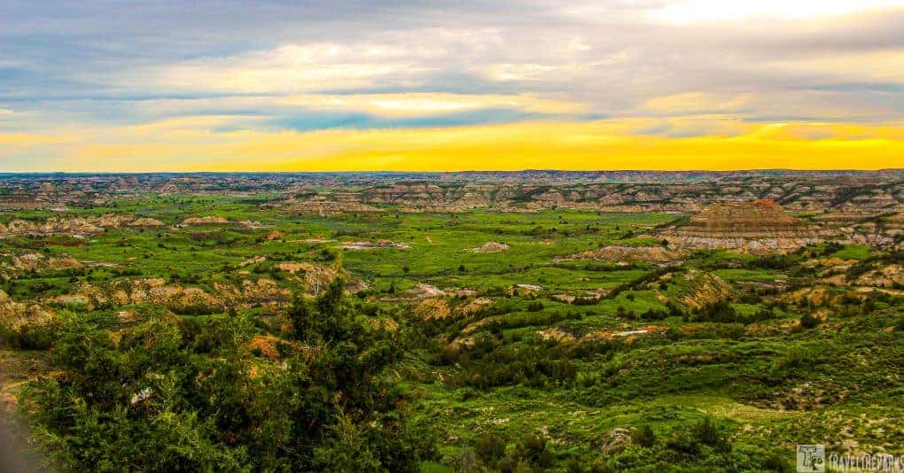
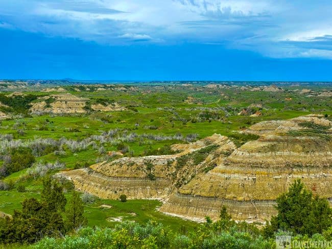
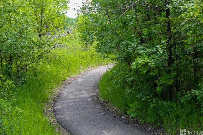
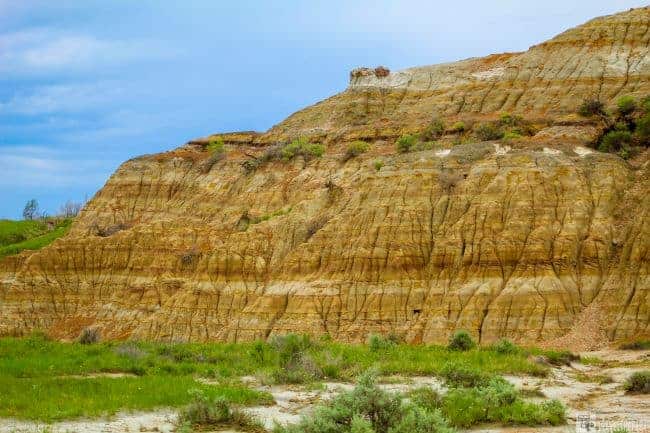
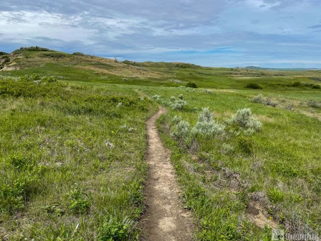
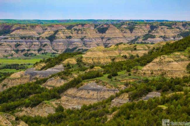
The Badlands landscape comprises tan and gray layered buttes, dense green trees grow on the butte face, and a green prairie grasslands. It is a place you can just soak in the beauty. Hiking trails in the park will take you to the bottom of canyon ravines or all the way to the top of buttes as you pass through prairie dog towns and sagebrush terraces.
This post may contain affiliate links, meaning if you purchase something through one of these links, we may earn a small commission at no extra cost to you! Read the full disclosure policy here.

Table of Contents
Getting To Theodore Roosevelt National Park
Yellowstone and Glacier National Parks are both a day’s drive away if you want to combine them! For us, it was the perfect addition to a road trip that also includes Badlands National Park, Custer State Park, Mount Rushmore National Monument and other Black Hills venues in South Dakota.

North Unit Access
We accessed the north unit of Teddy Roosevelt National Park, beginning at the junction of I-94 and ND22 in Dickinson, North Dakota. Head west on I-94 18.9 miles to Interstate Hwy 85 at Belfield. Turn right on US-85 and head north for 51.2 miles to the north entrance station into Theodore Roosevelt National Park. The park is 15-miles south of Watford City, North Dakota if you access from the north.

South Unit Access
133 miles from Bismarck, North Dakota, and 27 miles from the Montana state line, lies the South Unit. Easily accessed from I-94, exits 24 and 27 just outside the town of Medora, North Dakota. The South Unit’s Painted Canyon Visitor Center is located 7 miles east of Medora at exit 32 off of Interstate 94.
There are 3 Visitor’s Centers. They are in the North Unit, the Painted Canyon rest stop on I-94 and the Medora entrance of South Unit. Every time we visit a National Park, we always start at the Visitor Center to get up-to-date information on trails and closures. A Park Ranger is always available to provide information that will help you make the most of your vacation.

Hiking the Painted Canyon Nature Trail
This overlook is one of the most iconic views of Theodore Roosevelt National Park. It is also the most visited. Just off I-94, the rest area/visitor’s center is by far the most photographed. I think it is an excellent spot for photographing the sunrise. The topography is mesmerizing. The colorful badlands formations, hills and lush green valley are one of the most dramatic landscapes in the park.


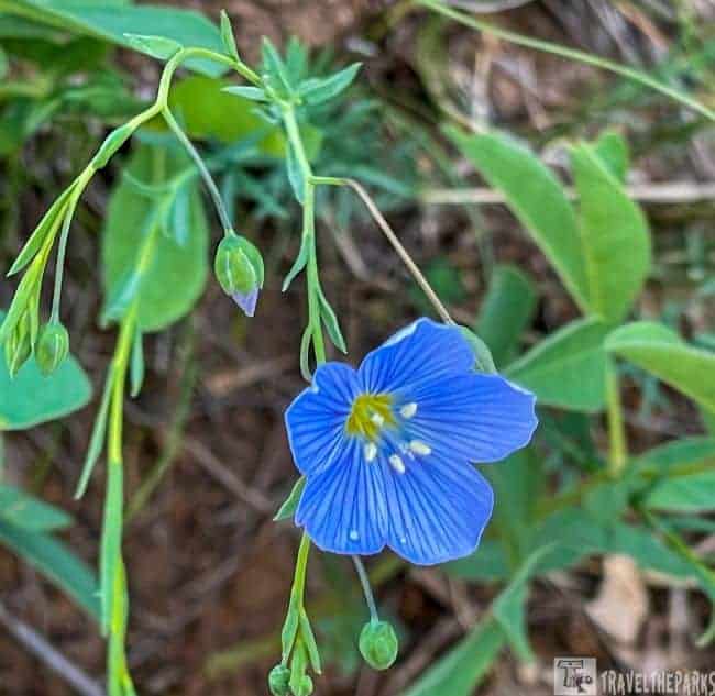

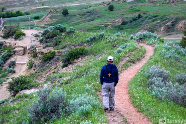
Painted Canyon Nature Trail offers a 1.1-mile moderate challenge loop down into the valley. The trailhead is located just to the right of the visitor’s center nearest the picnic shelter. The trail down is steep and slippery in some places. It is important to remember that you have to climb back up on the return trip. We spotted plenty of wildlife along the trail, bison, pronghorn, deer, rabbits, and a lone coyote. We observed so many varieties of birds and wildflowers in the early spring. The trail takes about 45-minutes to complete without stopping for photographs. If you have the stamina, you can do the entire 4.2-mile out & back trail in a couple of hours.
What did we bring with us? Remember, a good pair of sunglasses, sunscreen, towel, ball cap or wide-brimmed hat, and a light loose-fitting long-sleeved shirt for sun protection while on the trail. If you plan to walk the trails, bring bug spray for the biting insects.
Trail Guide to Theodore Roosevelt National Park South Unit
There are short and long hikes depending on what you are looking for in the South Unit of the park. Varied terrain and distances for every type of fitness level. Many of the hiking trails are directly off the scenic loop drive. Easily accessible with plenty of parking.

Best Hikes Along the Scenic Road Loop in TRNP
A portion of the scenic drive loop is closed at the moment. The last viewpoint at Badlands Overlook is about two hours away (not including hikes). At this point, the road stops and you must turn around. Bison jams are common from time to time. The chances of them occurring are high, so you just need to be patient and wait. Along the scenic drive, there are loads of doable trails for every level of hiker. Mostly, when we stopped at a viewpoint, we hiked. This is the best way to experience any National Park.
Overlook #1-Skyline Vista Trail
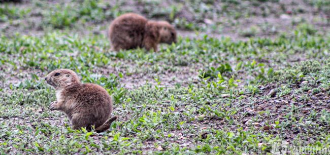
The first overlook on the scenic road lies just past the visitor’s center. The Skyline Vista Trail is a short 0.3 mile walk on a level dirt path. Close to the prairie dog metropolis. Remember to bring binoculars to get a better view. The labyrinth of prairie dog mounds reminded me of a whack a mole game. I could hear everywhere the warning chirps and squeaks.

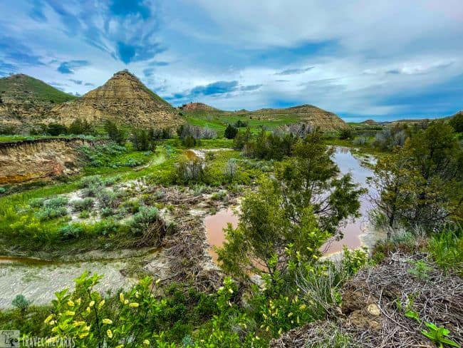
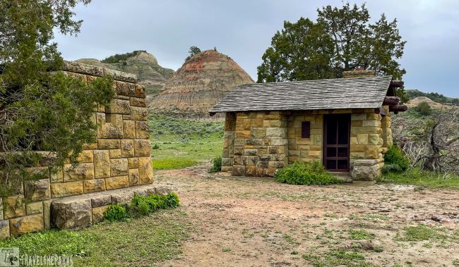
Quaint Peaceful Valley Ranch
The name says it all. Short dirt road leads to an abandoned paddock area and a few remaining buildings that were once part of a concession area. The original ranch house is among the vacated buildings. The park has recently made renovations to some buildings. Initially, the ranch served as the park’s headquarters when it was first established in 1947. The area later served as a venue for horseback riding (1918-2014). Today it is a suitable spot to venture to the river for a quick photo op and often see the feral horses.

We arrived early mid morning to find the feral horses in the meadow and woods along the Little Missouri River. Delighted, we took the pathway leading down to the shoreline. Most of the horses were just inside the tree line. Notwithstanding, a few were eating fresh grasses and wildflowers in the open paddock. With the fence between us, I could get some great photographs. The two social groups we spotted on this day only had one foul amongst them.

Today approximately 170 horses freely roam the 47,000 acres of the South unit of the park. Originally left behind by ranchers, they eluded capture in the early round-ups held in 1959. They attempted to remove the feral horses in the early 1970s. The historical significance was recognized and park officials decide to manage the herd rather than remove them. The park service manages the horses, keeping their numbers in check.
Trailheads at Peaceful Valley Ranch
A few trails begin from this section, including the Ekblom Trail, Big Plateau Trail (5.4 miles), Lone Tree Loop Trail (9.2 Miles) and the CCC Trail connects to both the Jones Creek Trail and the Lower Paddock Creek Trail. A Civilian Conservation Corps (CCC) camp occupied the Jones Creek area from 1939 to 1941, giving the trail its name. Although the camp was dismantled, you may still find the occasional foundation stone.

Overlook #2 – Amazing Views on the Wind Canyon Trail
An easy trail along the wind-sculpted canyon overlooking the Little Missouri River, this 0.4-mile loop offers panoramic views of the river. The hike from the parking lot is short and moderate. We climbed to the top of the ridge, taking in the river’s sandy eroded cliffs. From the observation platform, we could see the prairie dog town below an excellent perspective on the grasslands of North Dakota. Despite a slightly cloudy day, the 360-degree views were spectacular.
An eagle flew directly over our heads. In the distance, we watched it land on a deadfall before making its way downstream. It would have been great if we could have taken a picture. Sadly, it happened so quickly. I considered this one of the prime spots to watch the sunset. Turning around, the loop trail descends back to the parking lot. If you’re visiting the South Unit, stop here to see the Little Missouri.
Overlook #3 – Boicourt Overlook Trail
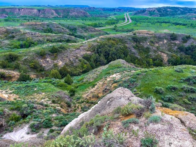
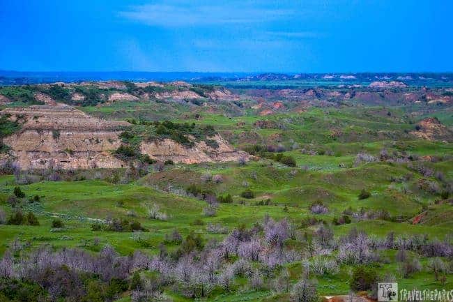
This paved 0.2 mile paved trail is one of our favorite for sunsets. The accessible trail is level and flat. A dirt path continues if you want to get better views. With the rainy overcast day, we could smell the coal seam fire started in 2018, burning a few miles distant. Benches near the end of the paved path make this a great place to reflect. From this vantage point, the views of the badlands seem endless. The interpretive sign states that the badlands are 100-miles long and average 15-miles wide. You can see for miles, including Sentinel Butte, Camels Hump Butte, and West & East Buttes, all approximately 20 miles distant.
Overlook #4-Coal Vein Trail Loop
This is a great hike for all ages. Nothing too strenuous. There is an inner loop (0.8-miles) and an outer loop (0.6-miles). We picked up a free self-guided Nature Guide at the trailhead (please remember to return it afterwards). The trek wanders through a landscape where a coal vein caught on fire in 1951and continued burning for 26 years. The parking lot was full when we arrived. However, the rain kept most people off the trail. The downpour did not deter us from hiking the loop.

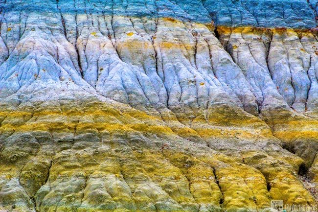
What do the Colored Layers Mean?
The scenery is interesting looking at the different layer colors. Each layer signifies a particular rock type. Clinker is the bright red rock that comes after the coal burns and hardens. We could see the bluish-grey layers of bentonite clay made of volcanic ash. Those dense black layers are coal that has been compacted and hardened from ancient plant remains. You can also see the lighter tan/brown layer of sandstone washed down from the distant Rocky Mountains.
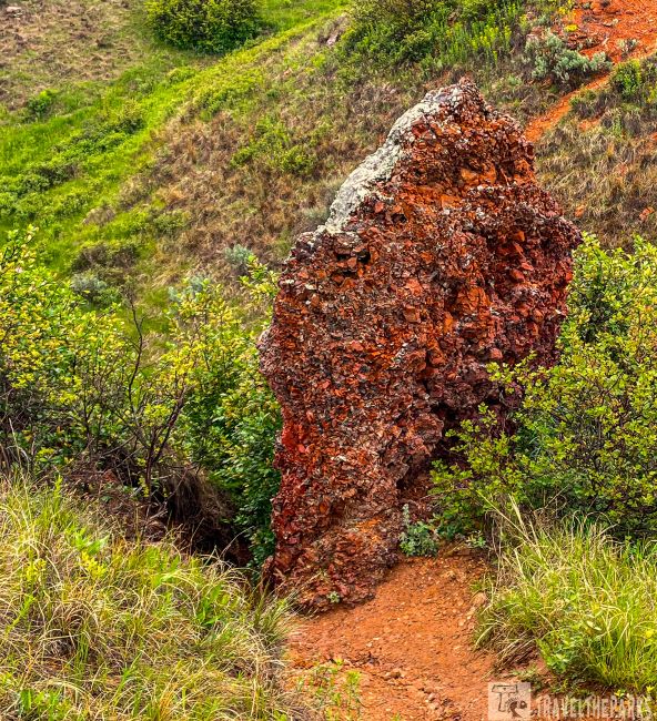
The trail passes through a gigantic artifact of clinker just after the wooden bridge. Most coal vein fires are started by lightning. Currently, one of these coal fires is within feet of the scenic drive, just east of the parking area for Upper Jones Creek Trail. Recently, park staff determined that this fire had the potential to burn under and damage the road and took preventative action. These fires are incredibly difficult to extinguish and may burn for many years.
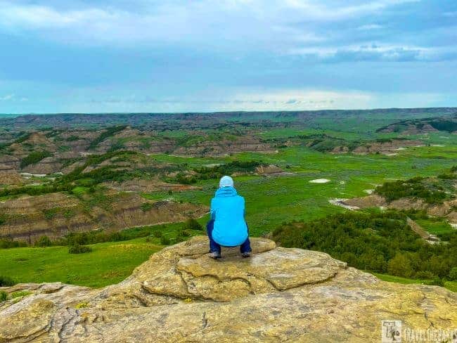
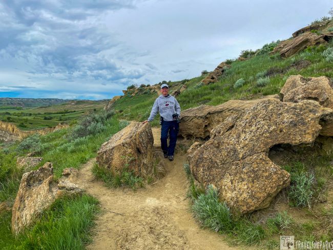
Overlook #5-Climb the 2nd Highest Point Buck Hill
A short 1.0-mile dirt trek offshoot from the paved scenic drive leads to a roundabout parking area. This is where the trail starts. A steep grade this 0.4-mile out-and-back trail leads to breathtaking 360-degree view of the painted canyon and the dramatic badlands landscapes beyond. It is the second highest point in the park, climbing this 2,855-foot tall hill. A popular spot. This is the only place we really came upon many people. On a clear day, the badlands colors are simply amazing. The trail continues across a level top. A grouping of boulders is a great place to sit and admire the view. Just watch for rattlesnakes. The valley below was incredibly green from the spring rains. With binoculars, you may spot pronghorn, bison, or coyotes on the valley floor. You can start the Painted Canyon Trail here.
Stretch Your Legs Hiking the Lower Paddock Creek Trail
A 11.4-mile out-and-back pathway if you include the upper & lower segments together. The scenic road divides the sections. The lower pathway is 4.5-miles and the upper section is 6.8 miles. It is a narrow dirt path difficult to follow. We only got the first two miles of the lower section before having to turn back because of the water levels in the creek. This spring the park had lots of rain in early June. The trail was muddy and slippery, many of the log bridges were impassable.

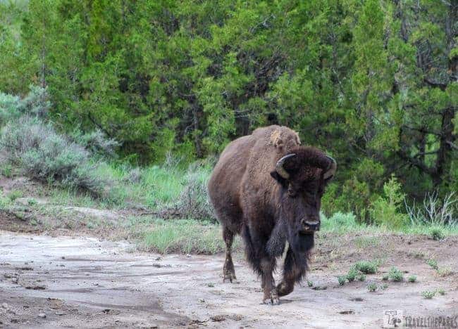
An out-and-back trail, the Badlands Spur, is 1.7 miles long. The trailhead is on the right after turning off the Coal Vein Trail in the South Unit. Since we could not complete the Lower Paddock trail, we included the Badlands Spur trail. As you hike along the trail, you reach the Lower Talkington Trail junction, where you can add more miles if you wish. You can combine the trail with the Upper Paddock Trail and Talkington Trail to complete a loop. I would love to do this trail in the summer months when the creek is low. Lots of bison along the trail. We gave them a wide berth.
Overlook #6-The Historic Old East Entrance Trail
There is an original entrance station at the end of this mostly flat trail. The 0.9-mile out-and-back trail meanders through a large prairie dog town. There were plenty of yips and squeaks from the cute little guys. Many seemed to take us in stride, a good place to get up-close pictures. We saw lots of small pups emerging from the dens. We had to dodge a good deal of bison patties, fortunately we did not encounter any bison along the trail. Interesting fact, we learned that on the early pioneer wagon trains, children picked up the dried patties to burn as fuel since the prairie had no trees for firewood.

Remember: Stay at least 25 yards away from other large mammals like bison, elk, bighorn sheep, deer, moose and coyotes. Bison might look heavy and slow. They run fast: three times faster than humans can run.
During the Great Depression, they built the Old East Entrance Station as part of a relief project to open Theodore Roosevelt National Park. Medora became the park entrance when Interstate 94 replaced US Highway 10 in 1968. The old station building is still standing but is locked-not accessible. You can continue to Peck hill the highest point in the park if you choose too.
What are the Best Long Hikes in the South Unit?
Don’t Miss the Petrified Forest Loop
This 10.2-mile loop trail is moderately challenging yet quite rewarding. We got an early start taking the West River Road Exit 23 off I-94 to the well-maintained dirt road (forest road 730). Takes about 30-minutes just follow the signs. The parking lot was empty when we arrived. We had the trail all to ourselves. Be sure to bring plenty of water and sunscreen since there is little to no shade available on the trail. After 0.6-miles we reached the fork in the trail. We chose the left path. After another 3/4 of a mile, we entered an otherworldly landscape. It was like traveling back in time. From here, it is easy to find the petrified tree stumps. Some of the larger ones are about six feet tall.

Note: It is illegal to remove any resource from a national park. Leave any fossil, stone, or other object where you find it. Always practice Leave No Trace ethics on your adventures and follow local regulations. Please explore responsibly!
Millions of years ago, the landscape here looked much like the Everglades do today. Considerable parts of North Dakota were once part of a great inland swamp. Later, when marine waters submerged the trees, they began to fossilize. As they became decayed, minerals hardened in place. Since rain was in the forecast, we only did a few miles of the trail before returning to the parking lot.

Alternative Route to Petrified Forest Loop
In the summer months, you can park at Peaceful Valley Ranch and wade across the Little Missouri River using the Elk Bloom Trail and Big Plateau Trail. The first 4-miles is through dead flat knee high grasslands. This avoids driving the 4-mile dirt road. Unfortunately, in June, the river current was fast and the water level too high to wade across.
Up for an Even Longer Hike-Then the Maah Daah Hey is it
The 144-mile-long trail connects all three Teddy Roosevelt units and the Missouri Grasslands. This trail stretches from the USFS Burning Coal Vein Campground south of Medora to the USFS CCC campground south of Watford City. The Maah Daah Hey Trail symbol is a turtle. It stands for determination, steadfastness, patience, a long life, and fortitude, as well as being a symbol of the Lakota Sioux. Maah Daah Hey in the Mandan and Hidatsa language means “grandfather” or “an area that has been or will be around for a long time.”
Sections of the trail within the park are not always well-maintained. This trail is best tackled in the cooler shoulder months, in our opinion. If you decide to trek, the entire length water will need to be cached. Plan ahead for this trail. We only did a short section of the trail and it was a challenge because of the heavy rains the previous day. The views are stunning, to say the least.

Trail Guide to Theodore Roosevelt National Park: North Unit
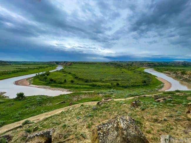
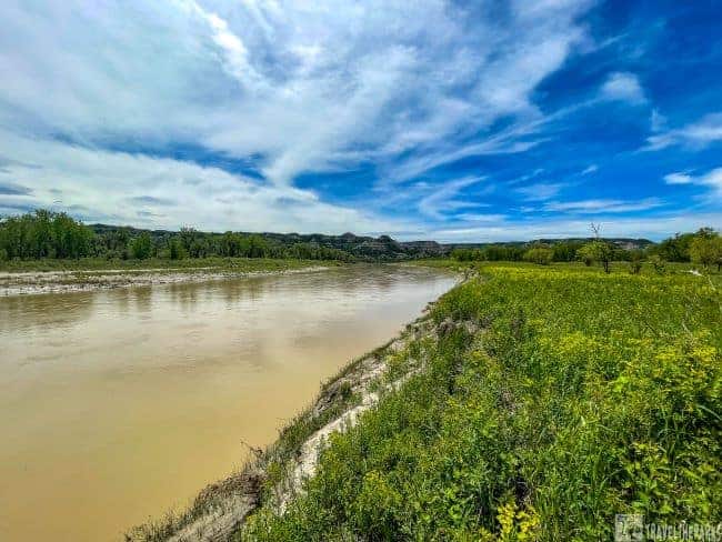
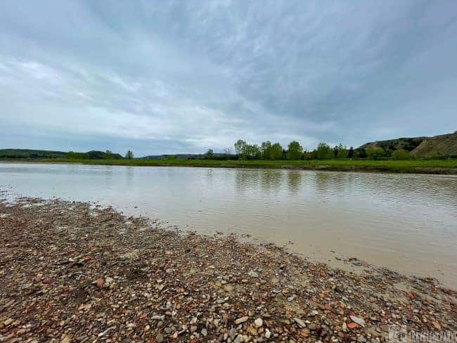
A visit to North Dakota would not be complete without experiencing the Little Missouri, which played such an important role in creating the badlands and Theodore Roosevelt National Park. Clay-rich soils have been severely eroded in the badlands, which are composed primarily of sedimentary rocks.


Fun for the Kids – Little Mo Nature Trail
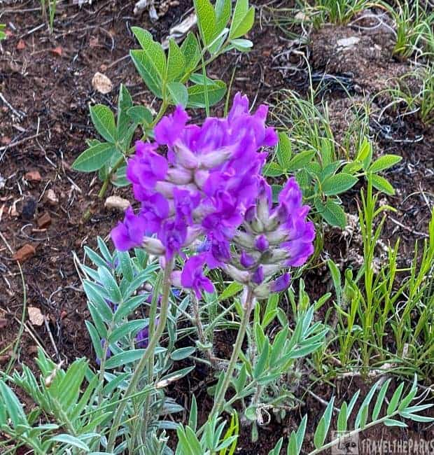
A relatively short 1.1-mile loop trail. We access the wide paved path from the Juniper Campground. The latter part of the trail is hard packed gravel. We picked up a trail brochure at the trailhead as a guide for each of the stops. The numbered posts 1-19 are well marked and detail the flora & fauna of the area. The trail moves through Missouri river bottomland with large Cottonwood and Juniper being the predominant trees. Closer to the river, we spotted the Longhorn cattle herd grazing. Just past the bridge over the creek, I was super startled by a snake. I think I jumped a few feet in the air. We continued to the end of the trail, making our way down to the Little Missouri. Being early spring, the river was running high and filled with silt. Beautiful wildflowers lined the eroded banks. Was a beautiful sight.
PRO Tip: The prairie rattlesnake is the only venomous snake that lives in Theodore Roosevelt National Park. Yes, they are dangerous, so keep your distance.
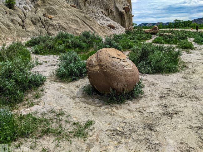
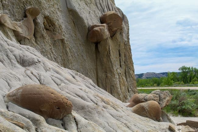
Walking Among the CannonBall Concretions
This pullout is along Theodore Roosevelt NP North Unit’s 14-mile scenic drive, across from the spur road to campground and picnic area, about 4.5 miles from the visitor center. Currently, it is easy to bypass with the road construction. However, it is one of the strangest oddities within the North Unit. Scientists say they are form from long ago river sedimentation. This is a process where particles in suspension in water settle out of the suspension under the effect of gravity. These particular cannonballs formed when this area was an ancient riverbed. The deposited and grains became cemented together. Erosion of the rock bluff over time exposes these unique spherical concretions. We viewed all different sized concretions along this short trail in various stages of being exposed.
A Full Day Hike Explore the Buckhorn Loop
Buckhorn trail is an 11.4-mile long loop trail. We accessed the trail via the Caprock-Coulee trail, but you can also start at the Cannonball concretions. The trail at the northern end passes through two large prairie dog towns. In early June, the hustle and bustle is quite intense with the emergence of the curious young pups. We spent a few moments just watching them interact. In the Badlands National Park in South Dakota and Devil’s Tower, we hiked through a few prairie dog towns. They are adorable and hard to resist.
Interesting Fact: prairie dogs play an important role in maintaining a healthy and balanced prairie ecosystem in Theodore Roosevelt National Park.
Our Favorite Must-Do Hike is the Caprock-Coulee Nature Trail
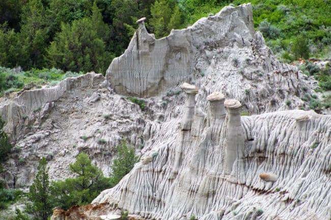
This 4.4-mile loop was by far our favorite trail. We did not encounter another soul during our 3-hour hike. The first 0.8 miles is the nature trail with markers for each stop (we started the trail counterclockwise). I download the brochure to my phone, but you can also pick up a paper copy (nps map) at the visitor’s center at the park entrance. Caprock “Hoodoos” dominates the trail, hence its name. A hoodoo formation is made up of soft muds and silts held together by a relatively resistant caprock top. The formation is a testimony to how a landscape has changed through processes of weathering and erosion.
Note: We advise caution in the spring when the trail gets muddy, and the clay is very slippery. Wear good hiking boots and long pants to protect against ticks in the long grasses. We recommend trekking poles for steep grades.

Definitely the highlight of our trip was the wildlife along the trail. A wide variety of animals make their home in Theodore Roosevelt National Park. We saw plenty of rabbits, bighorn sheep, bison and a large spade toad. Moving through the coulee, the geological formations, petrified wood and colorful bentonite layers are fascinating. Bring plenty of water in a refillable bottle (most parks have refill stations) and a snack for a break at the River Bend Overlook. We spent 30-minutes watching two bighorn sheep resting on a ledge here. From the overlook, the loop trail follows the ridgeline above the river before returning to the parking lot. The views of the Little Missouri are breathtaking from the trail. At the end, it caked our boots with muck, yet it was so worth the struggle to see this diverse landscape.

Oxbow Overlook/Sperati Overlook Trail
The trail 2.4-mile out-and-back trail begins at the Oxbow Overlook parking lot. It is relatively flat, cutting across gentle rolling prairie and sagebrush flats. With that said, there is little to no shade on this trail. Luckily for us, today is overcast. Views from the point are spectacular of the Little Missouri River, with mesas, buttes, and tablelands in the background. We did not encounter any bison on the trail, just lots of bison patties.
For the Most Adventurous-Hike the Achenbach Trail
This 18.2-mile loop trail requires that you stop at the visitor center to get your backcountry permit if you plan to do both the North & South sections with an overnight camping stay. I always printout a paper copy of the map when we hike, rather than rely on just the AllTrails, GaiaGPS, or Maps app. Many trail reviews noted that the trail markers do not line up with the apps. We wore long pants embedded with Permethrin and followed up with bug spray on our boots to avoid the ticks in the long sage grasses.
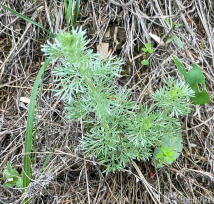
Interesting Fact: As you walk through the park, you will see sagebrush all around you. In fact, it’s difficult to find a landscape without it! There are six known species of sage that live here: big sagebrush, western (also known as green sage), pasture sagebrush (also called fringe sage), white sage, long-leaved sage, and dwarf sagebrush (commonly referenced as silver sage). All species of sage are long-lived and uniquely adapted to survive in dry climates.

Explore the Trails of TRNP: The North Achenbach Trail
We only had time to do a brief part of the North Achenbach trail (4.4-miles). There are two river crossing on this trail if you complete the loop, and the river was just too high to ford in early June. Our short hike started at the Oxbow Overlook, heading towards Juniper Springs Campground. The only reliable source of water found along this trail is at this campground (springs are unreliable at best).
Never underestimate how much water you will need. We went through almost all the water on this short hike and it was cloudy and cool afternoon. Hard to imagine how much we would have drank if it was sunny and hot. The ruggedness of this trail makes it so inviting. There was a lot of cacti everywhere on the ridgelines, and wildflowers in the tableland areas. I would love the next visit to do the entire loop with an overnight camping stop near Sperati Point.
Tips for Hiking in Theodore Roosevelt National Park
- When in the backcountry, remember to always bring water, food, a first-aid kit, binoculars and a printed map. Cell service may not always be available.
- Always let someone know your plans.
- Choose a trail that is right for your level. Be realistic!
- Be prepared for various types of weather in the North Dakota Badlands!
- Bring two gallons of water for each person per day-heat exhaustion and dehydration are common hazards.
- Always give wildlife some extra space.
The tiny tourist town of Medora, North Dakota, sits at the entrance to the park’s south unit. An ideal location to camp or find lodging. In the north unit, you can find accommodations in nearby Watson City, North Dakota.
Final Thoughts on the Best Hiking in Theodore Roosevelt National Park
Such a hidden gem. We so enjoyed many timeless moments of peace on the trails in Theodore Roosevelt National Park. As isolated as Theodore Roosevelt National Park is, it is worth the time. We added this to our itinerary when visiting the Black Hills of South Dakota, never realizing the impact this park would have on both of us. Get out and hike TRNP in North Dakota!
What’s your favorite hike in the park? What is your best-loved geological feature of the park? Share an experience you had while visiting the park in the comments section!
Wanda Page
Our favorite hike was the cannonball concretions. Our kids loved the large boulders, scrambling around the hills. We stayed across the road at the Juniper Campground. Thanks for the reminder of how great this park is.
Travel the Parks
Thank you! So glad you enjoyed reading our blog. We too loved the cannonball concretions!