Table of Contents
Updated June 2023
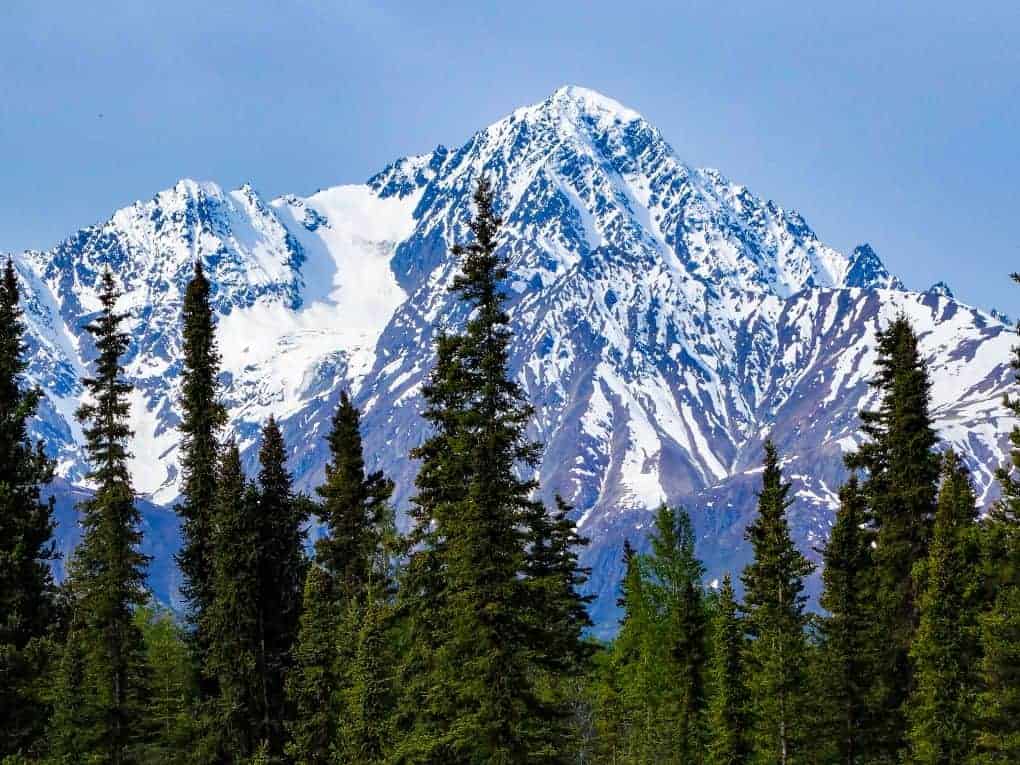
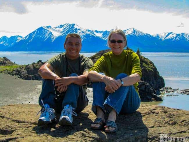
If you are headed from Anchorage to Seward on the Seward Highway, you are in for the most amazing experience! Making a trip down the Seward highway should be part of any Alaska itinerary. These are just a few of the best things to see along the way. Alaska has stunning vistas at every turn driving the Seward Highway-Alaska Highway 1. This award-winning highway is recognized as the National Forest Scenic Byway, All American Road and Alaska Scenic Byway. Of all the places I’ve driven…this is still the top of the list for beauty.
The highway traverses 125-miles from Seward to Anchorage. Completed in 1951, you will drive through the scenic Kenai Peninsula, Chugach National Forest, Turnagain Arm, and Kenai Mountains. On our dream Alaska RV vacation, we started our adventure by driving to Seward, Sterling, and Homer, Alaska.
This post may contain affiliate links, meaning if you purchase something through one of these links, we may earn a small commission at no extra cost to you! Read the full disclosure policy here.
Seward Highway Alaska travel guide: Anchorage to Seward
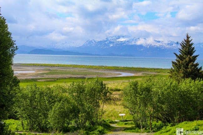
Cook Inlet stretches 180 miles from the Gulf of Alaska to Anchorage in south-central Alaska. The Cook Inlet then branches into the Knik Arm and Turnagain Arm at its northern end, almost surrounding Anchorage.

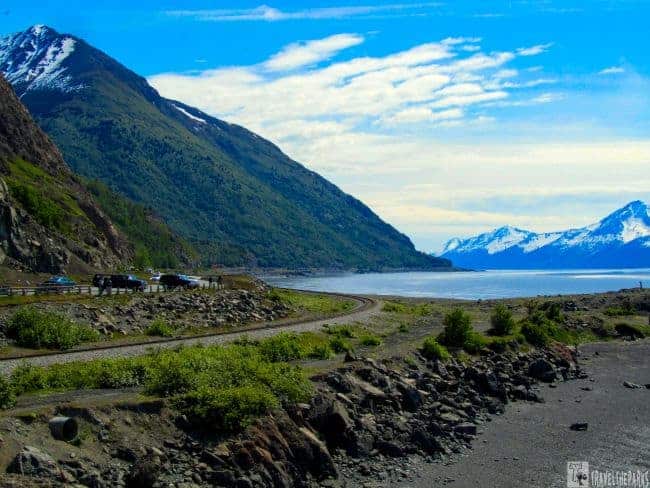
Driving the Seward Highway, you see the natural beauty of south-central Alaska. Exiting Anchorage, the highway hugs the coastline following the Turnagain Arm. They carved the highway from the jagged cliffs of the Chugach Mountains State Park. They list this in the top ten scenic drives in the WORLD!

Alaska Seward Highway road trip: Discovering the Coastal Beauty of Turnagain Arm
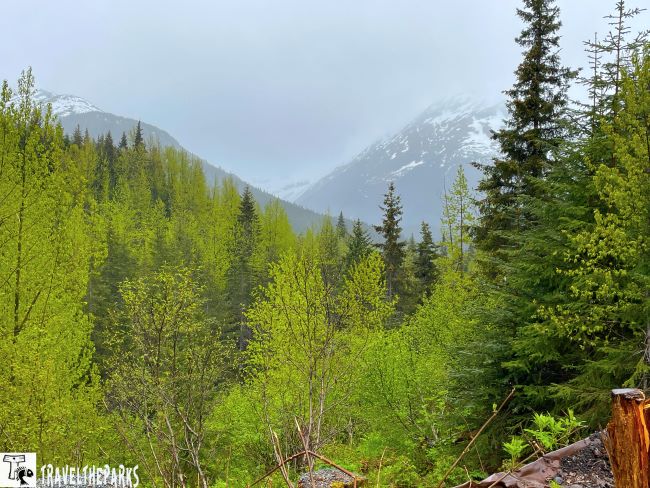
On this beautiful day, we had clear blue skies. You see shining snowy peaks, green forests, alpine meadows, mountain glaciers, and crystal blue lakes, all visible as you travel along the highway. The travel time to Seward is 3-hours. However, it is difficult not to pull over at every turnout taking another captivating photograph. There are panoramic views around every bend in the highway. So pretty much it can take you all day. None of your photographs will do justice to this spectacular scenery. It is just simply too difficult.

The highway climbs out of Anchorage over a hilltop, opening up to a breathtaking panorama of the Turnagain Arm. The Turnagain Arm received its name from the famed British explorer James Cook when he discovered it was not the “Inside Passage” he was looking for. Sadly, he had to “Turn Again” back into open waters. These are 14 of the most popular viewpoints, from Anchorage to Seward.
1. Seward Highway Scenic Drive Alaska: Birders Heaven the Potter Marsh (Milepost 116)
Our first stop is Potter Marsh. The marsh is a popular stop for migratory birds about 10-miles south of Anchorage. This is a coastal wildlife refuge. Moose love Potter’s Marsh. The elevated boardwalk over the marsh keeps you above the wetlands, making spotting wildlife easier. Spotting scopes along the way brings distant wildlife into focus. Educational interpretive signs with information on native species found in the marsh.
The first wildlife we saw were eagles soaring high in the distance above the marsh. A good pair of binoculars makes spotting birds easier. Always bring a refillable water bottle with plenty of water to quench your thirst on any hike. There is a large parking area to accommodate RVs and public restrooms.
Across the Road-Quick Stop at the Potter Section House
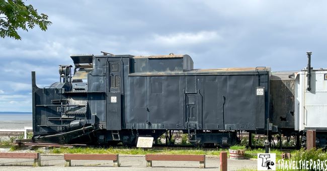
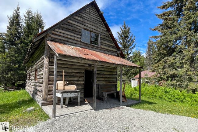
The section house is now a designated historic site and provides visitors with a glimpse into the history of the Alaska Railroad. Headquarters of Chugach State Park. The building has been preserved and restored, showcasing the living conditions and lifestyle of the railroad workers during that time. The Potter Section House was originally constructed in the early 1900s as part of the Alaska Railroad infrastructure. It served as a residence for the railroad section foreman and his family.
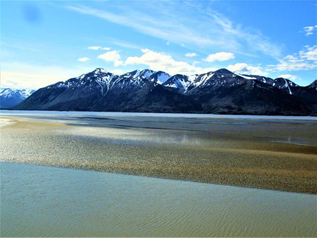
2. The Tide Turns – Beluga Point Overlook (Milepost 110)
At mile point 110, Beluga Point is an excellent place to take a break, stretch your legs. The Alaska Railroad passes directly in front of the parking lot.
Beluga Point is a rocky outpost extending out into the waters of Turnagain Arm. They named it for the white beluga whales that are often spotted chasing the salmon that run in the spring. Educational interpretive signs describe the history of this location.
Beluga Point has jaw-dropping 180-degree views of the Turnagain Arm and Kenai Mountains. We spent about 30-minutes scrambling over the rocks looking for belugas in the bay, but it was low tide, so our chance was slim. You can often see Dall sheep on the towering cliffs on the far side of the highway. We could see a few sheep on the mountainside today.
The park is an ideal place to watch the bore tide check the tidal charts for the best date and time. The bore tide is a rushing wave of seawater created during extremely low tide and a full moon. It forms a wave that is 6-10 feet high. We can sometimes see surfers running the wave as it enters the Turnagain Arm. I think that this would be a once in a lifetime moment!
PRO Tip: Do not walk the mudflats. They act much like quicksand and can be dangerous. Fatalities occur every year.

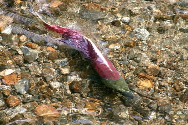
3. Fishing Paradise in Bird Creek (Milepost 100)
About 25-miles south of Anchorage on the Seward Highway, Bird Creek empties into Turnagain Arm. From July through September, anglers from all over the world descend on Bird Creek for the spectacular silver salmon runs. The best tackle to use includes Salmon Eggs, streamer flies, spoons, and spinners. “Combat fishing” is the norm during this time as everyone vies for a prime fishing spot and a chance to catch the big one.
If you want a long hike, the Bird Creek Trail starts in the parking area. It is a moderately difficult out & back trail that is very popular with local Alaskans. We walked a short trail to the creek, searching for signs of salmon, before returning to the RV to continue our journey.
4. Exploring Seward Highway by car: Stop at Bird Point Scenic Overlook (Milepost 97)
The Bird Point Scenic Overlook is one of the best places to stop along the Seward Highway to take in the views of Turnagain Arm, the Chugach Mountains, and perhaps see some wildlife. Chugach State Park is Alaska’s third-largest state park.
Here you can access the Bird to Gird paved multi-use pathway. If you plan to hike, prepare with a good jacket, a hat, and long pants. Invest in a magnificent pair of walking or hiking shoes. Pack some snacks and have a refillable water bottle before going up the trail. This is a 12-mile, one-way trail that will take you a few hours to complete. It connects the communities of Girdwood, Bird, and Indian. The trail hugs the shoreline of the Turnagain Arm for most of the hike before the bike path passed under the highway. The trail follows the boundary of the Chugach State Park for the rest of the hike.

The Seward highway passes through the small towns of Girdwood, Portage, and Moose Pass before reaching Seward. I can’t imagine what this must have been like for the builders on the road. This route is thousands of years old. Explorers and gold miners have long traversed this route before it became a major scenic byway. Part of me wishes to have seen it before they built the road.

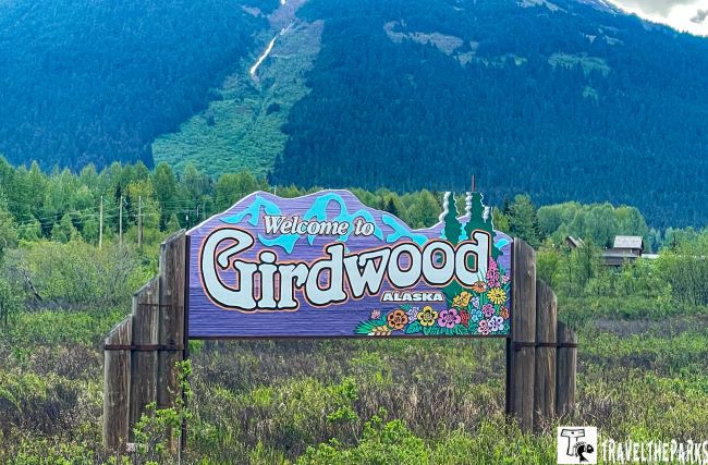
5. Sky High Alyeska Aerial Tram-Girdwood (Milepost 90)
The city of Girdwood, located 20-miles outside of Anchorage, is a small ski resort that has a rich history. “Glacier City,” as they originally called it, was later renamed after James E. Girdwood after he discovered gold in 1896.
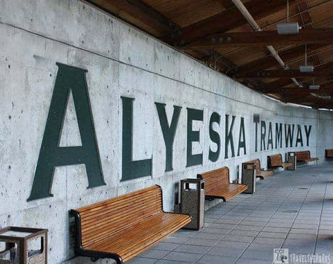
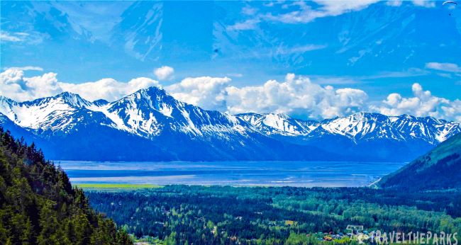
We found following the signs for the Alyeska Resort was relatively easy. From the resort, you can take the Alyeska Aerial Tram. It takes about 3 to 7 minutes scenic ride up to the top of Mount Alyeska from the base at the Hotel Alyeska. The view from the top is spectacular and well worth the price of admission. At the top of the gondola ride, there is a large observation deck. The breathtaking natural scenery of the Turnagain Arm, and the Chugach Mountains, and the forested valley below is stunning!
Eat Lunch Dining at Seven Glaciers Restaurant
The tram ride up the mountain gives you a view of waterfalls and the trail up. Arriving at the top, we were lucky to still have snow on the slopes. The restaurant at the top of the mountain is the Seven Glaciers, named after the seven “hanging” glaciers that you can see from this vantage point. This restaurant was open, but it was way too early for lunch. The food was a little pricey. We thought the snow was great for a snowball fight. We spent a good half hour walking the top before descending back to the parking lot and cruising the gift store.

Pan for Gold at the Crow Creek Mine
The Crow Creek Mine, located just a short drive from Girdwood, has a rich history dating back to the late 1800s when gold was first discovered in the area. During the early 20th century, it was one of the most productive mines in South-central Alaska. Today, the Crow Creek Mine is a significant historical site. The Crow Mine is on the National Register of Historic Places.
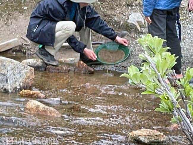
You can take a guided tour of the mine and learn about the mining techniques used in the past. The mine features a museum that showcases mining artifacts, historic photographs, and displays that provide insights into the life of gold miners in Alaska’s past. The exhibits offer a glimpse into the challenges and successes of the miners who worked in the area.

One highlight of visiting the Crow Creek Mine is the opportunity to try gold panning. You can rent gold panning equipment and receive instructions on how to pan for gold in the creek. We took an hour to try our hand at gold panning. It’s a fun activity for all ages, and any gold flakes you find are yours to keep!
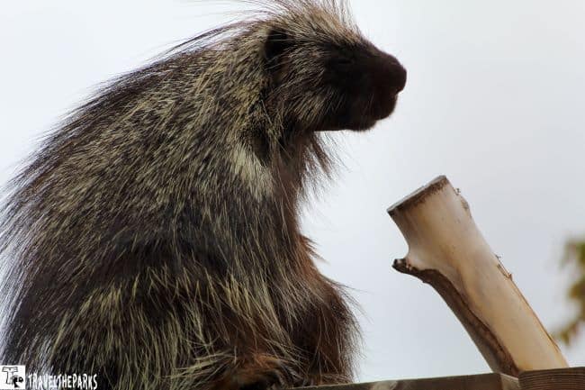
6. Must-Do The Alaska Wildlife Conservation Center (Milepost 79)
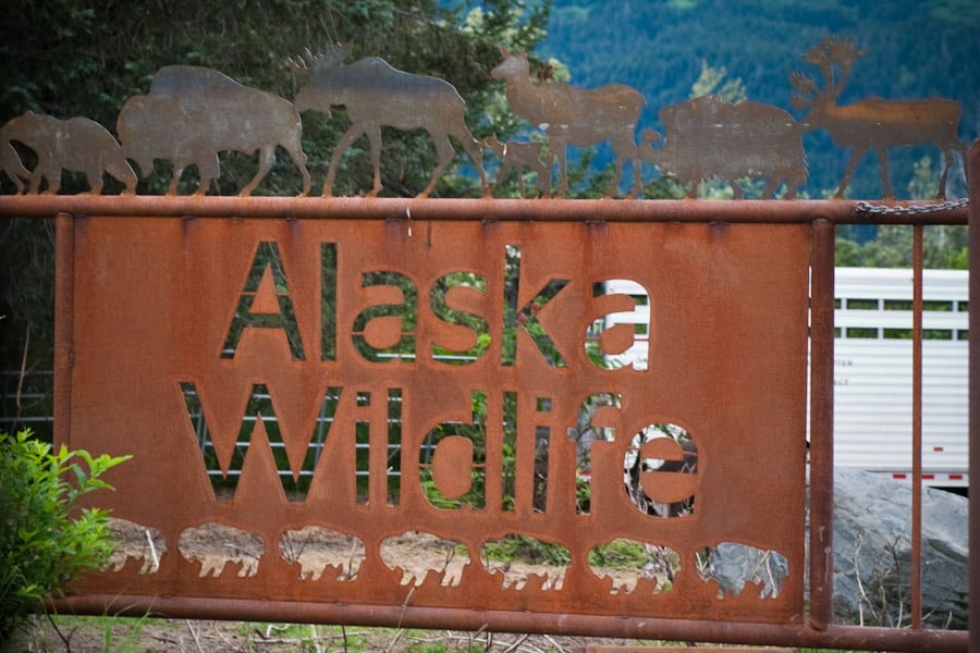
An Alaska vacation would NOT be complete without a detour off the Seward Highway to The Alaska Wildlife Conservation Center. Located 50-miles from Anchorage, the AWCC is a nonprofit organization that takes in injured and orphaned animals, caring and protecting them. However, many of these animals cannot get reintroduced to the wild therefore, they have a haven here at the center. They have carefully constructed permanent enclosures here to house the animals that blend in well with the natural surroundings. The wildlife center has rescued orphaned Alaskan wildlife, such as elk, reindeer, bears, wolves, and lynx. They are constantly adding fresh additions and rebuilding better enclosures. A work in progress!
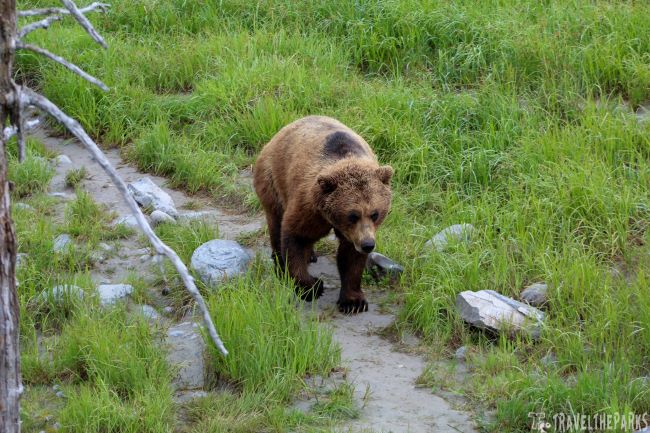
Visitors can walk or drive to view the wildlife along the gravel loop road. A guided trail map is available for paid admission. I suggest walking instead of driving this way you get the best viewing being closer to observe the animals. Take your time. Don’t rush. I love seeing the natural behaviors, especially the bears. We could watch them swim and play all day long. There are wonderful photo opportunities!
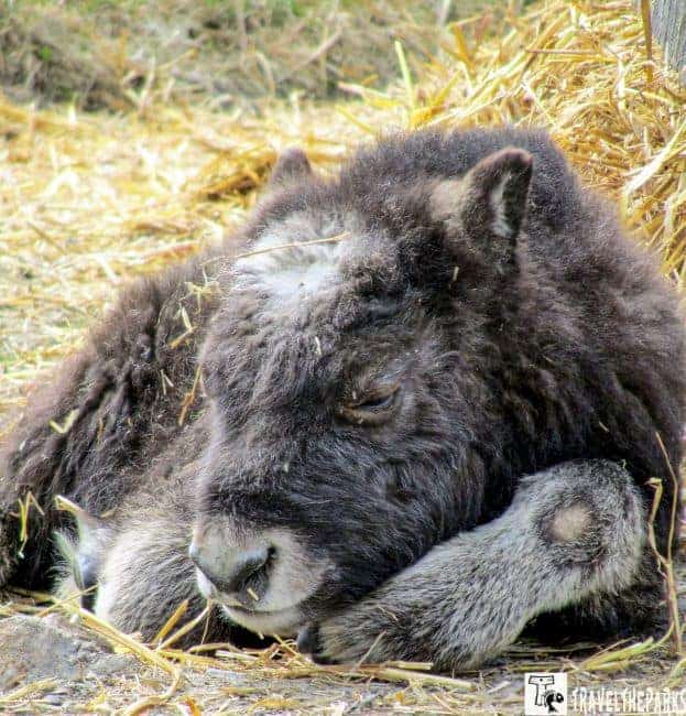
We spent about 1-2 hours viewing the wildlife, talking with the animal caretakers. You can tell they have a heartfelt relationship with these orphans. This is a popular destination therefore, I would suggest going early to see the animals, beat the crowds. They have a small gift shop with souvenirs that benefit the conservation center. We loved walking the pathways and watching the bears.
7. Driving the Seward Highway-Portage Valley Ghost Town (Milepost 73)
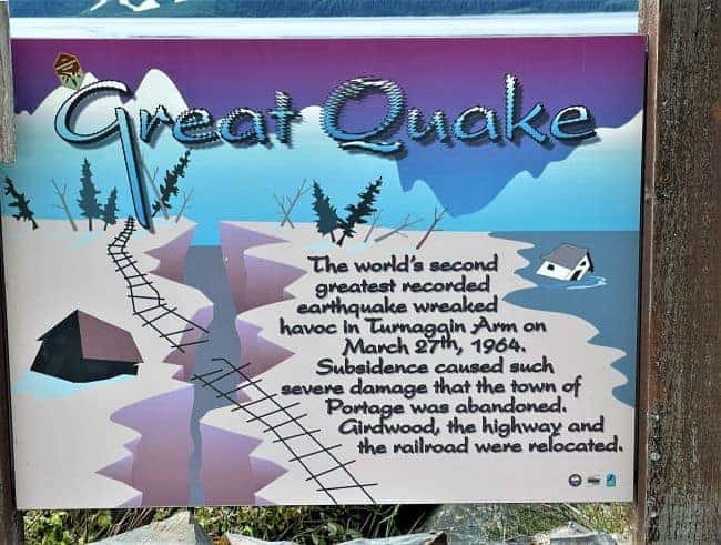
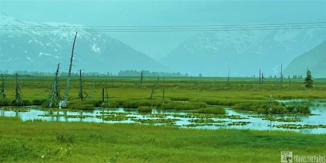
At MM 70 lies the ghost town of Portage Valley. All that remains is a partially submerged building, truck, and a forest destroyed when the devastating 1964 Good Friday Earthquake generated a huge tidal wave. The land dropped 10-12 feet in a matter of seconds, flooding with seawater. You will see the dead salt-soaked trees often referred to as the “Toothpick Forest”. Nature is slowly reclaiming what’s left of this abandoned boomtown.
At mile marker 70 is the turnoff for the Portage Glacier and the Whittier Tunnel. If you have additional time built into your schedule, continue through the Anton Anderson Memorial Tunnel to Whittier. Whittier connects to Valdez via the Alaska ferry system.
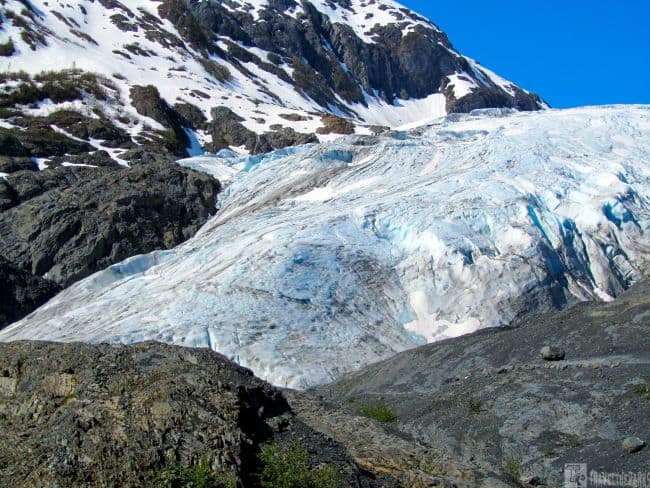
8. Portage Glacier Access Road (Milepost 70)
The glacier is 6-miles off the Seward Highway on the Portage Glacier Access Road. Don’t pass up the opportunity to see the glacier from the cruise vessel-MS Ptarmigan. We purchased our tickets online prior to our flight. You must stop at the Portage Glacier Café to check-in before driving prior to boarding. The café has a wonderful gift shop.
An Exploration of Nature and Glacier Majesty at Begich Boggs Visitor Center
In 1914, the glacier was at the visitor center. Today we spoke to a railroad worker we met at Beluga Point. He recounted how many years ago, as a child, the glacier was visible from the Begich Boggs Visitor Center. He stated he could actually walk up and touch the glacier. However, the glacier has steadily receded in recent years (2.5km) to where it is no longer visible from the visitor center. There is only one way to view the glacier, and that is to hike or take the 1 hour boat cruise. The Portage Pass trail is a 4-mile round-trip hike that gets you a magnificent view of the glacier. The center has excellent educational exhibits. Watch the videoRetreat and Renewal: Stories from Alaska’s Chugach National Forest have wonderful information.

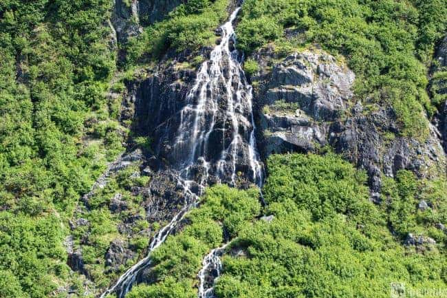
The cruise port is a mile beyond the visitor center. There is plenty of parking for all vehicles. Yes, it costs, but it is well worth the price. There are seats on the lower deck, but the best place to take pictures is on the open-air upper deck. I would recommend dressing in layers as the “Katabatic winds” at the glacier are chilly. The Chugach National Forest surrounds the glacial blue waters of Portage Lake. Many cascading waterfalls from the melting snow caps of the Kenai Mountains surround the lake. These only added to the grandeur of this place. Stunning scenery on a beautiful day, we highly recommend taking the time to see it before it disappears forever!

Navigating Nature’s Wonders: Portage Glacier Cruise Adventure
The captain Joy expertly maneuvered us really close to the glacier hoping it would calve (it had on the previous tour) but alas it did not. We could see the icebergs from the previous calving and got brilliant images from the close vantage point. The US Forest Service ranger’s narrated information is wonderful. She explained the history and geology of the glacier. The cruise staff retrieved a sizeable chunk of ice from Portage Lake for us to touch and taste. Touching the huge chunk and eating a piece is unique to this tour. She explained how ice worms contribute to the periwinkle blue on the glaciers. Burns and Shakespeare are valley glaciers visible in the higher elevations of the Kenai Mountains on the eastern edge of Portage Glacier.

We returned to the RV to continue our journey to Seward. We did not have a reservation at any campground for this evening. In Alaska, most state parks are on a first-come, first-served basis, and most do not have reserved sites. We are hoping to get a site at Trail Lakes.
PRO Tip: you can also just pull over at any wayside and camp for the evening.
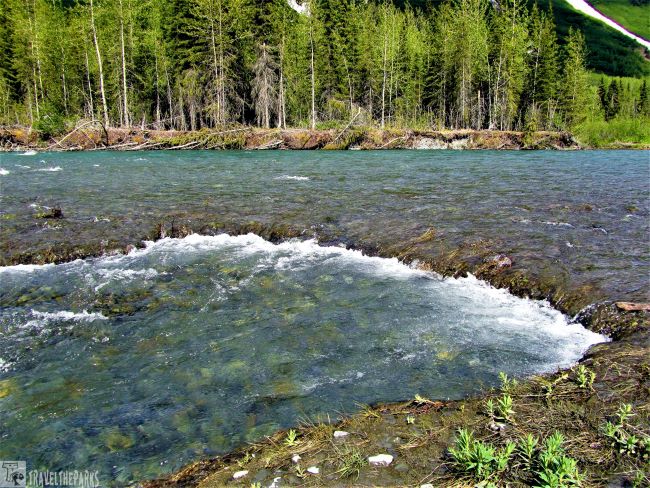
9. Positively Mesmerize Granite Creek (Milepost 64)
Granite Creek is a roaring glacier-fed river, an ideal place to stop and fly fish for Dolly Varden. There is a campground at Granite Creek. However, we did not stop here overnight. This is a great little spot. I would spend more time fishing on this creek on our next visit. After walking the creek and stretching our legs, we headed toward Seward. Stopping at different waysides is the best way to take pictures and enjoy what Alaska offers.

10. Deep Gorge of Canyon Creek Wayside (Milepost 56)
We stopped to stretch our legs, reading the interpretive signs detailing the area’s gold rush history. We walked down on the old Hope highway cutoff road to the bridge to the jaw-dropping views of Canyon Creek. You get gorgeous views of the canyon from the parking lot. However, walking to the edge, you can feel the power of the water. There are clean restrooms and plenty of parking for cars and RVs. A young lady and her dog were selling fresh hot chocolate from their van. We chatted for a few minutes and discovered that she was traveling through Alaska for the summer. Something we have always wanted to do.
The turnoff onto the Hope Highway is at Milepost 56.3. Follow the highway for 16.5 miles to the charming town of Hope on the turnagain arm. The rustic appeal of this small town is its rich gold rush era history. Spend a few hours wandering through the Hope and Sunrise Historical and Mining Museum. It is well worth the detour to explore this hidden gem.
At Milepost 45, the Lower Summit Lake Overlook has magnificent views of the lake. The Tenderfoot Campground and Summit Lake Lodge are a few miles down the road. Summit Lodge provides a daily made-to-order breakfast.

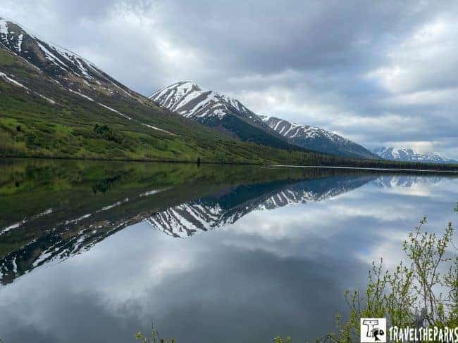
11. Sterling Highway Tern Lake Viewpoint (Milepost 37)
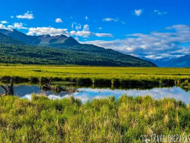
Tern Lake Viewpoint is a picturesque lake at the junction of the Seward and Sterling Highway. This is the perfect place to take in the beautiful Chugach National forest and stretch your legs before continuing toward Seward. Tern Lake is a prime wildlife viewing area, especially for waterfowl. The lake is relatively shallow, a good place to see spawning fish.
There is plenty of parking for RVs, a picnic area, and a raised overlook platform for viewing wildlife. The lake is shallow. Alder and willow trees enclose the banks, making good forage for waterfowl. We can see migrating birds in the early morning hours. The rugged mountains seem to jut off the water on the far shore, making for a wonderful photo opportunity.
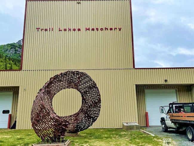
12. Trail Lakes Fish Hatchery (Milepost 32)
If you have the time, detour to the Trail Lakes Fish Hatchery. Operated by the Cook Inlet Aquaculture Association, the hatchery is owned by the State of Alaska. The rearing facility produces sockeye, coho, and chinook salmon for release at selected sites throughout the Cook Inlet watershed. Open 8-5 daily. There is a self-guided visitor center that explains how the hatchery raises the different fish species. We were lucky. We saw a few fingerlings in the tanks. Worth the short detour!
13. Moose Pass -Upper Trail Lake (Milepost 28.6)
Upper Trail Lake is located north of the charming Moose Pass (Marker 31.5). There is a short gravel pullout on the north side of the highway. There are picnic tables to enjoy lunch. The view of the lake while eating lunch is stunning. Posted on a tree beside the lake, we enjoyed reading the “Legend of Mad Sally Lake”. It told the story of a legendary miner who found gold near here. He never spoke and was fond of his cat. The story goes the cat protected him one day, and the only word that he ever spoke was Sally (the name of the cat).

The Upper Lake has a rocky shoreline, easily accessible for fishing. We can do fishing for trout in the clear, shallow water using lightweight tackle. An ultralight spinning reel and rod combo with a travel case is ideal for catching rainbow trout. For the kids, I would suggest a simpler setup, such as a Zebco spincast rod and reel. We did not catch any fish, however, many small rainbows followed our Mepps lures to the shoreline.
Returning to the highway, we ventured through Moose Pass. The Chugach National Forest surrounds Moose Pass. The quirky town has a 1927 waterwheel replica used to power the original sawmill along with a grindstone. A small sign states, “Moose Pass is a peaceful little town. If you have an ax to grind, do it here.”

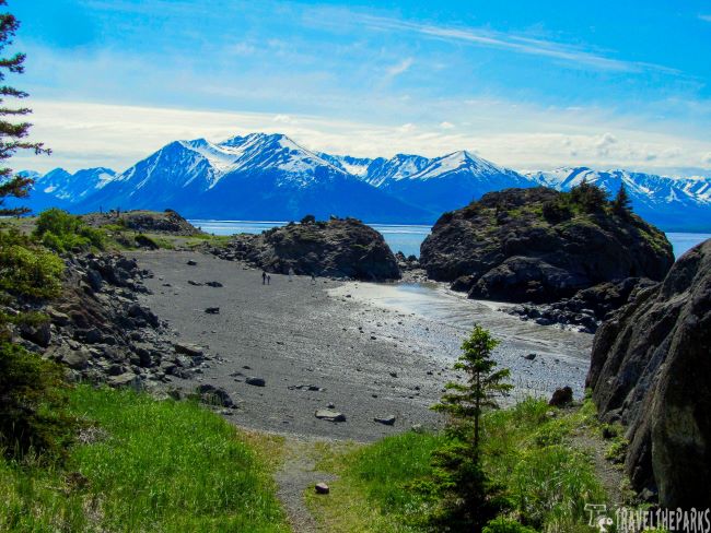
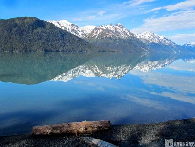
14. Stunning Kenai Lake(Milepost 25)
The turquoise waters of Kenai Lake are the most stunning glacial waters I have ever seen. The reflection on the lake perfectly mirrors the Chugach Mountains. This amazing backdrop just mesmerizes us, it holds us spellbound as we walk the shoreline. We have fallen in love with this place! If you need to spend an overnight on your trip, camp here. It is truly heaven.
The RV follows the highway south along the edge of glacial Lake Kenai before crossing over the Snow River. At MM 6, we turn onto Bear Creek Road, looking for the Bear Creek Weir. We loved looking for salmon in the creek.
PRO Tip: Bears are highly active along trails in Alaska. Be bear aware, carry bear spray or travel in a group.
15. Anchorage to Seward travel guide: Bear Creek Weir (Milepost 6)
Bear Creek Weir is a short walk from the Bear Creek campground. You can view the salmon migration and occasionally see bears. Regrettably, we just missed a Black Bear. It ran behind us. We took some beautiful pictures of a bald eagle sitting in a tree, watching the salmon running up the creek.

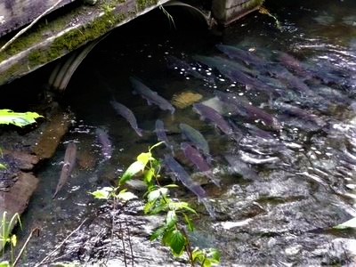
Bear Creek has been the site of salmon enhancement activities since 1962. Initial enhancement activities, conducted by the Alaska Department of Fish and Game (ADF&G) Sport Fish Division, focused on Coho salmon and the control of predator and competitor species. When you cross the road to the weir, the culvert is chock full of salmon. This weir is small and, luckily, today volunteers allow us to see the weir in action. They were taking the salmon and injecting them with antibiotics before releasing them back upstream.
The Cook Inlet Aquaculture Association also manages this weir. Approximately 10,000 to 20,000 salmon a year, mostly Sockeye and Coho, pass through the weir. Watching the fish navigate the small artificial waterfall and the fish ladder is an outstanding way to spend your evening.
Ultimate Destination: End of the Road, Seward, Alaska
At milepost 3, is one of the most accessible and well-known glaciers in Alaska. Exit Glacier can be accessed via the Exit Glacier Turnoff.
Climate change and its effects on glaciers and the environment can be explored in the Exit Glacier area. One can see markers showing glacier recession on the Glacier View Trail, which illustrates the impact of global warming. The road to Exit Glacier in Kenai Fjords National Park is the next must-do side trip for all visitors to Alaska. This is an entire day trip and an adventure unto itself.
The highway ends in the quaint village of Seward, Alaska. Here you can take a boat tour of Resurrection Bay, spend a day on the water fishing for the prized halibut, or just walk the shops along the boardwalk. The Seward Highway gives you a glimpse of Alaska. This state has so much to offer the visitor, it gets in your blood.
Driving the Seward Highway – Best Campgrounds
Trail River Campground on Kenai Lake
This campground is on mile marker 24.2, just south of Moose Pass inside the Chugach National Forest. We could find one of the last campsites here in the evening. Trail River Campground RV sites are large, well-separated by trees and brush for just the right amount of solitude and privacy.
The campground’s paved roads are easy to navigate. There are no hookups, and sites are back-in or pullthrough. They keep the pit toilets spotless. Our campsite was only a short walk to Kenai Lake, where the views of the mountains were breathtaking. Trails traverse the shore of Kenai Lake. All Alaska state campgrounds have strict hours for running your generator. I suggest an inverter for running your RV coffee maker, charging your electronics, and other small appliances.
Early in the morning is ideal for a walk along the shoreline of the lake. We spent some time casting for trout in the lake, but we got no bites. The lake this morning is still no wind. The sky was clear, making it ideal for photographs. We came to the river, running high with snowmelt. The quiet was the first thing we noticed. We had not thought to make noise just in case a bear was browsing through the brush. A word to the wise: stay alert for bears, you never know!
Tranquil Escapes at Tenderfoot Campground beside Summit Lake
At Mile-marker 49, turn left onto the gravel access road and follow it to the backside of Summit Lake, where you will find the campground. This is a newly renovated campground and is very popular. Larger sites that can accommodate RVs. The campground hosts keep the pit restrooms clean and sell firewood for your fire pit. The major attraction is Summit Lake, a great place for fishing and boating. They stock the lake with rainbow trout.
Dense alder, aspen and hemlock forest trees separate the sites, giving you a private feeling. They make reservations through Recreation.gov (1-877-444-6777). This campground has 35 sites and no hookups.

Anchorage to Seward road trip: Exploring Nature at Bear Creek Campground
We also did a one-night stay at Bear Creek Campground. A small family-owned campground on the outskirts of Seward-mile-marker 6. All the RV sites are close together. You are basically in an open grassy field. However, we loved the quaint, quiet setting close to the Bear Creek Weir. The bonus is that there were only two other RV campers.
The showers were spotless-individual rooms that are no-charge. There are full hookups here for water, electricity, and sewer. Getting registered at the office and hooking up the utilities went smoothly. We had a home-cooked dinner before snuggling in for the evening.
Travel Resources for Seward Highway Scenic drive Alaska
- You can get updates on road conditions and construction at http://511.alaska.gov
- Anchorage CVB Dining, accommodations, and scenic tours
- Girdwood Chamber of Commerce accommodations and things to do
- Hope Chamber of Commerce accommodations and things to do
- Moose Pass Chamber accommodations and things to do
- Seward Chamber of Commerce– accommodations, dining, and tours
- Alaska Department of Fish & Game – Fish regulations and license information
- Weather Conditions – Alaska Weather Information: 1-800-472-0391
- Avalanche Information Center. Even in early spring, this can be a hazard.
- National Weather Service – current weather & hazards
Final thoughts: Driving the Seward Highway Alaska – How to See it Best
Driving the Seward Highway in Alaska is an incredible experience. The Seward Highway is a relatively short drive, approximately 125 miles, but the journey is about the experience, not the speed. Plan enough time to stop, explore, and soak in the scenery. The highway is dotted with pull-offs and turnouts for safe parking. Use these spots to admire the vistas, take photos, and simply enjoy the surroundings. The Seward Highway is a journey of natural wonders and unparalleled beauty. For us, the Seward Highway was “a drive of a lifetime.” We feel so privileged to visit this magnificent state. A dream come true!
Have you experienced the scenic Seward Highway? If so, did you stop along the way, see a lot of wildlife? Let us know!