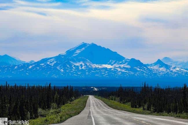
They designate the Glenn Highway, a national scenic byway for good reason. The 135-mile route from Anchorage to the Glennallen has spectacular panoramic views of the Chugach mountains, Matanuska glacier and rivers teeming with trout. This guide to the Glenn Highway National Scenic Byway will help you plan your next Alaska road trip.
Today, this early June morning, the air is cool and crisp. We are heading east on the Glenn Highway National Scenic Byway to our final evening destination at Pippen Lake near Wrangell – St. Elias National Park. Travelling north, the Glenn Highway begins just outside of Anchorage at Merrill airfield. If you have the time, stop at the Alaska Native Heritage Center off Muldoon Road. It is a wonderful place to spend a half-day.
This post may contain affiliate links, meaning if you purchase something through one of these links, we may earn a small commission at no extra cost to you! Read the full disclosure policy here.

For a road to be designated a National Scenic Byway, the U.S. Department of Transportation evaluates it based on six “intrinsic qualities”: archaeological, cultural, historic, natural, recreational, and, of course, scenic. This highway meets all of those criteria.
It is named after Captain Edwin Glenn of the U.S. Army, who led an expedition to Alaska’s gold deposits in 1896.
Table of Contents
Exploring Eagle River—A Must-See Stop on the Glenn Highway Scenic Drive
To locate pullouts on the road along the Glenn Highway National Scenic Byway, we recommend purchasing the Milepost Travel Guide. We have used this resource on each of our Alaska trips. The town of Eagle River is only about 17 miles or 40 minutes from downtown Anchorage.
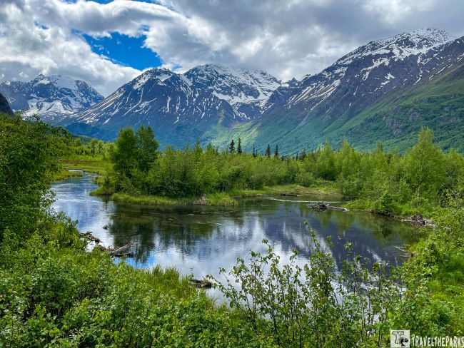
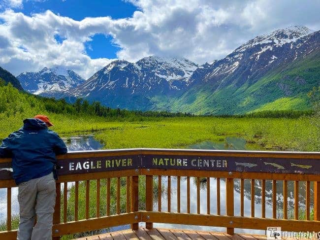
Eagle River Nature Center, is located at mile 20 on Eagle River Road within the 500,000-acre Chugach State Park. It serves as a gateway to the park, which is the third-largest state park in the United States. From the center’s log cabin (mile 12), visitors have access to many self-guided hiking trails.
Interpretive displays inside the center explain that the original log cabin was once a popular bar known as the Paradise Haven Lodge. The nature center now offers a variety of activities and programs for visitors of all ages, including hiking, wildlife viewing, educational exhibits, and guided nature walks.
It is an excellent destination for nature enthusiasts, hikers, and anyone interested in learning about the local flora, fauna, and natural history of the area. The friendly and knowledgeable staff also provide trail maps and wildlife information.
Hike the Trails of the Eagle River Nature Center
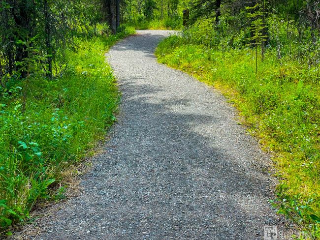
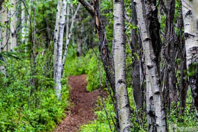
The center provides access to a network of well-maintained trails that traverse diverse ecosystems, including forests, meadows, and alpine tundra. One of the popular trails is the Albert Loop Trail, which is a 3-mile loop trail that offers scenic views of Eagle River and the surrounding mountains.

The Rodak Nature Loop trail is a relatively short loop trail, measuring approximately 0.7 miles. It is considered an easy trail, suitable for hikers of all skill levels, including families with children. The trail meanders through a scenic forested area, providing visitors with an opportunity to immerse themselves in the natural beauty of the Chugach Mountains. Along the trail, you can expect to encounter a variety of plant and animal species native to the region.

Arriving at the boardwalk over the river, we were greeted with open views of the marshland and the Chugach Mountains. Bear scat was visible along the path, a reminder of how active the area can be. The previous week, a hiker had to use bear spray to deter a charging mother grizzly. Always be bear aware—stay vigilant, make noise, and travel in groups when possible.
At the salmon viewing deck, we spotted a bald eagle and several songbirds, though no moose or bears at that time. We then hiked the Dew Mound Trail back toward the center. However, we did see a black bear grazing on grass near the main building.
The nature center is an ideal place for stretching your legs and exploring the surroundings. A downloadable trail guide. is also available for visitors.
Hike Thunderbird Falls: A Scenic Stop at Mile 24 on the Glenn Highway
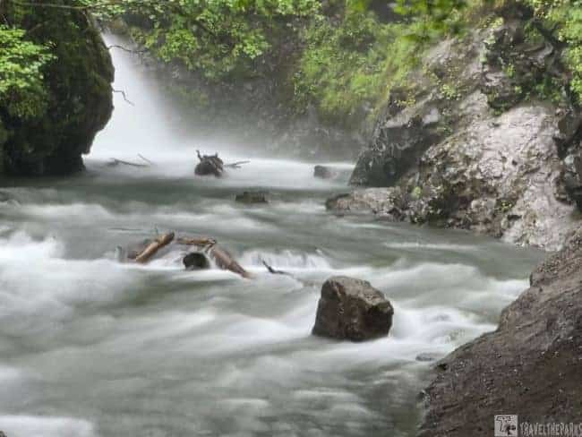
At MM 24, we stopped to do the 1.8 mile (RT) out & back trail, which leads to Thunderbird Falls just outside the town of Chugiak, Alaska. This trail is immensely popular, yet today the parking lot is empty. For whatever reason, maybe the cool morning drizzle has kept travelers from hiking this morning, so we have it all to ourselves. The state parking fee is $5.00 per vehicle. The “fee station” allows you to pay by credit card. Leave the receipt on your dashboard.
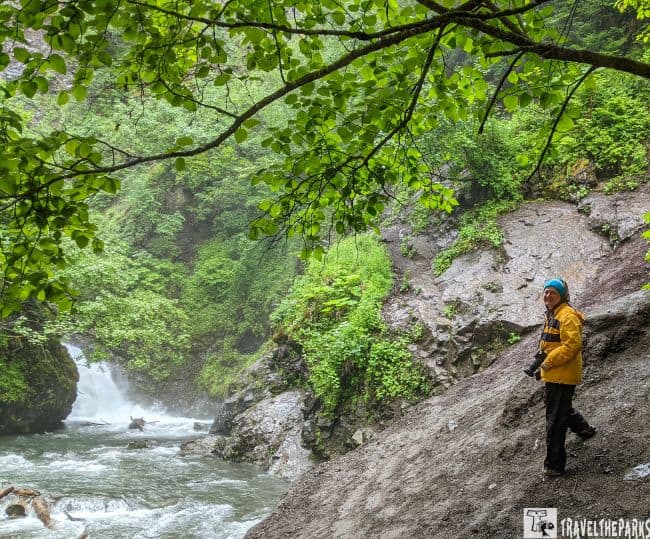
Starting at the parking lot, the well-maintained trail begins with a steep incline as it follows the deep Eklutna River ravine. The trail really gets your heart rate going climbing the many inclines. The upper trail boardwalk leads to a viewing platform of the 200-foot waterfall. A collection of locks on the rails left by other hikers was interesting. The lower trail will take you to the base of the falls and the plunge pool.
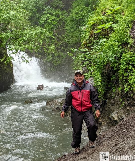
The creek-side trail is muddier and steeper the closer you get to the plunge pool. We recommend bug spray because the mosquitoes are a force to be reckoned with. Bringing trekking poles can be helpful on muddier slopes. We also suggest bringing plenty of water in a refillable bottle. People often saw black bears on the trail. Today we opted not to bring bear spray; instead, we just kept talking so they would know we were there. We noticed on our other hikes some wore bear bells, but these do not work. Downloadable trail guide.
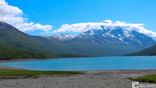
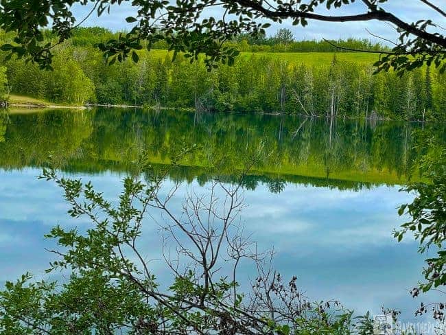
Discover Eklutna Lake—A Must-Visit Stop on Alaska’s Glenn Highway
The lake was formed because of the Eklutna Hydroelectric Project, which dammed the Eklutna River in the 1950s to generate hydroelectric power. Today, Lake Eklutna serves as a water source for the Anchorage area and offers a wide range of recreational opportunities.
Combine a visit to Eklutna Historical Park with kayaking on Eklutna Lake for a full day of outdoor exploration. The area offers excellent opportunities for hiking, fishing, biking, wildlife viewing, horseback riding, and ATV trails. The Eklutna Visitor Center also rents kayaks, bikes, and other outdoor gear.
Surrounded by the Chugach Mountains, this 6-mile-long lake is a striking glacial-fed body of water left behind as the Eklutna Glacier receded. In the Dena’ina Athabascan language, the lake is called “Idlu Bena.” The reservoir is used to generate electricity and also serves as the primary water source for the city of Anchorage.
The many trails showcase the alpine landscape, most trekking along the old road around the shoreline. Often you can encounter abundant wildlife, such as Dall sheep that frequent the upper reaches, while moose, bears, and ptarmigan prefer the backcountry areas. On our first trip here, we hiked the 2.5-mile out & back on the Twin Peaks trail, packing a picnic lunch. We had lunch at the midpoint. Gorgeous panoramic views of the lake in the early morning. It was like glass.
Kayaking on the lake is very popular. Wear your life jacket. The water is 40°F and winds can pick up quickly. It is best to be prepared. Downloadable brochure. We suggest avoiding the lake on weekends, as it tends to fill really early with locals.

What to See on the Glenn Highway Alaska Byway: Visit Eklutna Historical Park
A guided tour here offers a great opportunity to learn about the customs and traditions of the Dena’ina Athabascans. Donations of about $5 per person are suggested. The influence of Russian Orthodox missionaries, who arrived around 1830, is also evident. Soon after, they constructed St. Nicholas Church, and over time the two cultures became more integrated.
This blending is especially visible in the cemetery, where white crosses stand alongside traditional spirit houses. Originally, the Dena’ina practiced cremation, but later they began interring the dead in these uniquely constructed spirit houses. These brightly colored miniature structures were built after a person’s death. The head was traditionally placed facing upriver, and a blanket was laid over the grave as a symbolic gesture of warmth.
This side trip only takes about an hour, but it provides a wealth of insight, especially thanks to the knowledge shared by the young guide.
Experience Knik River at Mile 30 on the Glenn Highway Route
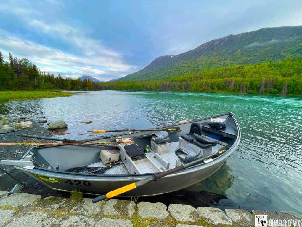
We crossed the 25-mile-long braided Knik River on the Old Glenn Highway near the town of Butte. To the Dena’ina, they know the river as “Skitnu.” The river is an Alaskan playground for fishing, ATVs, biking, wildlife viewing, and camping. The 25 mile long Knik Glacier is only an hour from Anchorage. For those adventurous types, the Knik River Lodge offers helicopter tours that land on the glacier, giving you an up-close and personal experience. There is also airboat or 4WD trips, too.
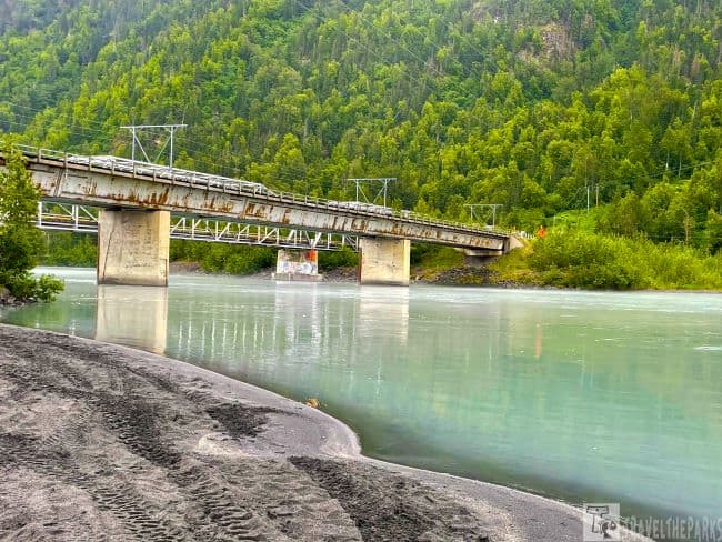
We stopped at a gravel bar used as a multiple-use outdoor recreational area in the shadow of Pioneer Peak. The melting glacier filled the river with gray glacial silt. A gravel bar on the west side allows public use access with a new campground area. The state-owned public access is on the eastern side, across the road. It was littered with debris left by campers. Very discouraging. We finished our walk before continuing into Palmer.
The Glenn Highway National Scenic Byway splits from the Parks Highway at mile marker 34. The Parks Highway continues north to Denali National Park and Fairbanks.
Explore Matanuska Lakes State Recreation Area at Mile 36 on the Glenn Highway
This is a popular fishing, hiking, and biking park close to the highway and the town of Palmer. Our first trip in 2012 to Alaska, we rented an RV with Great Alaskan Holidays. We overnighted in the park on our way to Denali National Park. The state park includes Matanuska, Canoe, Irene, and Long Lake, which are stocked with trout and grayling by the Alaska Department of Fish and Game. This is a small campground with 6 sites in a gravel parking lot. Not your traditional campsite. There are additional campsites for tents in a wooded area. You can make reservations for the campground through the Alaska State Parks website.
Note: Be bear aware-it is always important to carry bear spray. Watch for signs that bears are in the area, as you may encounter a bear at anytime.
Explore Scenic Hiking Trails at Matanuska Lake
Trails connect Matanuska, Canoe, Irene, and Long Lake, each teeming with rainbow trout. The heavily wooded trail to the lake had us continually bombarded with clouds of mosquitoes. Bring lots of bug spray. Matanuska Lake is a well-maintained trail with benches and two fishing docks on the lake. The water was so clear you could see the trout swimming, rising to eat flies on the lake surface.
Because it was the summer solstice, we made a campfire and enjoyed the fact that the sun wouldn’t set that evening, only skimming the horizon.
The next morning, we woke to the sound of a moose calling. When I opened the curtain, I found the moose standing right beside the RV window—a beautiful, unforgettable sight. I was worried it might head toward the highway; this year, there had already been 285 moose struck along the roadway.
During this stop, we focused on hiking the trails and doing a bit of fishing. It was a peaceful place to pause along the journey.

Palmer: Heart of the Mat-Su Valley Along the Glenn Highway Scenic Byway
We recommend stopping at the Palmer Visitor Information Center for information on activities in the Mat-Su Valley. Palmer is a major agricultural center with a fascinating history. Inside, the free museum engages visitors with interactive exhibits that detail the government’s attempt to settle the area during the Great Depression. Watching the documentary video “Alaska Far Away” and talking with the knowledgeable staff, we learned all about the 200 families who became known as the Colony Project in the 1930s. The government experiment ultimately failed. Visit the gift shop for locally made items and walk the gardens to see the giant vegetables that grow in the land of the midnight sun.

Explore Hatcher Pass—A Must-See Detour from the Glenn Highway National Scenic Byway
The Glenn Highway parallels the glacial river valley formed by the Matanuska River for most of its length. The junction of FishHook leads to the Independence Mine State Historical Park. We enjoyed the fascinating story of the Independence Mine. Reading the background stories of miners and their families, you get a sense of what life must have been like on this desolate mountain. The state is working to preserve buildings, many unfortunately are beyond repair. Take a hike above the mine for breathtaking scenery. Looking down, Hatcher Pass to the Mat-Su Valley, was simply beautiful. You get an entirely different perspective of the valley. Definitely worth spending a day.

Musk Ox Farm -Glenn Highway MM 50
Muskoxen (Ovibos moschatus) are large Arctic herbivores and survivors of the Ice Age. These animals weigh between 500 and 800 pounds, stand about 4 to 5 feet tall, and live 12 to 20 years. Musk oxen were once extinct in Alaska but were reintroduced in the 1930s.
In 1986, a nonprofit musk ox farm was established to create a cottage-based textile industry. They are highly prized for their qiviut, the soft underwool they shed each year. During this time, the animals are gently combed as they naturally lose their shaggy winter coats. The collected wool is then spun into yarn that is, pound for pound, eight times warmer than sheep’s wool.
Today, local subsistence knitters use the yarn to create hats, gloves, and scarves, which are sold to provide a supplemental income.
Interpretive guides offer daily tours of the farm. We learned that both males and females have horns, which they keep for life. These horns are made of keratin—the same substance found in human hair, nails, and skin. She also explained how musk oxen are ideally adapted for survival in the harsh Arctic climate.
This is a perfect detour off the Glenn Highway, as the tour is highly informative and we enjoyed seeing these animals up close. It is well worth the small admission fee.
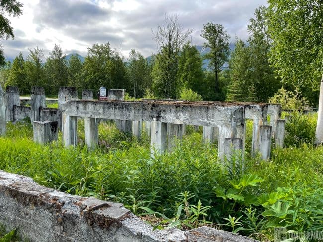
Alpine Historical Center – Sutton-Glenn Highway MM 62
A surprising gem at milepost 61.6 in Sutton is an old coal washery plant constructed by the U.S. Navy in 1922. A conveyor belt once delivered coal directly to the facility, where it was dumped into a large tank and mechanically mixed using three plungers.
Separation occurred through differences in density: impurities sank to the bottom while the coal floated to the top. The plant was capable of processing up to 25 tons of coal per hour. Coal elevators then removed the cleaned coal for drying.
Unfortunately, the Wishbone Hill Coal Mining District operated for only about a year, as the Navy quickly deemed coal obsolete and shut the facility down. This closure ultimately contributed to the abandonment of nearby towns such as Chickaloon and Eska.
The Alpine Historical Park is well worth a visit and is open daily from 9 AM. to 7 PM.
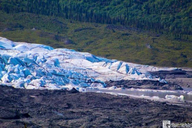
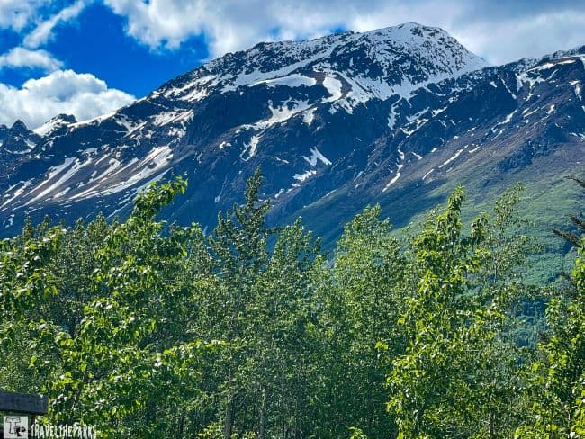
Glenn Highway Adventure: Discover Matanuska Glacier at MM 101
At MM 101, we stopped at the 300-acre Matanuska Glacier State Recreation Site for a snack break. If you are on a budget and cannot spend the $80 to walk on the glacier, the park is the best option. Long Rifle Lodge manages the park, charging a fee of $5 for day-use visitors/vehicle. The “fee station” allows you to pay by credit card. Leave the receipt on your dashboard. The site has 12 campsites on a gravel loop. Vaulted toilets, picnic tables, and a nice pavilion.
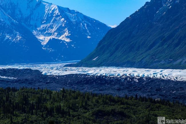
The Matanuska is the largest valley glacier accessible by car from the Glenn Highway. At 27 miles long and 4 miles wide, it is massive. The glacier carves its way through the valley wedged between Mt. Marcus Baker (13,176 feet) and Mt. Wickersham (7,415-feet). Eventually the meltwaters empty into the Matanuska River.
Edge Nature Trail-Glenn Highway MM 102
We had magnificent views from the parking lot, but even better views were from the trail. Although you cannot get up close to the glacier or walk on it at this site, the short, easy 20-minute hiking trail through the cottonwoods provides a better view of the glacier from raised overlooks. The Edge Nature Trail has interpretive placards scattered along the trail with good educational information. Good photo opportunities of the glacier against the beautiful backdrop of the snow-capped Chugach Mountains. Binoculars enhance the view.
If you prefer the enhanced experience, hire a guide. Matanuska Glacier Park (MM102) is privately owned but allows visitors to get out and walk to the glacier for a hefty fee. Nova Glacier Guides or Mica Tours will supply you with crampons, ice axes, mountaineering boots, and an information guide. The narrated hike takes about 3 hours to complete.
Lionhead Mountain Trail-Glenn Highway MM
Next to the AT&T communications towers at MM 106, you will find the trailhead. They named the trail for the rock outcropping that looks like a lion’s head. Before hitting the trail, call for permission to access the cell tower’s private property. Call the number on the sign before proceeding. The Lionhead Mountain trail is 2.1 miles long, steep and sometimes difficult to follow, ending at an elevation of 2864 feet. This was our first taste of the expansive Alaskan wilderness. You would never tire of the view at the top, which makes this trek so worthwhile.
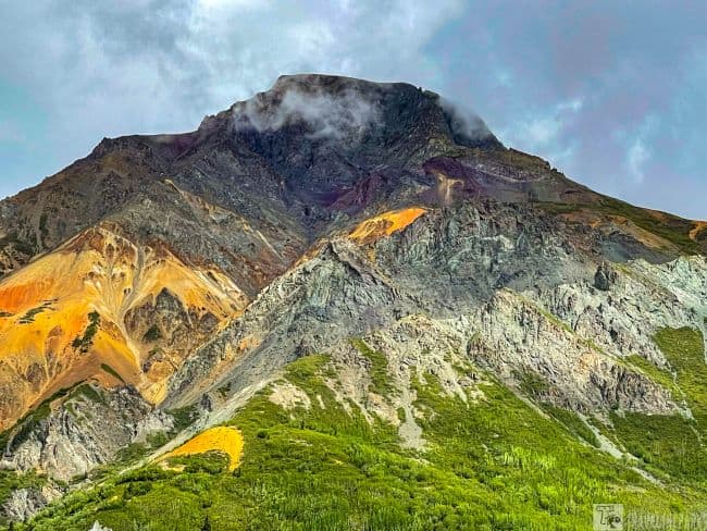
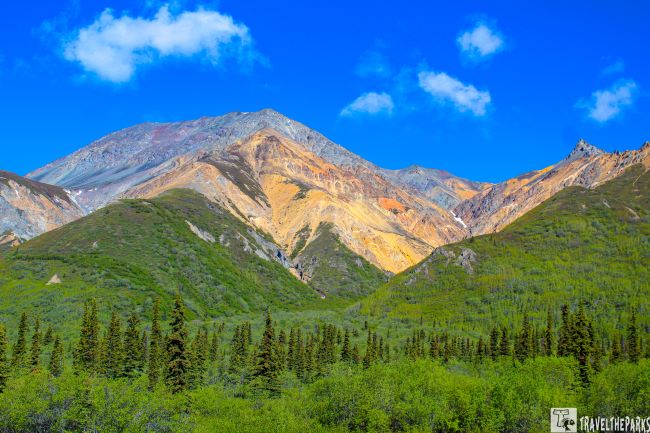
Sheep Mountain – Glenn Highway MM 114
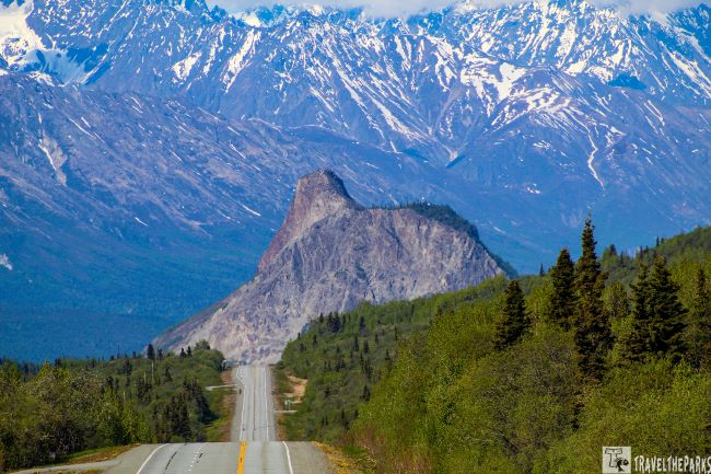
The landscape becomes copper-colored around Sheep Mountain. These glacially carved mountains reach an elevation of 6,223-feet. Using our binoculars, we could see a large herd of Dall’s sheep clinging to the cliffs. They are attracted to this diverse terrain by eating gypsum for the calcium minerals unique to these rock formations. When the Glenn Highway was being constructed, trapper Ed Ueeck sought to have this entire area preserved. His fear was that opening the area would lead to the demise of the herd through endless hunting. Today the area is a closed sanctuary for the taking of mountain goats and Dall sheep.
Sheep Mountain Lodge, right off the Glenn Highway, is a perfect stop between Anchorage and Glennallen. The cabins give 360-degree views of the Chugach Mountains and lush green valley.
Eureka Summit-Glenn Highway MM 129
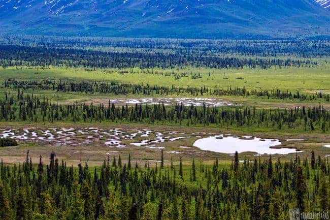
Leaving the Matanuska Valley, the highway rises to Tahneta Pass (MM 122). Here you see a transition to boreal forest dominated by black spruce on the lowland flats and scattered lakes surrounded by peat bogs. Ideal moose habitat. Lake Leila and others are excellent at fishing for Arctic grayling. There is boondocking for RVs at this location.
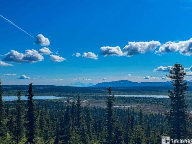
This is the highest point on the Glenn Highway National Scenic Byway at 3,332 feet. Spectacular bird’s-eye views of four mountain ranges include the Alaska Range, the Chugach Mountains, the Talkeetna Mountains, and the Wrangell Mountains. Awed by the scenery, we lingered awhile, enjoying the amazing view of the mountains. We made a quick stop at the Eureka Roadhouse for a hot cocoa before driving down the highway, descending into the Copper River Basin. Officially, the Glenn Highway National Scenic Byway ends at the Little Nelchina River.

Lake Louise Road-Glenn Highway MM 187
If you have extra time, the Lake Louise Recreation Area (milepost 160) is about a 20-minute, 19-mile drive off the highway. Lake Louise is a beautiful destination in both summer and winter. Known as “Sasnuu’ Bene” in the Ahtna language, this recreational area features the Army Point Campground, a boat launch, and picnic facilities.
Fish in the lake include lake trout, burbot, and Arctic grayling. One of the more common spring sights is nesting trumpeter swans. We saw a bonded pair during our visit, although we weren’t able to get photos.
We could see the dilapidated cabins, part of the original recreation area built after World War II on the interpretive trail. One used by General Dwight D. Eisenhower still stands. Take lots of bug spray the mosquitoes were voracious.
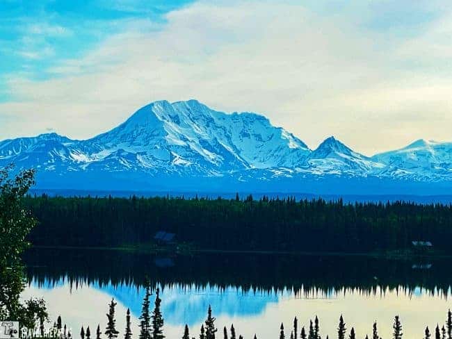
Glennallen-Glenn Highway MM 187
The small town is at the junction of the Glenn Highway National Scenic Byway and the Richardson Highway. Glennallen is an excellent location to restock on groceries and gas. It is also the gateway to the largest national park, Wrangell – St. Elias. It is also a good launching-off point for river rafting, hiking, fishing, and flightseeing excursions.
Places to Stay We Found Along the Way
- Lakefront Hideaway – this cabin near Sutton is a hidden gem. Absolutely beautiful, clean home with a marvellous view of the lake and snow-capped mountains in the background. The host greeted us with cookies upon arrival.
- Pippin Lake Bed & Breakfast–they nestle this cozy little Alaska cabin in the woods at Pippin Lake (Copper Center) with breathtaking mountain views. It is just the spot to unwind from a day of sightseeing in Wrangell – St. Elias National Park. A great spot to relax on the lake with a fishing pole, or just sit on the dock and soak in the land of the Midnight Sun.
- Pippin Lakeside Bed & breakfast: (Copper Center) Wonderful cabin with awesome hosts. Kym even met us on our arrival and provided us with banana bread. She also provided us with breakfast to go! It is a great cabin with spectacular views of the mountains and tons of amenities. Highly recommend!
Best Places to Dine
- Palmer Alehouse: This is a delightful place to have dinner or lunch. It was extremely crowded, but must say it is worth the wait. I had the Philly cheesesteak with a side salad, and hubby enjoyed a delicious gyro. They have lots of choices on tap for local brews. We both enjoyed a different selection to top off our meal. Good place to unwind and enjoy Palmer, Alaska.
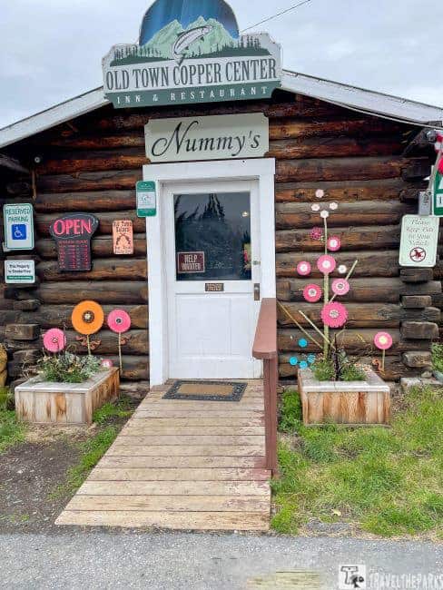
- Nummy’s: The sign says, “You are only a stranger once.” On the main loop in Copper Center, this log cabin is a great place for dinner. Tastefully decorated, we loved the atmosphere. You would not think that food could taste so good. The halibut dinner was amazing. Hubby had the cheeseburger-the bun was perfect! The service was excellent! Wonderful surprise in the middle of nowhere!
Note: On TripAdvisor®, it is listed as Nummy’s, also known as the Old Town Copper Center Restaurant. It is located off the Richardson Highway, not along the Glenn Highway.
Final Thoughts on Our Guide to the Glenn Highway National Scenic Byway
We’ve seen a lot of natural beauty on our travels, but few places compare to the breathtaking vistas we experienced as we drove the Glenn National Highway scenic byway. Having recently visited Kenai and Seward, this adventure was comparable. From Anchorage to Glennallen, you enjoy dazzling panoramic views of snow-capped mountains, waterfalls, receding glaciers, and rushing creeks. An Alaskan road trip to remember for a lifetime.
Have you driven the Glenn Highway? Did you stop at Matanuska Glacier? Did you enjoy the view as much as we did? Join the conversation and share your experiences in the comments below.