
Adventurers, Roadtrippers, and those seeking untamed wilderness should put Big Bend National Park on their bucket list. In the heart of West Texas, this expansive desert oasis is a haven for nature lovers. From soaring canyons carved by ancient rivers to rugged trails leading to panoramic viewpoints, we’ll take you on an unforgettable journey through Big Bend’s must-see sights and activities. There are no limits to the adventures you can have in Big Bend National Park.
This post may contain affiliate links, meaning if you purchase something through one of these links, we may earn a small commission at no extra cost to you! Read the full disclosure policy here.


Table of Contents
Planning your Itinerary for Big Bend National Park
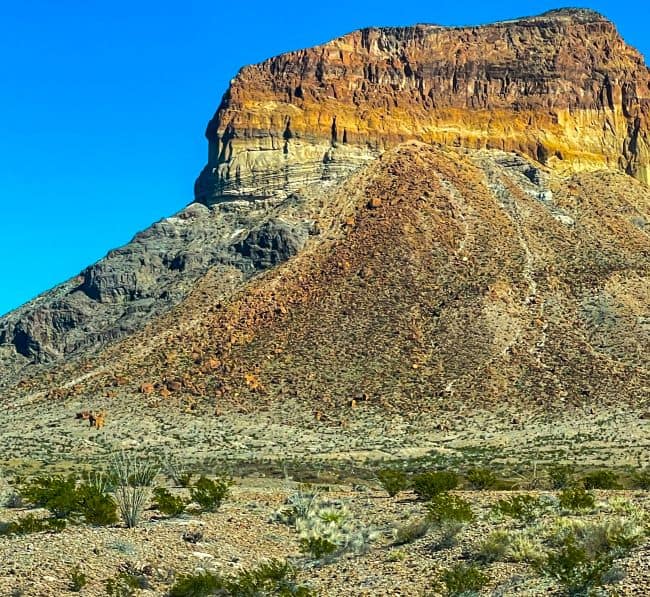
Big Bend National Park covers over 801,000 acres of west Texas. A remarkable natural wonder. Most people know this park for its vast open spaces, mountainous landscapes, and distinct flora and fauna. If you’re planning a trip to Big Bend National Park, here we have listed some of the must-see sights and activities to add to your itinerary.
Big Bend National Park: Fascinating Facts and Insights
- Big Bend National Park is one of the largest national parks in the United States, but it is also one of the most remote. Its isolation and vastness make it a special place for those seeking solitude and a deep connection with nature.
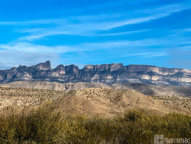
- With canyons, mountains, desert landscapes, and the Rio Grande River forming the border with Mexico, the park boasts an astounding array of geologic formations.
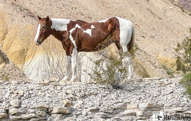
- The park is home to over 1,200 plant species, 450 bird species, and many mammals, including black bears, mountain lions, and javelinas.
- Big Bend National Park has been designated as an International Dark Sky Park, making it a great place to gaze at the stars. Night skies are stunning due to the remote location and minimal light pollution.

Navigating your Way to Big Bend National Park
Going to this park is an adventure in itself. We feel the excitement increasing as we leave the city life and head towards the calm of nature. Our first stop was Amistad NRA; after a quick visit, we spend the night at Seminole Canyon State Park. Then from here, it’s a long drive of around 3 hours to Persimmon Gap entrance station. For us, what makes this park even more special is its isolation, allowing us to disconnect completely from the world. Most of today’s drive has no cell signal. Right? It’s about being immersed in the great outdoors, isn’t it? You can reach this park through a variety of routes.
If you plan to arrive by air, the nearest airports to Big Bend National Park are Midland International Air and Space Port (MAF), which is about 165 miles away (3hrs), and El Paso International Airport (ELP), which is about 330 miles away (4.5hrs). From either airport, visitors can rent a car to drive to the park.

By Car:
- Driving to the Park: Most visitors to Big Bend National Park arrive by car. The park is in southwestern Texas, near the Mexican border. The park’s main entrance is near the town of Study Butte/Terlingua, and there are other entrances and access points as well. TX 118 from Alpine to Study Butte or FM 170 from Presidio to Study Butte (then 26 miles east to park headquarters), or US 90 or US 385 to Marathon (then 70 miles south to park headquarters).
- From Midland/Odessa: If you’re flying into Midland or Odessa, you can drive to the park from there. The drive takes approximately 4-5 hours, depending on your starting location and the route you choose.
- From El Paso: If you’re flying into El Paso, the drive to Big Bend National Park takes approximately 4-5 hours as well. It’s a scenic drive through the desert.
What to know Before You Visit Big Bend National Park?
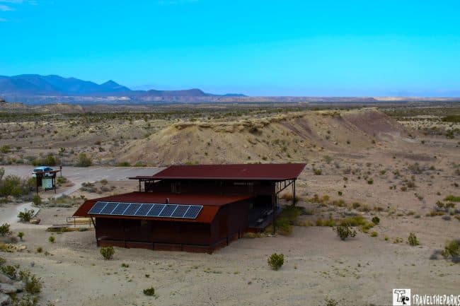
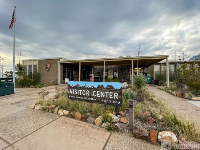
- Park Hours and Entry: Open 24/7 year-round, but visitor centers have limited hours. The park has three entrance stations: the Persimmon Gap Entrance Station on the north side, and the Maverick Entrance Station on the west side. Visitors can enter the park at any of these stations, depending on where they are coming from. The park admission fees are valid for seven days and are $30/vehicle, $25/motorcycle, $15/individual/bicyclists. We recommend purchasing the Annual Pass. It costs $80 and is valid for one year from the month of purchase. It provides admission for the pass holder and up to three accompanying adults to all national parks and federal recreation sites that charge entrance fees. Additionally, there are five Visitor Centers in Big Bend National Park: Panther Junction, Chisos Basin, Castolon Historic District, Persimmon Gap, and Rio Grande Village.
- Border Safety: YES, ITS SAFE! The park borders Mexico—crossing at Boquillas requires a valid passport. The crossing is open seasonally and during daylight hours only.
- Best Time to Visit: Fall (Oct–Nov) and Spring (Mar–Apr): Ideal for hiking (60–85°F / 15–29°C). Summer (Jun–Aug): Extreme heat (100°F+/38°C+); stick to early mornings or river activities. Winter: Mild days (50–70°F / 10–21°C) but freezing nights at higher elevations (Chisos Basin). On our Texas/New Mexico road-trip, we had extreme freezing temperatures during the evenings and 70-degree afternoons.
- Cell Service: cell phone service can be spotty or nonexistent in most parts of the park. Be sure to gas up prior to entering the park. There are limited resources inside the park.
- Fuel up: Gas stations are sparse—fill your tank in Terlingua or Alpine before entering the park.

Pro Tip: Start hikes at dawn to beat the heat and crowds. Monsoon season: Sudden flash floods in canyons (July–Sept)—check weather alerts. Check the park’s official website for real-time road closures and fire bans.
When is the best time to visit Big Bend National Park?
From November through February is the best time to visit the park. Outdoor activities like hiking and camping are easier to enjoy during this time because of moderate temperatures. The park was also less crowded during this time, so we could enjoy more solitude. At least that was what we thought (Christmas holiday can be very busy). For wildflower blooms, March and April are the best months to visit. During these months, the Chihuahuan Desert blossoms in incredible color.
PRO Tip: Pets must be on a 6-foot leash at all times. Allowed areas: Campgrounds, picnic areas, parking lots, and paved roads. Rio Grande Village: Pets can walk along the river’s edge (avoiding trailheads). Prohibited areas: All hiking trails (including Santa Elena Canyon, Lost Mine Trail, and South Rim). Backcountry (including desert and mountain zones). Park buildings (visitor centers, lodges, restrooms).

Exploring the National Park: A Travel Guide Best Things to Do Big bend
There is a lot to see in this park. We only saw a fraction of the park on this visit. Our itinerary includes most of the must see destinations in this park has so much more to see. You could spend a week in the park and still not see experience it all.

Check Out the Dinosaurs at Fossil Discovery Exhibit (MM 8)
If you enter the park via the Persimmon Visitor Center (Hwy 385-Main Park Road), be sure to make the stop at the Fossil Discovery Exhibit. Within, there are some displays that show the past history of this area where 1,200 fossil species have been discovered, which represent 130 million years. They included exact life sized replicas of dinosaur sculptures such as T-Rex and triceratops. In addition, it had exhibits with interactive features to enable us to touch actual fossils and learn about the geology and paleontology of the place. A ranger program offers more specificity about dinosaurs that once roamed in these parts as well as how these fossils were uncovered.
Take the short hike up the Fossil Bone Exhibit Trail to the look-out points for grand views of the what was in the Cretaceous period, a vast inland sea. At the top of the ridge, you get beautiful views of the Black peaks in the distance that mark the K-Pg time.
Note: The parking area is small and fills quickly. It is not ideal for travel trailers.

The Drive to Panther Junction Hwy 385
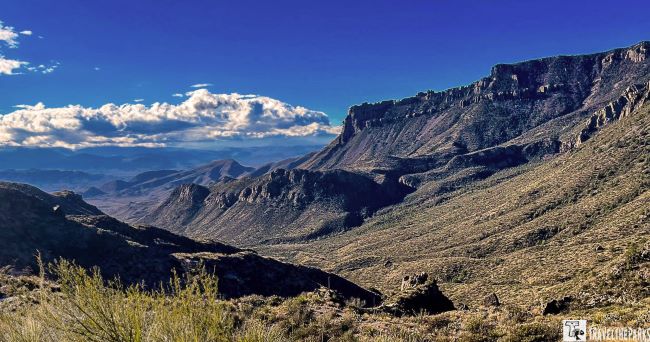
If you have the time, make a stop to hike the Devil’s Den or Dog Canyon Trails (MM 24). Starting from the road, we walked 1.5 to find a fork in the trail. We took the right-hand turn for the Devil’s Den Trail. It is a moderate 5.6-mile out & back hike. It is through a rocky dry wash or you can opt to walk the canyon rim. Rock cairns mark the trail and we had no trouble following them.
Today the creek bed is completely dry, but we could see that with a heavy rain, the mud could be an issue. Bring plenty of water if you plan to do the entire hike. You can combine this trail with the Dog Canyon Trail and make a full day of it. Dog Canyon, turn left at the fork is a 4.3-mile out & back trail. Both trails from the top appear as a rather dark scar running the length of the valley.
Plan A Stay at Rio Grande Village RV Park
The scenic highway descends two thousand feet to the Rio Grande Valley, close to the border of Texas and Mexico. Here we overnighted at the Rio Grande Village RV park for two nights. Our first day we spent exploring the surrounding area. This region of the park gave us access to Boquillas Canyon, Hot Springs, hiking trails and the Rio Grande Village Historic District.

Our first evening in the park started with a quick stop at the Rio Grande Village Visitor Center, just a short walk from the campground. We always find interesting exhibits, displays and general park information by beginning our adventures with a stop at the visitor center. From here, we learned about the area trails and the historic district.

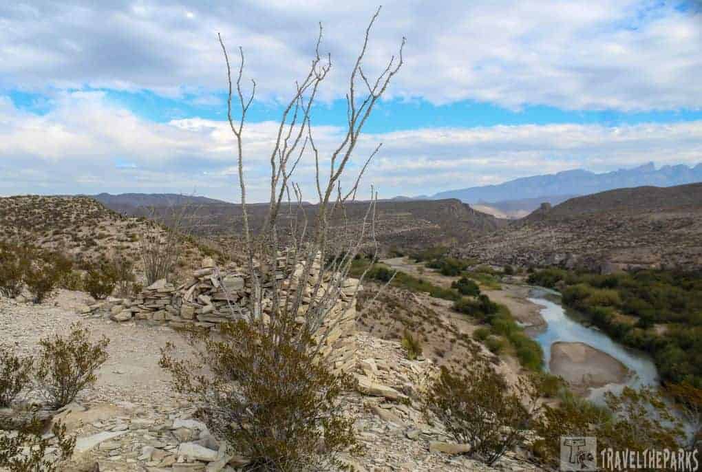
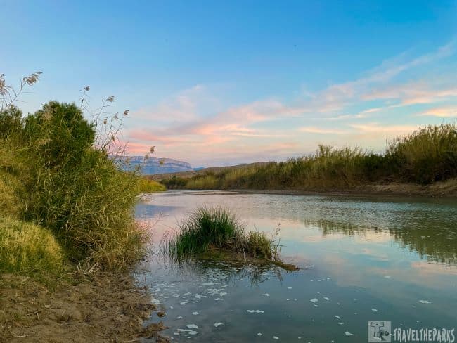
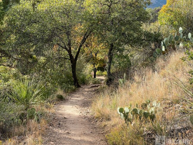
Boquillas Canyon Trail in Big Bend National Park
Rio Grande Village has access to many hiking trails. We explored the Boquillas Canyon Trail on our first evening in the park. It’s a 1.2-mile out-and-back trail. It begins with an easy climb up the bluff following the Rio Grande River. As we venture deeper into the canyon, I was surprised as the landscape began to transform. Towering canyon walls rising on either side, coinciding with the sunset a kaleidoscope of colors, was a real treat to end our day.

Day 1: Exploring Boquillas Canyon and Soaking in Hot Springs
Remember, this is just our general itinerary. Adapt it to your preferences and interests. You can add additional hikes based on your skill level. It’s important to note that you may encounter Mexican vendors selling a variety of goods and crafts. We saw several of these setups in the park where vendors have an honor pay system. The items sold by the vendors are considered contraband, meaning they were brought into the US illegally. Do not encourage illegal activities and be mindful of the complex dynamics at play in the area.
Early Morning Hike the Rio Grande Village Nature Trail
As the first light of dawn paints the sky in hues of pink and orange, we find ourselves rising to walk our dog Sage. The roadway through the campground is a good place to walk the dog. Dogs are not allowed on the trails in Big Bend. After breakfast we hike the Rio Grande Village Nature Trail. This short 0.75-mile trail is perfect for a morning stroll. The riverside path leads to bridges that criss-cross the river wetlands. The reeds are high and thick. Birdwatching along the trail is best in the early morning hours. After crossing the final bridge, the Sierra del Carmen mountains in Mexico rise above the river. Returning to camp, we plan to visit the Chisos Basin today.

The Daniels Ranch Wild as the West
A short one-mile walk from the RV park is the remnants of the Daniel’s family ranch. The information kiosk told us this land was first settled by the Daniels family in the early 1900s for cattle ranching. Ranch operations lasted several decades before the National Park Service bought it in the 1980s. In 1989, the house was listed on the National Register of Historic Places. We went on a self-guided tour of several historic buildings, including the main house, barn, and corrals, all built in the 1920s. Currently, the National Park service is renovating the ranch house.

The Border Crossing: A Cultural Experience
Note: You must have your passports to go through U.S. Customs and Border Protection at the Boquillas Port of Entry. You must check in and pay the $3 entrance fee.

Hot Springs Historic District: Soak in Nature’s Spa
Native Americans and settlers have used the Historic Hot Springs in the region for centuries for their therapeutic properties. The water temperature inside the rustic stone tub ranges from 105 to 108 degrees Fahrenheit. Calcium, magnesium, and sodium are among the minerals found in the waters. Following a hike through Hot Spring Canyon, we found this to be the perfect place to take a soak. A great way to relax and unwind, while rejuvenate the body and mind.
While walking the 0.7 mile trail, we came across several historic buildings, including the old bathhouses and the remains of the old hotel that used to operate in the area. Additionally, Native American pictographs and petroglyphs
PRO Tip: Before setting out on any of these trails, it’s important to be well-prepared. Make sure you have plenty of water, appropriate clothing, and a map of the area. Check trail conditions and be aware of the weather, as temperatures in the desert can be extreme.

Day 2: Discover the Chisos Basin: A Desert Hiker’s Paradise
In the morning, stop at the Panther Junction Visitor center. We took some time to explore interactive exhibits, learn about the park’s diverse ecosystems. Take time to chat with knowledgeable rangers who can provide insights and recommendations tailored to your interests. Trail maps and updates, passport stamps and park updates are always important to us. We took a bit of time to walk the nature trail, noting the fauna and fauna markings to help ID plants us once we were on the trail. Gas is available for fill-up at Panther Junction and Rio Grande Village.
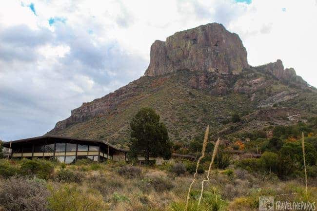
The Chisos Basin Road is a scenic drive that offers breathtaking views of the surrounding mountains and valleys. The road is paved and suitable for all vehicles. Once at the basin, you can spend the day hiking and seeing the local sights. We started our day by visiting the Chisos Basin Visitor Center. Here, we could gather information on current trail conditions, and daily ranger-led programs that might be available. Not to mention I needed my passport stamps for my book.
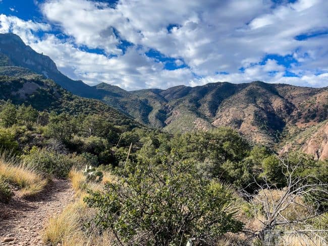
Hiking the Trails here is a Rare Delight
Chisos Basin is often called the heart of Big Bend National Park, and for a good reason. It’s an oasis of green in the midst of the arid Chihuahuan Desert. There are 150 miles hiking trails for every skill level, from the leisurely stroll to the strenuous climb.
Some of our favorite hikes in the park were in Chiso Basin. We found hiking the different trails to be a rewarding and unforgettable adventure. Each trail offered us a rare perspective of the park’s distinct landscape. There are panoramic views on most of them, which are truly breathtaking. Whether you’re an experienced hiker or a beginner, getting out on the trail here is a must-do. If you’re up for a real challenge, the “Emory Peak Trail” takes you to the park’s highest point.
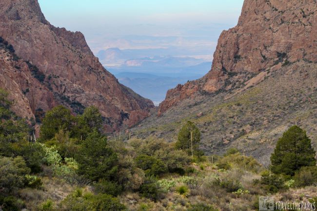
Plan for Sunrise at the “Windows” View Trail
The trail that most people have time to experience is this short 0.4-mile paved loop trail that is wheelchair accessible. It is one of the most sought after for watching the sunrise. The trail leads to a wide platform with interpretive placards that are informative. From the Loop trail, you can only see the two peaks forming a V shape above the window down below. This is where we saw the most birds attracted by the fruits in the nature garden.
Our Favorite Hike in Big Bend-The “Window” Trail
The Window Trail is one of the most popular hiking trails in Big Bend National Park. It gets its name from the two towering rock formations that look like a window. From the “window”, there are impressive views that accentuate the desert landscape. Here’s what you need to know before setting out on the Windows Trail:
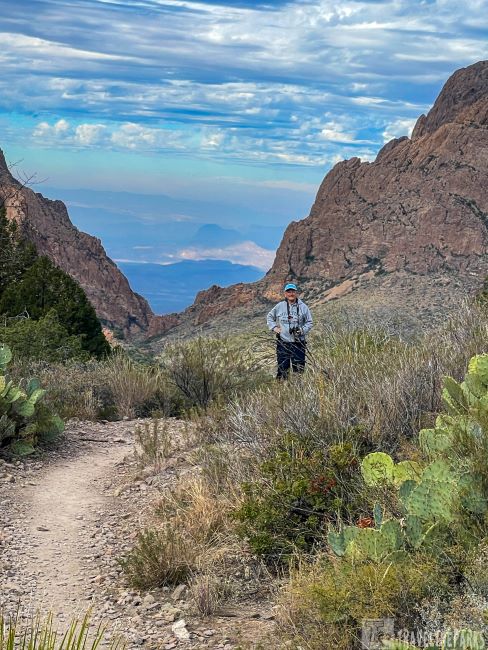
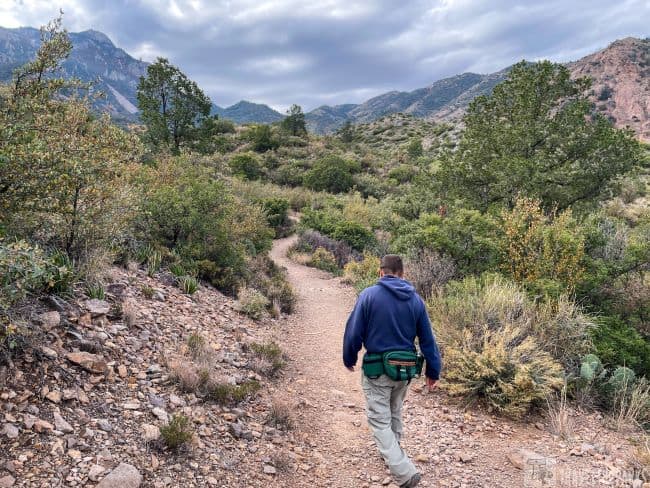
The 1st trailhead for the Windows Trail is near the visitor center at the Chisos Basin Trailhead. From here it is a moderate 5.6-mile round-trip hike that descends 800 feet into Oak Creek Canyon through a wooded landscape. You can shave off 1.4-miles by beginning at the Basin Campground. Park in the amphitheater parking lot. We intercepted the trail near campsite 51. This made the distance 4.8-miles RT.

Psst, Taking a Short Cut
Starting out, we found the first half-mile of the trail was relatively easy. The well-maintained path continues to descend (just remember that it is all uphill coming back). This is a great spot for wildlife. We saw lots of mule deer, especially early morning. As we continue, the path follows the Oak Creek bed. Occasionally it may fill the stream bed with running water. This water created the window. No water flows today, however.
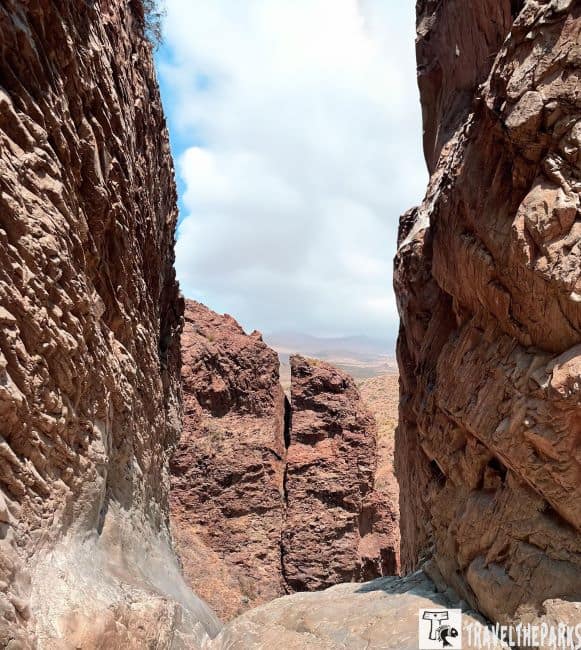
The end of the trail became more challenging as we navigated a narrow slickrock canyon framed by steep vertical walls on either side. Stone stairs help a bit. This section of the trail is where you’ll find the “window.” The natural rock arch perfectly frames the landscape.
Lost Mine Trail – A Scenic Hike in Big Bend National Park
The trail is a moderate 4.8-mile (2-3 hrs) round-trip hike that takes you up to an elevation of 7,535 feet. The parking lot here is small, so get an early start. Be sure to bring plenty of water., sunscreen, sunglasses and hat to protect yourself from the sun, as there is not much shade. Trekking poles and good hiking shoes are a must. About a mile into this trail is a nice “saddle.” If you are unwilling to do the entire hike, I suggest at least getting this far. The views are spectacular from this vantage point. From the saddle, it is a steady climb to the top of Lost Mine Peak. Multiple switchbacks near the end can be daunting. However, the Chisos Mountains views at the top are so rewarding. Well worth the effort.
PRO Tip: Be sure to carry plenty of water. Temperatures in Big Bend National Park can reach well over 100 degrees Fahrenheit during the summer months.

Day 3 – Explore the Ross Maxwell Scenic Drive in Big Bend National Park
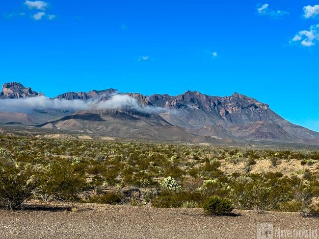
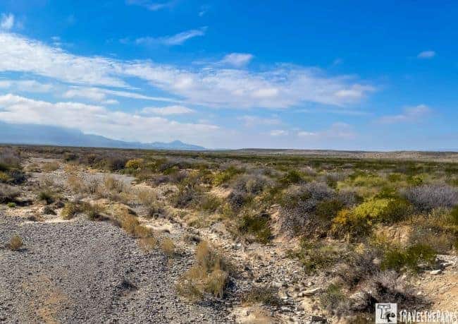
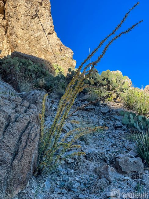
The Ross Maxwell Scenic Drive is renowned for its awe-inspiring views of the Chisos Mountains, the Chihuahuan Desert, and the Rio Grande River. Popular hikes include the Santa Elena Canyon Trail, the Mule Ears Trail, and the Chimneys Trail, each providing different perspectives on the park’s natural elements. Binoculars can enhance your chances of spotting wildlife from the comfort of your vehicle or at one of the many designated pullouts.

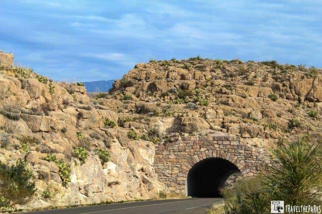
We began our day early with a mesmerizing sunrise. Our goal was to take full advantage of the cooler morning temperatures and avoid the midday heat. The 31-mile scenic road passes many vistas, including the Castolon Historic District, before ending at Santa Elena Canyon. Consider the significant distances within the park when making your plans. The road is named after Ross Maxwell, who served as the first superintendent of the park (1944-1952). This must-do road snakes up and down the desert landscapes, and was doable with our travel trailer, but is not ideal for towing. It is worth taking your time to stop and explore some pullouts as you drive it.
Sam Nail Ranch: A Glimpse into the Rustic Charm of the Old West (MM 3)
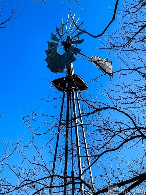
Our first stop of the morning was Sam Nail Ranch. Not much remains of the old ranch, but it is an oasis in the desert. Sam Nail and his brother Jim moved to the valley between the Chisos Mountains and Burro Mesa in 1916. After digging a well and constructing an adobe home, they were fairly self-sufficient and had cows, chickens, cattle, a garden and fruit trees. The Nails rented out their horses for government workers. The Great Depression prompted them to sell the ranch to the government for the creation of Big Bend National Park.
Wandering the short 0.46 mile trail made us ponder how people lived in this harsh environment. The old windmill still runs. It provides power to irrigate the unique flora that was planted here so long ago. I can see why this is a recommended birdwatchers site.
Taking a drive on the Ross Maxwell Scenic Drive in Big Bend National Park for us was such a memorable experience. The ever-changing landscapes, from canyons to desert vistas, evoked a sense of wonder. Definitely gave me an appreciation for the natural world. Each pullout and hike offered a different perspective on the park’s differing ecosystems and many geological formations.
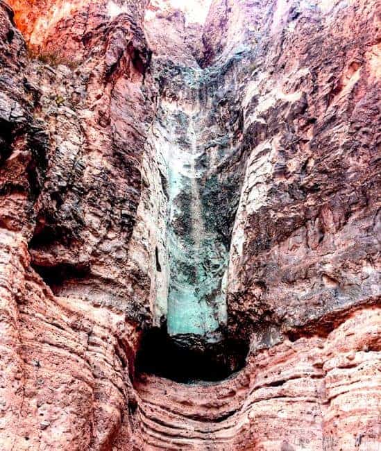
Burro Mesa Pouroff Trail: A Mesmerizing Desert Adventure (MM 8)
We found the 1.1-mile round-trip trail at the end of Burro Mesa Spur Road. The lower Burro Mesa is relatively flat. The gravel path led us to a dry waterfall. This 100 foot pouroff is a natural basin carved out by water erosion over time. Although this is a relatively short, it’s still a desert hike, so proper preparation is essential. Be sure to carry plenty of water, wear sturdy hiking boots, and dress appropriately for the weather. As with all desert hikes, it’s wise to bring sun protection and a hat.

The Upper Burro Mesa Pouroff Trail begins at the trailhead near the junction of Ross Maxwell Scenic Drive and Burro Mesa Pour-off-road. This is a 3.5 mile out & back trail following a sandy wash through a slot canyon. Impressive steep canyon walls on all sides. We had to do some scrambling over boulders and slick rock close to the grotto. The play of light on the canyon walls in the early morning made for interesting photographs. Eventually, we reached where the waterfall should have been. Today, the spectacular pouroff is dry but still impressive. I would love to see this when it is flowing. A good reason to come back again.
Note: Flash floods can occur at any time of the year. Be alert for the possibility of flash flooding anytime that rainfall is forecast.

Homer Wilson Ranch: An Oasis of Solitude (MM 10)
The Homer Wilson Ranch trail is a hidden gem that encapsulates the untamed spirit of the American West. Although the ranch can be viewed easily from the overlook, if you want, take the trail down into the valley for a closeup view of the buildings. The 1-mile gravel trail takes about 15 minutes to walk. It follows an old road across Blue Creek. The uneven trail took us by the remnants of a corral, bunkhouse, dipping vat and the old ranch house. Keep an eye out for desert critters, including roadrunners, javelinas, and the elusive desert bighorn sheep.

Sotol Vista Overlook (MM 11)
This viewpoint is a favorite for photographers at sunset. The vibrant colors on the horizon paint the sky in beautiful hues. It is also a great place for stargazing with little light pollution. On a clear night, you can see a multitude of stars, planets, and even the Milky Way.
Exploring the Chimneys Trail (MM12.4)
The 4.6-mile out-and-back trail is relatively flat, with only about 475 feet of elevation gain. This trail gets its name from the prominent rock formations known as chimneys, which rise up from the desert floor like towering sentinels. The chimneys themselves are eroded, volcanic rock formations that look like chimneys from a distance. Look for the Native American petroglyphs at the base of the chimneys.

The Mule Ears Viewpoint: The Iconic Twin Peaks (MM 14)
There is nothing to compare to the beauty of Mule Ears Peaks, with their twin-hump shape. The peaks are named for their resemblance to a pair of mule ears. On this clear day, we could see for miles in all directions. The walk to the Mule Ear Spring is 3.9-miles out & back. We took the Stony Creek off shoot for the best views. The spring at the end was dry due to dry winter conditions, nothing too spectacular. The trail is an ideal spot for photographers for the views of the peaks, desert terrain and desert flora.
Tuff Canyon (MM 16), Currently Closed
We could not walk this trail because of a rockfall closure. It is a cool rock canyon, with three overlooks and a trail that descends into the slot. The slot shows tuff rock. It is a rock formed from the accumulation and consolidation of volcanic ash after an eruption. The canyon is so named for these volcanic rock formations. If the trail reopens, it should be considered a must-do.
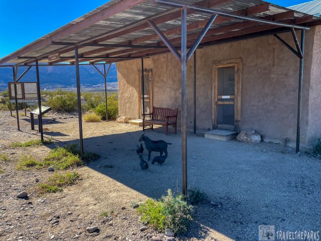
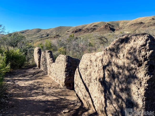
The Historic Ruins of Castolon Visitor Center (MM 20)
A stop at Castolon Visitor Center, you’ll find a rich history of this former trading post. The story starts in the early 1900s when Mexican farmer Cipriano Hernandez established a homestead, followed by Anglo-American settlers drawn to the area. Wandering among the adobe walls, it was not hard to imagine the bustling activity that once filled this remote army outpost. Unfortunately, a 2019 fire damaged some structures. A huge renovation is underway on the many of the buildings.

Exploring the historic ruins of the Castolon Store, which served as a hub for trading between Anglo and Hispanic settlers in the late 19th and early 20th centuries. During the Mexican Revolution (1910-1920), the U.S. Army established Camp Santa Helena nearby, influencing life in Castolon.
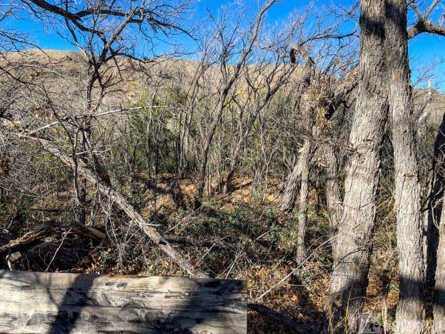
Discovering the Dorgan-Sublett Trail (MM 21)
Right off the bat, we saw the remains of a stone farmhouse with an interpretive exhibit that tells the story of the Dorgan and Sublett families who ranched here early 1900s. The trail winds through typical Chihuahuan Desert vegetation, including scrub brush, cacti, and mesquite trees. We came across the foundations of other ranch buildings, including “La Casita,” a smaller dwelling believed to have housed farmhands here in the 1900s.

Balanced Rock: A Natural Wonder Along Old Maverick Road (MM 22)
A nice side trip. This gravel road is not for the faint of heart. Out here it is remote, like time has stood still. The hike to Balanced Rock is at the end of the 6.4 mile Grape Hills Road. Balanced Rock is a natural wonder that anyone traveling along Old Maverick Road should not miss. A short 0.8-mile walk, there is a bit of a rock scramble near the end. The rock itself juts out from the rugged landscape like a precarious sculpture, defying gravity. Looking at it, this massive boulder sits precariously perched on a narrow base and has been sculpted by millions of years of erosion. It was spectacular.
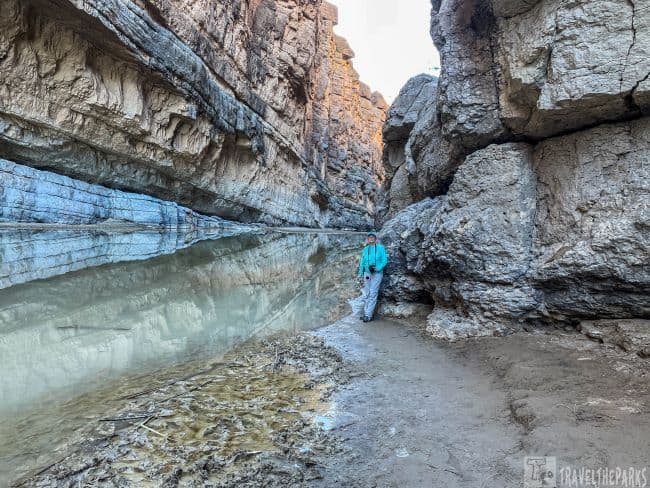
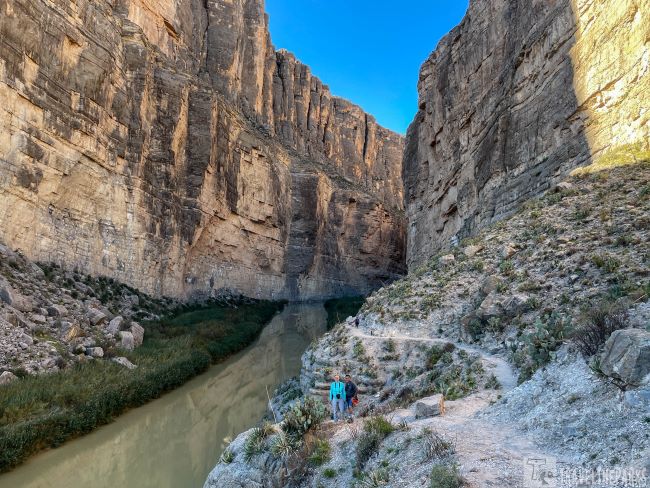
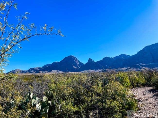
Santa Elena Canyon: A Journey through Time (MM 23.5)
At the end of the Ross Maxwell Scenic Highway, this trail is the star of the show. Parking is limited for travel trailers but we get lucky today finding a spot. The weather is sunny but cool, so we can leave Sage behind in the trailer while we hike.
PRO Tip: We use the Waggle app to monitor the temperature in our travel trailer for our dog’s safety.

The Santa Elena Canyon Trail is a 1.7-mile round-trip hike that guides you through the narrow canyon. Beginning with the switchbacks, we were treated to dazzling views of the 1500 feet cliffs and the Rio Grande River. Further down the trail, we climb over rocks and boulders to get better views. Standing at the entrance of this renowned canyon left us feeling quite small. I found myself remembering the Nevada Barr novel, “Borderline.” Envisioning park ranger Anna Pigeon, being lost on a raging Rio Grande River.

Today, all is calm on the river. The early morning sunlight does not quite reach the canyon floor. The low, calm waters occasionally allow visitors to wade across the river to a sandbar for a more isolated perspective. However, this morning, the river is too icy cold for my liking, so we opted not to wade across. For me, it was the interplay of light, shadow, and colors within the narrow canyon that showcases the raw beauty of this place.
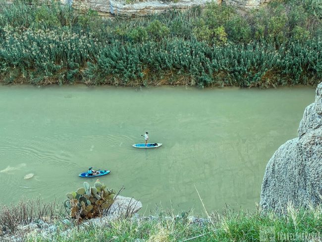
Rafting/Paddle Boarding the Rio Grande River
The towering cliffs and the crystal-clear waters of the Rio Grande make Santa Elena Canyon a great place to explore by canoe or kayak. I could just imagine the excitement of paddling down the Rio Grande. You would feel dwarfed by colossal limestone walls. The views of the wall striations painted in warm hues of ochre and rose as sunlight struggles to penetrate the narrow canyon would be impressive, to say the least. This will be the trip we add when we return to Big bend National Park.
Where to Stay in Big Bend National Park: Accommodation Options and Tips
The park has only one lodge, the Chisos Mountains Lodge. This lodge offers 72 comfortable hotel/motel accommodations, dining options, and access to park amenities. The Chisos Mountains Lodge also rents Roosevelt Cottages. These rustic cabins are in the heart of Big Bend National Park within the Chisos Basin area. They afford a unique way to experience the park with varying views of the Chisos mountains. We strongly recommended reservations. I think the greatest advantage of staying here is access to the trails early in the morning or later in the evenings. They even sell, “hiker’s lunches” for a quick bit on the trail.
Leave No Trace: Respecting the fragile desert ecosystem is crucial. Remember to leave no trace of your visit, stay on the designated path, and take your trash with you. By treading lightly on the land, you help preserve its natural beauty for generations to come.

Campgrounds in Big Bend: Your Gateway to Adventure and Natural Beauty
The park has four developed campgrounds, including the Chisos Basin Campground, Rio Grande Village Campground, Cottonwood Campground, and the backcountry campsites. Camping is a popular way to experience the park, and all campgrounds have amenities such as restrooms and potable water.

The Chisos Basin Campground has 60 campsites with basic amenities such as potable water, flush toilets, and picnic tables (no RV hookups). A much sought after campground, it is a great place to stay if you want to be close to the hiking trails. Open-year-round, the 5,400 feet elevation has cooler temperatures. The road into the Chisos is not suggested for trailers or RVs greater than 24 foot in length.
Cottonwood campground is close to the Santa Elena Canyon and the Castolon Historic District. Open year-round it has 24-dry sites (no generators allowed) available on a first-come, first-served basis.. The sites here lie within a shaded cottonwood stand. This rustic camping experience has basic amenities for campers, include potable water, flush toilets, picnic tables, and grills.
RV Campground Rio Grande Village
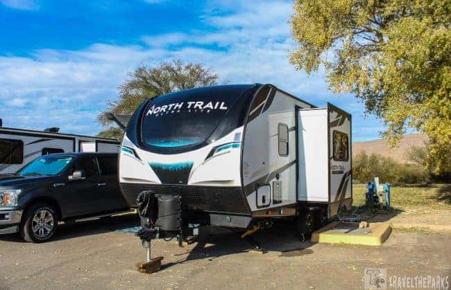
We stayed in our 21-foot North Trail travel trailer at the Rio Grande Village RV Campground. It doesn’t skimp on modern comforts. The conveniences include electrical hookups, (including sewer dump) picnic tables, and access to clean restroom and shower facilities. The 25 sites can accommodate RV travelers of all types. Additionally, the campground features a convenience store stocked with essentials, laundry and Wi-Fi. Pets are allowed but must be leashed.
Our first night, we had an incredible lightning storm. The crackling lightning over the illuminating the mountains in the distance was a sight to behold. Each bolt casting a glow on the rough terrain, showcasing the sheer power of nature. The campground was a unique vantage point to view this spectacular dark skies.

Additional Destinations to Explore in & around Big Bend
If you have additional time in the park, consider adding Big Bend Ranch State Park. It is next to Big Bend National Park and offers additional hiking and camping opportunities. The state park is less crowded than the national park and offers a more remote experience.

Explore the Ghost Town of Terlingua: Take a break from the wilderness to explore the quirky ghost town of Terlingua, just outside the park’s western entrance. Discover its unique history, vibrant art scene, and delicious Tex-Mex cuisine.

Final Thoughts on Big Bend National Park: Where Adventures Know No Bounds
This is an undiscovered jewel in our National Park system. In Big Bend National Park, adventures truly know no bounds. From hiking the rugged Chisos Mountains to drifting down the Rio Grande, soaking in the hot springs, and stargazing under the darkest skies, this remarkable place offers a taste of nature’s finest. Reminiscent of the Grand Canyon, Big Bend National Park will leave you with memories that last a lifetime. So, pack your gear, lace up your hiking boots, and get ready to embark on a journey where the adventure is as boundless as the Texas sky.
Have you visited Big Bend? What was your favorite thing to do there? Did you find an adventure? Please share in the comments below.


Fellow Traveller
This was one of our favorite parks. So many trails and beautiful views.
Travel the Parks
It is spectacular. We will be back for sure!