Connecting Custer State Park and Mount Rushmore National Memorial, Iron Mountain Road is one of the most unforgettable drives in the Black Hills. Granite spires, forest-covered hills, and open grassland prairies create a landscape that changes around every curve.
If you’re planning a larger South Dakota adventure, our Ultimate South Dakota and North Dakota Road Trip includes this incredible drive as one of the must-see stops in the Black Hills.

So why drive Iron Mountain Road? Because this 17-mile stretch of the Peter Norbeck Scenic Byway isn’t just a route to get somewhere else—it’s an experience all on its own. The road features 14 switchbacks, 314 curves, three famous pigtail bridges, and three narrow tunnels carved through the mountains.
The engineering is impressive, but the views are what make this drive unforgettable. As you wind through the Black Hills National Forest, you’ll find sweeping overlooks, towering granite formations, and one of the most famous views in South Dakota—the carefully framed sight of Mount Rushmore through the Iron Mountain Road tunnels.
This post may contain affiliate links, meaning if you purchase something through one of these links, we may earn a small commission at no extra cost to you! Read the full disclosure policy here.

Table of Contents
How to Get to Iron Mountain Road
The easiest way to reach Iron Mountain Road is by flying into Rapid City Regional Airport and using the city as your base for exploring the Black Hills. From Rapid City, the drive to Iron Mountain Road takes about 20 minutes.
Iron Mountain Road can be driven in either direction, but most visitors combine it with a trip between Mount Rushmore National Memorial and Custer State Park.
From Keystone / Mount Rushmore Area
If you’re coming from Keystone or Mount Rushmore, take US-16A east toward Custer State Park. The road becomes the famous Iron Mountain Road portion of the Peter Norbeck Scenic Byway as you continue south through the Black Hills. Along the way, you’ll experience the winding curves, pigtail bridges, and tunnels that make this drive famous.
From Custer State Park
Coming from Custer State Park, follow the signs for US-16A/Iron Mountain Road toward Keystone and Mount Rushmore. This route takes you north through some of the most scenic sections of the Black Hills.
Important: Check Your Vehicle Size Before Driving
Iron Mountain Road was designed as a scenic mountain road, not a highway. The tunnels have limited clearance, so larger RVs, trailers, and oversized vehicles should check dimensions before attempting the drive.
Tunnel Clearances:
- Doane Robinson Tunnel: 13 feet 2 inches wide, 12 feet 2 inches high
- C.C. Gideon Tunnel: 13 feet wide, 11 feet high
- Scovel Johnson Tunnel: 13 feet 2 inches wide, 12 feet 4 inches high
PRO Tip: Iron Mountain Road is not regularly maintained during winter months, and seasonal closures or hazardous conditions are possible. Check current road conditions before visiting.

History of the Iron Mountain-Peter Norbeck Scenic Byway
The Peter Norbeck Scenic Byway was the brainchild of Peter Norbeck. His idea was to bring more tourists to the area. Engineers told him it was impossible. However, he persisted, and they eventually constructed it in 1933. The three tunnels were labor intensive, requiring dynamite to blast. He asked Cecil Clyde Gideon to design the road to connect the three tunnels. What makes this roadway so exceptional is that all three tunnels frame the faces of the Mount Rushmore presidential faces. He incorporated the idea of using ‘pigtail bridges’. These corkscrew-shaped wooden bridges allow for quick elevation increase/decrease in a smaller footprint. The roadway loops over itself 360 degrees.

Peter Norbeck was elected governor of South Dakota in 1917. Previously, he had served as a state senator and lieutenant governor. Officially named in his honor in 1996, the Peter Norbeck Scenic Byway creates a loop if you include the 14-mile scenic Needles Highway. The Iron Mountain Road connects Custer State Park to the Mount Rushmore National Monument.

Why Not Make a Connected Loop: Needles Highway and Iron Mountain
One of the best ways to experience the Black Hills in Custer State Park is to combine both Needles Highway and Iron Mountain in a 1-day loop. Start from Hwy 385, continue via Needles Highway, and then drive south on US-87 to Sylvan Lake. The highway passes through notable tunnels, including the Needles Eye, before reaching the awe-inspiring Cathedral Spires. The byway US-87 connects back to US-16-A. Turn left heading towards the Custer State Park Visitor Center.
PRO Tip: You can access Iron Mountain Road from Needles Highway 87 by turning left at the junction of south Playhouse Road-head north for 4-miles. You will then turn left onto Iron Mountain Road 16A.

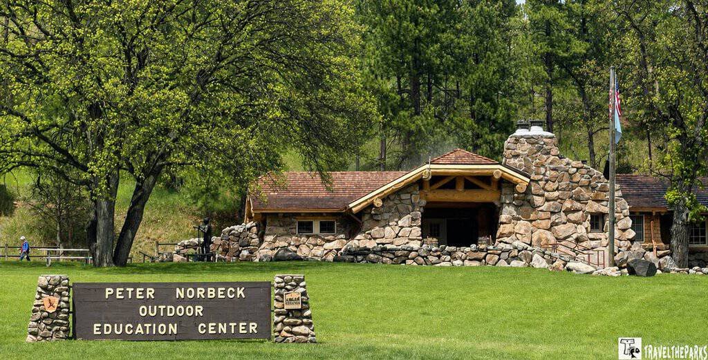
Make the stop at the Peter Norbeck Outdoor Education Center is one-mile west of the Visitor Center and one-mile east of the Park Office. This is a great place for kids to learn about the ecosystems in the park. We did Needles as a separate day trip so we could do more of the hiking trails.
Where should we start on the Iron Mountain Scenic Highway?
If you want the best views, go northbound from Custer State Park towards Mount Rushmore National Monument. The scenic drive is truly captivating. We steered toward Iron Mountain after completing the Wildlife Loop at Custer State Park in the morning. By the time we hit the road, it was mid-afternoon. Depending on the number of stops, the trek can take 1-2 hours to complete. The speed limit is 35 miles per hour or less.

After a brief lunch break of walking through the Custer State Park Visitor Center, Peter Norbeck Education Center, and the Game Lodge, we continued our drive. A short 1-mile on East US 16-A/US-36, turning left onto North US-16A. The Iron Mountain road steadily climbs out of the valley through a series of tight switchbacks. At the top, the first pull-out overlooks a lush green meadow. There are distant views of the Black Hills and Black Elk Peak. Stunning on a clear day. Unfortunately, we have more clouds than sun today. Not optimal for distant panoramic shots.

An informational placard gave us insight into why the meadow exists. A lightning strike in 1988 ignited the Galena Fire, which burned 16,002 acres in Custer State Park. There were many Ponderosa pine forests along Iron Mountain roads that were consumed. The fire was actually beneficial for the wildlife as the forest service overseeded the area to protect it from erosion. The meadow is a prime spot for bison and pronghorn antelope in the summer.
Back in the car, the road begins its twists and turns, following the plateau as it rambles through ponderosa pine and aspen forests lining both sides of the highway.

Why not stop at the Iron Mountain Road Visitor Center
Our next stop was the Iron Mountain Road Visitor Center. It is at the halfway point next to the Spokane Creek Cabins & Campground. This is a good place to stretch your legs. The center can tell you more about the road’s history and how it was built. Old photos tell the story.
The gift shop has collectibles, memorabilia, and merchandise like shirts and mugs. There is a small coffee shop, so we grabbed a cup of their famous Iron Mountain Road Coffee and enjoyed it with a freshly baked cinnamon roll. Delicious!

Iron Creek East Trailhead #15-Lakota Lake Picnic Area
A good place to stretch your legs is along the shores of the crystal clear Lakota Lake. We stopped for a quick snack from our picnic lunch. We hiked the Iron Creek Trail, even though I wanted to fish for trout in the lake.

PRO TIP: For your trip to Iron Mountain, pack sturdy walking shoes, water, and sunscreen—especially if you’ll be out on the trails or overlooks. A camera is great for capturing the sweeping mountain views, and a light jacket can come in handy with changing weather at higher elevations. Don’t forget snacks or a small daypack if you plan to explore for a while.

The trailhead for the Iron Creek East Trail (#15) begins here. The trail follows the southern boundary of the Black Elk Wilderness Area. Dogs are welcome on this 5-mile out & back trail. There were a few places we had to cross over wooden plank bridges placed over the river. On a few crossings, logs or well-placed rocks kept our hiking boots mostly dry. Pretty secluded as the trail meanders through ponderosa forest. The smell is amazing. You can connect to the Iron Mountain #16 Trail by following Forest Service Road 345.

We encountered a friendly group of horseback riders on the return leg of the trail. Thinking this is a great idea if we ever return to the Dakotas. The views are good, but not spectacular.

Why Iron Mountain Road is a must-drive: First Tunnel-Scovel Johnson Tunnel
This is the first tunnel you will encounter when driving along Iron Mountain Road toward Keystone. The tunnel isn’t very long, but once you pass through it, the trees lining the road open up to reveal a distant view of Mount Rushmore’s presidential faces. This is your first glimpse of Mt. Rushmore as you travel the road. We pulled off just before the tunnel to take a few pictures before moving on.

The tunnels are all one lane, so driving slowly is essential. Honk your horn before entering as a warning to other drivers, and proceed only when you are sure the coast is clear.

Norbeck Overlook-A Tribute to a Great Conservationist
Peter Norbeck came to the hills in 1905, determined to preserve the area for future generations. A small memorial to Governor Norbeck stands at the summit of Iron Mountain, the highest point (5,446 ft.) on the byway. This is a must-do stop not only for the views of Mount Rushmore but also for the panoramic vistas of the Black Hills Wilderness Area, which are breathtaking. The 35,000-acre preserve he established in 1920 features rugged terrain that provides vital habitat for bighorn sheep, mountain goats, deer, elk, and other species. Although we did not see wildlife on our drive, the area is renowned for its effective management and protection of wildlife habitat.

The overlook is a good place to rest and have a picnic lunch enjoying the views. The rocks created small arches, nooks and crannies where kids were scrambling up and over them, appreciating the day.
Iron Mountain Trailhead & Picnic Area
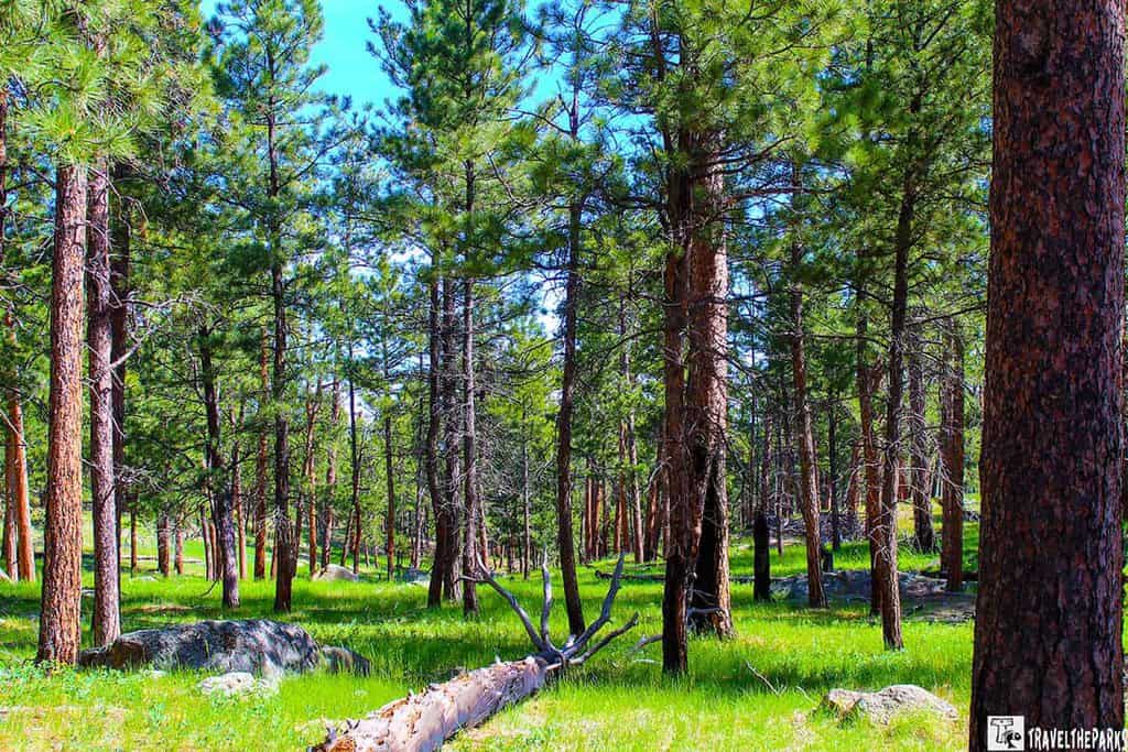
The picnic area has magnificent views of the surrounding wilderness, plenty of tables set amongst giant granite boulders, in a good deal of shade. The pit toilets were actually really well-maintained.
It is a fairly easy 1.4-mile out & back trail through the Black Elk Wilderness. The trailhead for the Iron Mountain Creek #16 begins at the picnic area. Go along the paved section of Centennial Trail Bypass #89B for 0.5 miles to reach the #16N trail. The trail climbs through a ponderosa pine forest affected by beetle damage.

If you take the #16 trail, it follows the creek. The rock formations near the end of the trail, the “Turtle Rock,” are pretty interesting. We created a loop by taking the forest road to the Grizzly Creek, returning on the Centennial Trail Bypass #89B. The trail was muddy in some areas, but hiking boots made the difference.
What did we bring with us? Remember, a good pair of sunglasses, sunscreen, towel, ball cap or wide-brimmed hat, and a light, loose-fitting, long-sleeved shirt for sun protection while on the trail. If you plan to walk the trails, bring bug spray for the biting insects.


CC Gideon Tunnel and Pigtail Bridges
Pigtail Bridge leads into the CC Gideon Tunnel. It sits at an elevation of 5,043 feet. This tunnel has the ceiling open up about halfway through. A marvel of engineering, you can see how difficult it must have been 70 years ago for CC Gideon and Scovel Johnson to achieve the dream of creating this scenic byway. Naming the tunnels is a fitting contribution to them. It is possible to see Mt. Rushmore faces, but the view is not that remarkable because of the distance and trees.

About a mile further down the road, the pavement splits, separating the north and southbound lanes. You feel a sense of isolation. The trees lining the road are thick and serene. As we approached the pigtail bridges, I had the GoPro camera mounted to the dash of the car. Unfortunately, none of the videos turned out. Bummer.

Framed by the Doane Robinson Tunnel
The best view is yet to come. The third and final tunnel is the Doane Robinson Tunnel. It affords the best view of Mt. Rushmore. The tunnel walls perfectly framed the faces. There is no parking area on the north side of the tunnel, only on the south side. Limited, the pullout can support about 3 or 4 cars. We got lucky and found a spot to park. It was difficult to find the perfect shot with no cars, but with patience, I did finally get my photo opportunity. Not the best, but I was delighted I got something. It is a highlight for sure on the scenic drive. From this point, the road descends back down the mountain to the intersection of US-244 and US-16.

Final Thought: Why Iron Mountain Road should be on your itinerary
Iron Mountain from Custer State Park to Keystone, South Dakota, is totally worth the journey. Adding this in conjunction with the Needles Highway creates a dazzling scenic loop. There is no fast lane on Iron Mountain Road; it was built to allow travelers to slow down and take in the beauty of the Black Hills. If you are visiting the Black Hills, definitely add this to your itinerary. You will enjoy every moment on this awesome drive.
Do you have any experience driving the Iron Mountain Road? Are there any scenic drives in the Black Hills that you particularly enjoy? Why did you think it was best?