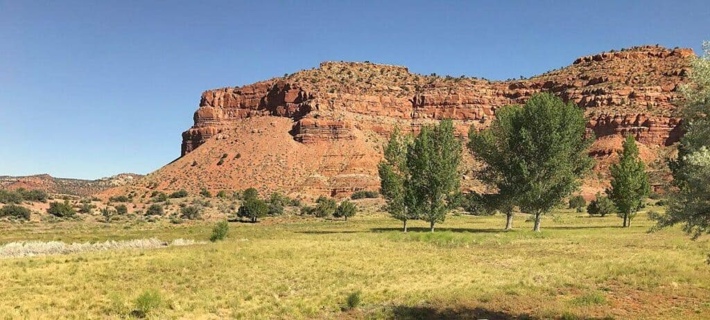
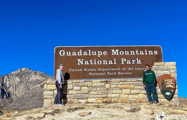
On our Texas/New Mexico road trip, we had no idea what to expect when we arrived to spend a day in the remarkable Guadalupe Mountains National Park. As we drove into the park, the rugged peaks of the Guadalupe Mountains rose up in front of us, and we couldn’t wait to explore. I had heard this extraordinary park is a favored destination for hiking enthusiasts. It has over 80-miles of varied trails, so we took advantage of less traveled trails that led us to some incredible encounters. Many combine this park with Carlsbad Caverns National Park as there are in proximity. Carlsbad is a mere 45-miles from Guadalupe Mountians. Planning to spend an unforgettable day in Guadalupe Mountains National Park can be exciting.
This post may contain affiliate links, meaning if you purchase something through one of these links, we may earn a small commission at no extra cost to you! Read the full disclosure policy here.

Table of Contents
How do We Get to Guadalupe Mountains National Park?
By Car: If you are driving from El Paso, the nearest major city, you can take US-62/US-180 east for approximately 110 miles until you reach the park entrance. If you are driving from the east, you can take I-10 west to Exit 140 and follow the signs to the park entrance. We drove from Big Bend National Park with a detour to see Fort Davis National Historic Site.
We stopped for gas at each town due to the lack of stations. There is no gasoline available in the park. Ensure your vehicle has sufficient fuel before heading out. The nearest gas station from the park headquarters is 35 miles away in either direction. Your final gas options will be Dell City or Van Horn in Texas or White’s City in New Mexico.

By Plane: The nearest major airport to Guadalupe Mountains National Park is El Paso International Airport (ELP), which is approximately 110 miles away. From the airport, you can rent a car or take a shuttle service to the park.
Important Info to Know Before You Visit Guadalupe Mountains National Park
- Park Hours & Entrance Fees: Entrance fees are charged per vehicle. Payment can often be made at the entrance station or online.
- Operating Hours: The park is open 24 hours daily, but visitor centers and facilities have set hours (usually 8 AM to 5 PM). Check the official park website for current opening hours.
- Pet Policy: Pets are not allowed on most trails or in backcountry areas to protect wildlife and sensitive habitats. Pets must be leashed at all times in parking areas and campgrounds. Be sure to bring water and waste bags if bringing a pet in permitted areas.
- Weather Preparedness: Weather can vary widely, from hot desert heat to cooler mountain temperatures. Dress in layers, wear sun protection, and check forecasts ahead of time.
- Best times to visit: spring (March–May) and fall (September–November). These seasons offer cooler temperatures, blooming wildflowers, and vibrant fall foliage—ideal for hiking and photography. Summer can be hot and stormy, while winter may bring high winds and snow at higher elevations.
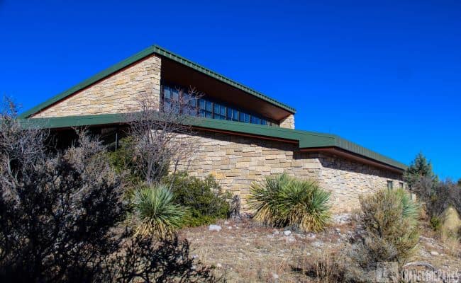
Start Your Day at The Visitor Center
Once you arrive at the park, there are several options for spending your day. You can either hit the hiking trails, drive the scenic roadways, or attend a ranger-led program.
But first things first. Our initial stop is always the visitor center. It’s helpful to visit the visitor center to get your bearings in a national park. I always grab a map and speak with a ranger/docent to get some insider tips and trail updates. Rangers are consistently super helpful, giving us the lowdown on the best trails and sights to see. The Guadalupe Mountains National Park has two visitor centers. McKittrick Canyon and the Pine Springs Visitor Center are both on the east side of the park. Dog Canyon Ranger Station is on the western side of the park. Pine Springs is where we started our day, doing an early morning hike before the visitor center opened.

The interactive displays explain the geological history of the park. Here we discovered that what are now the highest peaks in Texas were once the seabed of an ancient Permian Sea raised up by tectonic activity in the Cenozoic Era. Over 250 million years later, the massive fossilized reef system formed the Guadalupe Mountain range. The Karst limestone terrain is rich in marine fossils.
What things can we do at Guadalupe Mountains?
In one day, it is impossible to do all the park’s trails. These are just a few of the trails we could do during our stay in the park. Remember, this park has over 80 miles of hiking trails. In comparison with other national parks we have visited, we can definitely say that this one is geared towards hikers.
Best Hikes to Explore in Guadalupe Mountains
Guadalupe Mountains National Park offers plenty to do for everyone. With a wide range of trails suitable for every skill level, whether you want to enjoy a short, simple walk or seek solitude in a remote corner of the park, you’ll find the perfect spot here. To best appreciate this magnificent scenery, plan your day in advance.
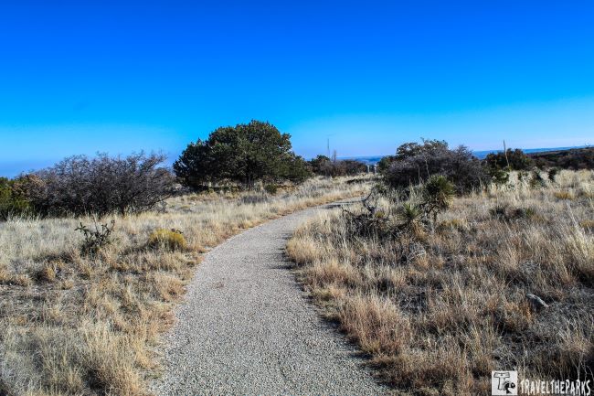
Walk The Pinery Nature Trail
Located directly outside the visitor center, this 1.0-mile out-and-back nature trail is an easy introduction to the park (30-minutes). This is the only dog-friendly trail in the park. Our dog, Sage, loved the opportunity to stretch his legs. The trail that leads to the Pinery Butterfield Stage Station remains one station along the Butterfield Overland Mail route. It was a stagecoach and mail delivery service that operated in the mid-19th century, from 1857 to 1861. Informational signs detail the effect of the 1993 Guadalupe fire on this area.
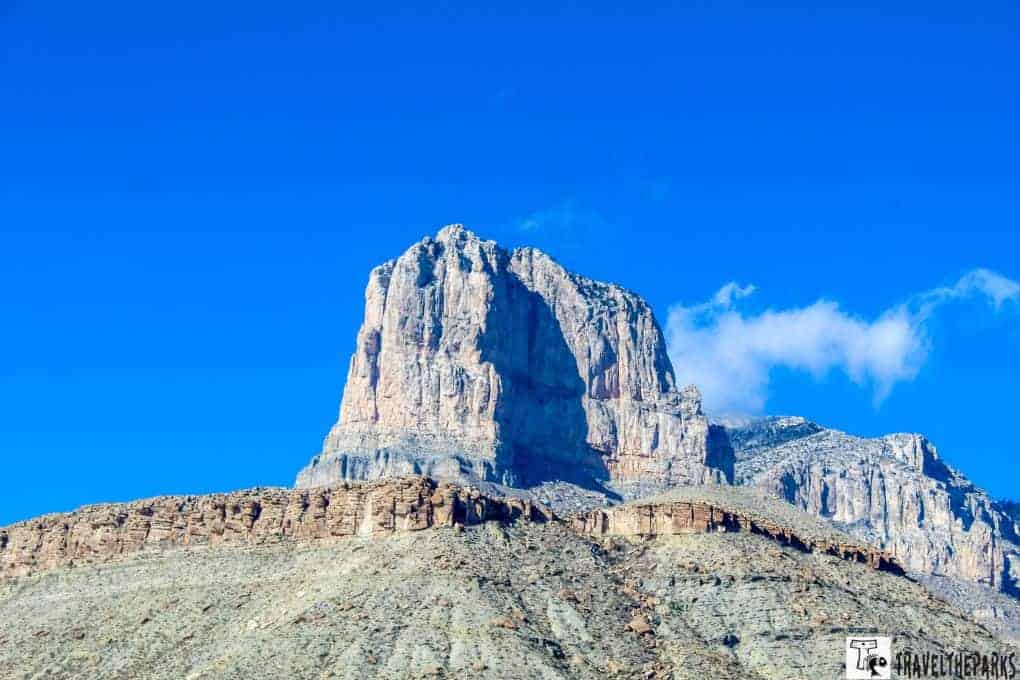
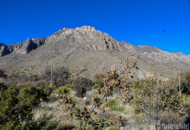
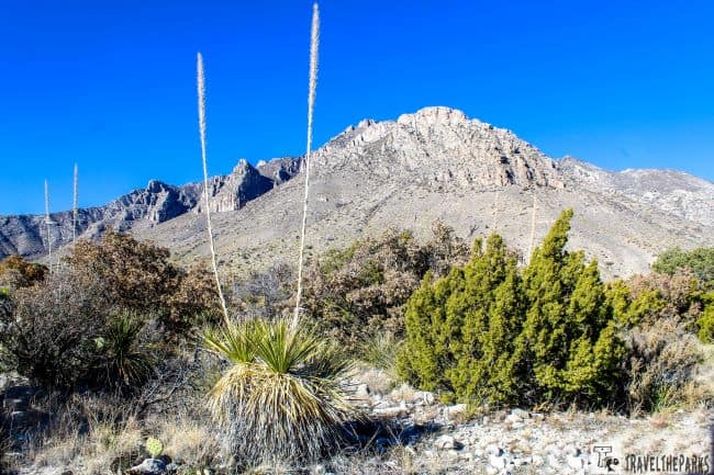
Attempt the Guadalupe Peak Trail
Diehard hikers flock to this park to tackle the Guadalupe Peak Trail. At 8,751 feet elevation, it is the highest point in Texas. Because the Pine Springs Visitor Center does not open until 8 AM, we decided to confront the peak early morning to avoid the midday crowds (6-7 hours). The 8.1-mile out-and-back hike is regarded as challenging. Bring plenty of water, sunscreen, a hat, and trekking poles. It’s totally worth it for the incredible view at the top. I felt like my legs were going to give out as the first 2-miles are very steep indeed. The deteriorating weather, with super windy conditions, forced us to turn around. Honestly, getting my rear end handed to me by the mountain was a humbling experience. The only good outcome of not completing the trail today was having more time to spend doing other trails since we only have one day here.

Explore Frijole Ranch Museum in Guadalupe Mountains National Park
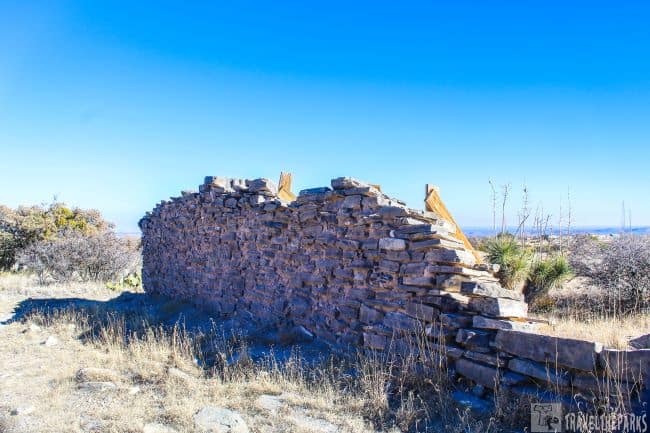
Our next stop was Frijole Ranch along Hwy 62/180, 1.4 miles north of the Pine Springs Visitor Center. Here we visited the well-preserved homestead that is now a museum. The museum tells the story of the human history of the Guadalupe Mountains. Inside, the exhibits begin with the Native Americans, moving on to ranchers, and eventually to the establishment of the National Park. On November 21, 1978, the National Register of Historic Places included this historic structure on its list.
The original homestead was first settled by the Radar Brothers around 1876. They ran a small cattle operation and built the original ranch house using locally sourced rock.
In 1906, the Smith family acquired the home, renaming it Spring Hill Ranch. They added additional rooms during the 34 years they inhabited the house to make it a cozy ranch house. They also built the springhouse, bathhouse, guesthouse, and nearby storage buildings. The two springs on the ranch were the lifeblood of the ranch. They allowed the brothers to farm and maintain a small orchard. In 1925, the family constructed the small red schoolhouse to educate 8 local children. Being a retired teacher, I am always interested in schoolhouses. Later, Judge J.C. Hunter purchased the ranch as part of an accumulation of ranch properties in the area. In 1966, the entrepreneur sold the property to the National Park Service, which later incorporated it into Guadalupe Mountains National Park, officially established in 1972.
Today, the historic schoolhouse and the springhouse are both still standing. The springhouse was used to store/cool dairy products, fruits, and vegetables.
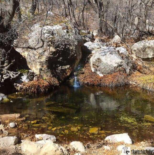
Discover the Manzanita Spring Trail in Guadalupe Mountains National Park
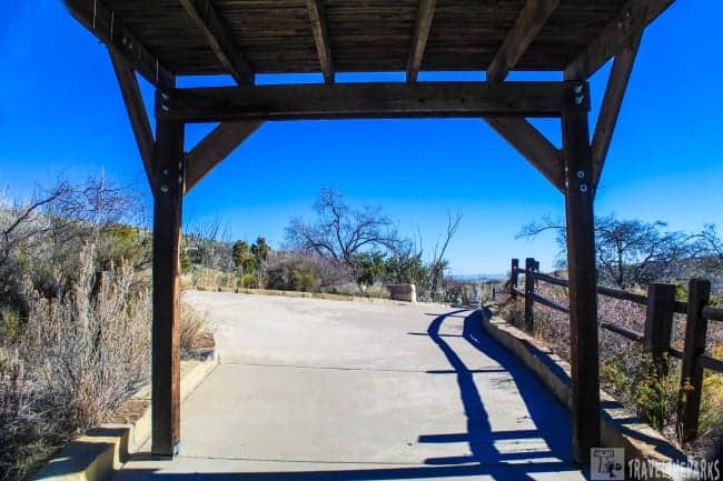
The informational brochure about the ranch’s history made the structures and grounds interesting. We spent a bit of time walking the grounds before taking a moment to eat our lunch. The small, shaded picnic area creates a relaxing haven, perfect for enjoying the view. After lunch, we walked the short 0.6-mile Manzanita Spring Trail. leads to a small pond created by the spring. This natural water source provided sustenance for the wildlife in the desert landscape. We walked the trail counterclockwise, adding the Smith Spring Trail.
Unforgettable Day hike to Smith Spring Trail
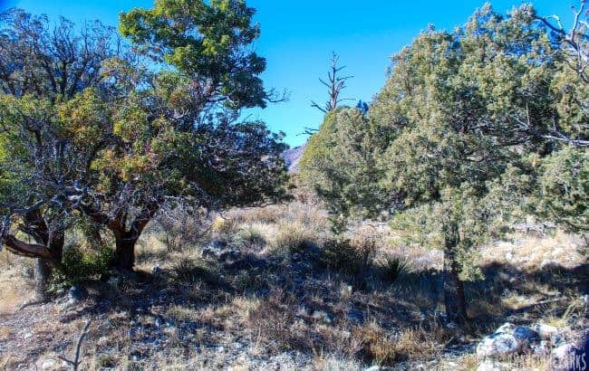
Frijole Ranch is the starting point for several picturesque trails, including the Smith Spring Trail. This is a short loop of 2.5 miles, taking about 1-2 hours to complete. The trail is mostly level, traversing a small meadow before ascending a rocky canyon wash. Most of the trail is exposed to the sun. A pleasant surprise was this hidden oasis of oaks and maples, which contrasted to the park’s desert.
Must-do stops in Guadalupe Mountains NP is McKittrick Nature Trail
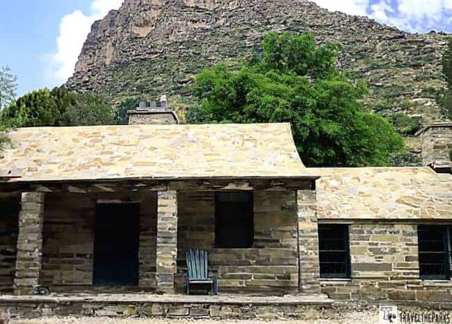
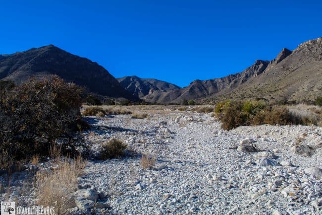
We are excited to do the next trail as we’ve heard good things about the McKittrick Canyon trail. The trail is a 7-mile round-trip loop that winds through McKittrick Canyon to The Grotto (4-5 hours). If you only want a short hike, it is a 4.8 miles round-trip to the historic Pratt Cabin. The trail is relatively flat and easy, making it accessible for hikers of all ages and skill levels. When we reached the junction of the North and South McKittrick Creek, we crossed over the dry creek-bed, taking a brief rest at the cabin. The old stone cabin, settled by oil geologist Wallace Pratt, dates back to the early 1930s. This old limestone cabin and its outbuildings have an interesting history. A docent volunteer gave us the lowdown on Wallace Pratt’s family and the construction of the buildings.

No matter which trail you choose, be sure to bring plenty of water, snacks, and sunscreen, and wear sturdy shoes and appropriate clothing for the weather. Be prepared for sudden changes in weather, as the park’s elevation can result in rapidly changing conditions.
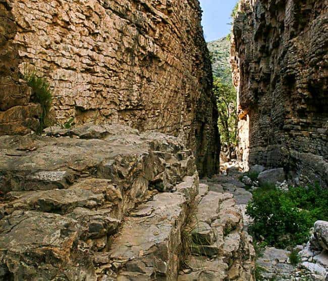
Explore The Grotto
After a break, we continued down the trail to reach the grotto. The canyon gets narrower as we make our way. There are more trees and shade. The trail is a little rockier here, but is still an easy walk. We reach a fork that says to take the left turn trail to reach the grotto-it is marked with a sign.

The grotto itself is a beautiful area with picnic tables and lush vegetation, even in winter. The grotto itself is a limestone alcove with stalagmite and stalactite formations. It would have been nice to reach the hunter’s cabin off a short spur trail, but time was not on our side. The gate to McKittrick Road closes promptly at 6 PM MST. Remember, the park is in two time zones. With Sage in the camper (we have a Waggle to monitor temperature in our camper), we err on the side of caution and head back to the trailhead.
Which other hiking trails do people favor in the Guadalupe Mountains?
I wish we had built more time into our schedule to explore additional trails in other areas of the park, but that just gives us a great reason to return to the Guadalupe Mountains. This park is often underestimated—some even suggest skipping it—but I think it offers truly incredible hiking.
- Devil’s Hall Trail:Immerse yourself in the beauty of Devil’s Hall Trail as you hike through a narrow slot canyon, surrounded by towering rock walls, on this 4.2-mile round-trip trail. Before the wash, the trail transitions from being well-packed to becoming somewhat rocky. In the wash, you must scramble over some huge boulders. Climbing the steep stairs before Devil’s Hall was manageable. It is recommended to wear good tread shoes, since the boulders can be slick in several spots.
- The Bowl Trail: For those seeking a much more demanding adventure, this 11-mile trail presents a formidable hike that leads hikers to an isolated basin amidst towering mountains at a high altitude. It is advisable that only seasoned hikers should attempt this trail.
- Salt Basin Dunes Trail: Hikers who embark on this 2.3-mile round-trip trail will be treated to an otherworldly experience as they traverse through towering sand dunes, all while enjoying breathtaking panoramic views of the vast desert that surrounds them
- Tejas Trail: This 8.8-mile one-way trail is a challenging hike that traverses some of the park’s most rugged terrain, including steep switchbacks and rocky ridges.
Final Thoughts on Guadalupe Mountains National Park
One of the major challenges we faced during our visit to remarkable Guadalupe Mountains National Park – the mountainous terrain and steep hiking trails. The elevation gain on the many rocky paths made it physically demanding for us. Not reaching the summit of Guadalupe Peak left us disappointed. Nevertheless, finishing the other trails brought a sense of accomplishment, making the entire experience worthwhile. I found it surprising that it is considered one of the “least visited” national parks. Overall, we found it was a great place to explore the natural beauty of the West Texas desert, especially if you like hiking to remarkable mountain vistas or learning about this area’s history.
Have you had a chance to visit Guadalupe Mountains National Park? What was your favorite hiking trail? Share your thoughts in the comments below.