
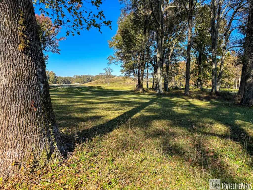
Hidden in the heart of northeastern Louisiana, Poverty Point was once the largest and most sophisticated settlement in North America during the Archaic period. If you’re looking for a truly unforgettable experience, Poverty Point is where history comes to life. Exploring history at Poverty Point is an opportunity to delve into one of North America’s most important prehistoric landscapes. This was our first World Heritage Site. The massive mound, set against a backdrop of lush, sweeping meadows, is an ancient engineering wonder that will leave you in awe. Trust us—it’s one of those places you really have to see to fully appreciate just how impressive it is.
This post may contain affiliate links, meaning if you purchase something through one of these links, we may earn a small commission at no extra cost to you! Read the full disclosure policy here.
Table of Contents
Where is Poverty Point National Monument?
Reaching Poverty Point National Monument (Poverty Point World Heritage Site) is straightforward. Whether you’re coming from a nearby city or exploring Louisiana’s scenic backroads. The monument is near the town of Epps, about a 30-minute drive north of the Mississippi River and roughly 2.5 hours north of New Orleans.
- From New Orleans (approx. 4 hours): Head north on I-10 W, then take exit 193A to merge onto I-20 W toward Shreveport. Continue on I-20 W for 120 miles and take exit 139 for LA-577 toward Poverty Point. Follow LA-577 north for 7 miles to reach the site entrance.
- From Monroe (approx. 45 minutes): Head east on US-165 S, then take a left onto LA-577 south toward Epps. Continue on LA-577 for 10 miles until you arrive at the site.
- From Shreveport (approx. 2 hours): Head south on I-20 E toward Monroe, then take exit 139 for LA-577 toward Poverty Point. Drive south on LA-577 for 7 miles to reach the entrance.
Useful Information for Visitors to Poverty Point
- Operating Hours: Poverty Point is open year-round. Visitor Center/Museum: Open from 9:00 AM to 5:00 PM daily. Site Access: The park grounds are open from 9:00 AM to 5:00 PM daily. The museum and visitor center are closed on Thanksgiving, Christmas, and New Year’s Day. We got our National Park passport stamps from the visitor center.
- Pets: you can have pets in parking lots and on paved roads, but they are not allowed inside the buildings. Must be kept under control or on a leash that is no longer than 6 feet at all times.
- Entrance Fees: Louisiana State Parks operates this site. Therefore, they do not currently honor the NPS Annual Pass.They honor the Louisiana State Parks Annual Pass. Adults (age 18-61): $4. Golden Agers (age 62+) & Children (under 3): Free admission.
- Cell Service: Cellular service varies depending on your service provider. Surprisingly, Verizon provided a good signal.
- Wi-Fi: They offer free visitor Wi-Fi. The password is at the check-in desk in the museum, along with the QR code for our VR/AR app.
When is the best time to visit Poverty Point World Heritage Site?
- Spring (March to May) Mild weather makes for great outdoor exploration. The area is lush with new growth and wildflowers. Spring is also when you’ll see the most wildlife activity.
- Fall (September to November): Cooler temperatures and fewer crowds, making it pleasant for walking and hiking. Fall also offers the chance to see the vibrant colors of autumn in the landscape. Fall events and cultural activities, like Native American heritage celebrations, can add to the experience.
- Winter (December to February): While it can be cooler (with daytime temperatures ranging from 40°F to 60°F), there are fewer visitors, and the monument is peaceful. This time can also provide clearer skies for photography.
- Summer (June to August): Summers can be very hot and humid, with temperatures often exceeding 90°F, so be prepared for high heat and potential thunderstorms. If you’re comfortable with the summer weather, early mornings or late afternoons are the best times to visit.
A Step Back in Time to Ancient Poverty Point
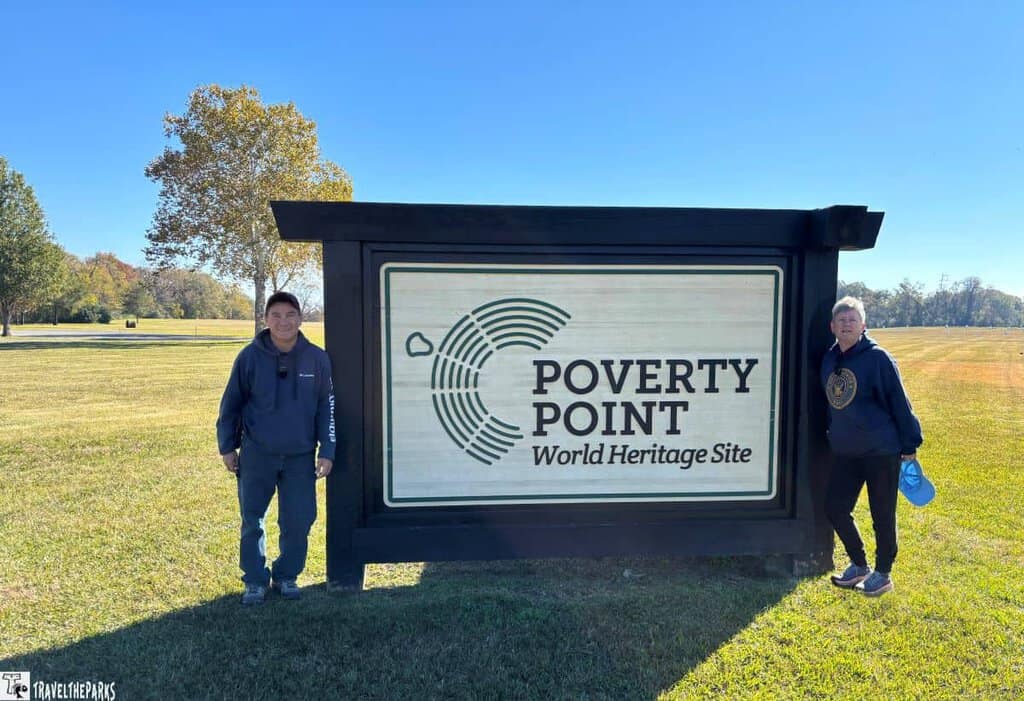
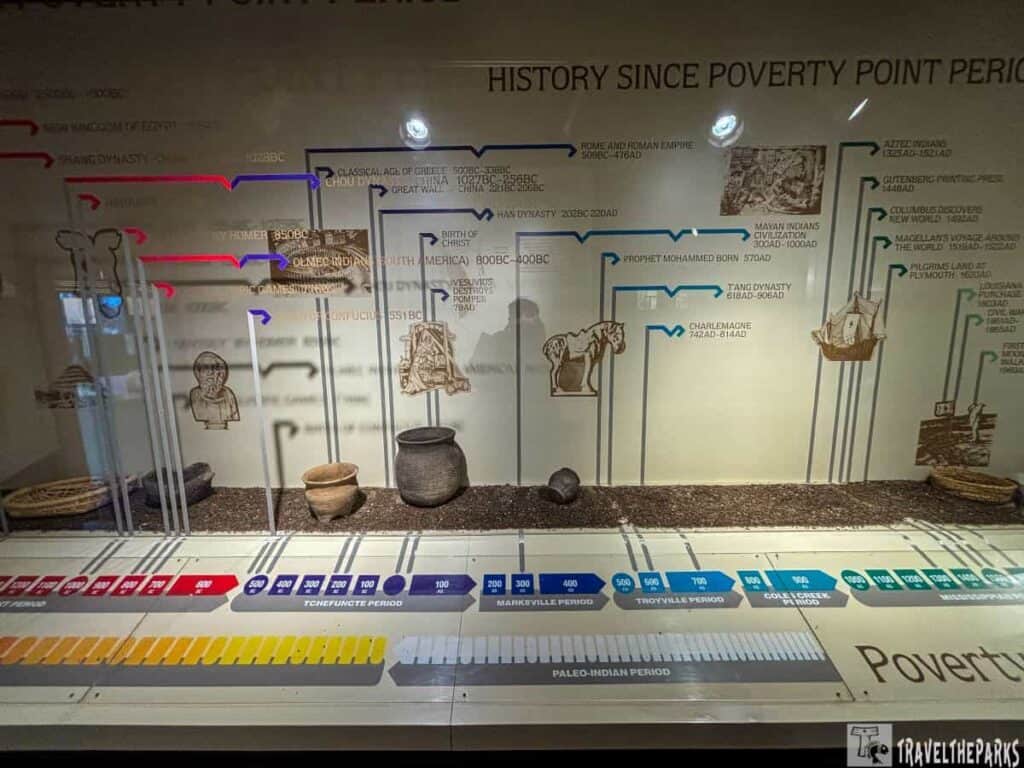
During my visit to Poverty Point, I was utterly amazed to discover that these mounds date back over 3,000 years! Archaeologists date the Poverty Point mounds to around 1650 BCE, while they date the Great Pyramid of Giza to around 2560 BCE. The sheer scale of the ancient earthworks in Louisiana—right where I was—defies belief, predating even the conception of iconic Old World structures by thousands of years. This 345-acre state park provides a fascinating glimpse into ancient history. UNESCO recognized it as a World Heritage Site in 2014.
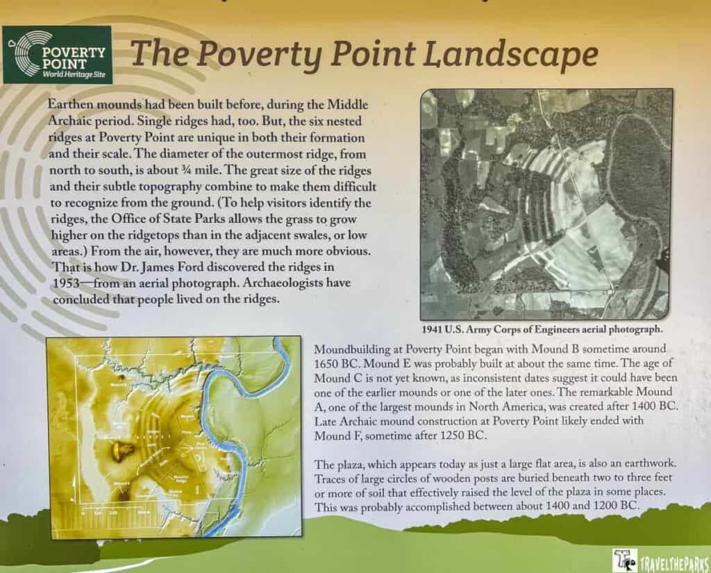
Between 1700 and 1100 B.C., this place was the city of its time—imagine, it was the biggest in all of North America! What makes this even more incredible is that people of the Archaic period didn’t live in cities at all. They were hunter-gatherers, with no agriculture or pottery to support sizeable populations. Yet here, they built massive earthen mounds and six miles of concentric ridges, shaping the land itself to create a thriving community.
Significant of the Earthworks at Poverty Point
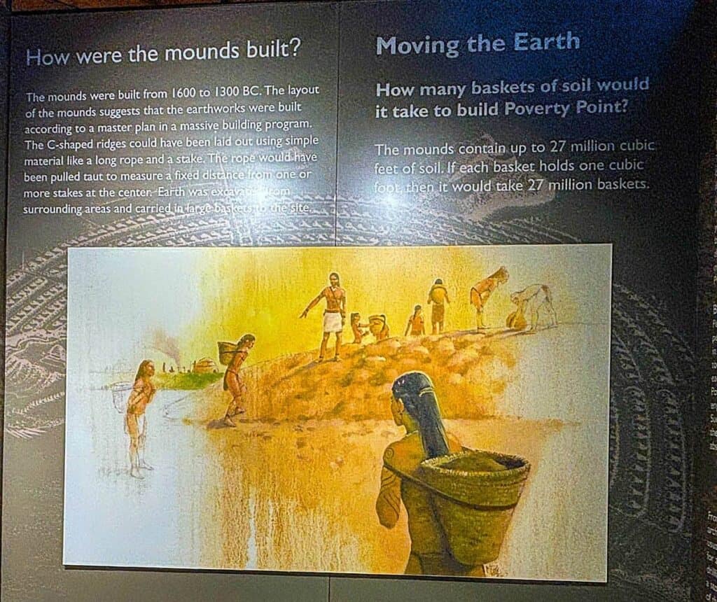
The ancient earthworks are incredibly extensive. Constructed through the backbreaking process of moving dirt, forming each mound and ridge. Carried out with no other help than that of draft animals, carts, and no modern tools at all. This great, unyielding physical effort of human workers was a tribute to their ingenuity and great perseverance.
The Poverty Point culture was one of the most advanced and wide-reaching societies in North America during its peak, dating from approximately 3,500 years ago. They created large earthworks, like concentric ridges and mounds, and probably were a hub for regional exchange. The site itself played the role not only of a trading center but also that of a ceremonial and cultural point.
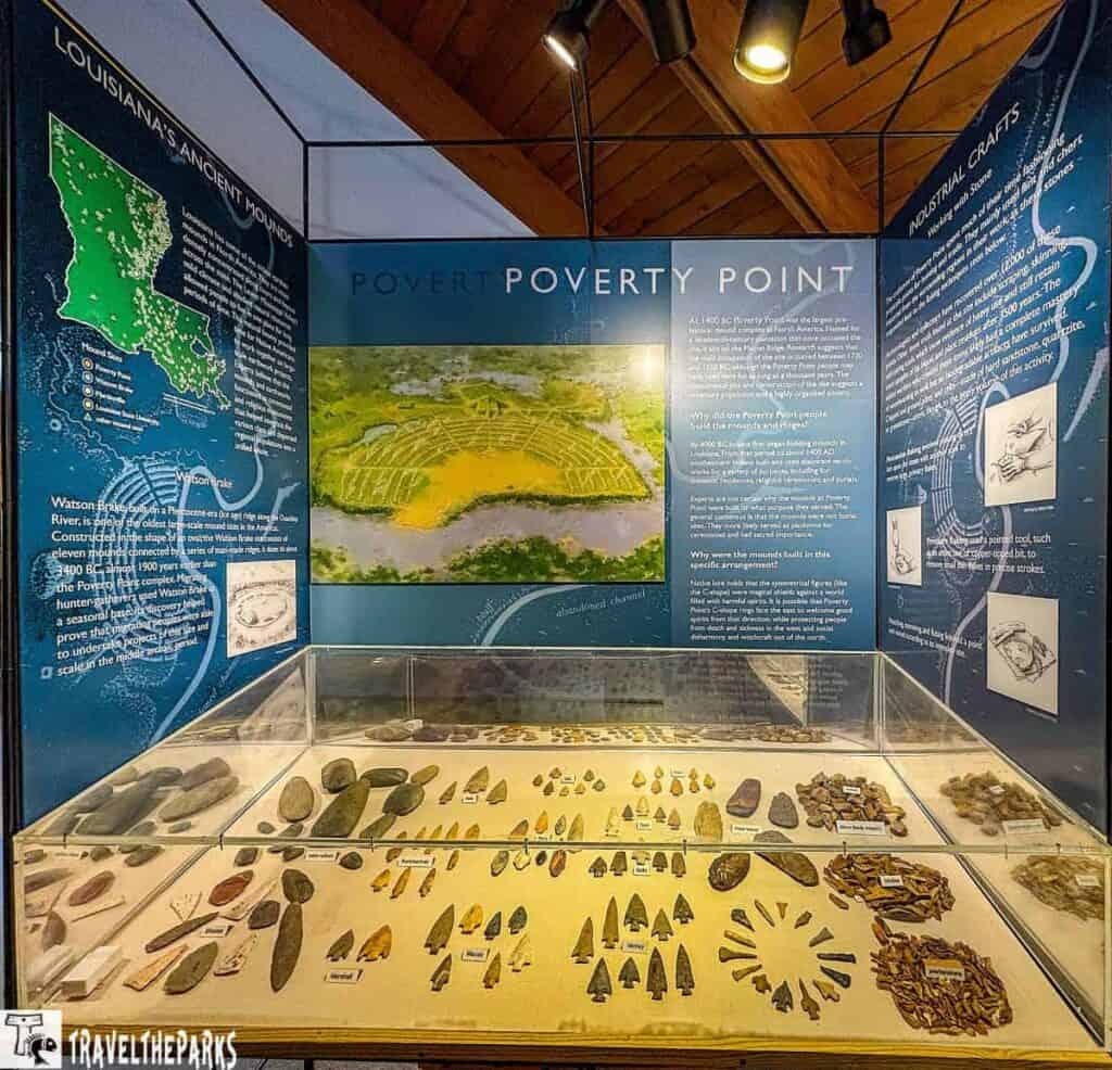
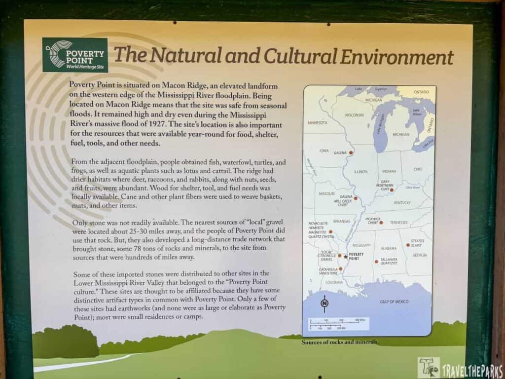
The people of Poverty Point were not isolated—they traded with other indigenous groups hundreds of miles away, and their culture has had a lasting impact. Archaeological evidence indicates that people at Poverty Point were trading with groups as far away as the Great Lakes for copper, the Appalachian Mountains for stone tools, and the Gulf Coast for shells and salt. The most famous artifact associated with Poverty Point is the Poverty Point stone, a type of stone used in tool-making, which was transported from long distances. However, around 1100 B.C., the people of Poverty Point mysteriously left this site. Nobody knows the reason?

How is Poverty Point different from other ancient mounds?
Mound-building cultures represent a very rich and long-lived tradition of mound-building across the continent of North America. People at Poverty Point, Ocmulgee Mounds, Kolomoki Mounds, and Etowah Indian Mounds built earthworks for ceremonial, residential, and perhaps trading purposes. Mound-building is an important feature of Native American cultural history. The locations represent different points in the history of this tradition.
During the Late Archaic period, between 1700 and 100 B.C., builders constructed Poverty Point. This makes it one of the oldest and most significant prehistoric sites in North America. People occupied Ocmulgee Mounds much later, during the Mississippian period (around 1000 to 1600 A.D.). This is thousands of years after Poverty Point, when societies in the region were already developing agriculture, complex social structures, and urban centers.
Things to Do at Poverty Point World Heritage Site
There’s a lot to see and experience in a single day at this fascinating site. Here are some highlights:

Begin at the Visitor Center & Museum: A Fascinating Journey into the Past
I found the Poverty Point Visitor Center really interesting because it showcases the amazing history and importance of this ancient indigenous people’s heritage site. It also houses an impressive collection of artifacts. Each of these provided insight into daily life and culture for the people of this region over 3,000 years ago. Artifacts such as intricately shaped stone tools, pottery, and figurines are exhibited here. The museum has hands-on exhibits that bring the past alive. They take you back in time to better understand just how these early inhabitants fit together within the natural world. It’s a perfect spot to gain context before or after walking the earthworks.
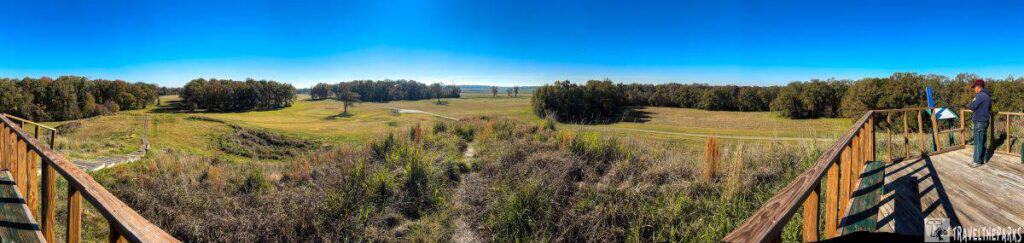
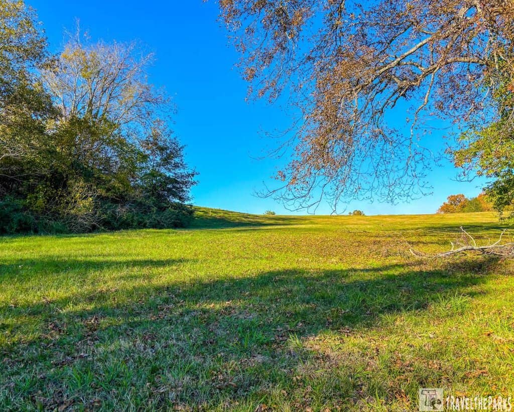
The earthworks of Poverty Point are the centerpiece of this sprawling site, featuring massive mounds and concentric ridges. This vast construction was most likely used for ceremonial and trading purposes, serving as a residential area for prehistoric peoples. The five major mounds – ranging from the largest, Mound A, to the more modest Mounds B and C – are arranged in a unique semicircular pattern.
Explore the Earthworks
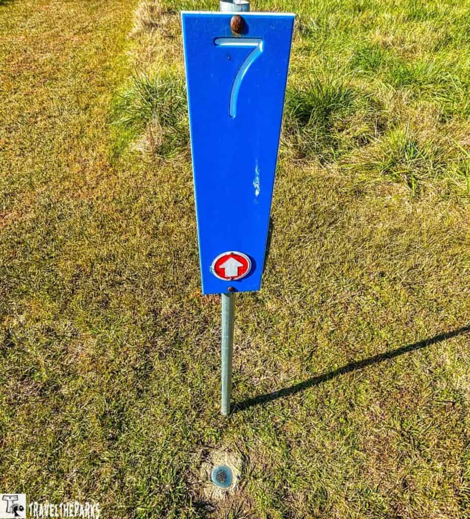
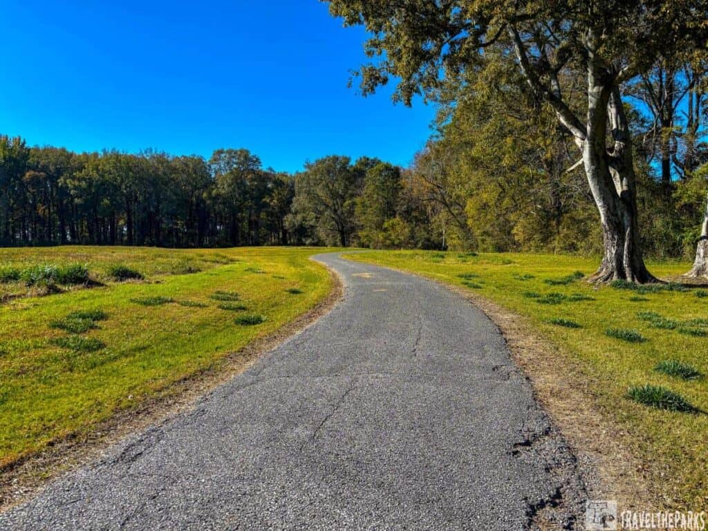
We started by taking a guided walking tour. Exploring the site on our own using the map from the visitor center, we took it slow and easy. The walking tour is 2.8 miles and takes about two hours to complete. There are 20 stops along the trail, including Mound A, Mound B, Mound C, and the Surveying Monument. The Poverty Point National Monument also offers a self-guided driving tour, which takes about 45 minutes to complete. There are also ranger-guided tram tours offered four times daily Wednesday through Sunday.
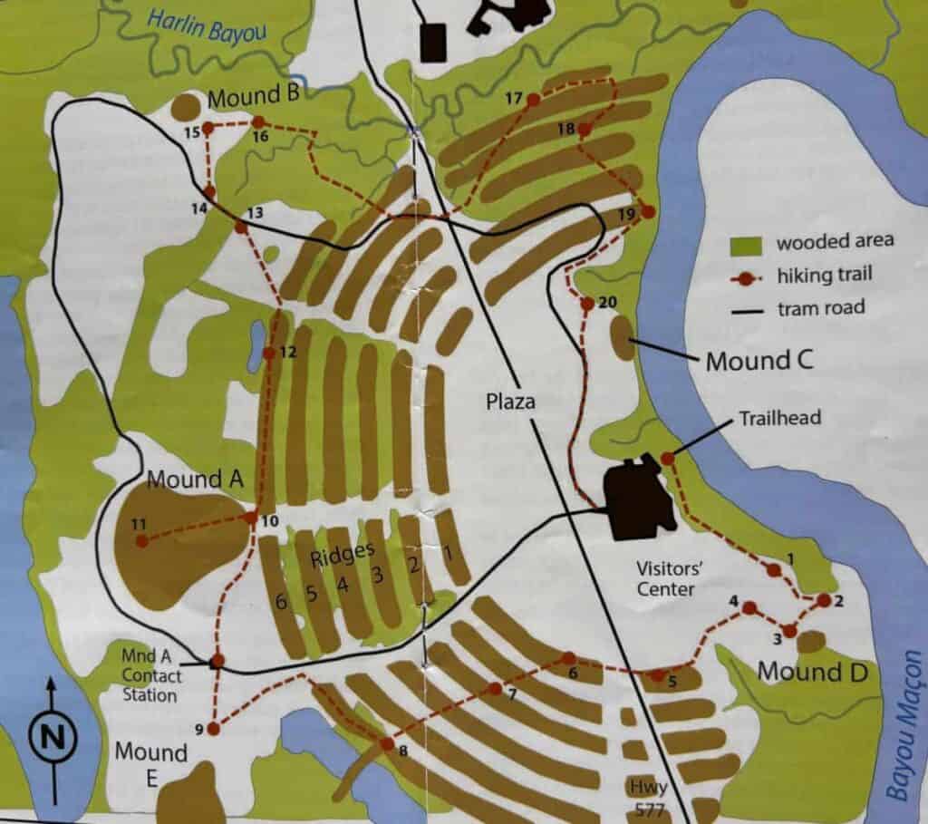
Credit: Poverty Point Heritage Site
NOTE: The self-guided driving and hiking guide has a QR code for the app at the back of the booklet.
Take a self-guided walking tour adventure
This path is meant for you to explore on your own. We carefully read the brochure as we reached each numbered stop. I previously had no knowledge of this UNESCO World Heritage site. It’s clear that there’s a gap in what we learn in history class. Many questions exist about how this place was created, but there are few answers. As we explored the tour stops, I considered how the ancient people who lived here may have used these monumental features in their daily lives and ceremonies. What do you think the purpose of these earthworks might have been? How do you believe they might have influenced the development of other ancient cultures in the region?
Note: The trail is mostly in the sun with some shade. Be sure to have sun protection and plenty of water. Walking the mowed path is simple. We recommend wearing comfortable shoes, a wide-brimmed hat and, insect repellent in the summer.
Insights on the Self-Guided Walking Tour: Discovering Stations 1-4
Station #1: Top of the Dock: Workers built this low hill by adding dirt. The goal was to keep the plaza out of sight until travelers coming to the dock reached the top of the hill. You could see the mounds from the top of the hill. Just a few steps into the plaza, when visitors turned around, they could no longer see the dock where they had come from.

Station 2: The dock at the southeastern corner of the plaza slopes down toward Bayou Maçon. Archeologists theorize that it’s likely that waterways played a key role in trade and transportation for the ancient inhabitants. Poverty Point had a strategic location for long-distance trade, and its positioning on Macon Ridge was important in developing its complex trade networks. The elevation of the ridge protected against flooding, so the people living there could maintain a stable settlement even during heavy rainfall. This natural advantage, combined with proximity to waterways, made Poverty Point a hub of cultural exchange and trade.
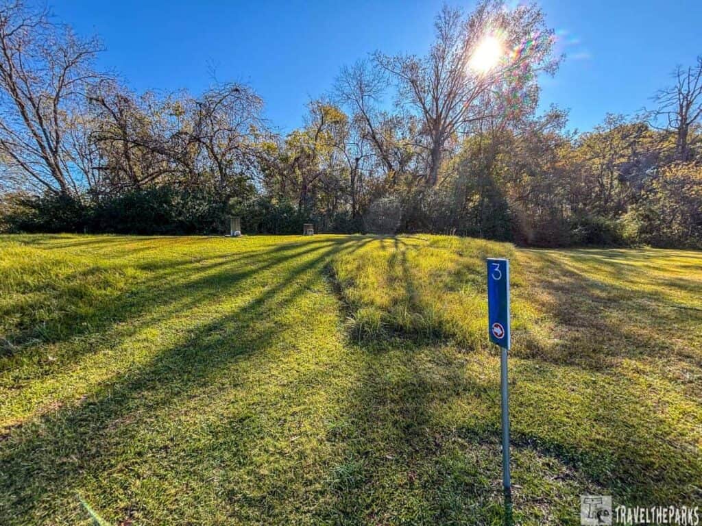
The Hidden Roles of Stations 3 and 4 in Ancient Earthwork Systems
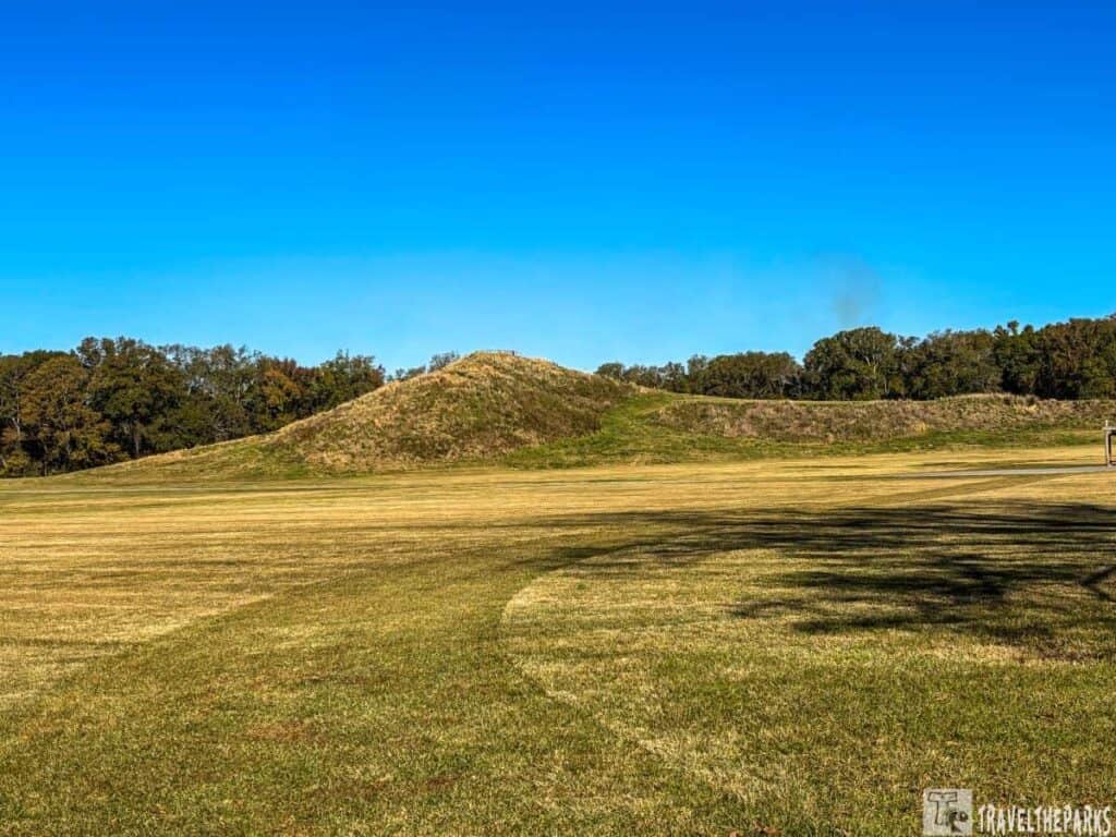
Mound D is one of the smaller mounds at Poverty Point, but it is still significant. This mound represents a considerably later occupation at the site-the Coles Creek culture (700-1100 AD). This mound sits atop a ridge that the Poverty Point culture (1700-1100 BC) constructed. Artifacts and pottery shards have been collected here. I believe early Europeans might have used the mound’s peak as a burial ground. Interestingly enough, this holds the graves of two women who lived in the area during the Poverty Point Plantation era. Death came to them in August 1851, and their headstones remain visible today. This newer Coles Creek mound offers an engaging window into the site’s long and layered history.

Why are The Ridges so significant at this Heritage Site?
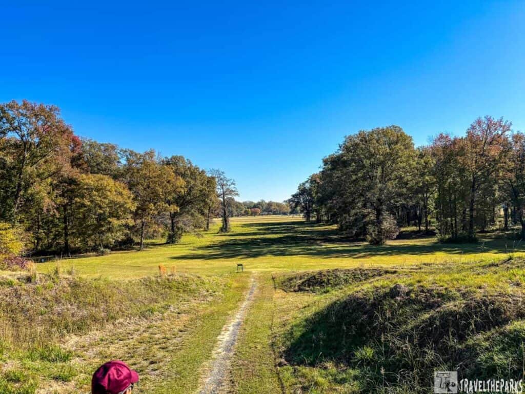
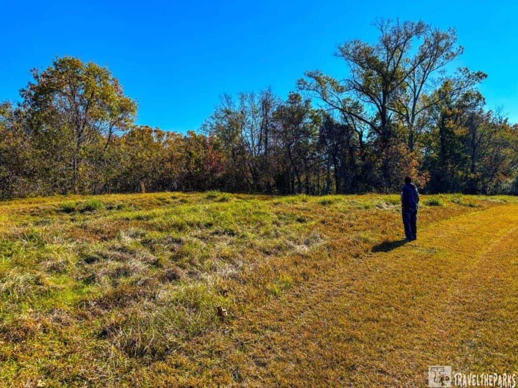
The ridge structures at the Poverty Point World Heritage Site are important because they represent the engineering capabilities of their builders. These ridges were constructed approximately 3400 years ago. Poverty Point represents an area of approximately 400 acres, and the earthworks, including ridges and mounds, had to be built over generations. Archaeologists speculate that the residents used baskets or other forms of containers to carry the dirt to build each ridge. Many believe they served many functions, including serving as platforms for houses and social gathering spots. The extent of the earthworks shows that the site was more than a temporary camp; rather, it represents long-term, sustained occupation.
The ridges form the most dramatic feature of this site. These 6 large, concentric C-shaped earthen ridges surround a central plaza. The tallest ridge is over 6 feet high. The lowest less than 1 foot in height.

Stations 5 through 7: What Archaeologists Are Discovering About Poverty Point’s Past
Station 5 Ridge 1 South: A large circle defines another important archaeological discovery marked out by white cylinders. The excavation of soil cores and this site showed that these were once circles formed by large wooden posts. Some are as thick as 2.1 feet (65 cm) in diameter. Radiocarbon dating of these samples showed that the oldest posts date back to 1630 BC, with the youngest around 1100 BC. Researchers believe these posts formed part of an extensive structure or ceremonial area. Thus, further highlighting Poverty Point’s mystery and importance as a major center of trade and culture.
Note: The area served as a graveyard well into the 19th century. However, it was eventually plowed after the wooden grave markers had rotted away. This delayed plowing left the C-shaped earthen ridge 1 intact and still partly visible, with its origin in antiquity.
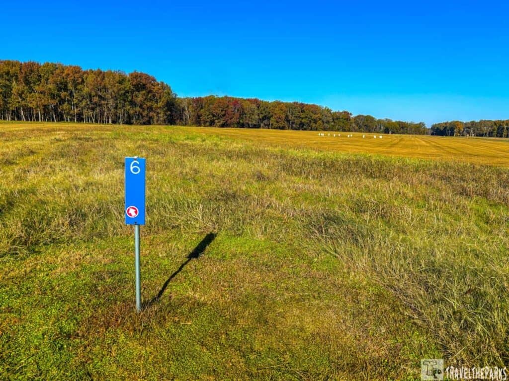
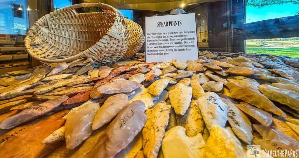
Station 6 Ridge 1 Southwest: From this station, you can see just how impressive the height of the ridges is. They vary from 0.3 to 6 feet. The park leaves the ridge area grasses tall so that you can easily see the spacing. Artifacts discovered here include cooking balls, stone projectile points, knives, and other debris that were carbon-dated from 1530 to 1150 BCE.
Station 7: Surveying Monument is a small concrete marker that is used to establish a reference point for mapping the site. There are 5 markers throughout the site.
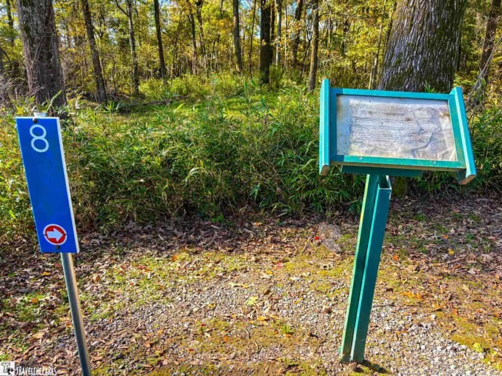
A Look at Stations 8 and 9: Connecting the Dots at Poverty Point National Monument
The Causeway is a raised earthen path that crosses a shallow depression outside the southwestern section of the ridges. Spanning approximately 295 feet long by nearly 50 feet wide, it connects various parts of the site.
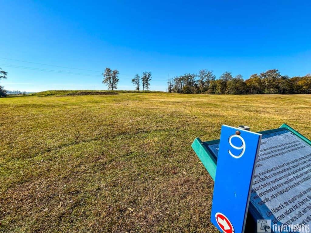
Mound E (1500 BCE) though it’s not as prominent as the larger mounds like A and B. It’s a low, flat-topped, roughly rectangular mound, reaching 13 feet tall with sides measuring approximately 360 feet by 300 feet. The purpose of Mound E. Its purpose baffles archaeologists, as they have found no evidence to suggest its use. Hmmm, I wonder what its purpose was?
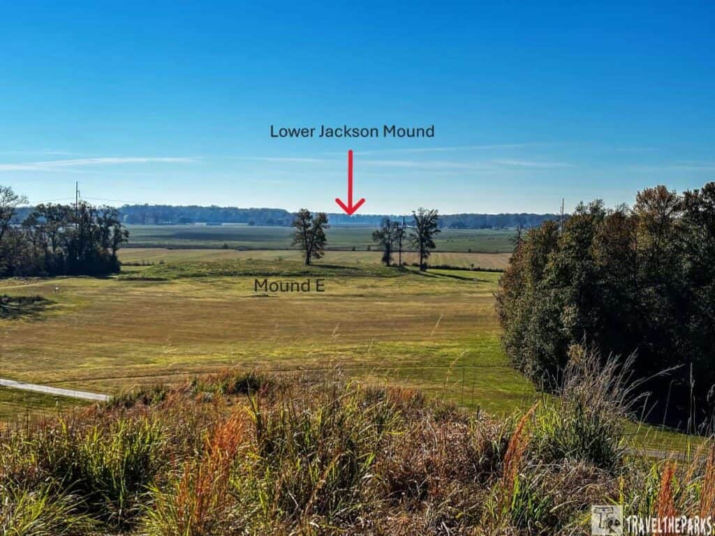
What interested me most, however, is the north-south line up of Mounds A, B, and E at Poverty Point into the alignment with Lower Jackson Mound. This itself represents an amazing aspect of this site. In fact, archaeologists have dated Lower Jackson Mound (15 miles south), a Middle Archaic mound, to be as much as 1500 to 200 years older than Poverty Point. Did the builders intentionally align the mounds? One leading theory proposes that the builders oriented these mounds to events, such as the solstice, equinox, and other significant astronomical phenomena, such as the position of the North Star, or Polaris.
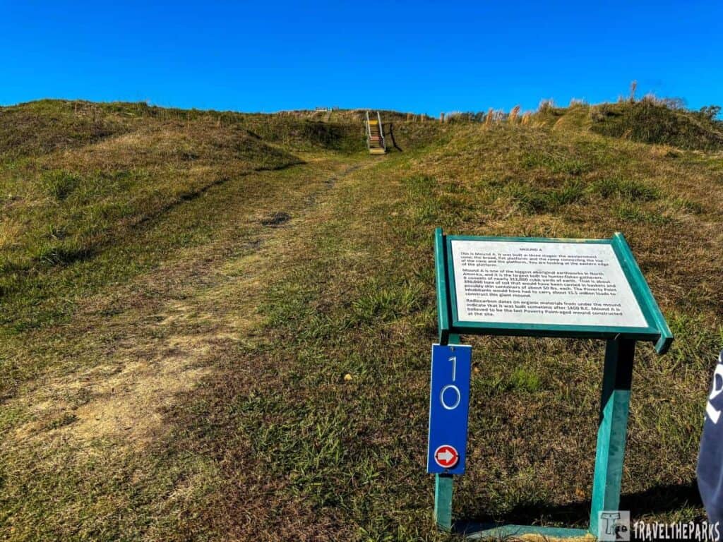
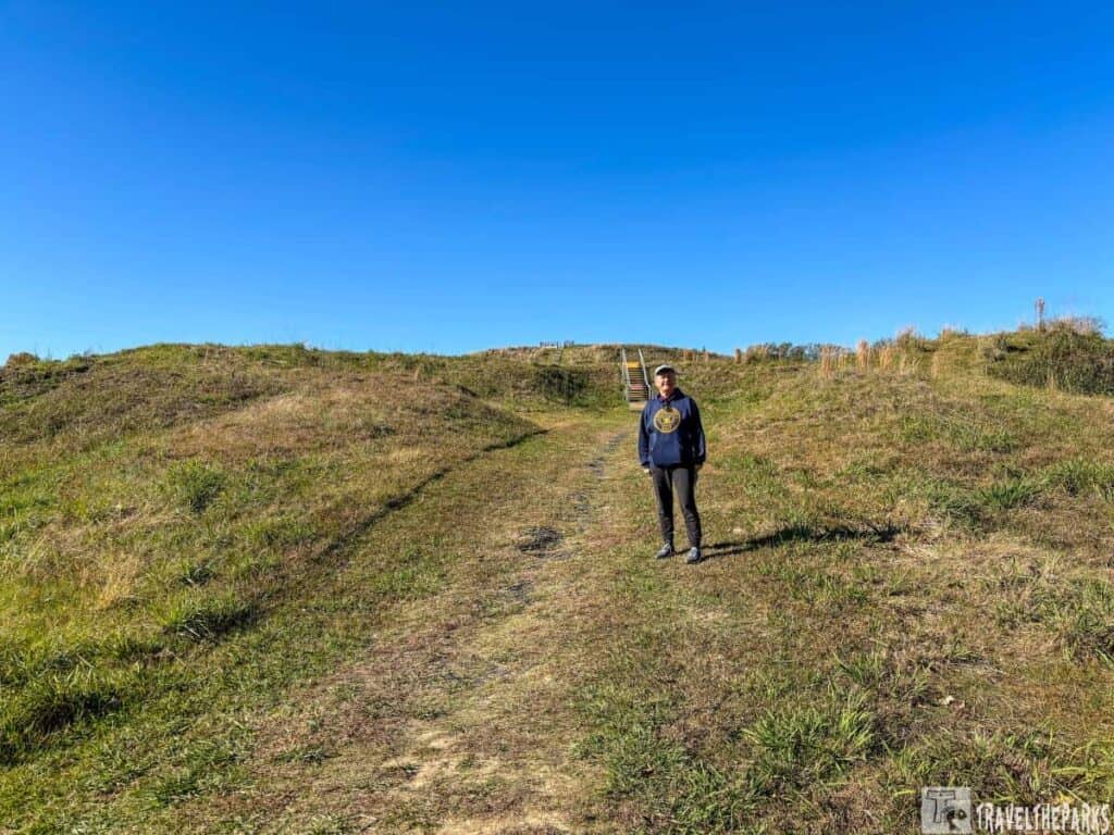
Reaching New Heights: The View from Mound A at Poverty Point
The engineering prowess of the ancient builders, who moved millions of cubic yards of earth to create this sacred landscape, is truly remarkable. Ascending the 72-foot-tall Mound A, the largest of the structures, at 710 feet long and 660 feet wide.
The top affords an incredible panoramic view of the entire site and the surrounding Bayou Maçon wetlands. Archeologists believed that 15.5 million baskets of earth were used to construct this mound. This prominent mound was likely used for ritualistic purposes or as a residence for important figures. It underscores the sophistication of the ancient culture responsible for this impressive archaeological layout.

Station 12: Borrow pit is a depression in the ground created by the removal of soil or other materials. These pits were used to source the earth and sand needed to construct the massive mounds and ridges that define this site.

Station 13: Old Harlin Bayou’s proximity to the site provided a reliable source of water for drinking, cooking, and other domestic needs. Over time, the course of the bayou has changed. Today, the water flows through a different part of the Poverty Point site.
The Mystery of Mound B at Poverty Point
Station 14: Mound B Field is a large open area that has a log fire pit for evening programs put on by the park. Small groups of hunter-gatherers who roamed the area probably used it. Researchers collected artifacts here.
Digging Deeper: The Mystery of Mound B at Poverty Point
Mound B is one of the earliest structures built at the site, dating back to around 1700 BC. It’s a smaller, conical mound, reaching a height of about 21 feet and a diameter of 180 feet. Again, while its exact purpose remains a mystery, archaeologists believe it may have served multiple functions. It could have been a residential area, a ceremonial platform, or a place for storage. The discovery of charcoal, fire pits, and post molds suggests that it may have been used for various activities.

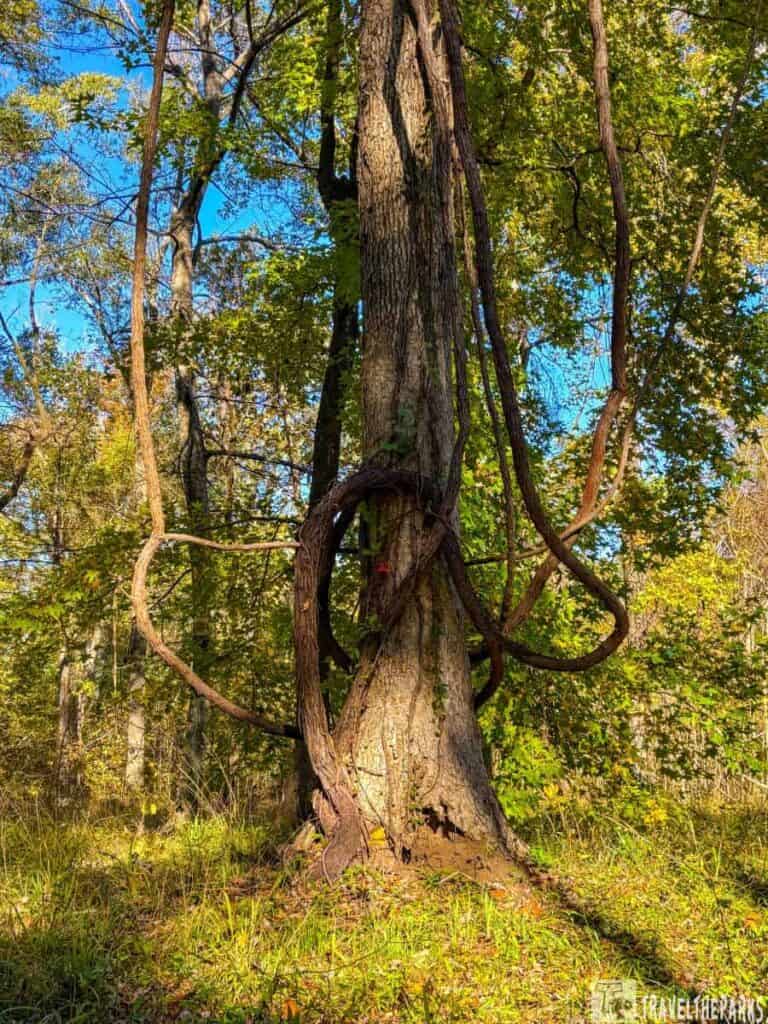
- Station 16: Nature Watch: We just kept walking. It is a place dedicated to observing the local wildlife and the natural environment. Squirrels were the only animals we saw today.
- Station 17: Harlin Bayou, similar to Old Harlin Bayou, is a key waterway in the region. Today it plays a role in the area’s ecology, offering a habitat for a variety of wildlife species.
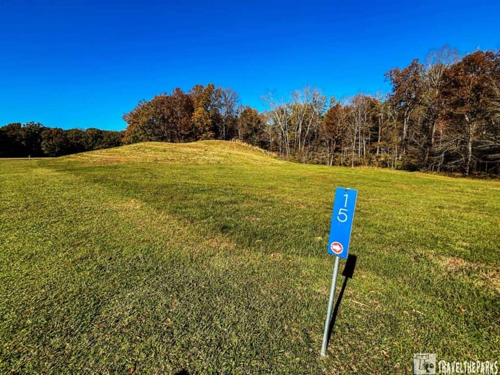
- Station 18 & 19: Ridges 1 & 4 North were more ridges. They are likely similar in purpose to the other ridges, serving as a marker or boundary within the site’s intricate layout.
Mound C: The Culmination of Poverty Point’s Ancient Legacy
Mound C (1650 BC), unlike other mounds, it’s the only one located directly within the central plaza. It’s a small, oval-shaped mound, measuring approximately 260 feet long. It has 16 distinct layers, each with its own color and texture. Its significant remains uncertain.
Tips for Your Visit to Poverty Point
- Wear comfortable shoes: the easy-to-navigate earthworks and trails require comfortable walking shoes, as the site covers a vast area.
- Stay hydrated: the Louisiana heat and humidity, especially in summer, can catch visitors off guard, so be sure to bring ample water.
- Bring a camera: the breathtaking views from Mound A and the park’s nature trails make this ancient landscape worthy of photographic documentation.
Camping at Poverty Point Reservoir State Park
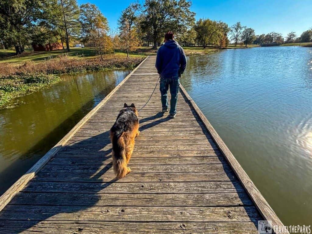
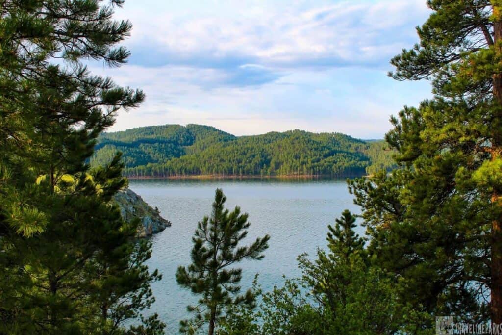
We camped at Poverty Point Reservoir State Park. It is a great locale to enjoy the natural amenities of Louisiana. Not to mention proximity to the historic Poverty Point archaeological site and the beautiful Poverty Point Reservoir. This park allows both tent camping and RV camping. The 2,700-acre artificially made lake. The centerpiece of Poverty Point Reservoir. Here you can hike the trails, rent a kayak to paddle the bayou, or simply enjoy the views. As part of the Mississippi flyway, the bayou is a birdwatcher’s paradise.
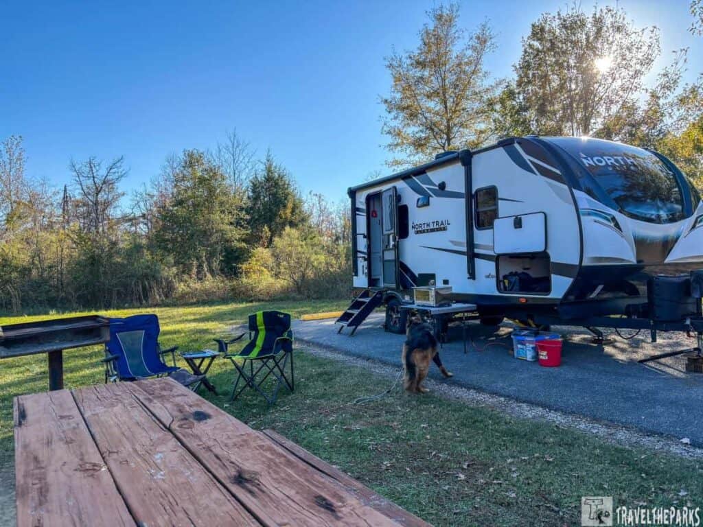
The park has 45 full-hookup RV sites, providing convenient amenities for campers with recreational vehicles. These sites offer electricity, water, and sewer hookups. Some sites are larger, making them suitable for larger RVs and motorhomes. Pull-through and back-in sites are available. For those who don’t enjoy camping, there are over-water bungalows available for rent.

During our stay in the park, we did the hike around Marsden Mound. It is one of several mounds within the boundaries of Poverty Point State Park, though it is considerably smaller compared to the more famous Mound A or Mound C. It still contributes to the overall complexity of the landscape of the site. Like other mounds, Marsden Mound is a large earthwork built by the prehistoric people who once occupied the region.

Final Thoughts: A New Perspective: Exploring History At Poverty Point
Poverty Point is not merely an archaeological site but a window into the complex, sophisticated society that once thrived in the prehistoric Mississippi River Valley. So when you stand here, you’re not just looking at a bunch of old dirt piles. You’re seeing the blueprint for what came later places like Crystal River, which took the burial-mound idea and turned it into a ceremonial hub on Florida’s coast, or Chucalissa, where they packed houses and plazas around a central platform much later on. Wickliffe picked up a similar layout but focused heavily on pottery styles and trade networks, while Cahokia—well, Cahokia blew the whole thing up into a city with woodhenges and a mound you could see for miles. It’s not the biggest or flashiest, but it’s the seed.
This remarkable location offers an unforgettable journey back in time, captivating visitors fascinated by history, archaeology, or the natural beauty of Louisiana. A day spent exploring Poverty Point leaves one with a profound appreciation for the ingenuity and cultural richness of the ancient peoples who once called this place home. Next up on this road trip is Moro Bay State Park in Arkansas.
We’d love to hear your thoughts! Share your reflections or questions about Poverty Point in the comments below.
M. Darlison
This looks interesting. I will definitely add this to our bucket list for our next roadtrip.