Have you ever wondered about the hidden wonders of Pictured Rocks National Lakeshore? We didn’t plan every second of our road trip. To tell you the truth, that’s what makes living in an RV so great — you don’t have to have a detailed itinerary. Some of the coolest journeys bloom simply from a rough concept, a great playlist, and some snacks. Our plan was to explore Pictured Rocks National Lakeshore in Michigan’s Upper Peninsula. We were excited about the prospect of kayaking alongside majestic cliffs and strolling along the trails by the lake. It had us buzzing with excitement.
This post may contain affiliate links, meaning if you purchase something through one of these links, we may earn a small commission at no extra cost to you! Read the full disclosure policy here.
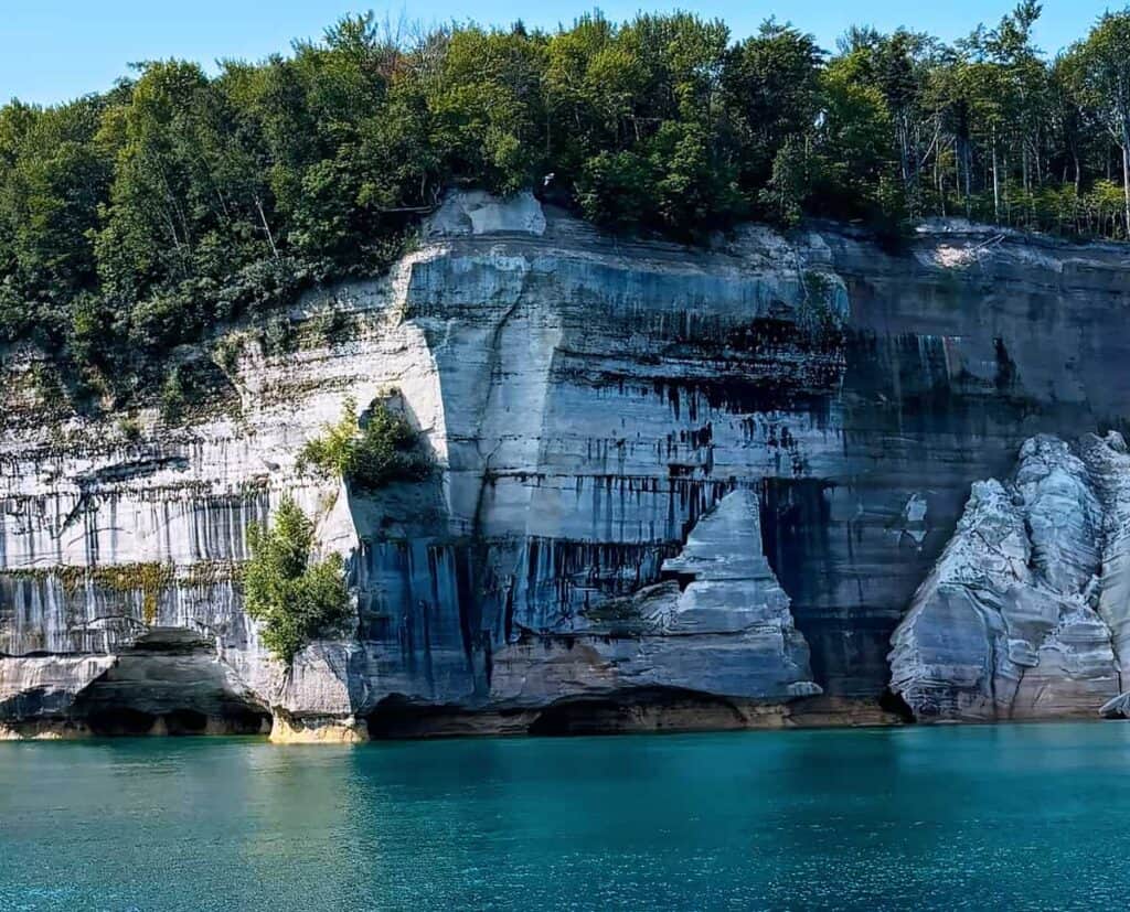
Table of Contents
How do you get to Pictured Rocks National Lakeshore?
Pictured Rocks National Lakeshore is truly a sight to behold. Directly on Michigan’s Upper Peninsula, this remarkable area has been a favorite for visitors for years. The National Park Service manages this national lakeshore. While it may not be a national park in the conventional way, this park attracts visitors because it provides an isolated feel. The coastline, spanning 42 miles from Munsing to Grand Maris, is famous for its colorful sandstone cliffs. You can reach Pictured Rocks National Lakeshore by:
- Car: It’s accessible via U.S. Highway 41 and Michigan State Highway 28. There are multiple entry points and parking areas throughout the park.
- Air: The nearest major airport is in Marquette, Michigan, about an hour’s drive from Munising.
- Bus: Some bus services connect to Munising, but it’s less common.
Useful Information for Visitors to Pictured Rocks NL:
- Operating Hours: The park is open to visitors 24 hours a day, 365 days a year. The Munising Falls Visitor Center is open year-round from 9:00 a.m. to 5:00 p.m. During the summer is the Grand Sable Visitor Center is open from 9:00 a.m. to 5:00 p.m/. It is closed September 30 – May 31. To find out more about other facilities, visit the park’s official website or contact them directly: 906-387-4025 or 1-800-544-4321 (toll-free).
- Entrance Fees: An entrance pass is required to access Pictured Rocks National Lakeshore. A standard pass is $15-$25. Highly recommend purchasing the America the Beautiful Annual Pass. This pass allows entrance to all National Park Service sites for one year.
- Best Time to Visit: Summer (June-August) is the peak season. Warmest weather for hiking, kayaking, and boat tours of the colorful rock formations. Expect larger crowds and higher prices for accommodations. Fall (September-November) Fall is a fantastic time for visiting if you enjoy cooler weather and stunning fall foliage. Crowds thin out. Spring (April-May) Spring is a lovely time to see the park come to life with blooming flowers and less crowded trails. The weather can be unpredictable. Winter (December-March): Winter brings winter sports like cross-country skiing or snowshoeing, and unique ice formations along the lakeshore. Solitude at its best.
- Accommodation: Pictured Rocks National Lakeshore features three charming drive-in campgrounds: Little Beaver Lake with 8 sites, Twelvemile Beach offering 36 sites, and Hurricane River which has 21 sites. Campgrounds do not have electric, water, or sewer hookups. Each campsite comes equipped with a picnic table, a fire ring with a grill grate, and a tent pad. You’ll also find vault toilets and well water available at the campgrounds. Book reservations through recreation.gov.
Exploring the Azure Waters of Pictured Rocks National Lakeshore
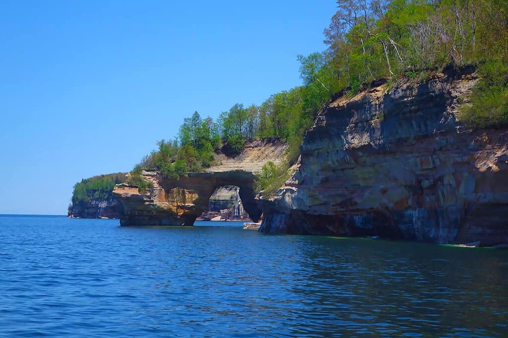
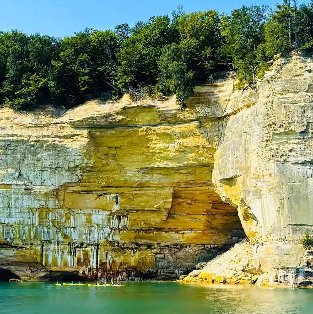
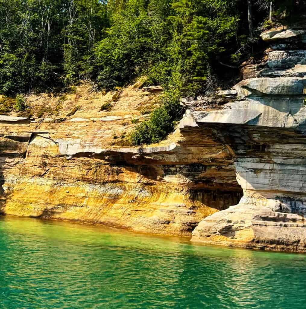
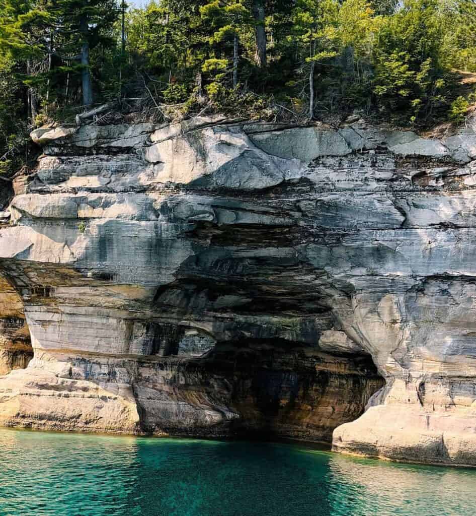
The mythic cliffs here stand at an astonishing 200 feet over the blue waters of Lake Superior. Lake Superior’s erosional forces — by wind, rain and waves — shaped these cliffs over thousands of years. Lake Superior is renowned for its incredible landscape. These cliffs are proof of the untiring nature of nature. Oh! the tales they would share. The extraordinary coloring is a result of mineral deposits within the rock. These iron-rich sediments also form the complex orange, red, green, and blue striations on the rock faces. We were especially looking forward to finding secret sea caves, climbing gigantic arches, and backpacking waterfalls in this landscape.

Just past the cliffs, the lakeshore boasts thick boreal forests, beautiful beaches, and a variety of wildlife, including black bears, bald eagles, and the rare gray wolf. Whether you’re trekking along the picturesque trails, kayaking in the clear waters, or soaking up the stunning views, Pictured Rocks National Lakeshore gives you a deep connection to nature and a chance of discovering its amazing geological and ecological treasures.
What are the Must-Sees When Visiting Pictured Rocks National Seashore?
The national lakeshore is 42 miles long. Exploring Pictured Rocks National Lakeshore, you can discover over 10 inland lakes, and nearly 100 miles of trails. During our short stay, we focused on a few must-see highlights—this guide covers our top picks, though there’s still plenty we didn’t get to!
1. Pictured Rocks Boat Tours—The Best Way to See the Cliffs from Lake Superior
On this road trip, seeing Pictured Rocks from the water was hands-down the highlight of our visit. The boat tour glided along Lake Superior’s crystal-clear shoreline, giving us front-row views of multicolored cliffs, sheltered caves, and those famous painted rock walls that seem to change color with the light. Our captain pointed out landmarks like Chapel Rock, The Castle, and a whole lineup of other formations. The water vistas give you an entirely new appreciation for just how pretty yet rough this really is. It’s one of those things where photographs can’t really do it justice — you really just need to see it for yourself.
PRO Tip: Since these tours are super popular, it’s smart to book ahead during the busy season.
2. Start your adventure at the Munising Falls Visitor Center in Pictured Rocks
We parked our RV near the Munising Visitor Center and were happy to find beautiful Munsing Falls just a short walk away—a nice way to unwind after our drive.
Once inside the Munsing Visitor Center,(Western Gateway) we found a trove of stuff to help bring Pictured Rocks National Lakeshore to life. With educational displays about the unique geology and shipwreck stories of the region, touch screen information, and wildlife, the center felt more like an adventure than learning. It was fun, accessible, and surprisingly interactive — perfect for kids and grown-ups like us. After our visit of the displays, we grabbed some detailed trail maps. We asked the knowledgeable staff for suggestions regarding the best hiking for our particular skill set and interests. The perfect first stop, it provided everything we needed for an introduction to our incredible adventure of Pictured Rocks.
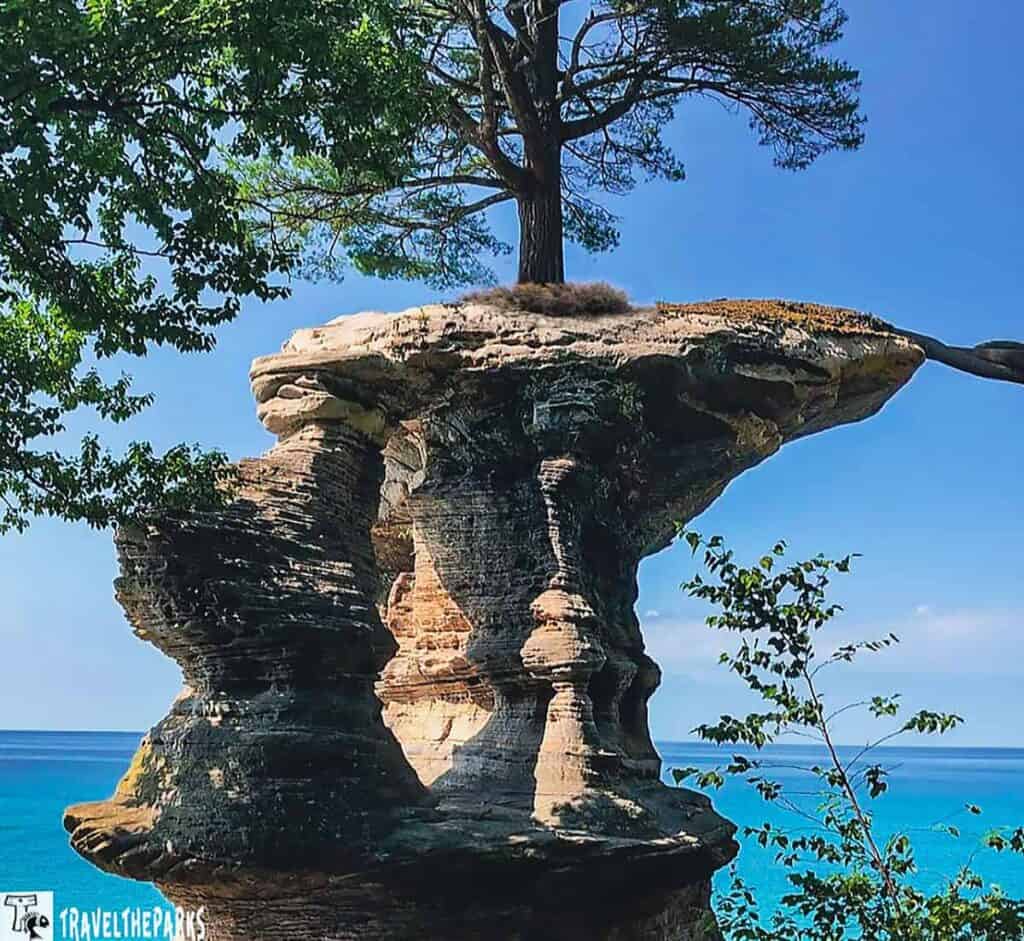
3. Hike to Chapel Rock Loop Trail: A Must-Do Trail in Pictured Rocks
If you only have time to hike one trail during your trip to Pictured Rocks, this is the one you must hike. The Chapel Loop Trail hike leads you to the magnificent Chapel Rock and equally wonderful Chapel Falls. We accessed the Chapel/Mosquito trailhead parking lot off Chapel Road. The 10-mile round-trip trail leads you through forested ground, along lakeshore cliffs and rocky beaches. We started the loop beginning with the Mosquito Trail to Mosquito Falls.
Continuing toward Chapel Rock, it wasn’t long before it came into view. A lone pine tree sits atop a remarkable sandstone formation. It’s connected to the mainland, though just barely. For me, it was a great photo spot. For us, it was an easy but long walk with some rolling hills in between. We walked toward Chapel Falls. It is quite romantic 60-foot cascading waterfall into Chapel Creek. They are most lovely in spring and early summer when the water run is highest.
PRO TIP: If you plan on doing any hiking, we recommend each person should bring at least one liter of water per hour to drink. Protect yourself from the sun and heat by also wearing sunscreen with a high SPF. Wearing a hat is a must. No pets are allowed on the trail for safety reasons.
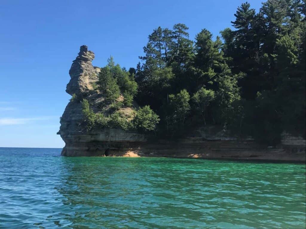
4. Visit Miners Castle—one of the most iconic spots in Pictured Rocks
One cannot visit Pictured Rocks National Lakeshore and skip the Miners Castle–the park’s most recognizable and photographed rock formation. We could not believe how accessible it was. Just a short drive from Munising, paved trails lead to nice viewing platforms looking out at the cliffs, Lake Superior and the “castle” itself.
That is one of those places that you get out of the car and immediately reach for your camera. With the layered rock, vertical topography, a deeper blue water at the bottom, it seemed like a postcard. Miners Castle is a must-see on any Pictured Rocks itinerary.
PRO Tip: Catching the sunset here can be absolutely breathtaking.
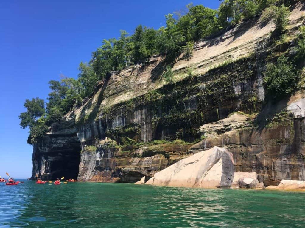
5. Kayaking Pictured Rocks: A Paddle Through Wonder
Paddling on Lake Superior, we instantly understand why kayaking at Pictured Rocks is a must-do. We chose the 5-mile ultimate guided kayak paddle. This tour took us past Lover’s Leap, under overhangs, and into secret coves that you can’t get to on foot. Navigating beneath sheer 200-foot sandstone cliffs, we marveled at the colors of the rock formations. Early sunlight colored the rocks with stripes of red, orange, and green. And the water here is so clear. You could see the bottom even at 20 feet deep.
At the end of our paddle, I glanced up to see the solitary pine of Chapel Rock clinging to its ledge with roots stretching across a rock bridge. In some spots, the sea is so glassy that the reflections resemble beautiful paintings. It is hard to put into words what we were experiencing. Nature’s cathedral is best seen from the water. I was so mesmerized I forgot to take pictures.
PRO Tip: Be aware that Lake Superior’s conditions can change fast, so be sure to check the weather before you go.
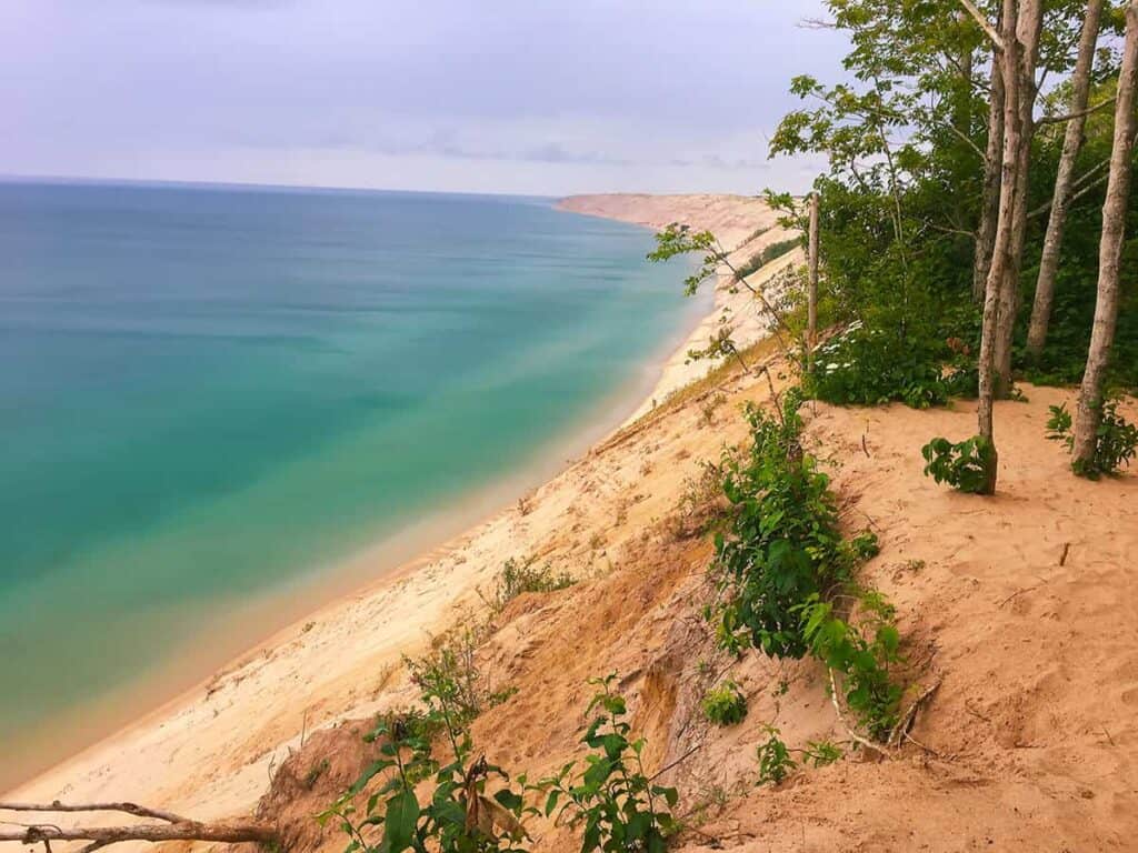
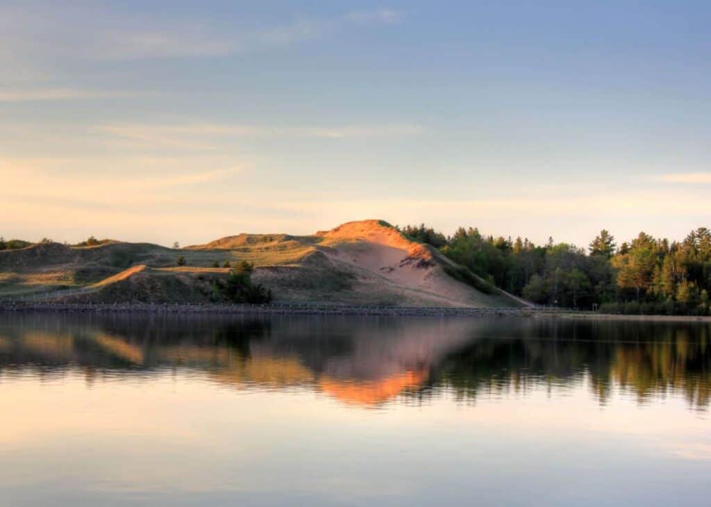
6. Grand Sable Dunes: Towering Sands Above Lake Superior
The dunes extend five miles along the Lake Superior shore, peaking at 300 feet. They reminded me of our adventure hiking at Indiana Dunes National Park. The 1-mile out and back trail is easy to follow, crossing Sable Creek. Though I must say walking is harder on the dune’s crest, keep going; it’s worth it.
We saw a sweeping, almost surreal landscape—massive golden sand dunes rolling toward the horizon as we looked east across Grand Sable Dunes. It was picture perfect framed by the deep blues of Lake Superior on one side and the dense green of northern forests on the other. The view is vast, and humbling—like standing at the edge of a forgotten desert perched above a freshwater sea.
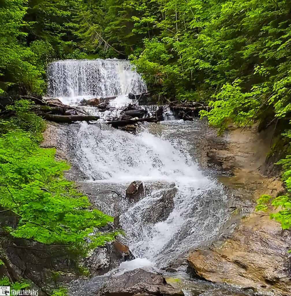
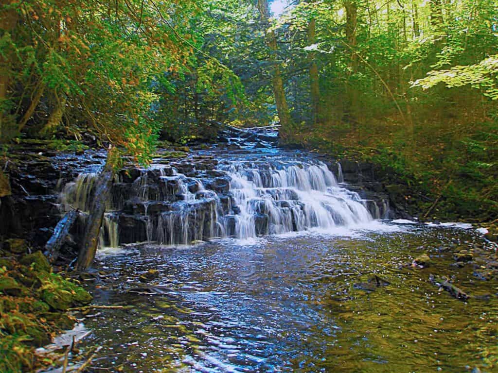
7. Visit Sable Falls: A Peaceful Hike to a Cascading Gem
The 0.5-mile hike to the 75-foot Sable Falls for us was a worthwhile 0.35-mile trek. Part of the North Country Scenic Trail, it was well-maintained, with 168 wooden steps that made navigating the descent to the waterfall much easier. While the stairs might be uneven and the trail slippery, good footwear made it safer. Here, by the falls, there are a series of rock ledges forming a multi-level fall. I just adore the water flowing down after a rainfall. It’s such an ideal photo spot. Because of the rainy day, we did not continue through to the beach. We did, however, make a brief stop for passport stamps at the Grand Sable Visitor Center (Eastern Gateway)
Pro tip: In the summer, the biting flies and mosquitoes are horrendous, so bring plenty of bug spray.
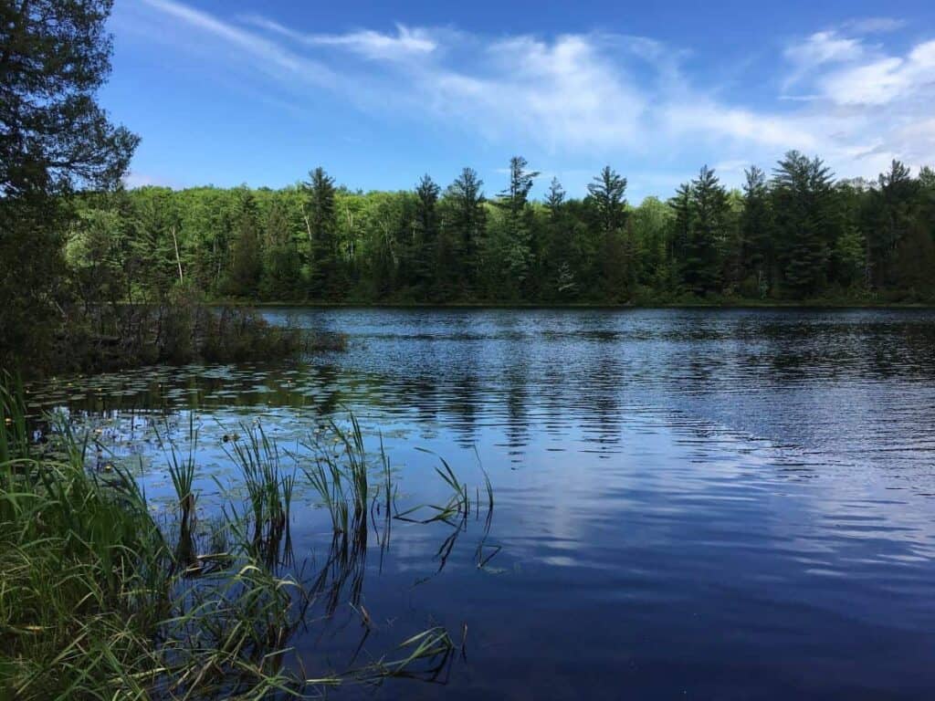
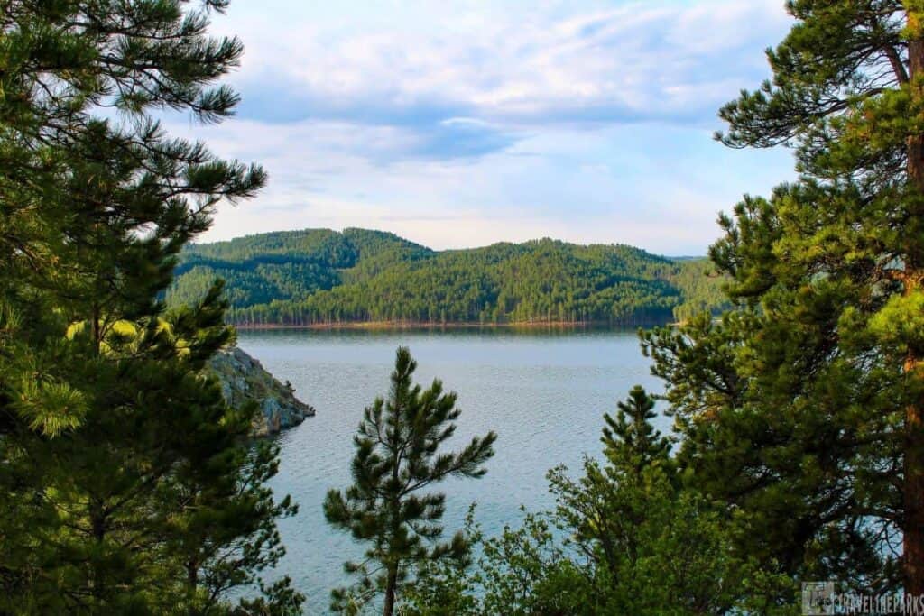
8. Beaver Pond Trail: A Quiet Walk Through Wetlands and Wildlife
We camped one night at the Little Beaver Lake Campground. It’s an off the beaten path little campground with great access to the Beaver Basin Wilderness. The Little Beaver Nature Trail is a scenic 1-mile loop near Little Beaver Lake Campground, about 20 miles northeast of Munising. This easy trail winds through hardwood forests, wetlands, and along the lake’s edge. In the spring it offered us views of wildflowers, beavers, and songbirds. We walked the connector trail to Twelvemile Beach, where it intersects with the North Country Trail for a longer hike.
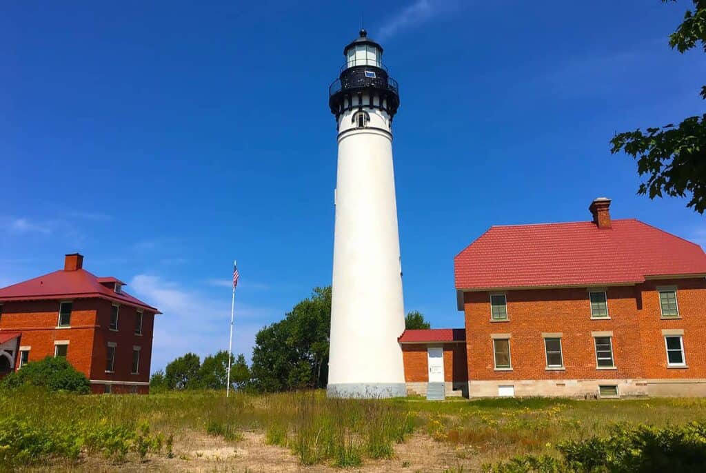
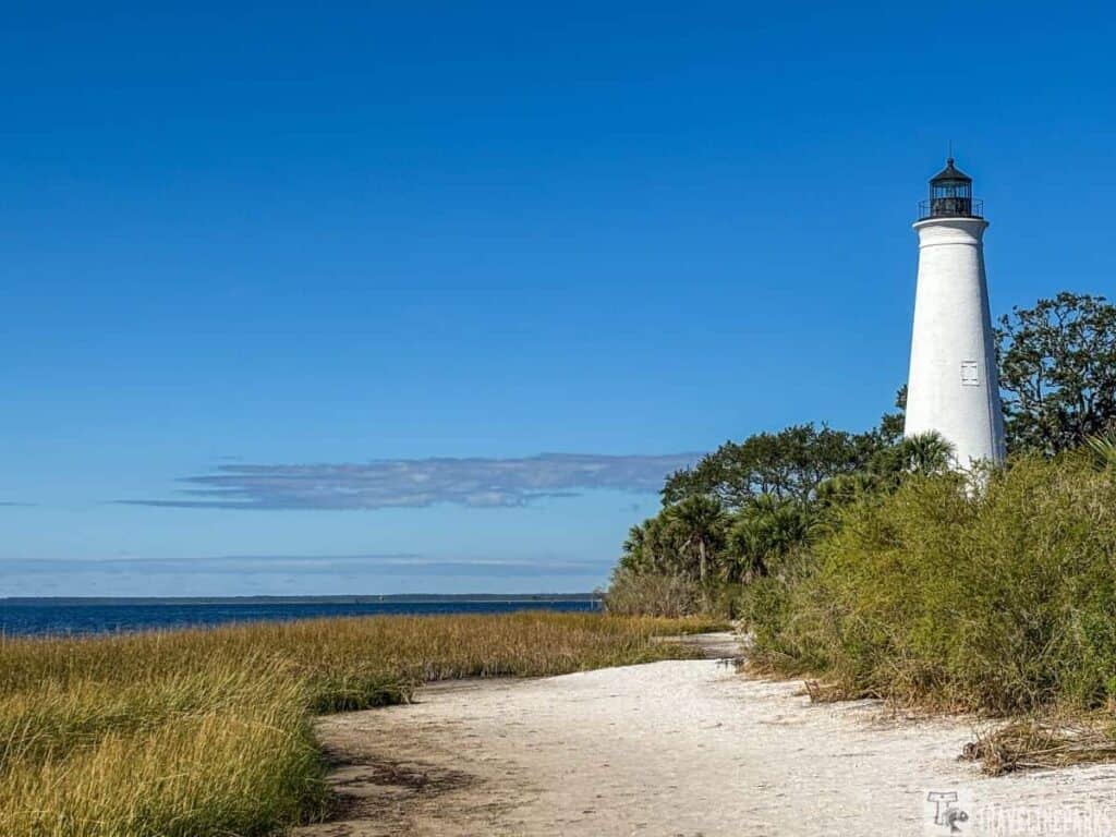
9. Exploring Au Sable Lighthouse: A Step Into Lake Superior’s Maritime Past
Constructed in 1874 to illuminate the perilous “Shipwreck Coast,” its 86-foot tower, designed by Colonel Orlando Metcalfe Poe, originally housed a third-order Fresnel lens to help navigate ships through fierce storms and fog that caused disasters like the Lady Elgin in 1859. Built in 1874 to guide ships along the treacherous “Shipwreck Coast,” the light station rises 86 feet, a design by Colonel Orlando Metcalfe Poe that first harbored a third-order Fresnel lens. The beacon lit the way during storms and fog that swallowed so many vessels, including the tragic Lady Elgin in the waters of 1859.
Since we were already camping at the Hurricane River Campground, we hiked 1.5 miles to see the restored 1909-era Au Sable Lighthouse. The trail is an old access road, easy to follow. The keepers’ lonely, tough lives on this southern headland are the focus of 30-minute guided tours offered at half-hour intervals from mid-June until early October. We ascended its 98 steps for stunning views of Lake Superior and the Grand Sable Dunes. From this vantage point we could also see tatters or remains of old shipwrecks, such as the Mary Jarecki, on the shore.
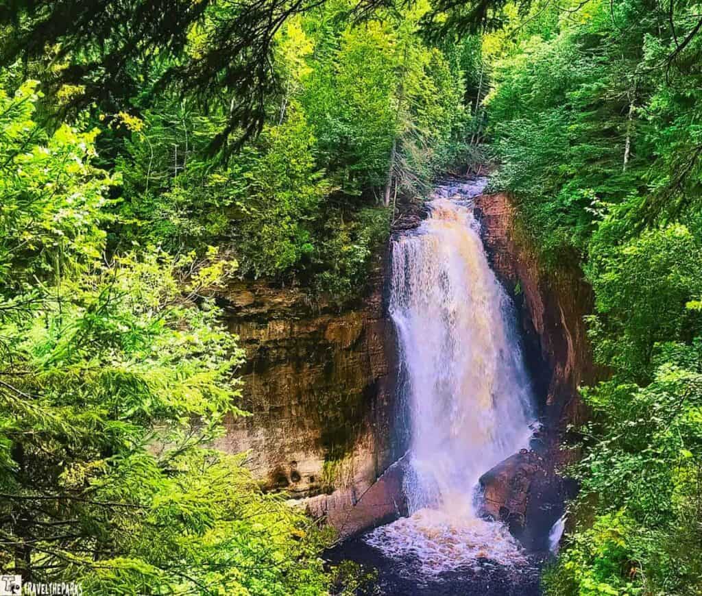
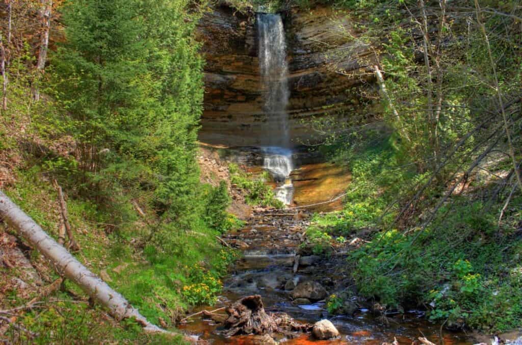
10. Exploring Pictured Rocks National Lakeshore: Hike to the Powerful Miner’s Falls
We walked the 1.2-mile round trip from the Miners Castle overlook, parking off Miners Castle Road—about 7 miles northeast of Munising. The trail is gravel, mature pine and hardwood forest. Interpretive signs along the trail outline the geologic history of the area. Closer to the last turn, there is a solid platform that juts out over the canyon. Miners Falls plunges 40 feet straight into Miners Basin. The steady Miners River feeds the falls. It is completely surrounded by thick forest, making for postcard views. We combined this trail with a visit to nearby Miners Castle and the Au Sable Light Station.
Check out Grand Marais Harbor
This charming little town is your gateway to the park’s eastern side. You’ll discover adorable shops, delicious eateries, and a great harbor atmosphere. The harbor is a hub for local fishing and boating activities. This lovely harbor town serves as the eastern entrance to Pictured Rocks National Lakeshore. What we enjoyed most were the opportunities to take a walk along the breakwater, check out the historic Outer Range Light, and just take in the scenery where Lake Superior touches the sky. In the evenings, it’s a great place to unwind after hiking and seeing the sights. It has lots of places to dine while appreciating the beauty of Michigan’s Upper Peninsula.
Pro tip: It’s an ideal place to relax and enjoy the local vibe after your park explorations.
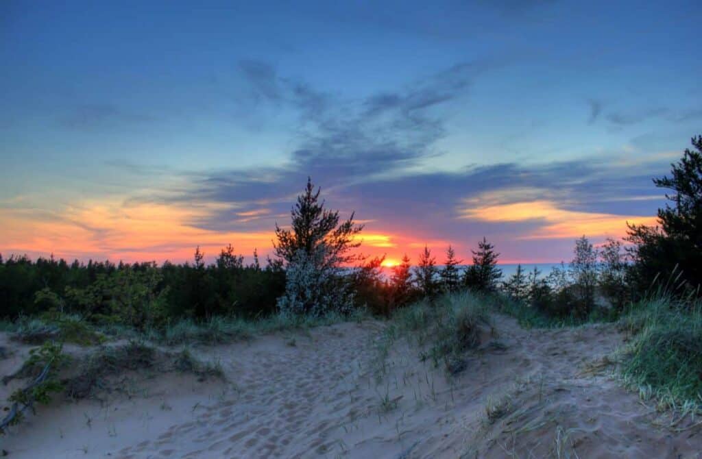
Final Thoughts: Exploring Pictured Rocks National Lakeshore
As the sun dipped below the horizon, coloring the sky with hues of orange and violet, the cliffs of Pictured Rocks remained still—unmoved by our presence, yet profoundly affecting us. Shaped by time and the elements, they serve as a reminder that beauty often emerges from persistence, from slow, unseen forces that work patiently over time.
Standing at the edge of Lake Superior, observing the light diminish over the water, we were reminded of our smallness—and how important it is to simply be present in a place molded by ages. These moments are not just memories; they are quiet lessons in humility, awe, and the lasting rhythm of the natural world.
Have you explored Pictured Rocks? Share your favorite spot or hidden gem in the comments—we’d love to hear about your adventure!