Table of Contents
All Images Credit D. Carrion-Jones
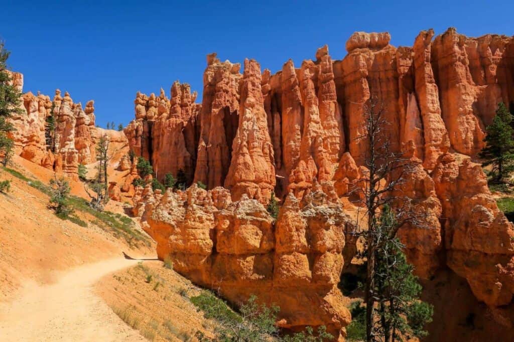
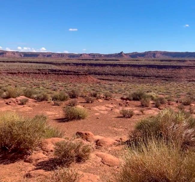
A place of striking beauty and cultural significance, Bears Ears National Monument, can be found in the heart of the American Southwest. Within the monument lies a hidden gem known as the “Valley of the Gods.” We almost skipped exploring this treasure near Mexican Hat. Here we discover the mesmerizing allure of the Valley of the Gods embarking on an expedition through this otherworldly landscape. A captivating landscape that feels like something out of a dream.

This area, managed by the Bureau of Land Management. It contains a wealth of archaeological sites, petroglyphs, and sacred grounds. Bears Ears is so named due to the distinctive twin buttes that resemble bear’s ears. They often compare this geological wonderland to its more famous neighbor, Monument Valley, yet it offers a quieter, more intimate experience.
This post may contain affiliate links, meaning if you purchase something through one of these links, we may earn a small commission at no extra cost to you! Read the full disclosure policy here.

Getting to the Valley of the Gods
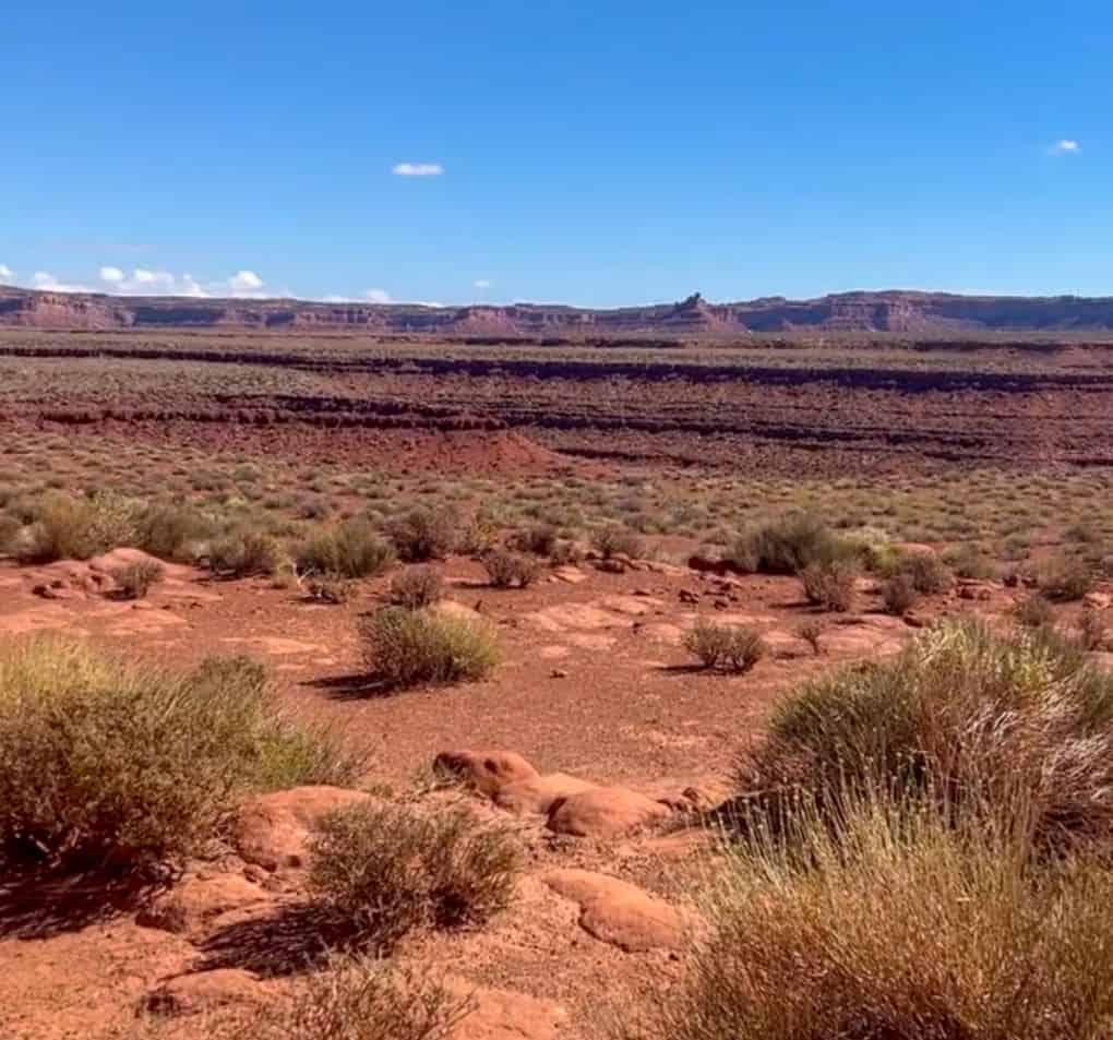
The Valley of the Gods boasts a striking landscape filled with towering sandstone buttes, mesas, and dramatic spires. It’s a remarkable destination in southeastern Utah. For those seeking solitude and a closer connection to nature, the Valley of the Gods is an ideal getaway. The scenic valley is close proximity to Monument Valley, Glen Canyon National Recreation Area, Canyonlands National Park, Arches National Park, and Hovenweep National Monument. Three state parks Gooseneck, National Bridges and Edge of Cedars are also close,
From Mexican Hat, Utah: drive west on U.S. Route 163. Look for the well-marked Valley of the Gods Road, which is located off Utah Highway 163. It’s about 14 miles west of Mexican Hat and approximately 15 miles east of the junction of Utah Highway 261 and Utah Highway 163. Once you’ve turned onto the Valley of the Gods Road, you’ll find yourself on an unpaved, graded road that meanders through the heart of the Valley of the Gods.
Useful Information for Visitors Valley of the Gods
- Location: The Valley of the Gods is in southern Utah, about 122 miles south of Moab and 13 miles from Mexican Hat.
- Operating Hours: open year-round, and visitors can access the area at any time. However, the best time to visit is during daylight hours for safety and to fully appreciate the stunning scenery.
- Pets: Pets are allowed.
- Entrance Fees: An entrance pass is not required to access Ocmulgee Mounds. Special Events held throughout the year may charge a nominal fee.
- Best Time to Visit: The best times to visit are spring (March to early June) and fall (September to October). Temperatures are more moderate and the scenery is particularly beautiful, with wildflowers in spring and vibrant fall colors. Summer (June-August) can be extremely hot, with temperatures often exceeding 100°F, and the monsoon season can bring thunderstorms, making conditions less favorable. Winter: If you enjoy solitude, visiting in late December through February can be rewarding. Daytime highs typically range from the 40s to 60s°F, while nights can get quite cold, often dropping below freezing.
- Accommodation: The nearest towns, such as Mexican Hat and Bluff, offer various lodging options, including hotels, motels, and inns.
- Camping: Dispersed camping is allowed in previously impacted areas, but campfires are not permitted. There are no developed campgrounds.

Entering the Valley of the Gods:
As we venture deeper into Bears Ears, we find ourselves at the doorstep of the Valley of the God. A mystical landscape of towering red rock formations. Each appears sculpted by the hand of time. Photographers, nature enthusiasts, or outdoor adventurers will find this place very appealing.
Whether you’re behind the wheel of a rugged 4×4 or a simple sedan, the 17-mile scenic journey is accessible to all. Many of the revealing vistas will steal your breath away. Along the way, we pulled over at various viewpoints. It was important to capture the ever-changing play of light and shadow on the sandstone monoliths. If you plan on hiking, bring lots of water! Remember to bring a hat, snacks, sunglasses, and sunscreen.
Traversing the Valley of the Gods: Scenic Drive and Must-See Stops
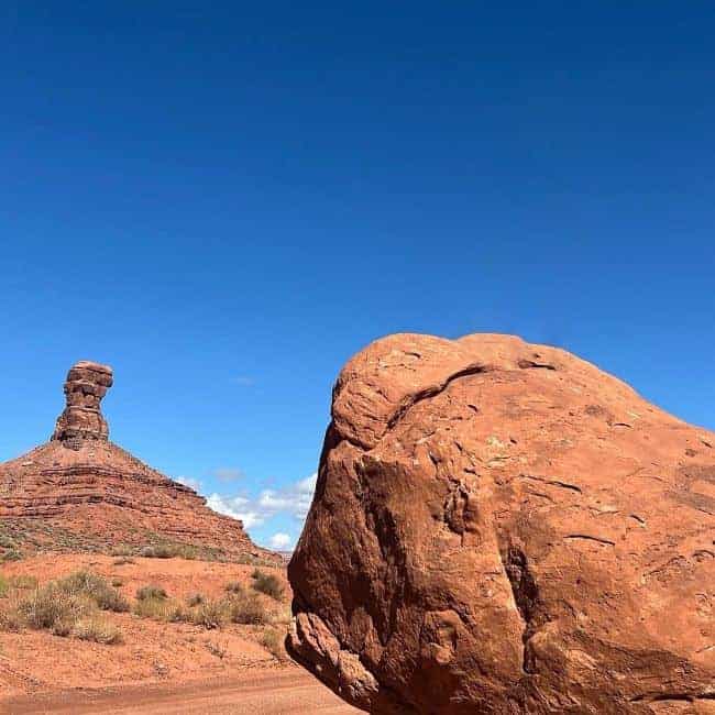
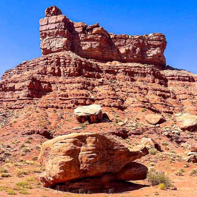
Along the Valley of the Gods Road, you’ll encounter various pullouts and viewpoints that provide opportunities to stop and appreciate the stunning red rock formations, mesas, and buttes that define this landscape. Take your time to explore and capture the beauty of the area through photographs. While the entire valley is a must-see, there are specific stops and viewpoints that offer the most striking and iconic views.
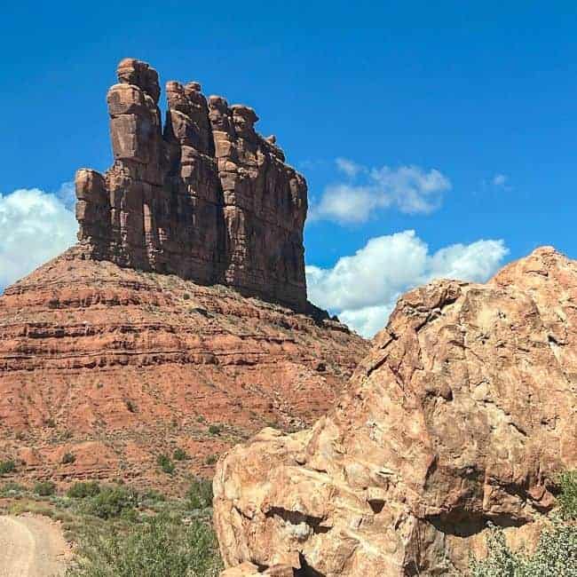
Seven Sailor Butte (MM 0.5) on the left side of the road is the first stop. “Seven Sailors” is named after the butte’s silhouette, which resembles seven sailors standing side-by-side. The changing light conditions throughout the day make it an intriguing subject for photography.
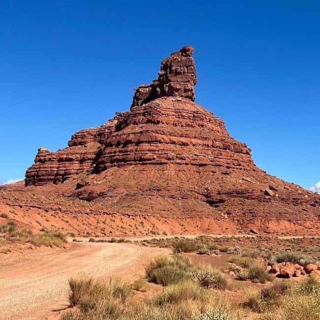
Setting Hen Butte (MM 1.5) next stop on the left is Setting Hen Butte. The red sandstone and distinctive shape make it stand out. This is called “Setting Hen” because it looks like a hen sitting in her nest. Wind, rain and wind have eroded the top to form the hen.
Rooster Butte (MM 3.7) View this one from a distance on your left. Again, some say this butte resembles a rooster. The red formation is typical of what you see throughout the valley.

More Buttes to See
Franklin Butte (MM 4.0) The 5,179-foot-high butte should be visible on your left. It is somewhat impressive in its size but does bring to mind any particular image. It seems that way to m
Battleship Rock (MM 5.5) Another sandstone outcrop on the left side of the road is Battleship Rock, which resembles the prow of a battleship due to its erosion over time. Navigate around it to really see the battleship. Use your imagination. There’s cedar mesa sandstone in this monolith.
Majestic Castle Butte a Turning Point
Castle Butte (MM 7.5) The scenic road traverses around this formation. The towering pinnacle has varying hues of pink, red and orange depending on the light. The Navajos believe that the rocks here are the frozen spirits of warriors. They are considered guardians of power.
De Gaulle & his Troops Butte (MM 8.0) was named in honor of General De Gaulle. It was a magnificent, prominent butte at the turning point in the road.
Santa Claus & Rudolph Butte (MM 8.5) This butte has eroded into the unique shape of Santa and his most famous reindeer, Rudolph.
Lady in the Bathtub and Balanced Rock (MM 12.0) This is the last of the spectacular buttes on the road. It’s easy to see Lady in the bathtub, a 5,552 ft quirky sculpture.
Beyond the Valley: Exploring Bears Ears: Moki Dugway
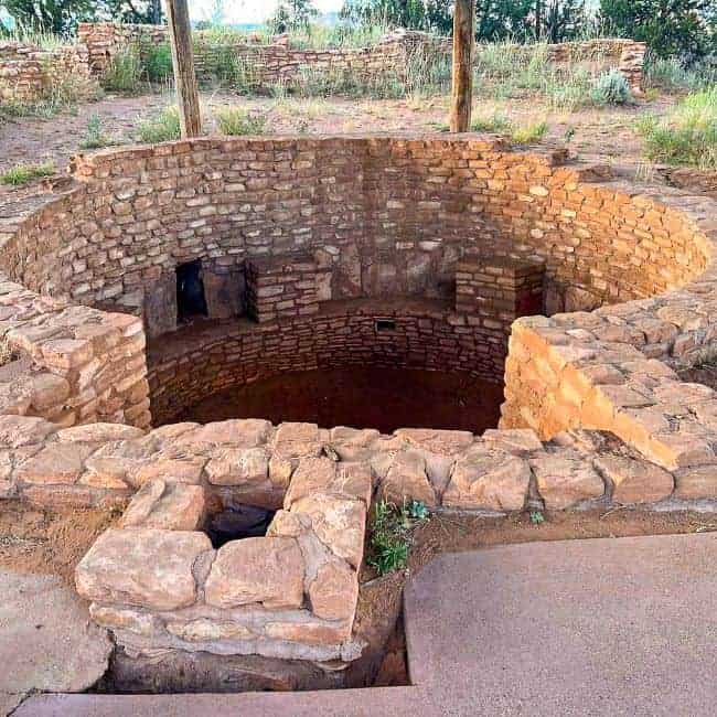
The Valley of the Gods is just one facet of the larger Bears Ears National Monument. As we conclude our journey, we’ll briefly explore some of the other wonders within the monument’s boundaries, from ancient cliff dwellings to the meandering canyons of the San Juan River.
What Is It?: The Moki Dugway is not a traditional highway but rather an unpaved switchback road carved into the side of a steep cliff. It comprises a series of tight, hairpin turns and steep grades that zigzag their way up and down the cliffs of Cedar Mesa. Happy Jack Mine constructed the road in the 1950s. Uranium ore was transported to Mexican Hat, Utah, for processing during the mining era.

Despite its steep, winding roads, the Moki Dugway is typically passable for most vehicles. You should only try this if you’re an experienced driver. Travelers with RVs or trailers may want to exercise caution and check road conditions beforehand.

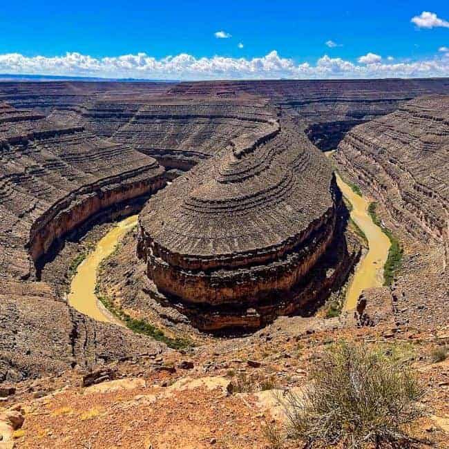
Gooseneck State Park: Nature’s Artistry Etched in Stone
Just down the road is Gooseneck State Park. It is a perfect short drive off the highway. The park is a geological masterpiece, featuring towering cliffs, steep canyons, and stunning rock formations. Millions of years of wind and water erosion have shaped the landscape. Gooseneck State Park is a place of incredible beauty and tranquility. The views of the Colorado River are the flagship of this views of this park. The entrance fee is $5 per vehicle.
Exploring the Wonders of Natural Bridge National Monument
This is a great side trip to add to a visit to the Valley of the Gods. The Natural Bridges National monument features three natural bridges, each of which is an impressive sight to behold. Visitors can hike and take in the incredible scenery, or explore the monument on horseback.

Muley Point’s Majestic Vista
The panoramic views from Muley Point are legendary. Perched on the edge of Cedar Mesa, it boasts a stunning view of the San Juan River and towering red rock formations surrounding it. From the overlook, you can see Monument Valley, Goosenecks State Park, and the Navajo Nation in the distance.
Muley Point is a photographer’s dream. The ever-changing play of light and shadow on the rugged landscape, especially during sunrise and sunset, provides ample opportunities to capture stunning shots. The layers of geologic formations and the colorful hues of the rocks make it a perfect location for landscape photography.
Final Thoughts: Exploring the Valley of the Gods: Journey Through Bears Ears National Monument
We did this as a part of our grand circle road trip through Utah and Arizona. I must say the Valley of the Gods serves as a captivating gateway to the wonders of Bears Ears National Monument. It’s a place where the forces of nature and history converge, leaving travelers with indelible memories. Exploring these timeless landscapes is an enduring legacy of the Native American cultures that call this land sacred. Join us as we embark on this unforgettable journey through the heart of the American Southwest.
Have you been to the Valley of the Gods? What did you think? Is this on your to do list?