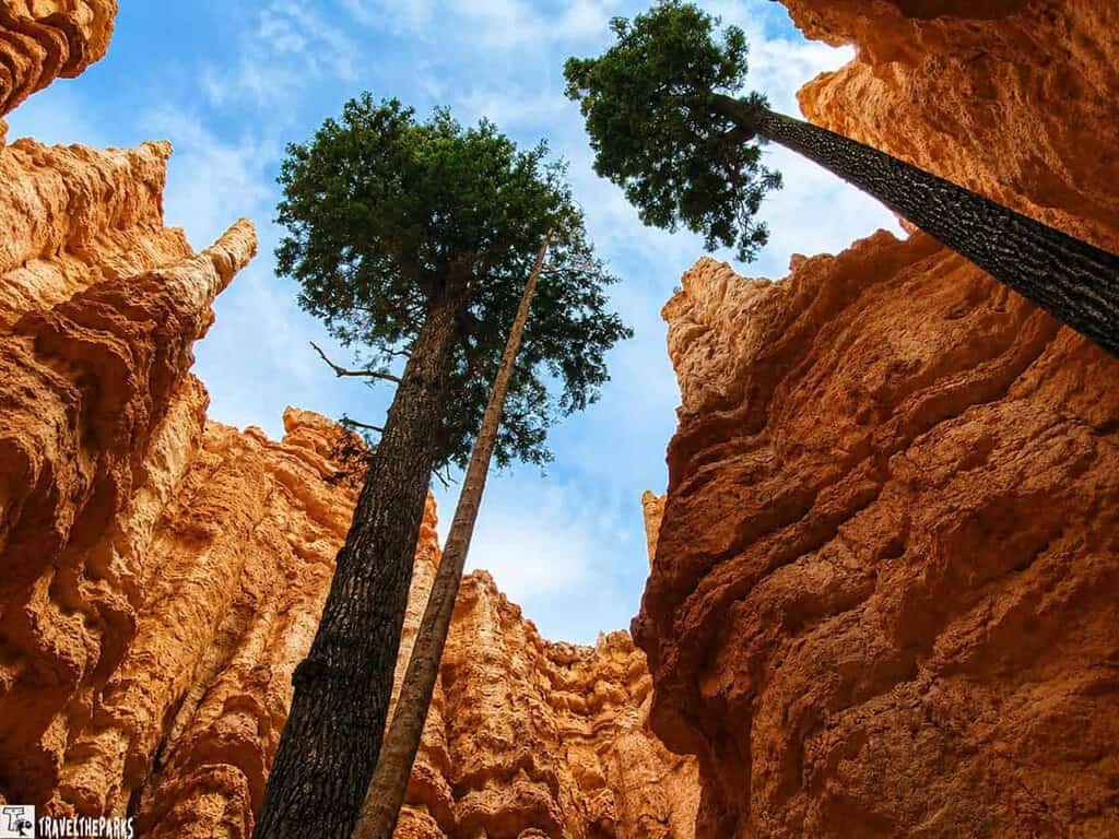
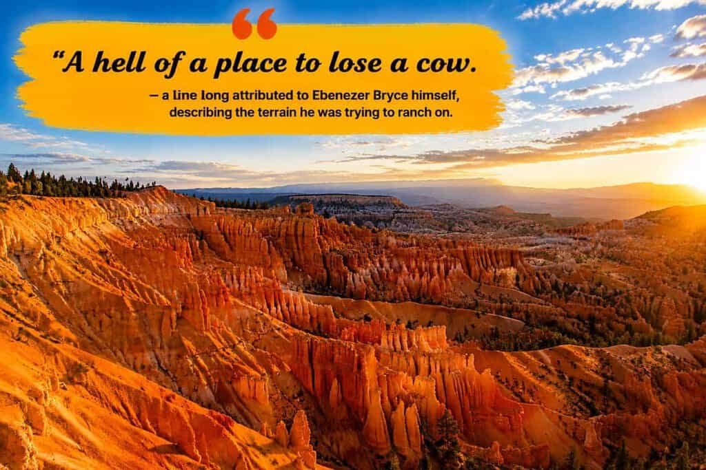
Let’s be honest: we thought we knew what to expect from Utah’s “Mighty Five.” We’d seen the pictures of those orange spires piercing the sky. But pulling up to the rim of Bryce Canyon? That’s a whole different ballgame, and exploring Bryce Canyon scenic drive viewpoints reveals just how spectacular this landscape truly is. Wow, this place doesn’t just resemble a canyon, it gives off the vibe of a huge, old amphitheater created by giants with a passion for abstract art.
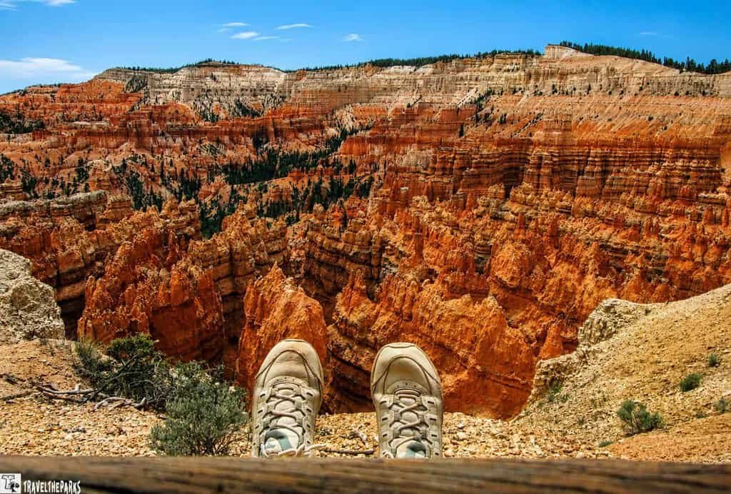
Here’s a fun fact we love dropping on road trip companions: Bryce Canyon isn’t actually a canyon. Canyons are carved by rivers, and there’s no river running through this stretch of southern Utah. What it really is, is a series of natural amphitheaters chiseled into the eastern edge of the Paunsaugunt Plateau, packed with thousands of thin rock spires called hoodoos. They glow orange, pink, and white depending on the hour, and from certain angles the whole place looks like a sandcastle city that a very patient, very talented giant forgot to knock down.
We spent a couple of hours working our way down the park’s famous 18-mile scenic drive, hopping in and out of the car at every pullout along the rim. This post is our attempt to walk you through it the way we experienced it: viewpoint by viewpoint, with the good, the slightly out-of-breath, and the genuinely jaw-dropping—plus the pit stops you absolutely cannot miss and the quiet moments that make this place magic.
Table of Contents
The Stories Behind the Hoodoos
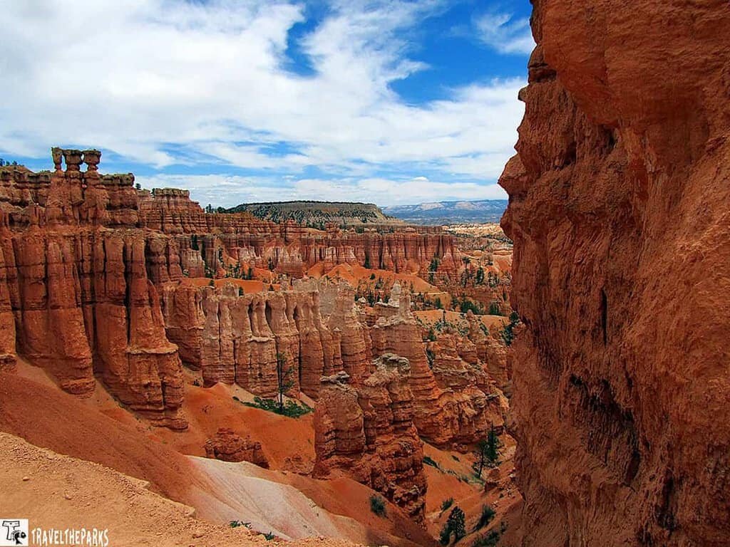
The process goes something like this: the rim erodes backward, leaving behind thin rock walls called fins. Freeze-thaw widens cracks in those fins, eventually punching holes through them. When the tops collapse, columns are left standing. The harder caprock protects the softer rock below, which is why the spires taper and bulge the way they do.
The result is the largest concentration of hoodoos anywhere on the planet. And it’s still happening—the rim erodes about a foot or more every century.
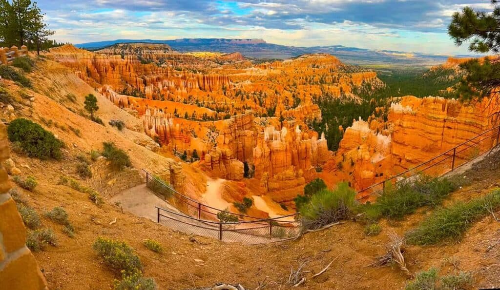
People have known about this landscape far longer than the park has existed. The Southern Paiute traveled through and used the area for centuries before European settlers arrived, and their traditional stories describe the hoodoos as “Legend People” who were turned to stone as punishment for bad behavior—which, honestly, feels like a more satisfying origin story than plain old erosion.
The park’s more recent name comes from Ebenezer Bryce, a Scottish immigrant and Mormon settler who homesteaded near the amphitheater in the 1870s while trying to run cattle and irrigate the land. He didn’t stick around for long—a handful of years, by most accounts, before moving his family to Arizona—but the name stuck to the canyon behind his old homestead. The area was protected as a national monument in 1923 and upgraded to full national park status in 1928, and it’s been drawing in hikers, photographers, and carloads of curious travelers like us ever since.
Know Before You Go
- Elevation matters here. The park sits between about 6,600 and 9,100 feet, so pack layers—mornings can be genuinely cold even when the afternoon warms up, and the thinner air catches some visitors off guard.
- The Scenic Drive is 18 miles one-way with no fuel stations along it, so fill up your tank in Tropic, Panguitch, or Bryce Canyon City before you start.
- A free shuttle runs during the busier months (roughly April through October) and is genuinely worth using—parking at the popular points fills up fast, especially midday.
- If you want the classic glowing-hoodoo photos, get to Sunrise or Sunset Point near golden hour. Everyone else has the same idea, so “early” means earlier than you think.
- Cell service is unreliable to nonexistent through most of the park. Download offline maps and save your must-see list before you lose signal.
- Weather turns quickly at this elevation. Snow and ice are possible even in shoulder-season months, so check conditions before you drive the whole route.
- An entrance fee applies, and an America the Beautiful annual pass covers it if you already have one.
- Pets are welcome on paved viewpoints and the main road but aren’t allowed on the hiking trails below the rim, so plan accordingly if you’re traveling with a dog.
- Not every viewpoint has water or restrooms nearby—carry your own water and use the facilities at the visitor center or main junctions when you see them.
- Get these basics sorted first, and the rest of your day exploring Bryce Canyon scenic drive viewpoints goes a lot smoother.
This post may contain affiliate links, meaning if you purchase something through one of these links, we may earn a small commission at no extra cost to you! Read the full disclosure policy here.
Bryce Canyon Scenic Drive Viewpoints, One by One
If you’re mapping out your day around the Bryce Canyon scenic drive viewpoints, here’s the order we’d actually recommend. The road runs north to south, and most visitors drive straight to the southern end first, then work their way back, stopping wherever a viewpoint catches their eye.
We ended up doing a little bit of everything—splitting the drive into two parts, doubling back a few times for another look. So treat the order below as a loose itinerary, not a rulebook.
The first few miles are the “Amphitheater” where the big crowds are, and the last stretch is the “Quiet South.” But honestly, we recommend starting at the end and working your way back.
Here’s our breakdown of each stop, starting from the southern terminus.
If you’re planning to hit the road and explore these views, here is our guide to doing it right, complete with the pit stops you absolutely cannot miss, a few laughs, and the quiet moments that make this place magic.
Start at the End of the Road: Rainbow Point and Yovimpa Point
First stop: Rainbow Point and Yovimpa Point, the two overlooks sitting at the southern end of the drive and the highest elevation in the park. From here, the view doesn’t stop at the hoodoos—it keeps going, across the Grand Staircase and, on a clear day, straight into Arizona.
Rainbow Point, at milepost 18, is the highest viewpoint in the park at 9,115 feet. Skip the towering hoodoos for a minute—up here it’s wide open, all forests, meadows, and mountain ranges stacking up into the distance.
The Paunsaugunt Plateau owns the view from this spot. Its name comes from a Paiute word for “home of the beavers,” which feels about right for a place shaped by water, weather, and a few million patient years.
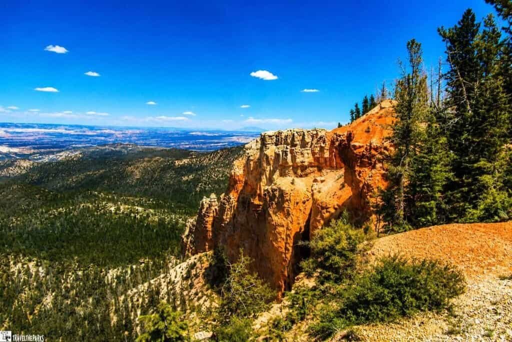
Do both overlooks. They’re a short walk apart but hand you slightly different angles, and after all that time among the hoodoos, the cooler forests and open sightlines here feel like a completely different park.
There’s also a weirdly satisfying moment in just reaching the end of the road. Sounds silly to feel accomplished for driving a car somewhere, but after winding through the whole park to get here, standing at the final overlook feels earned.
Best Things to Do:
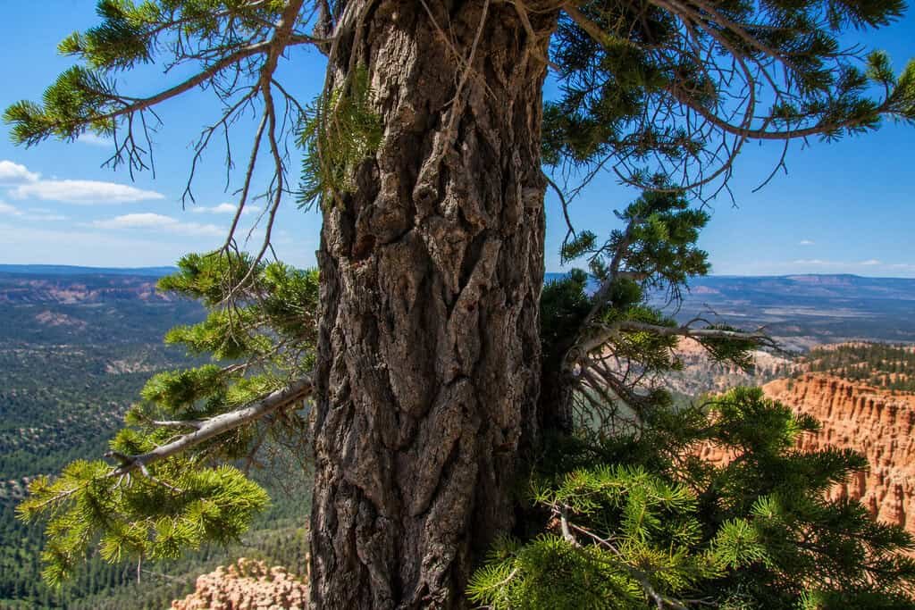
If you’ve got time, walk the Bristlecone Loop Trail—an easy 1-mile stroll along the rim through a grove of bristlecone pines, some pushing 2,000 years old. Twisted trunks, silver-gray bark, like the wind itself carved them.
Our Favorite Memory at Rainbow Point
Standing at the edge, we felt genuinely small next to that plateau stretching out in front of us. The bristlecone pines looked more like sculptures than trees, and it was hard not to sit with how much history was just — standing there, silently, being ancient.
One of those trees was already alive before Columbus set sail. Let that sink in.
Ponderosa Canyon: A Forested Oasis
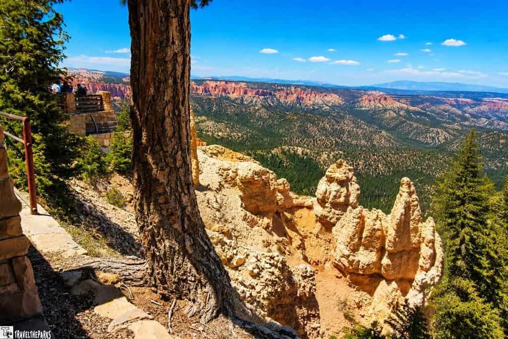
This viewpoint sits at 8,904 feet, looking out over vermilion hoodoos in the foreground with Dixie National Forest and Grand Staircase-Escalante National Monument stretching out behind them. The parking lot itself sits in a giant old-growth forest—blue spruce, Douglas firs, and ponderosa pines mixing together far below the rim. We stood there for a while just marveling at that blend of green forest against red rock.
Best Things to Do at Ponderosa Point: This is an easy stop along the drive—a paved, wheelchair-accessible viewpoint and a chance to see a quieter side of Bryce. Instead of dramatic hoodoos, the view here is all forest, blanketing the Paunsaugunt Plateau.
Our Favorite Memory at Ponderosa Canyon: We leaned against a ponderosa pine and just listened. Wind through the needles, sounding almost like a whisper. It was the kind of quiet that makes you realize how loud the world usually is — we took a breath and let the forest reset us.
PRO Tip: Be sure to have a refillable water bottle to quench your thirst in the heat. Hikers should plan accordingly and bring necessary supplies, including water, snacks, and sunscreen. The hot, dry air can take its toll in the summer if you don’t hydrate.
Agua Canyon: Majestic Vistas and Legendary Hoodoos
“Agua” turns out to be a bit of a misnomer—there’s no real water connection here. Go figure.
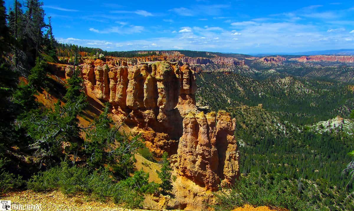
Two hoodoos steal the show at this stop. On the left, the taller one, known as “The Hunter,” has a shape dramatic enough to stop you mid-step. To the right sits “The Rabbit” (sometimes “The Backpacker”), which—depending on who you ask—either looks exactly like a rabbit or nothing like one at all. Together they make a genuinely captivating pair.
Beyond the hoodoos, you get a clean shot of Navajo Mountain on the horizon, evergreens filling in the middle ground, all of it set against that vibrant orange rock.
Best Things to Do:
- Bring your camera. This is one of the most photographed spots in the park, and it earns it.
- Try to spot The Hunter and The Rabbit yourself. We spent a solid twenty minutes arguing over which one actually looked like a rabbit and which one looked more like a melting candle.
Our Favorite Memory at Agua Canyon: We got into a genuinely ridiculous debate over whether The Rabbit looked more like a rabbit or a backpacker who’d been lost in the woods for three days. A couple nearby overheard us and jumped right in. Nobody won. Everyone laughed. That was the whole point.
Natural Bridge: A Captivating Eroded Wonder
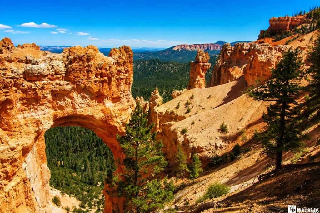
Despite the name, this is technically a natural arch, not a bridge — carved out when rain and frost wore straight through a fin of rock. It’s one of several arches in the park, and easily one of the most photogenic single features along the whole drive, punched through the reddest rock of the Claron Formation (all that color comes from iron oxide, for the geology nerds among us).
No hike required here. Pull over, step out, snap your photos, done. The arch frames the canyon behind it like a window, and it’s especially good at sunrise or sunset when the light really lights that red rock up.
Best Things to Do: This one’s a roadside stop, not a hike — an easy add-on even if you’re short on time or energy that day. Good spot to stretch your legs and grab a photo without committing to a trail.
Favorite Memory: We watched a couple try to take a selfie with the arch in the background. They must have taken twenty shots, and every time someone walked through the frame. We offered to take their photo, and their relief was palpable. In return, they took ours. It was a tiny moment of connection in a vast landscape.
Bryce Canyon Meadow & Swamp Canyon: Serene Beauty of Contrasts
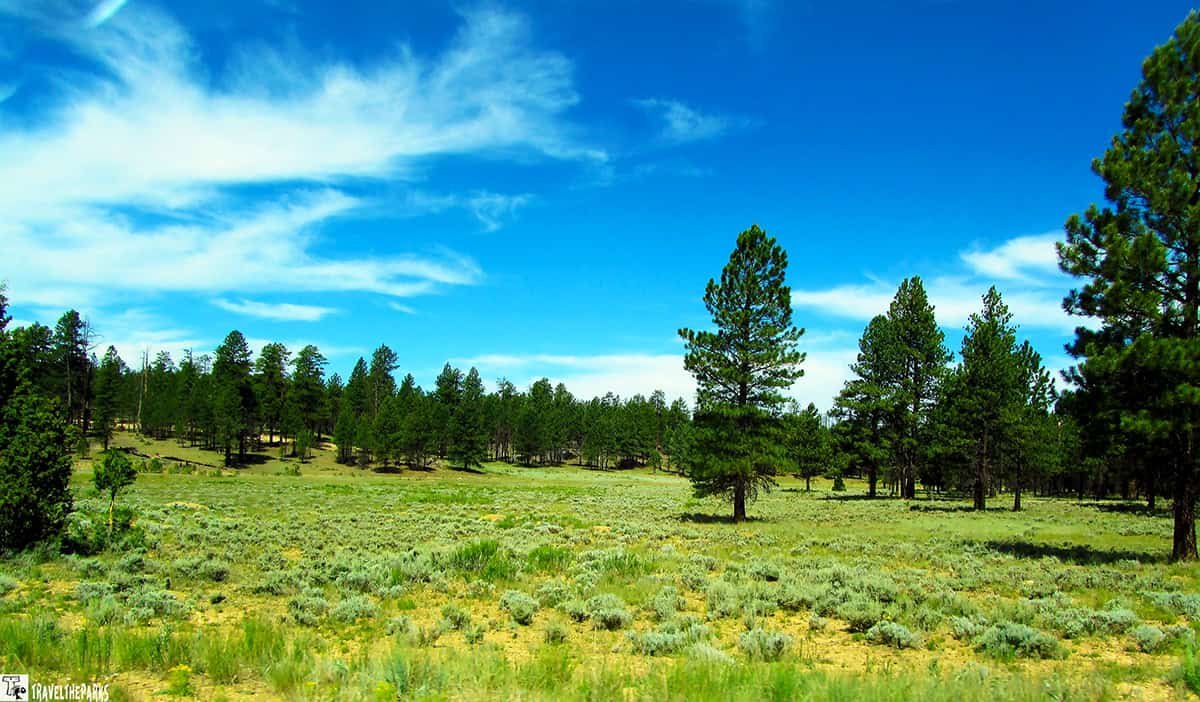
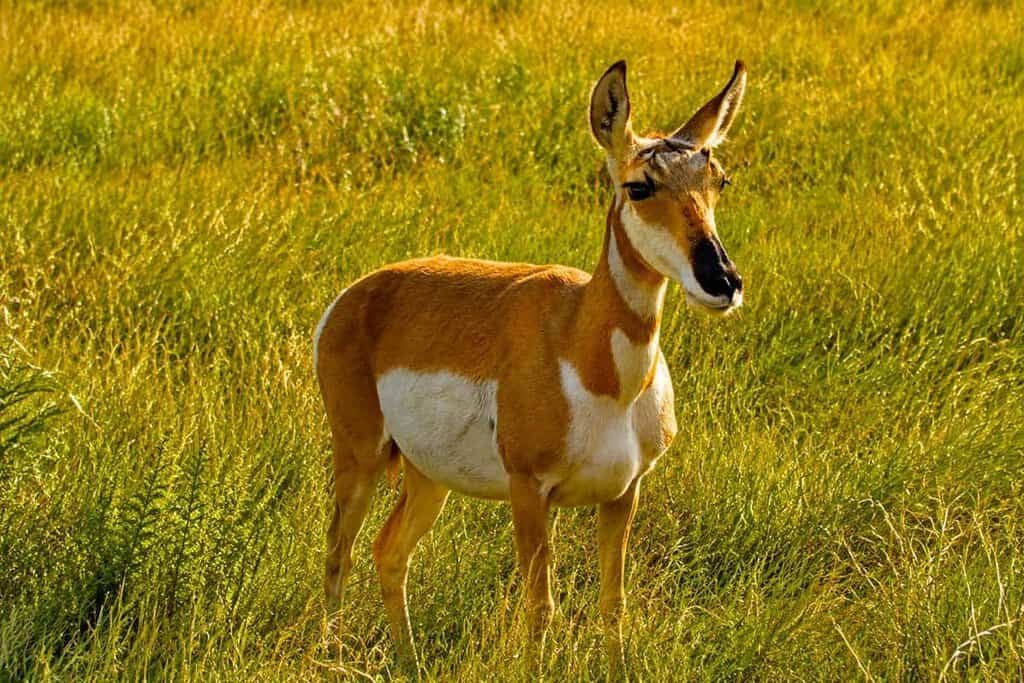
As the road drops out of the higher elevations, it opens into a lush mountain meadow—the kind of scene that feels straight out of Little House on the Prairie. Everything here is more open: meadows, forests, smaller rock formations scattered around instead of the towering hoodoos. Wildlife loves it too—we watched a pronghorn antelope graze right in the middle of it, lift its head to check us out, then go straight back to eating. Clearly we weren’t that interesting. Still, watching it move through that landscape with red rock in the background felt like stepping into a nature documentary.
Swamp Canyon, true to its name, is a different kind of surprise—a small wetland tucked into the canyon, a strange and welcome contrast to all the hoodoos and amphitheaters you’ve been seeing.
Best Things to Do:
- The Sheep Creek and Swamp Canyon trails connect here—combine them for a moderately difficult 4-mile loop if you’re up for it.
- Go early morning or late afternoon. Better light, better odds of wildlife.
Favorite Memory: Honestly, the pronghorn stole the show before we even got to the swamp. It barely acknowledged us—one look up, then straight back to grazing, totally unbothered. We just stood there watching it move against that red rock backdrop, feeling like extras in someone else’s nature documentary.
Farview Point and Piracy Point: Panoramic Vistas
At 8,819 feet, Farview Point delivers exactly what the name promises—wide-open, unobstructed views of the canyons, rock formations, and the park’s odd, beautiful geology. There’s a decent-sized parking area and restrooms too, so it’s an easy one to work into the day.
For something a little different, walk about 70 feet from the lot to the edge of the amphitheater, then follow the 1,000-foot unpaved trail north along the rim to Piracy Point. It’s fairly level, but heads up — there’s no driving here. Foot traffic only.
Best Things to Do:
- Make the short walk to Piracy Point. Fewer people, same jaw-dropping view.
- Bring binoculars—the meadows below are good for spotting wildlife.
Favorite Memory: We made the walk out to Piracy Point ourselves, and it was quiet—genuinely quiet. We sat on a rock and watched the sun start dipping, painting the whole canyon gold and pink. Felt like we’d stumbled onto something the main overlook crowds never bothered to find.
The Amphitheater Viewpoints: Bryce Canyon’s Greatest Hits
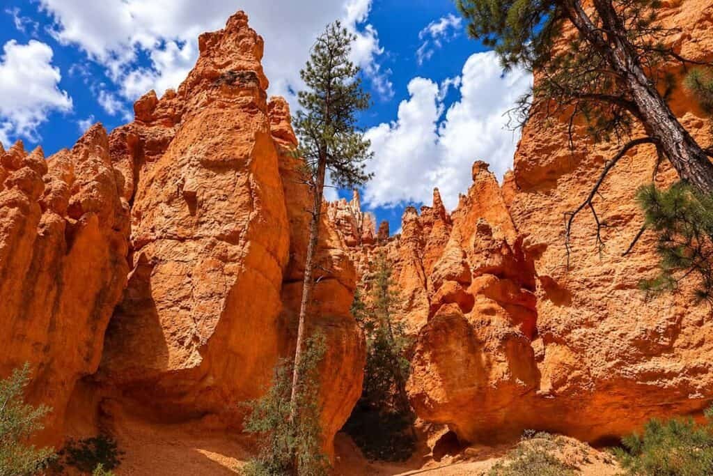
Once you leave the quieter southern end of the drive, you reach the section most visitors come to see when they think of Bryce Canyon scenic drive viewpoints—the main amphitheater. These five viewpoints are clustered within a few miles of each other, and honestly, you could spend an entire day just moving between them.
We did.
Each overlook offers a slightly different perspective.
- Fairyland Point: Most visitors barrel straight past this one on their way to the famous overlooks, which is exactly why we liked it. Wide-open views of colorful hoodoos, hardly anyone around — a great first stop before the crowds show up.
- Sunrise Point: One of the park’s most popular viewpoints, and it earns that reputation. Sunrise Point gives you sweeping views across the amphitheater and a front-row seat as morning light slowly brings the hoodoos to life. Bonus: it’s also your access point for the Queen’s Garden Trail.
- Sunset Point: A short walk from Sunrise Point, and one of the best spots in the park to watch evening color shift across the hoodoos. It’s also where the Navajo Loop Trail kicks off—including the famous Wall Street section.
- Inspiration Point: A short uphill walk gets you to a string of overlooks, each one opening up a wider view of the Silent City—a dense cluster of hoodoos that looks almost like a skyline carved out of stone. The upper viewpoint takes a little extra effort. Worth it.
- Bryce Point: One of the most dramatic overlooks in the whole park. Bryce Point hands you a sweeping view of the entire amphitheater, and it’s a favorite for sunrise and photography for a reason — you’ll get it the second you’re standing at the rim.
Final Thoughts: Bryce Canyon scenic drive viewpoints
You can drive the 18 miles in 45 minutes. We’ve seen people do it—pull into the lot, snap a few photos, roll back out like they’ve checked a box. Honestly, no judgment. But that’s not really experiencing Bryce.
This drive is meant to be savored. It’s a slow roll through one of the strangest landscapes on the planet, and every pullout hands you something new—different colors, different angles, different light. The hoodoos shift from orange to pink to deep red depending on the hour. The forests add contrast. The views stretch for miles. And if you stop long enough, the quiet has a way of settling into you.
We spent two full days working our way down that road and still felt like we’d barely scratched the surface. Trails we didn’t hike, viewpoints we only caught once, moments we wish we’d lingered in a little longer. But that’s the thing about places like this—they don’t hand over all their secrets in one visit. They leave you wanting more.
So here’s our advice: take your time. Pull over at every turnout. Walk the short trails. Sit on a rock and just look. Let the place work on you. And whatever you do, don’t be the person who drives past the prairie dog fields without stopping—those little guys are part of the story too.
However you plan it, working your way through the Bryce Canyon scenic drive viewpoints is time well spent. Bryce Canyon isn’t the kind of place you check off a list. It’s the kind of place that checks something off in you.
Which Bryce Canyon scenic drive viewpoint would be at the top of your list? Drop a comment and let us know—or tell us which one we need to hit next time.