Table of Contents
Updated July 2026
Planning a Road Trip Bryce Canyon adventure? We wondered the same things before our visit. Is one day enough? Which hikes are actually worth doing? Is it worth staying inside the park?
We didn’t expect Bryce Canyon to be the trip’s highlight. Honestly, it wasn’t even on our radar as a must-see—just a convenient stop between Zion and Capitol Reef. A one-and-done kind of place. That was the plan, anyway.
Then we stepped up to the rim.
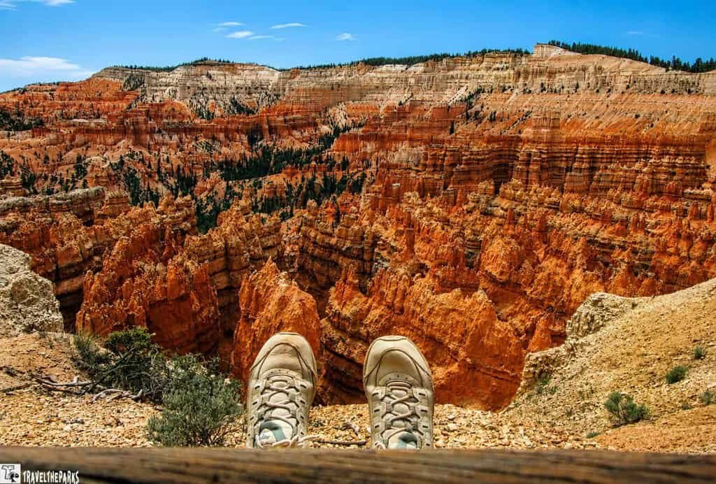
And yeah, we’d seen the pictures. Everyone has. But standing there, looking out at thousands of those orange-and-pink hoodoos scattered across the amphitheater like some giant’s forgotten chess pieces? The photos don’t capture the scale. It felt less like a canyon and more like the skeleton of an ancient city—all spires and towers and strange rock formations that don’t look like they belong on this planet.
We ended up staying two full days, which we’re really glad we did. We hiked down among the hoodoos, cooled off at that little waterfall near Mossy Cave, and caught both sunrise and sunset from different overlooks just to watch the light do its thing. Each time, the canyon looked completely different.
What we learned is this: Bryce isn’t just a quick stop. It’s the kind of place that rewards you for sticking around.
If you’re mapping out your own Bryce Canyon road trip, we put together this guide based on exactly what we did—plus all the stuff we wish someone had told us before we got there.
This post may contain affiliate links, meaning if you purchase something through one of these links, we may earn a small commission at no extra cost to you! Read the full disclosure policy here.
Why we Recommend Two Days in Bryce Canyon
Can you do Bryce Canyon in one day?
Sure. You absolutely can.
The park’s not huge, and plenty of people roll in early, hit the main overlooks, knock out a trail, and hit the road by dinnertime. It’s doable. No question.
But here’s the thing—Bryce is worth sticking around for.
Some of our best moments happened when the day-trippers started clearing out. Watching those hoodoos catch the last bit of golden light at sunset. Walking back to our room with nothing but stars overhead and that dead-quiet desert air. Standing alone on the rim before sunrise, not saying a word, just watching the canyon wake up. You don’t get that if you’re racing to the next stop on your itinerary.
With two days, we never felt rushed. There was no frantic checklist energy—just time to actually soak things in. We lingered at overlooks, took our sweet time on the trails, and parked ourselves on random rocks with snacks. No clock-watching allowed.
If you’ve got the flexibility, two days is the move. One day gets you the highlights. Two days gets you the experience.
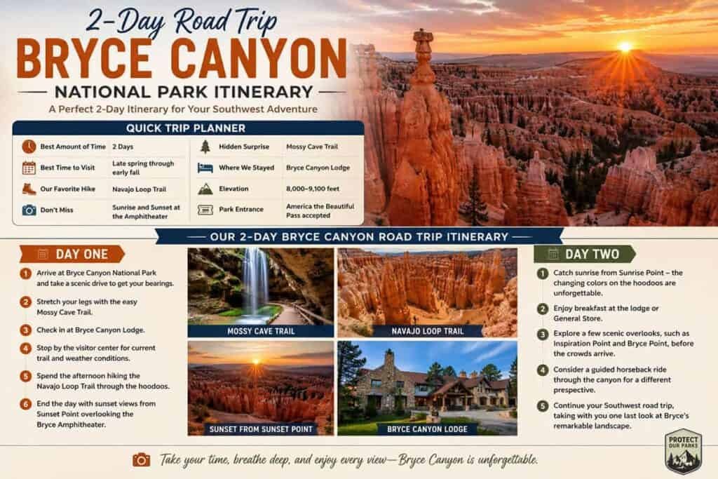
Our Bryce Canyon Road Trip Itinerary
Day 1: First Steps into Bryce Canyon National Park
We got an early start and rolled straight into the park, relieved we’d already snagged a room inside for the night. First up was Mossy Cave on the east side—an easy little walk that ends at a small waterfall. Nothing too strenuous, just a nice way to ease into things before tackling anything bigger.
After that, we checked in and headed over to the visitor center. Grabbed a map, picked the rangers’ brains about trail conditions, and got a lay of the land before we headed back out.
By late afternoon, the heat had started to fade, so we dropped into the Amphitheater on Navajo Loop. We planned it so we’d finish up just as the light started doing its thing, and we wrapped the day at Sunset Point watching those hoodoos glow in all those warm colors. One thing that actually helped: we’d downloaded the park brochure ahead of time. Flipping through it made it way easier to piece together our route each day.
Day 2: Deeper Into the Canyon
We dragged ourselves out of bed before sunrise and made our way to Sunrise Point. Yeah, it meant skipping breakfast and walking around half-asleep for a bit. But that first light hitting the hoodoos? Worth every lost minute of sleep.
Afterward, we cruised the Scenic Road and kept pulling over at overlooks. Some we barely got out of the car for. Others had us standing there for way longer than we meant to. It’s hard to rush when every turn gives you something that makes you go “whoa.”
We had enough gas left in the tank to hit a couple more trails, too. Being down there among the hoodoos—actually walking between them—it’s just different. Up top, you get the grand view. Below, you feel tiny in a good way.
And then there was the horseback ride. We weren’t sure what to expect, honestly, but it ended up being a blast. The wranglers knew their stuff and didn’t make us feel like clueless tourists, even though we kind of were. Seeing the canyon from the back of a horse, moving at that slow, steady pace—it gave us a whole other perspective we wouldn’t have gotten on foot.
Getting to Bryce Canyon National Park
Part of what makes Bryce so road-trip-friendly is where it sits. It’s not out in the middle of nowhere—it’s right along that classic southern Utah loop, which means you can slide it in whether you’re doing a quick swing through the state or a full-on national park marathon.
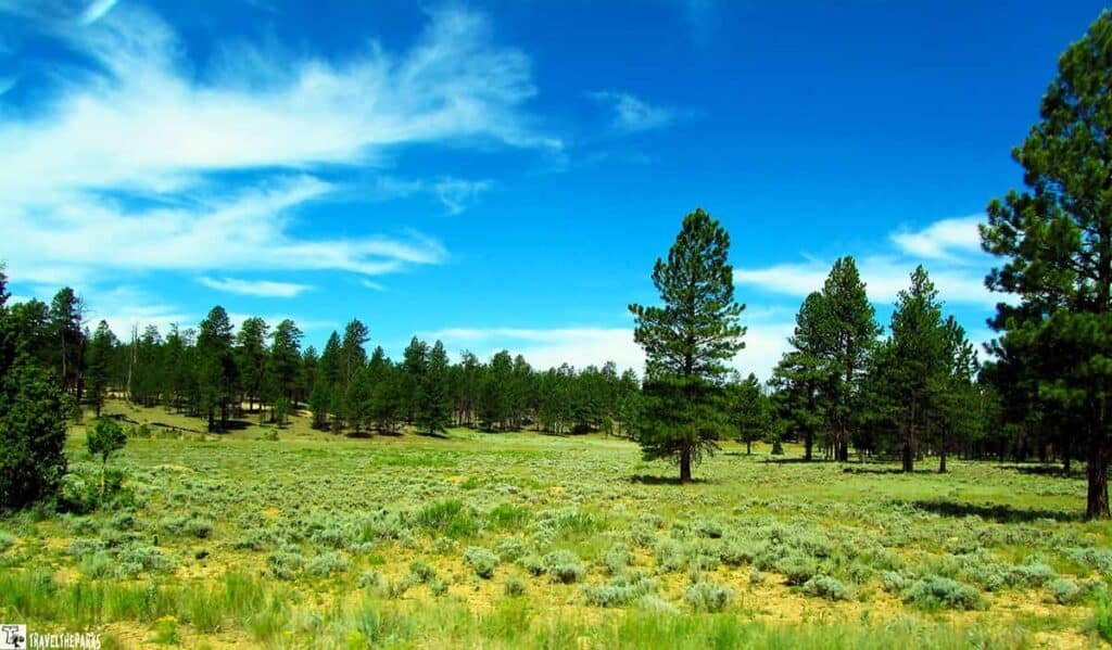
We came from Zion, which meant taking UT-9 east through the park, then hopping onto US-89 and picking up Scenic Highway 12. That stretch alone is worth the drive—open ranch land, cliffs in all kinds of colors, and these high plateaus that make you feel like you’re on top of the world. By the time we rolled into Bryce, we’d already had a pretty solid scenic fix.
If you’re coming from Capitol Reef, you’ll be on Highway 12 for a good chunk of the drive, and honestly? That’s a good thing. It’s one of those roads where you’ll keep pulling over for photos, so budget extra time and just embrace it.
One thing that caught us off guard: the last few miles before the entrance don’t give anything away. It’s all just… normal. Trees, curves, nothing spectacular. And then you step out at the rim and boom—there it is. The park keeps its best trick hidden right up until the very last second.
Know Before You Go: Bryce Canyon Essentials
- Hours & Seasons: The park never closes—open 24/7, year-round. The Visitor Center runs seasonal hours, typically 8 AM–6 PM in summer.
- Shuttle: A free shuttle runs the main park road from April through October. Plan ahead during peak season, since availability can get tight, and check current road conditions and closures before you go.
- Entrance Fees: Standard vehicle entry runs $35 and covers 7 days. If your road trip includes multiple parks, the America the Beautiful Pass ($80/year) gets you into every national park and federal recreation site.
- Best Time to Visit: Late spring through early fall draws the biggest crowds; winter trades crowds for quiet, snow-dusted hoodoos.
- Pets: Allowed on paved stretches like the Rim Trail between Sunset and Sunrise Points, but not on most trails.
- Elevation & Weather: You’re at 8,000–9,100 feet here, so pack layers—it stays cool even in summer.
- Accessibility: Sunset Point and the Bristlecone Loop both offer ADA-accessible viewpoints and trails.
A Brief History of Bryce Canyon National Park
This land wasn’t always a national park. Way before that, Native American clans—the Paiute among them—lived here for thousands of years. You can still spot bits of their presence if you look closely: artifacts, rock art, little marks left behind.
European Americans didn’t show up until the late 1700s. Then in 1850, a Mormon settler named Ebenezer Bryce came along and homesteaded near the canyon that later ended up with his name. A few years after that, in 1875, a Scottish guy named John Wesley Powell led a group through the area and documented all those wild hoodoos and formations that make this place so weird and wonderful.
It got designated as a national monument in 1923, and locals and conservationists pushed hard to make it a full park. By 1924, they got their wish. Now it covers over 35,000 acres.
The canyon itself is a bunch of horseshoe-shaped amphitheaters carved out by frost and rainwater over time. That erosion shaped the limestone into slot canyons, windows, fins, and those skinny spires everyone comes to see—the hoodoos.
Standing there on the rim, it’s kind of mind-boggling to think those spires took millions of years to form. They look so delicate and colorful, like they shouldn’t be real. But they are. And that’s what makes the view feel so otherworldly.
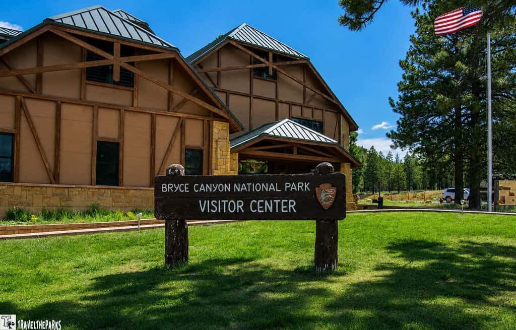
We Started Our Road Trip at the Visitor Center
As you approach the park, you’ll catch glimpses of the stunning scenery that awaits you. Your road trip to Bryce Canyon National Park should include a stop at the Visitor Center. Heading to the park’s visitor center, you will learn more about the geology, flora, and fauna of Bryce Canyon. We stopped at the visitor center to get a map of the park.
The Bryce Canyon Visitor Center is a great place to start your adventure. We recommend taking some time to speak with park rangers who can provide valuable insights and recommendations for the rest of your visit. The Visitor Center also features interpretive exhibits and a bookstore. Browse the exhibits, as many include interactive elements, videos, and informative panels. Watch the film “A Song of Seasons“. It is 24-minutes long, playing every 30-minutes during the summer. The center is open from 8 AM to 8 PM daily.
Families with children can participate in the Junior Ranger Program, available at the visitor center. Kids can pick up activity booklets and complete various educational activities to earn a Junior Ranger badge and certificate. It’s a fun and educational way for children to connect with the park.
Hidden Beauty in Bryce Canyon: Mossy Cave Trail
We followed Hwy 12 past the cutoff for Bryce Canyon NP into the town of Tropic. Stopping for a quick lunch, we continued on Hwy 12 to the Mossy Cave Trail. It is one of the few trails in the park that is accessible from outside the park boundaries.
This is a worthwhile side trip. This section of Bryce is often called Water Canyon. Mormon settlers created the stream by diverting water from the Sevier River. The shallow ravine provided a water source as well as irrigation water that could be accessed all year long. They also refer the stream to as the Tropic Ditch.
PRO Tip: The trail can be hot during summer months, so it’s recommended to bring water, sunscreen, and a hat.
The Mossy Cave Trail is a comfortable, family-friendly hike, 0.8 miles round trip, suitable for all ages and skill levels. The trailhead, located at mile-marker 18, has a small parking area and nearby restrooms.
The path follows a small creek and gradually climbs, crossing two small bridges. Taking the left fork leads to Mossy Cave, a grotto where dripping water allows moss to grow along the walls. The temperature drops slightly inside due to shading, offering a cool respite on a warm afternoon. While the cave itself is modest and not particularly impressive, it provides a pleasant spot to pause and escape the heat, though the climb can be a bit steep—especially at altitude.
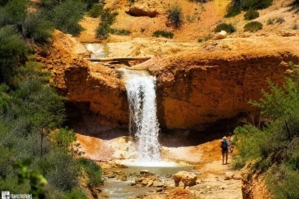
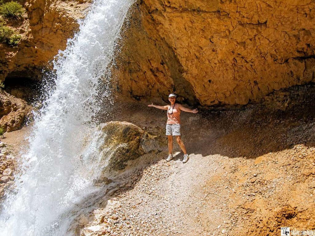
Cooling Off at the Waterfall in Bryce Canyon
Along the trek, it s marked with interpretive signs that provide information about the geology, plants, and history of the area. These signs offer educational insights into the unique features of the trail.
We headed back down the trail, walking toward the waterfall. As you walk the trail to the falls, you hear the sound of the stream. The view of the waterfall from the trail was exquisite, with the hoodoos behind it. The falls cascade 15 feet over a ledge into a circular plunge pool. You can walk to the top of the stream, but we opted to walk under the falls-soaking our heads to cool off in the super cold water. This trail is definitely worth checking out, provided you have the time. You get a fresh perspective of the canyon on this trail.
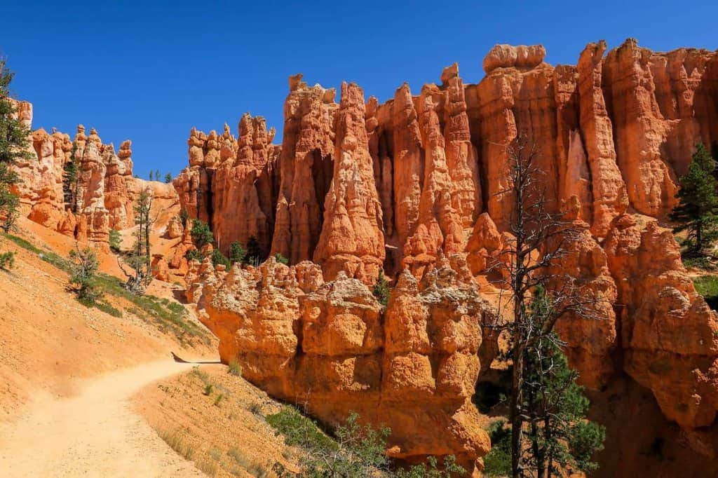
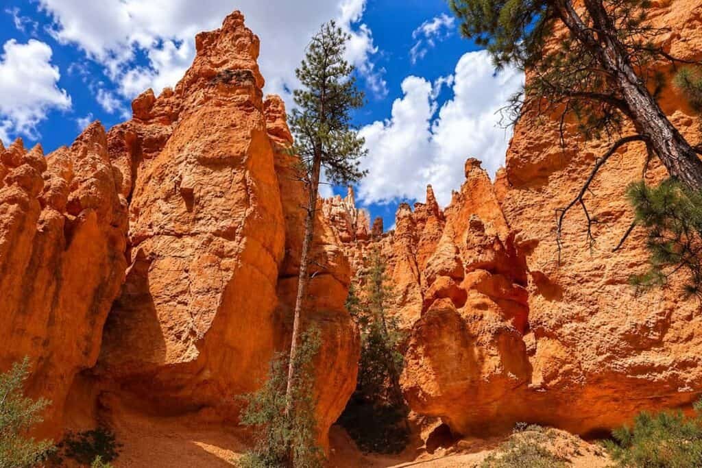
Hiking the spectacular Navajo Loop Trail in Bryce Canyon
This was our favorite trail in the park. Descending into the heart of the canyon, the Navajo Loop is a 1.3-mile loop, ultimately ends at Sunset Point. We started the hike late in the afternoon. The heat of the day was already upon us. Bring proper footwear! Saw many people slipping and struggling as they wore flip-flops or loose-fitting sandals. You really should have sturdy walking or hiking shoes as the trail is loose dirt. A quality trekking stick would be advisable on the switchbacks.
Hiking into The Amphitheater
This hike took us into the heart of the amphitheater. We recommend having a refillable water bottle to quench your thirst in the heat. The hot, dry air can take its toll in the summer if you don’t hydrate.
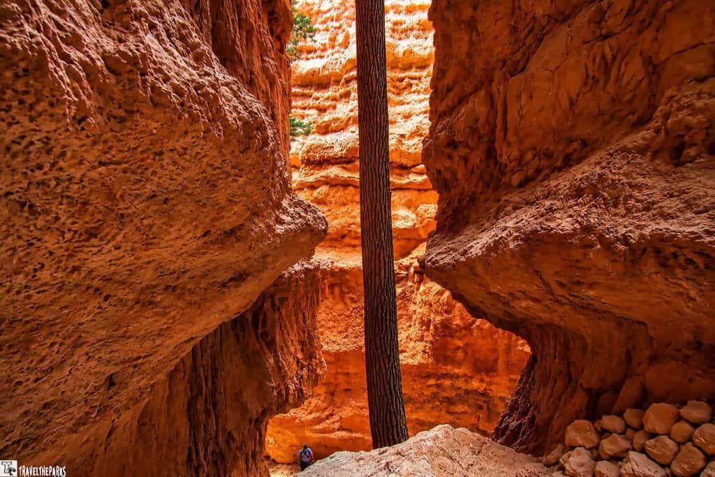
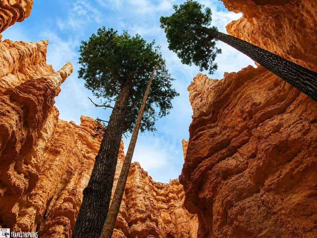
We departed from the top of the canyon rim, beginning at Sunset Point. You can access Sunset Point via the park’s free shuttle system or by parking in the designated parking area. The Navajo Loop Trail descends 550 feet into the amphitheater via a set of narrow switchbacks known as Wall Street. Standing between the towering rock walls is something you do not want to miss! In some places, towering Douglas fir trees grow up through sheer walls. The temperature for us is better on Wall Street. Dropping a few degrees was such a relief. This sheer-walled ravine gives way to the open expanse of the amphitheater. The otherworldly beauty of the hoodoos up close as you wind your way through the narrow passages and towering rock formations is impressive.
At the Twin Bridges, about the halfway point, there is a benchmark here and a nice shady area to hang out and have some lunch. Walking through the amphitheater, the massive, yet incredibly colorful hoodoos proved their point about how insignificant we are!
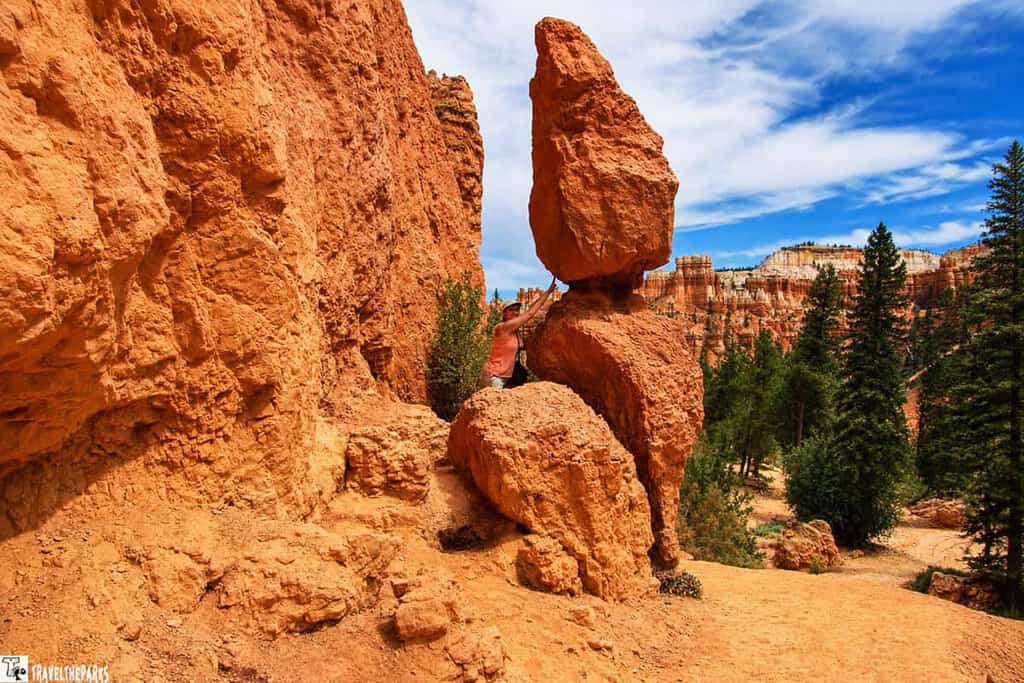
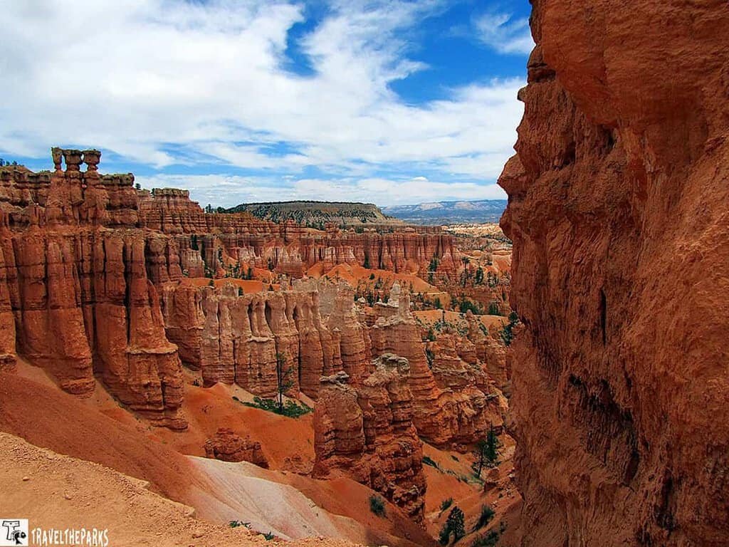
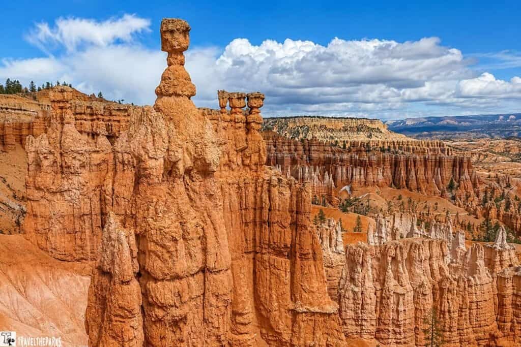
The Ascent: Thor’s Hammer to Sunset Point
On the ascent back to Sunset Point, the striking pinnacle Thor’s Hammer rises dramatically. With its narrow neck supporting a larger rock, it truly resembles a hammerhead and is one of the park’s most photographed geological features.
Looking west from the trail, the “Silent City” unfolds—a collection of rock formations that resemble towers, buildings, and temples. For me, it felt like something straight out of a “Lord of the Rings” scene. To the east, we could see the Temple of Osiris. Surrounded by countless hoodoos, the landscape seemed like a bustling city frozen in stone—a mesmerizing sight that truly captures the park’s unique and otherworldly beauty.
If you’re not very athletic, have health conditions, or are out of shape, this trail may prove challenging. While the 320-foot elevation change might not sound like much, remember that what goes down must come back up. The climb out of the canyon can be oxygen-depleting, especially at altitude. I had to stop several times to catch my breath—altitude was definitely a factor for this Florida girl!
My advice: don’t rush it. Take your time, enjoy the scenery, and bring plenty of water to stay hydrated.
The park newsletter shows hikers should travel counter-clockwise, but many people were hiking it clockwise. I prefer clockwise to save the best for last. It may be less steep hiking counterclockwise. If we did the trail again, we would take the Queen’s Garden trail as the ascent is easier and more gradual.
The Ultimate Bryce Canyon Hiking Adventures
Besides the Navajo Loop Trail, there are other hiking trails that provide access into the Amphitheater of Bryce Canyon. Here are a couple of notable options:
- Queen’s Garden Trail: This is a 1.8-mile trail that begins at Sunrise Point and descends into the Amphitheater. It is known for its scenic beauty and the opportunity to see rock formations resembling Queen Victoria and her garden. The trail offers a less steep descent compared to the Navajo Loop Trail, making it a popular choice for hikers.
- Peek-a-Boo Loop Trail: If you are looking for a more extensive exploration into the Ampitheater, then this is one of the best. The 5.5-mile loop trail begins at Bryce Point. It descends into the canyon, passing by stunning rock formations with many inspiring vistas. The well-known “Peek-a-Boo” rock formation, which can be seen from the trail, generated the trail’s name.
Hiking at the Amphitheater can be made longer and more interesting by combining the Navajo Loop Trail with either the Queen’s Garden Trail or the Peek-a-Boo Loop Trail. These trails let you see the unusual geological formations of Bryce Canyon from a variety of angles and take in their enchanting beauty.
What Exactly is a Hoodoo?
Good question. We had to look it up too.
Basically, it’s soft rock wearing a hard hat. A cap of tougher stone sits on top of softer sedimentary rock, protecting the column underneath from getting eroded away as fast as everything around it. Nature’s little cheat code.
Two things do most of the heavy lifting: frost wedging and rain. Freeze, thaw, crack, wash, repeat. For thousands of years. Eventually, you get these tall, skinny spires that look like they belong in a Dr. Seuss book.
Some are only a few feet tall. Others tower several hundred feet. And they twist into all sorts of shapes—figures, animals, weird structures. Other parts of the world call them “fairy chimneys,” which sounds way more magical than “geological oddity.”
We honestly spent way longer than we planned just staring at them. They’re strange and colorful and don’t quite look real. But they are. And that’s what makes them fun to look at.
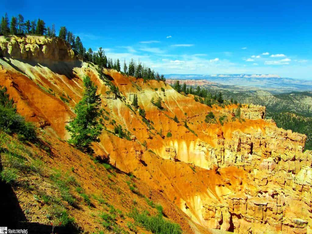
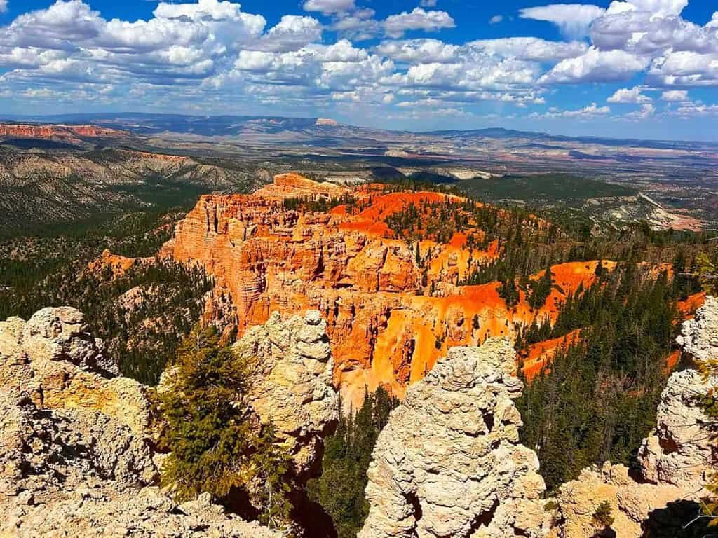
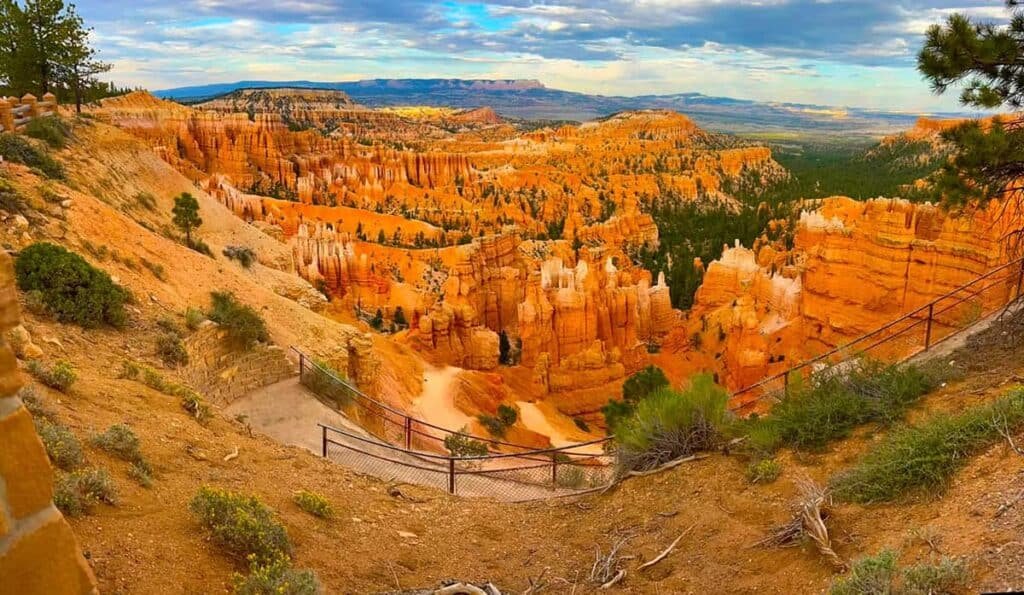
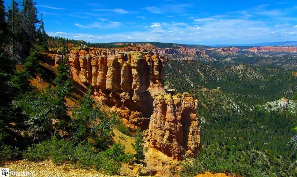
Drive the Awe Inspiring Bryce Canyon Scenic Overlooks
We spent part of our second day driving Bryce Canyon’s scenic road and stopping at several overlooks. There were far more viewpoints than we expected, each offering a completely different perspective of the hoodoos and surrounding plateaus. Rather than trying to squeeze them into this itinerary, we’ve put together a complete guide to Bryce Canyon’s Scenic Drive that covers every overlook and what makes each one worth the stop.
Here’s what we found along the way, from the southern end back toward the entrance:
- Rainbow Point – the highest point on the drive at 9,115 feet, with far-reaching views over the Paunsaugunt Plateau and distant mountain ranges
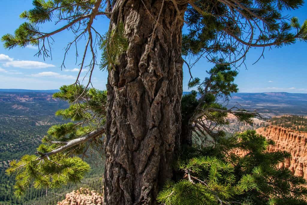
- Bristlecone Pine Loop Trail – an easy 1-mile rim walk through a grove of Bristlecone Pines, some pushing nearly 2,000 years old
- Yovimpa Point – shares a parking lot with Rainbow Point, sits at 9,100 feet, and delivers a quieter, 360-degree view of the Grand Staircase and Kaibab Plateau
- Ponderosa Canyon – vermilion hoodoos set against an old-growth forest of blue spruce, Douglas fir, and ponderosa pine; wheelchair-accessible viewpoint
- Agua Canyon – home to two of the park’s standout hoodoos, nicknamed “The Hunter” and “The Rabbit,” with distant views of Navajo Mountain (no facilities here, so plan ahead)
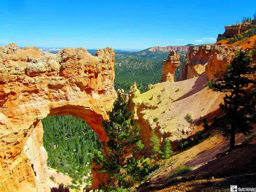
- Natural Bridge – a striking red-rock arch you can photograph without leaving the parking area
- Swamp Canyon – a quieter, lesser-visited pocket of wetland scenery, with access to a moderate 4-mile connector loop for those chasing solitude
- Farview Point & Piracy Point – wide panoramic views from the main overlook, plus a flat, foot-only trail extension out to Piracy Point
- Prairie dog meadows – protected habitat for the endangered Utah Prairie Dog, near the north end of the drive by the visitor center
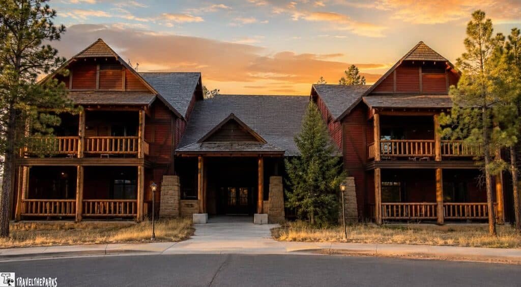
Where We Stayed: The Lodge at Bryce Canyon
Bryce is one of the most beautiful parks we’ve visited, and staying inside made it even better. Once the day-trippers cleared out each evening, the place got wonderfully quiet.
The Lodge at Bryce Canyon is the only spot inside the park, and you can’t beat the location—two-minute walk to the rim. Designed in the 1920s by Gilbert Stanley Underwood, it’s been a National Historic Landmark since 1987.
Check-in was smooth, staff were friendly, and we booked a full year in advance—yeah, plan ahead. While waiting, we watched a chipmunk steal someone’s chips. Best entertainment of the day. There’s Wi-Fi in the lobby, but it’s weak.
Our Room at Sunset Lodge
We stayed in the standalone Sunset Lodge building—basic but comfortable. First floor, right near the stairwell, and the ice machine got noisy during the day. Otherwise, clean, roomy, and cozy.
Two queen beds, extra sink, microwave, coffeemaker, mini fridge, and a screen door to a small porch. No AC, TV, Wi-Fi, or cell signal in the room. But the screened window let in cool night air, which made up for no AC. If you’re on the first floor, you’ll hear footsteps above—second floor’s quieter.
The real perk: walking to Sunset Point for golden hour and Sunrise Point for, well, sunrise. We watched deer graze outside our window and chipmunks steal chips from the patio. It’s rustic, peaceful, and perfectly located.
Next morning, we walked to Sunrise Point for first light. Those early rays on the hoodoos? Some of our favorite photos from the whole trip.
Bryce Canyon Dining Options
Dining inside the park is limited, but there are a few solid spots to grab a meal.
General Store
Right next to the lodge, this place has quick bites—sandwiches, snacks, ice cream, and drinks. We stocked up on fruit, milk, sandwich meat, and bread, and also grabbed pizza slices and hot dogs when we didn’t feel like making our own. Prices were reasonable, and we finished with ice cream sandwiches while watching sunset from the rim. Pretty great way to end the day.

Valhalla Pizzeria & Coffee Shop
Valhalla Pizza & Coffee is tucked in a little building out front of the lodge, with outdoor and indoor seating. We sat outside in the woods—pleasant spot. Friendly service, and the free Wi-Fi was a nice bonus. We grabbed coffee and sat down to map out our itinerary. Didn’t try the pizza, but it looked amazing. On our way back to the room near sunset, we spotted a couple of deer. Good spot for a quick muffin or scone and fresh coffee before hitting the trails.
Lodge Dining Room
This restaurant requires a dinner reservation. The room has exposed log trusses and a rustic but formal vibe—table settings are fancy enough that you might feel a little underdressed. Prices are on the higher end, but the food delivered. I had duck—tender and perfectly cooked—and my husband raved about the seafood risotto. The elk chili appetizer was outstanding. As a bonus, we watched deer stroll past the window while we ate. We’d definitely eat here again..
Essential Supplies for Your Road Trip to Bryce Canyon National Park
When visiting Bryce Canyon National Park, it’s important to pack the right supplies to make the most of your adventure. A sturdy backpack is essential to carry your essentials, including plenty of water bottles or a hydration system to stay hydrated during hikes. Wear comfortable hiking boots for proper support on rugged trails and bring a hat and sunscreen to protect yourself from the sun’s rays. A map or GPS device will help with navigation, while a camera is a must for capturing the stunning views. A lightweight jacket is recommended, as temperatures can drop in the evenings, and a first aid kit is always useful for emergencies. Don’t forget a headlamp or flashlight if you plan on exploring early in the morning or after dark. To stay comfortable and safe, consider packing snacks, trail mix, and a multi-tool for any unforeseen situations.
Final Thoughts Road trip to See Awesome Bryce Canyon An Epic 2-Day Adventure
A road trip to Bryce Canyon National Park promises an epic 2-day adventure filled with awe-inspiring landscapes, captivating hikes, and unforgettable experiences. From the panoramic viewpoints to the intricate hoodoos, every moment spent in this natural wonderland will leave you in awe. Pack your camera, hiking gear, and a spirit of adventure as you embark on this remarkable journey to witness the exceptional beauty of Bryce Canyon.
Bryce Canyon is a magnificent park. The scenery is unlike any other Utah 5 parks on the Grand Circle Tour. Truly different from Zion and Grand Canyon National Parks. Carefully planning your road trip to Bryce Canyon National Park can be a rewarding adventure!
Do you plan to visit Bryce Canyon? Have you already hiked the trails? Tell us what you think, we love it when you SHARE!!