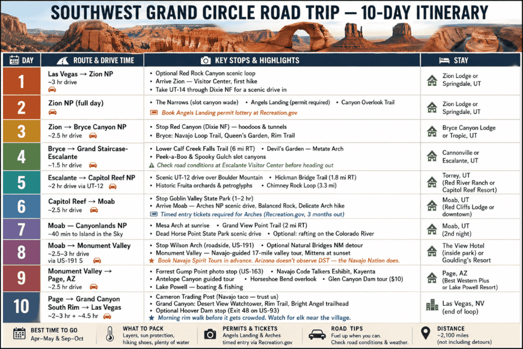
Table of Contents
Updated April 2026
There is a stretch of the American Southwest where Utah and Arizona take turns trying to outdo each other, and honestly, neither one ever wins. Red rock arches, hoodoos you will not believe until you are standing next to one, sacred Navajo lands, and canyon views that have a way of making whatever is on your mind feel much less important. The Utah Mighty 5—Zion, Bryce Canyon, Capitol Reef, Canyonlands, and Arches—are the backbone of the Southwest Grand Circle Road Trip Itinerary, and then Monument Valley, Antelope Canyon, Horseshoe Bend, and the Grand Canyon show up and make the word “road trip” feel like an understatement. All of it connected in a single 1,400-mile loop.
We have done this desert Southwest road trip more than once. That should tell you something. Every time we think we have checked it off the list, something pulls us back — usually the memory of standing on a canyon rim at sunrise, wondering why we do not do this more often. Whether you are working with 10 days or two full weeks, this Southwest Grand Circle road trip itinerary is built to fit your schedule and honest enough to tell you what is actually worth your time. Buckle up.
This post may contain affiliate links, meaning if you purchase something through one of these links, we may earn a small commission at no extra cost to you! Read the full disclosure policy here
Before You Go: Planning Your Grand Circle Southwest Road Trip
A Southwest Grand Circle road trip itinerary does not come together on its own. Here is what we always do before we hit the road on any Arizona—Utah road trip of this scale:
- Buy the America the Beautiful Annual Pass ($80) if you plan to hit multiple national parks. It pays for itself fast on a Grand Circle national parks loop.
- Book accommodations 6 months in advance—especially for park lodges. They fill up faster than you’d think.
- Download offline maps and apps before you leave. Cell service is essentially a rumor in most of the parks on this desert Southwest road trip.
- Print and laminate your paper maps. We have been doing this for years, and it never fails us.
- Pack a well-stocked daypack: water (lots of it), sunscreen, binoculars, snacks, and layers. Temperatures swing wildly in the Southwest.
- If a park shuttle exists, use it. Parking in peak season is a competitive sport we prefer not to play.
PRO Tip: This Southwest Grand Circle Road Trip Itinerary can be customized based on your preferences, pace, and the season. Some distances between stops are significant, so build in buffer time and enjoy the drive. Some of our best memories happen between the parks, not just inside them.
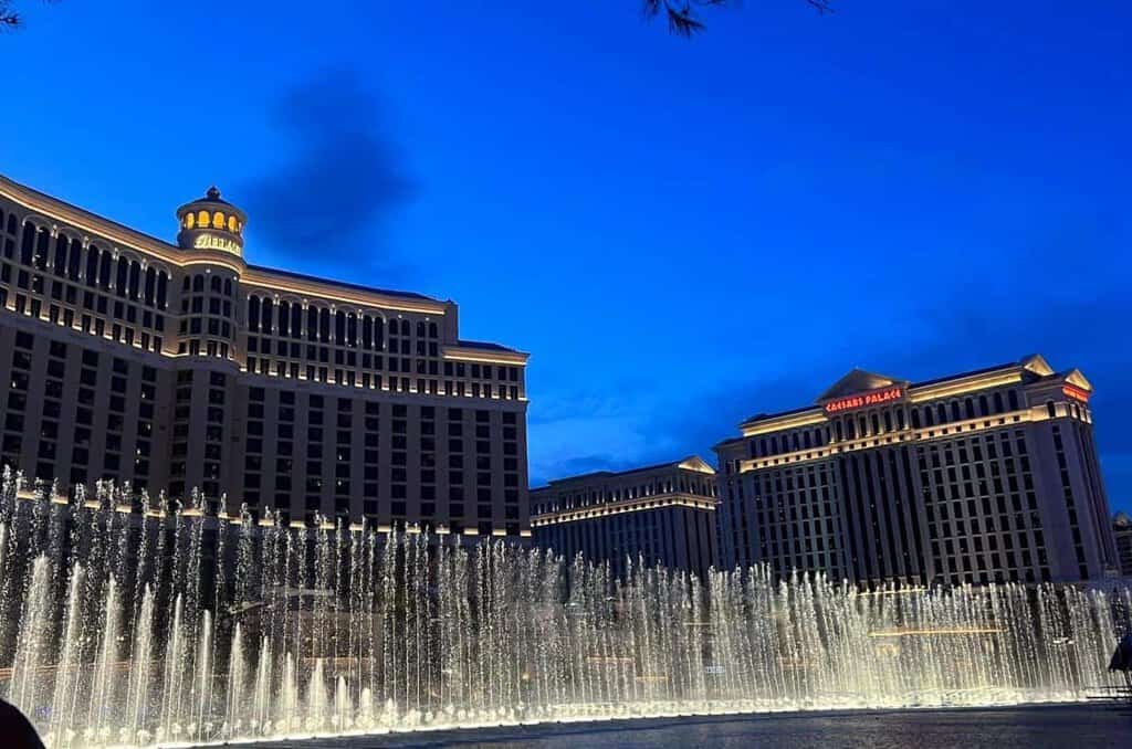
DAY 1: LAS VEGAS TO ZION NATIONAL PARK
Here’s the deal: most people kick off this Grand Circle self-drive tour by flying into Las Vegas, Salt Lake City, or Phoenix. We almost always go to Las Vegas—fly in, grab a rental, and get moving. Land with daylight? Go straight to Red Rocks Canyon. Fifteen miles from the airport and those red sandstone cliffs will hit you before you even have time to shake off the flight. Most people skip it in favor of getting on the road faster—we think that is a mistake.
Optional Side Trip: Red Rock Canyon
Red Rock Canyon is only about 15 miles west of Vegas, right off State Route 159. It’s huge—nearly 200,000 acres of classic Mojave Desert scenery. There’s a one-way scenic loop drive that’s worth doing even if you’re just passing through, and those red cliffs will get you genuinely hyped for everything ahead on this Southwest grand circle road trip itinerary.
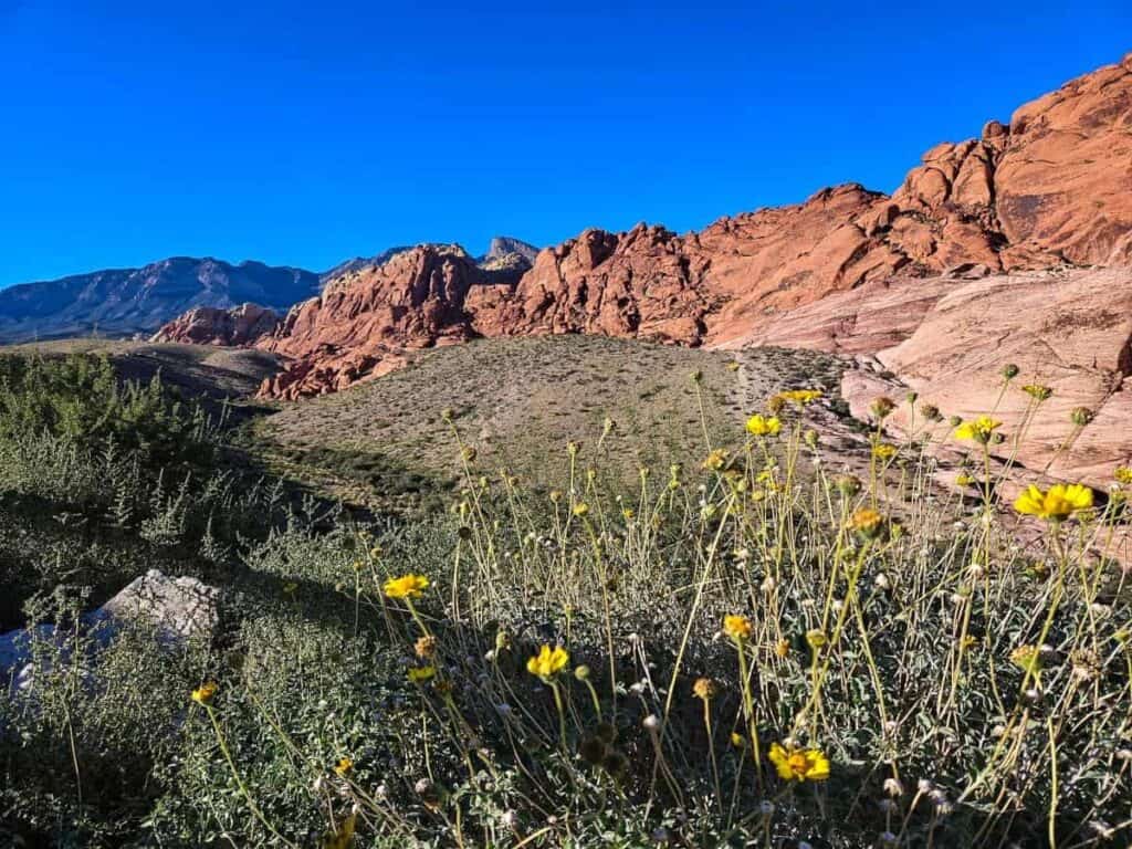
On our first visit, we were crunched for time, so we did the loop and kept moving. But here’s a move we always stick to no matter what park we’re in: hit the visitor center first. The rangers know their stuff—fresh trail conditions, recent wildlife sightings, little tips you will not find on any website. If you have extra time, Lost Creek Trail is an easy hike out to a small grotto and waterfall. Nothing dramatic, just a pleasant surprise in the middle of the desert.
PRO Tip: Timed vehicle reservations are required for the Scenic Loop between 8 AM and 5 PM from October 1 through May 31. Book in advance at Recreation.gov.
.
Las Vegas to Zion: The Scenic Route
Rather than taking the straightforward interstate, consider heading northeast on Utah State Route 14 through Dixie National Forest, past Cedar Breaks National Monument, and connecting with US-89 south into Zion. It adds a bit of time but delivers scenery that makes the Grand Circle Southwest road trip feel like it has already started—because it has.
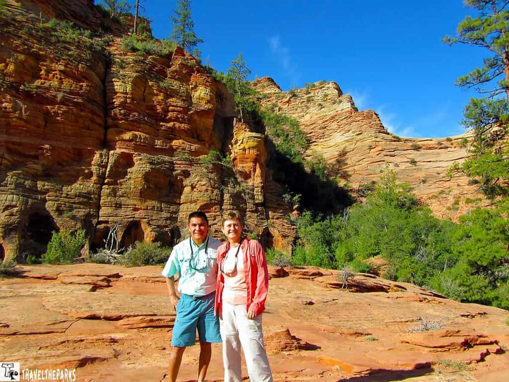
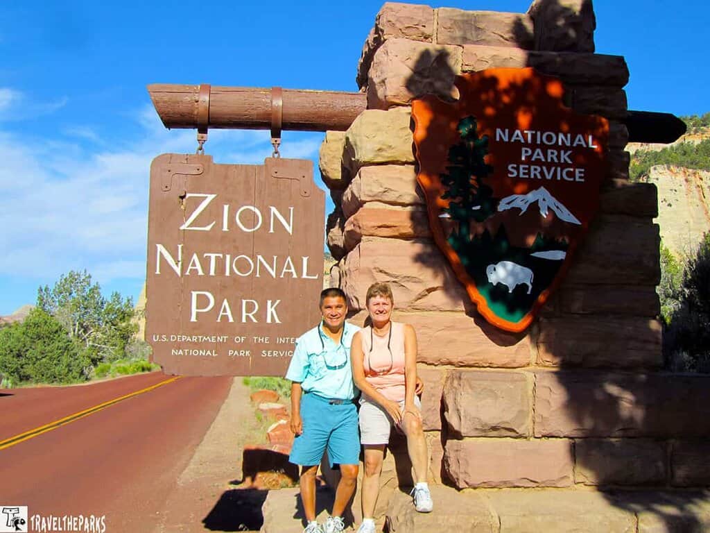
Day 2: Zion National Park: The Star of Utah’s Mighty 5
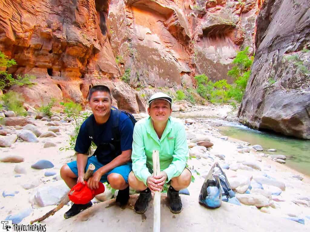
We will say it plainly: of all the Utah national parks on this Southwest Grand Circle road trip itinerary, Zion was our personal bucket-list leader. The sheer scale of the red rock walls, the low ribbon of the Virgin River winding through the canyon floor, the hikes that range from “pleasant stroll” to “vertiginous and unforgettable”—Zion delivers on every level.
We strongly recommend giving Zion at least two full days. One day simply is not enough, and you will leave knowing it.
- The Narrows: A slot canyon hike that involves wading through the Virgin River. It is wet, it is wild, and it is one of the best things we have ever done. Start early.
- Angels Landing: The famous narrow ridge trail with a 1,500-foot drop on either side. Not for the faint of heart—or those afraid of chains.
- Canyon Overlook Trail: An easy one-miler near the Mt. Carmel Tunnel with impressive views and a great sunrise spot.
- Observation Point via East Mesa Trail: Rewards hikers with an aerial view over the entire canyon.
Pro Tip: As of April 2022, Angels Landing requires a permit obtained through a lottery at Recreation.gov. Enter well in advance. The Narrows does not require a permit, which is one more reason we prefer it.
Where to Stay in Zion
Zion Lodge sits inside the park and is our top pick if availability allows. Springdale, just outside the entrance, has excellent lodging options for every budget. The Watchman Campground is open year-round for campers; Lava Point Campground is seasonal. Reserve 6 months out at Recreation.gov for any in-park options.
DAY 3: ZION NATIONAL PARK TO BRYCE CANYON NATIONAL PARK
Two and a half hours from Zion to Bryce Canyon—and this particular drive is one we genuinely look forward to every time. Don’t just white-knuckle it to the next park. Pull over when something catches your eye, because things will catch your eye.
Out of Springdale, you take Route 9 east along the Zion-Mt. Carmel Highway. Checkerboard Mesa comes up on your right and it stops you every single time—this massive sandstone dome with a natural grid pattern carved into it. Hard to explain, just look up from the wheel when you get there.
Then it’s US-89 north toward Bryce. The valley opens up and the pace of everything slows down a little. Small Mormon pioneer towns, cattle ranches, the Sevier River cutting through the fields. Nobody’s in a hurry out here, and after a few days of hiking, that energy is contagious. It’s the kind of in-between stretch that reminds you the drive is part of the trip, not just the getting-there part.
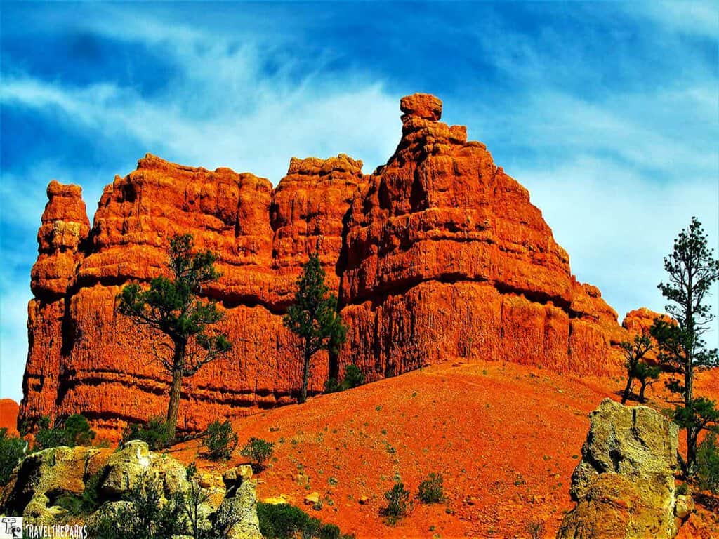
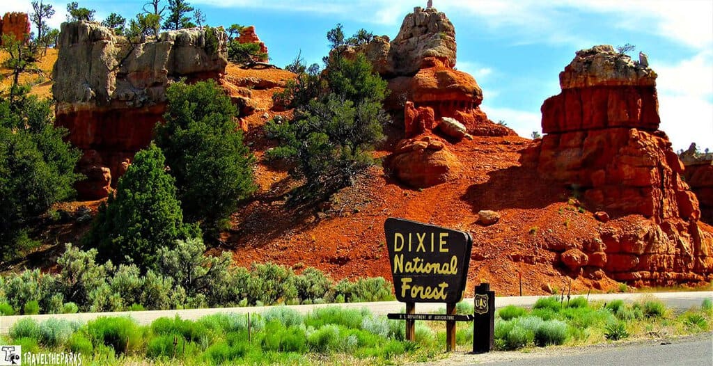
Stop: Red Canyon in Dixie National Forest
About 7 miles east of Panguitch, turn onto Highway 12 toward Bryce. But before you even get to the park, you’ll hit Red Canyon — and don’t just blow past it. There are two massive red rock tunnels framed by hoodoos and spires that give some of the famous stuff down the road a real run for its money.
Most people zoom right by. We always stop.
Red Canyon sits inside Dixie National Forest—2 million acres of protected land with a whole network of hikes, mountain bike trails, and ATV routes if that’s your thing. Short on time? Do the Red Canyon Tunnel Trail. It’s less than a mile out and back, the rock formations are gorgeous, and it’s a total photo magnet.
The visitor center is low-key and helpful. Just tell them what your group is up for and they’ll point you in the right direction.
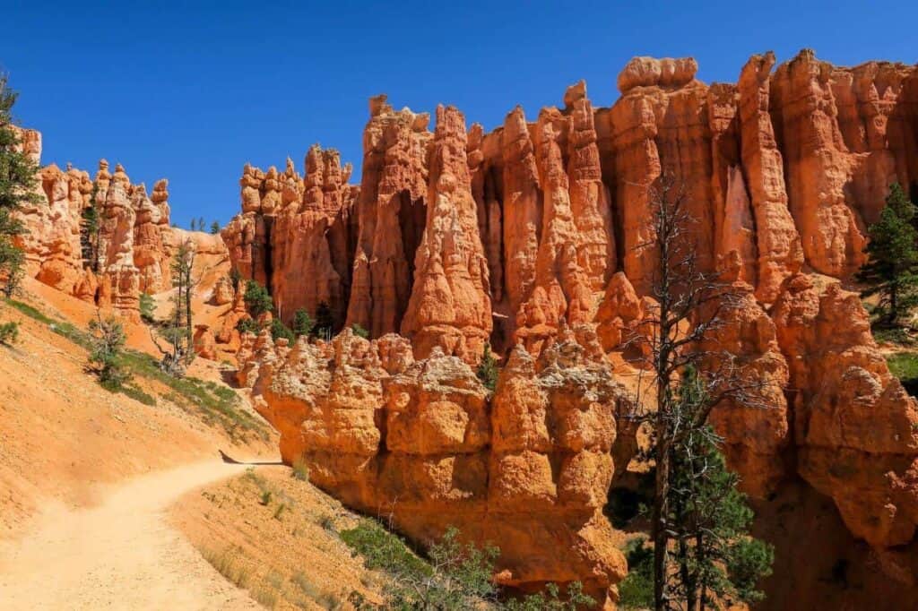
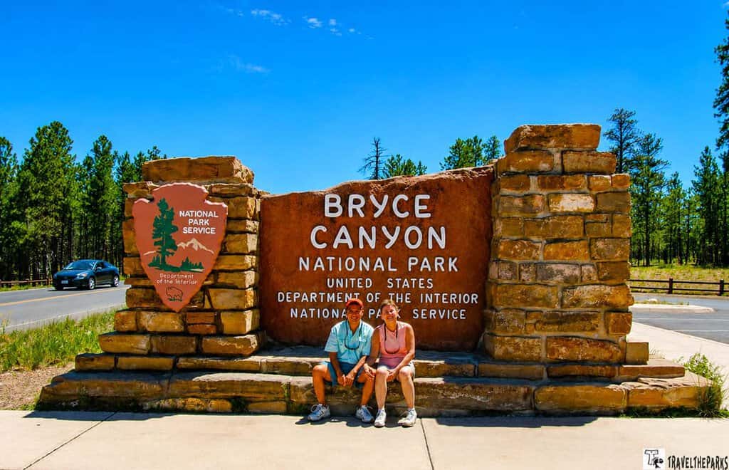
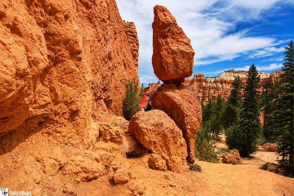
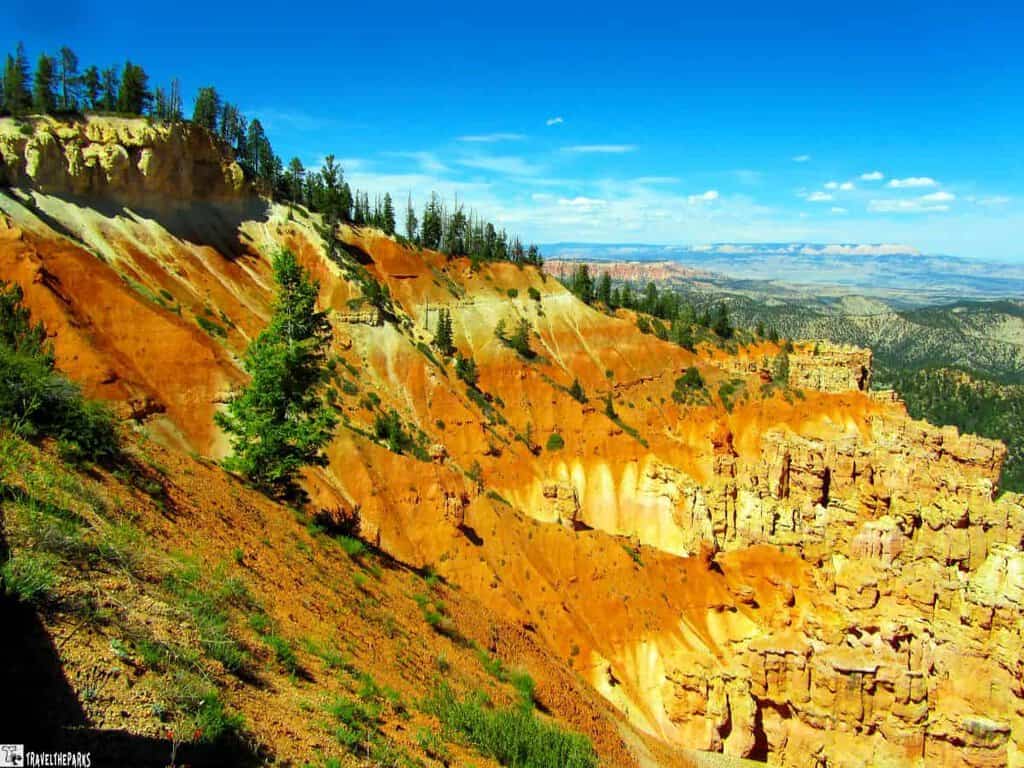
Bryce Canyon National Park: Hoodoo Heaven
Bryce Canyon is one of those places that just sticks with you. There’s nothing else like it on this whole Arizona—Utah road trip. Or anywhere else, really.
If you’ve never seen a hoodoo in person, the photos don’t really do it justice. They’re these tall, skinny rock spires—weird and lumpy and somehow completely majestic all at once. Frost and erosion have been chipping away at them for millions of years, and what’s left looks like nothing we’ve ever seen anywhere else on this trip. Or any other trip. We’ve stood in that amphitheater more than once now, and it still catches us off guard every time.
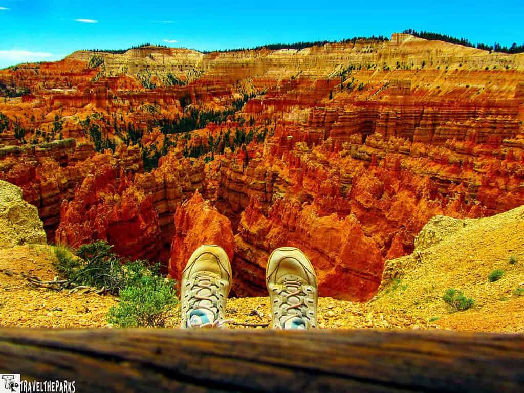
What to See and Do at Bryce Canyon
- Navajo Loop Trail (1.3 miles, moderate to strenuous): Winds through the “Wall Street” section of hoodoos. Steep switchbacks and tight red walls. Absolutely worth it.
- Queen’s Garden Trail: Pair it with the Navajo Loop for a longer, varied experience with different perspectives on the hoodoos.
- Rim Trail: Offers panoramic amphitheater views without the serious elevation change. Great for all fitness levels.
- Horseback Riding: Ruby’s Inn in Tropic runs trail rides right into the amphitheater. Seeing the hoodoos from the saddle is an experience in itself.
- Scenic Parkway Drive: Pull off at each overlook. Each one frames the amphitheater differently, and no two views are the same.
PRO Tip: Bring trekking poles on any Bryce trail. The steep descents into the amphitheater are hard on knees, and the loose trail surface rewards extra grip. Follow Leave No Trace principles and pack out everything you pack in.
Where to Stay in Bryce Canyon During Your Southwest Trip
We stayed at the Bryce Canyon Lodge on our trip—close to the amphitheater trailheads and within easy walking distance of everything. The park has two campgrounds, and the surrounding area offers options like Stone Canyon Inn and Canyon Country Lodge in Escalante for something more secluded.
DAY 4: BRYCE CANYON TO GRAND STAIRCASE-ESCALANTE NATIONAL MONUMENT
This next stretch of the Southwest Grand Circle is only about an hour and a half of driving. But honestly, UT-12 is so gorgeous it’ll make the time fly by.
Head east from Bryce toward Cannonville, and before you really get into the monument, make a pit stop at the Escalante Interagency Visitor Center. It’s worth it. And if you’re rolling in an RV like we were? Here’s a nugget we were really happy to know beforehand—the parking lot has a water fill station. Trust me, that little detail can save your whole day.
Grand Staircase-Escalante National Monument: Off the Beaten Grand Circle
Okay, so—Grand Staircase-Escalante. Not enough people talk about this place, and we genuinely don’t understand why. Maybe because it’s BLM land and not a national park? Maybe because it doesn’t have one single iconic photo attached to it? Either way, the crowds are thin, and we are totally fine with that.
1.9 million acres. Sit with that number for a second—1.9 million acres. You’ve got high desert, slot canyons, fossil beds that had paleontologists absolutely losing it when they first started digging around out here. And the name? It comes from the landscape itself—the rock layers stack up like stairs from the Grand Canyon all the way north to Bryce, with a whole lot of weird and wonderful terrain filling in the middle.
Oh, and the wildlife. Bighorn sheep just standing on the trail like they own the place, pronghorn antelope doing their thing in the distance, birds and reptiles everywhere you look. Easily one of the more animal-packed legs of the whole Desert Southwest road trip—just keep your eyes up and off your phone.
What to See and Do at Grand Staircase-Escalante
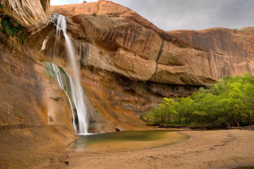
- Lower Calf Creek Trail: A 6-mile out-and-back sandy trail along Calf Creek, flanked by sandstone cliffs and desert flora. The waterfall payoff at the end is spectacular. Freezing cold, but refreshing on a warm day. Look for the petroglyphs at stop #9 on the trail map.
- Devil’s Garden: Easy 1-mile loop featuring Metate Arch. Good for all skill levels and a worthy stop even if time is short.
- Peek-a-Boo and Spooky Gulch Slot Canyons: Combine them into a 3.5-mile loop for a taste of slot canyon exploration without the crowds of Antelope Canyon.
PRO TIP: Check road conditions at the visitor center before heading out. Many routes within the monument require high-clearance vehicles, and a paved road can become a muddy mess after rain.
Where to Stay Near Grand Staircase-Escalante
Cannonville is your closest base. We’ve heard good things about the Grand Staircase Inn right in town—comfortable rooms, breakfast included, nothing fancy but nothing to complain about either. If you want a few more options, Tropic is about 10 miles out and has places like Bryce Pioneer Village:. RV people—Escalante Cabins & RV Park in Escalante is roughly 20 miles away and a solid spot to land for the night. Just don’t wait too long to book. This corner of the Southwest national parks itinerary fills up faster than you’d expect.
DAY 5: GRAND STAIRCASE-ESCALANTE TO CAPITOL REEF NATIONAL PARK
UT-12 from Escalante to Capitol Reef might be the best road we have ever driven. We will stand behind that. Boulder Mountain sneaks up on you, and then suddenly the Escalante River basin is spread out way down below and your foot is already hitting the brakes. Stop as many times as you want. Seriously. There is no bad spot to stop on this road. The “All-American Highway” designation? Totally earned.
Anyway, the road ends in Torrey at a stop sign with UT-24. Turn right. Nine more miles and you’re at Capitol Reef. That’s literally it.
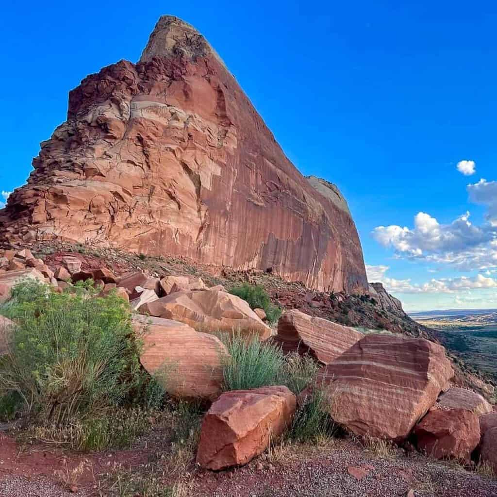
Capitol Reef National Park: Utah’s Underrated Gem
Capitol Reef. Nobody talks about it enough, and we will never understand that.
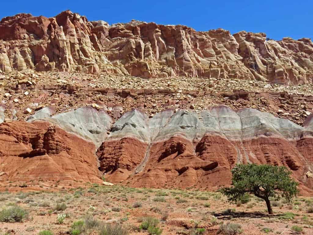
There’s this geological feature here called the Waterpocket Fold. A hundred miles long. Just a massive wrinkle the Earth made one day and never bothered to smooth out. And it’s one of the most dramatic things you’ll see on any Southwest road trip. Add in all the old frontier history scattered around the park, and it’s just… different. In a good way.
We made a beeline for the Gooseneck Overlook first — the canyon views up there stopped us cold. Then the visitor center for trail maps and a chat with the rangers who, as usual, knew exactly what we should do next. Capitol Reef had us from the start.
What to See and Do at Capitol Reef
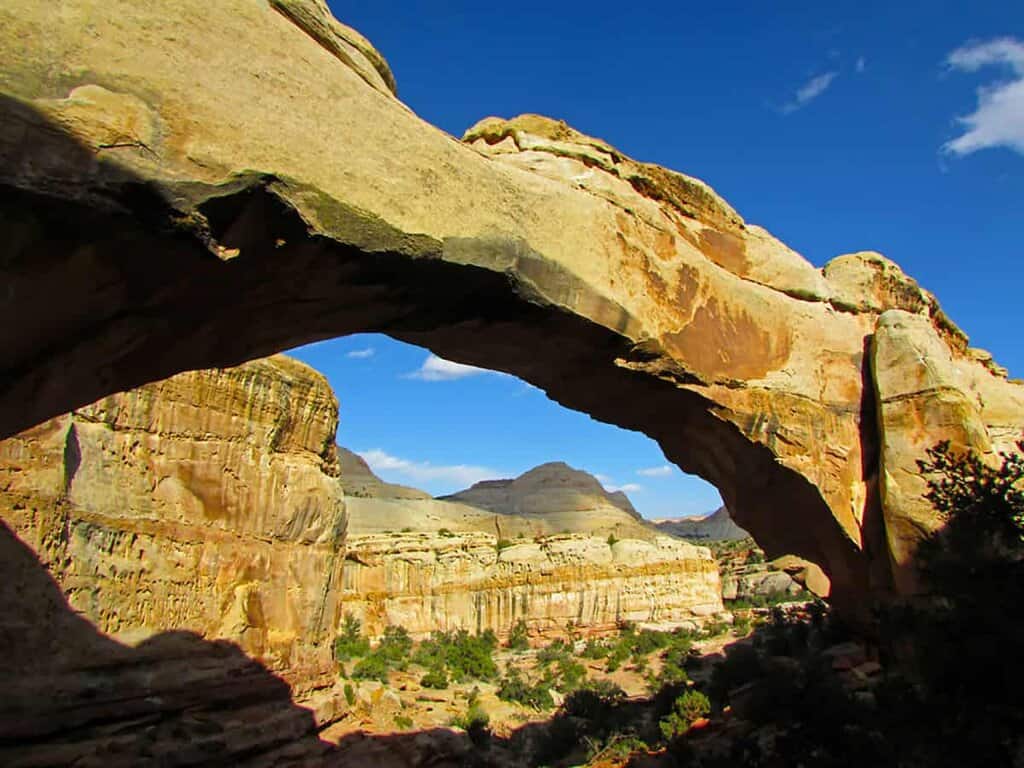
- Hickman Bridge Trail: A 1.8-mile round trip to a natural arch, with switchbacks and canyon views along the way. Moderate difficulty and absolutely worth it.
- Historic Fruita District: A preserved frontier settlement with a working orchard. In season, you can pick fruit straight from the trees. The pie from the orchards is legendary on this part of the Grand Circle self-drive tour.
- Fremont Petroglyphs: Accessible via a short boardwalk, these ancient rock art panels left by the Fremont culture are a fascinating window into the history of the region.
- Chimney Rock Loop Trail: A moderate 3.3-mile loop to a massive sandstone monolith with views of desert flora, juniper, and lizards who do not seem to mind being photographed.

Where to Stay Near Capitol Reef
We stayed at Red River Ranch in Torrey on our visit—slightly higher price point, but the on-site restaurant made it well worth it. Other solid options include Capitol Reef Resort (just outside the park entrance, with cabins and teepees), Broken Spur Inn and Steakhouse in Torrey, and Wonderland RV Park for those doing the Grand Circle self-drive tour in an RV.
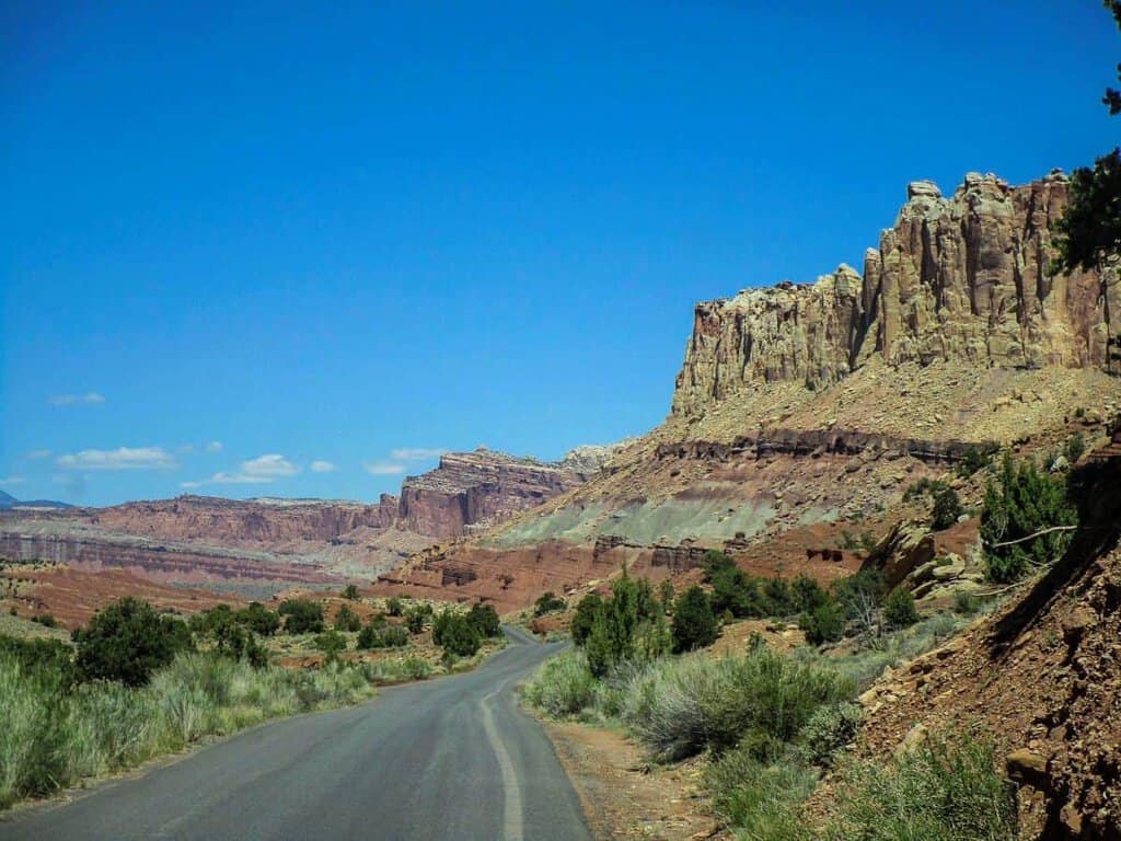
DAY 6: CAPITOL REEF TO MOAB — WITH A STOP AT GOBLIN VALLEY
Moab is about two and a half hours from Capitol Reef. The directions read like a mess — US-24 west, then UT-95, then I-70, then US-191 south. We know. Just put it in the GPS and trust the process. Sounds chaotic. It really isn’t. Just follow the signs and enjoy the ride. Signs are good, and the views keep you awake the whole way.
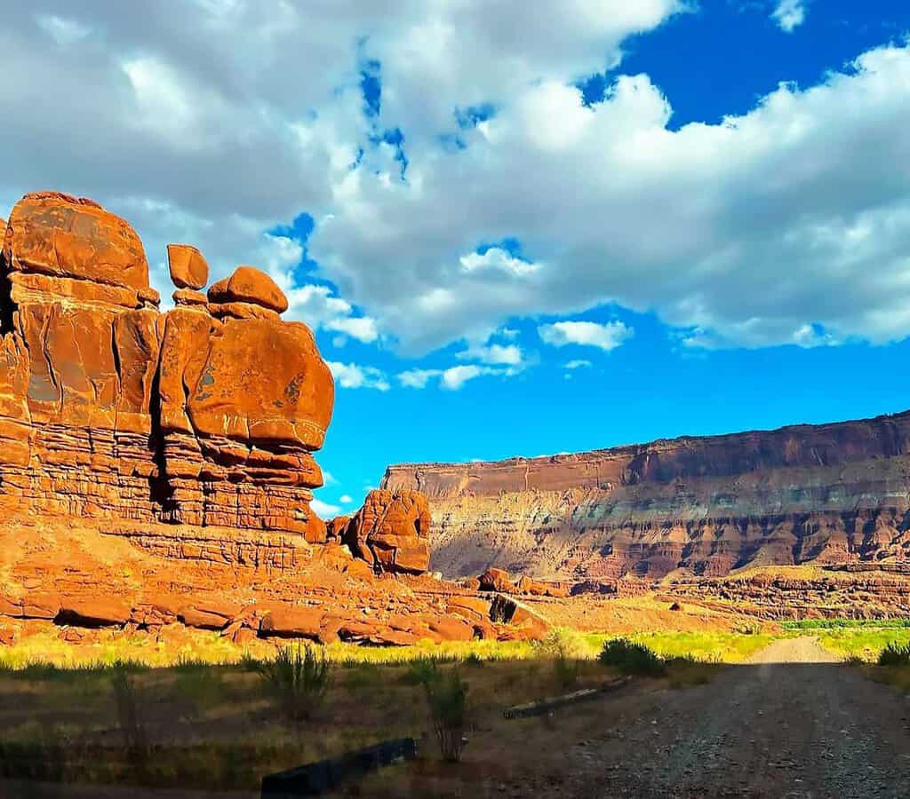
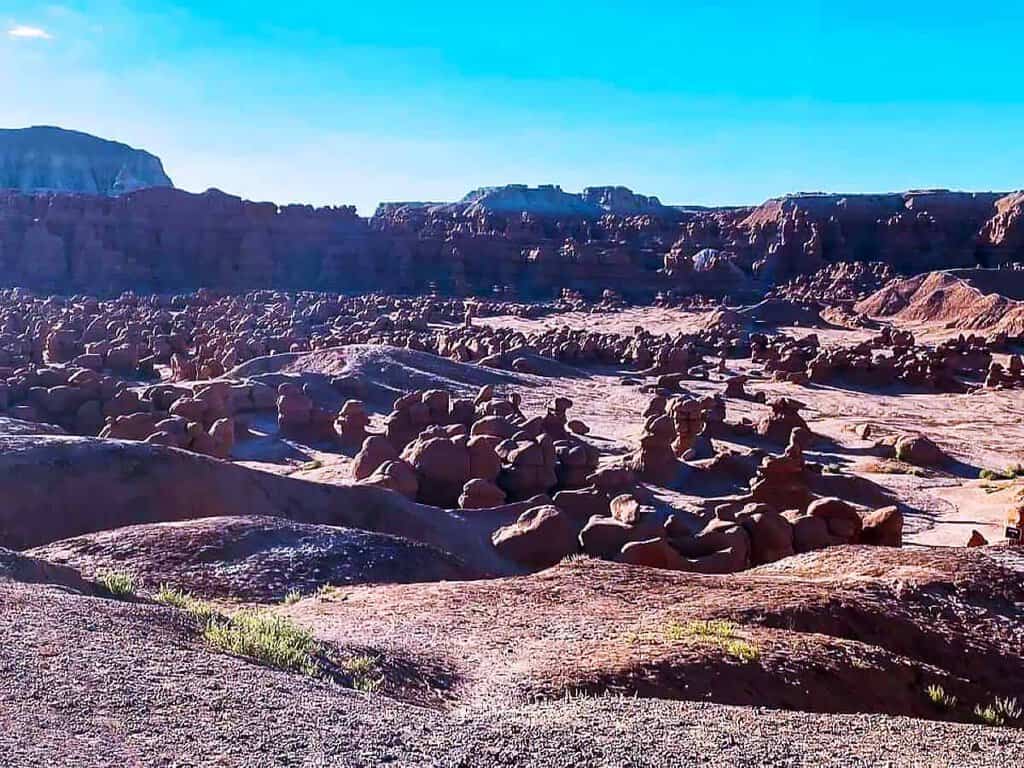
Oh, and do yourself a favor. Pull off at Goblin Valley State Park. We cannot fully explain what you’re looking at when you get there—squat, lumpy rock formations scattered across the desert floor, hundreds of them, just existing. Someone on our first visit said they looked like sleeping aliens, and now we cannot unsee it. Two hours there minimum. Never once regretted stopping. Could’ve stayed longer. Nobody we’ve ever sent there has complained.
Moab: The Adventure Capital of the Southwest
Moab is kind of the perfect home base. You’ve got Arches right there, Canyonlands right there—so yeah, it’s a big deal on this whole Arizona-Utah loop. But here’s the thing: the town itself is actually fun. Good food, gear shops everywhere, and this energy that makes total sense once you see what’s sitting outside the city limits.
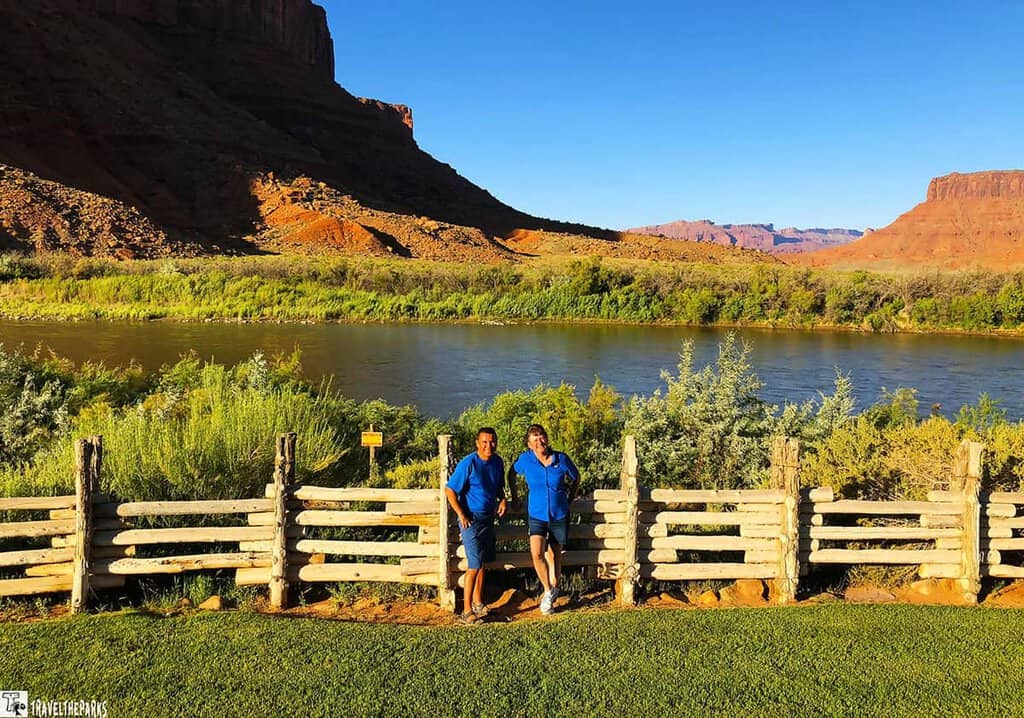
We usually stay at Red Cliffs Lodge on the Colorado River. It’s just a few miles outside of town. For us, it has become our home away from home. Being woken by the Colorado River, surrounded by canyons, creates the perfect mood for the day to come. Moab also has everything from budget motels to full-on resort properties—there is no shortage of options.
What to Do Around Moab
- Rafting the Colorado River: Half-day and full-day float trips are widely available and offer a completely different perspective on the canyon landscape.
- Scenic Drive: Dead Horse Point State Park: The 34-mile round-trip drive features an overlook 1,100 feet above the Colorado River. Even on a tight schedule, this is worth squeezing in.
- Mountain Biking: The Slickrock Bike Trail is legendary. The Whole Enchilada Trail is not for beginners. Moab Brand Trails offer something for every level.
- Jeep Tours: Guided backcountry jeep tours get you into terrain that most vehicles cannot reach. If you are renting a standard car for this Southwest Grand Circle road trip itinerary, a Jeep tour is your ticket to the remote stuff.
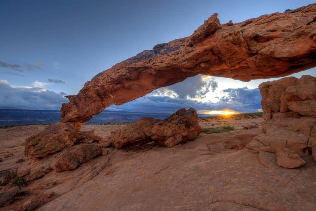
Day 6: Arches National Park: More Than 2,000 Reasons to Stop
Over 2,000 stone arches in 76,000 acres—Arches National Park holds the world record, and it shows. We tried to do it in one day on our first visit. Rookie mistake. We were back in the car wishing we had booked another night before we even made it to half the trails. So learn from us—if you can, give Arches a full day. You won’t regret it.
PRO Tip: Timed entry tickets are required during peak season in addition to your park pass. Tickets are released on Recreation.gov three months in advance. Entry before 7 AM or after 4 PM does not require a timed ticket—early risers have an advantage on this Grand Circle national park stop.
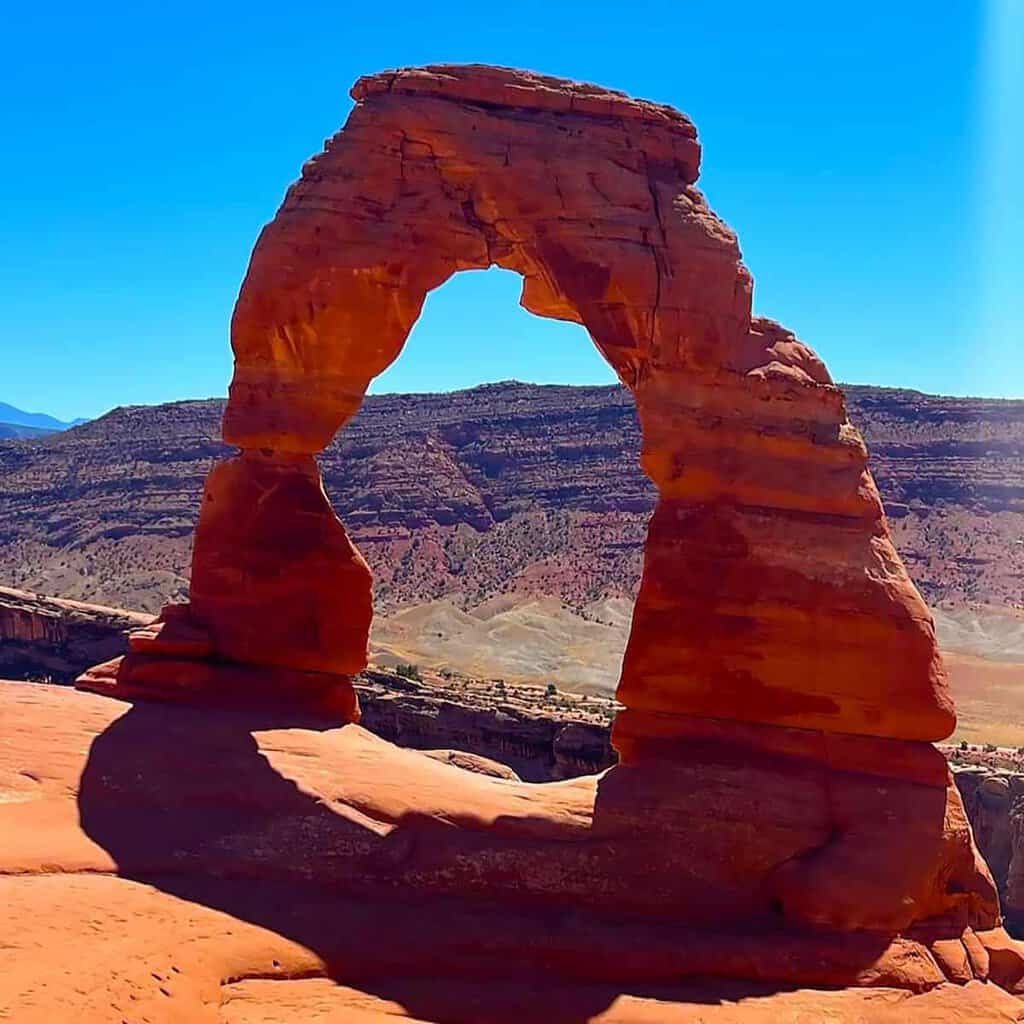
- Delicate Arch Trail: The iconic 3-mile round-trip hike to the most photographed arch in the world. Do it at sunset if you can manage the timing.
- Balanced Rock: Just off the main road and impossible to miss. It looks like it should have fallen over centuries ago.
- Landscape Arch: One of the longest natural arches in the world. Accessible via a 1.6-mile trail through the Devil’s Garden area.
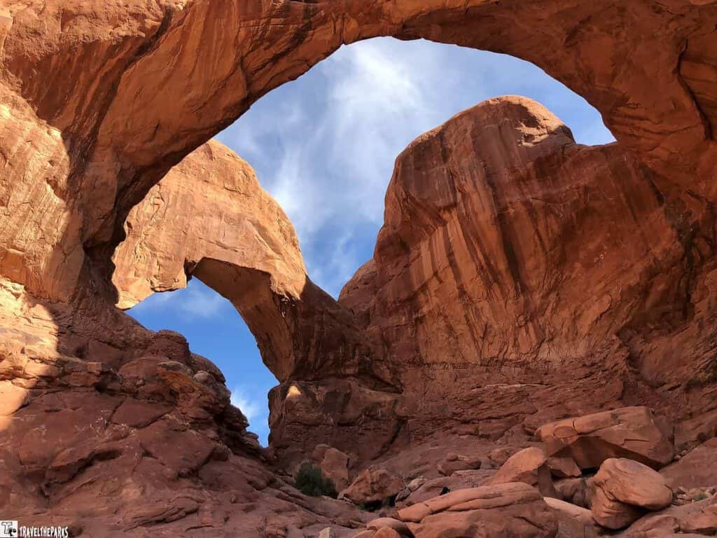
- Windows Section: Home to Double Arch and several other formations within easy walking distance of the parking area.
- Fiery Furnace: This labyrinth of narrow canyons and towering fins is a popular spot for adventurous hikers. Guided tours require a reservation at Recreation.gov.
- Stargazing: Arches is a designated Dark Sky Park. If you are camping nearby, stay up late.
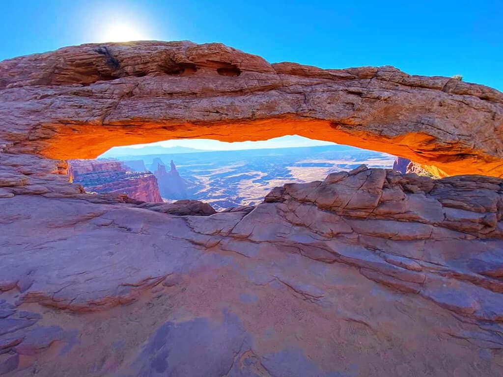
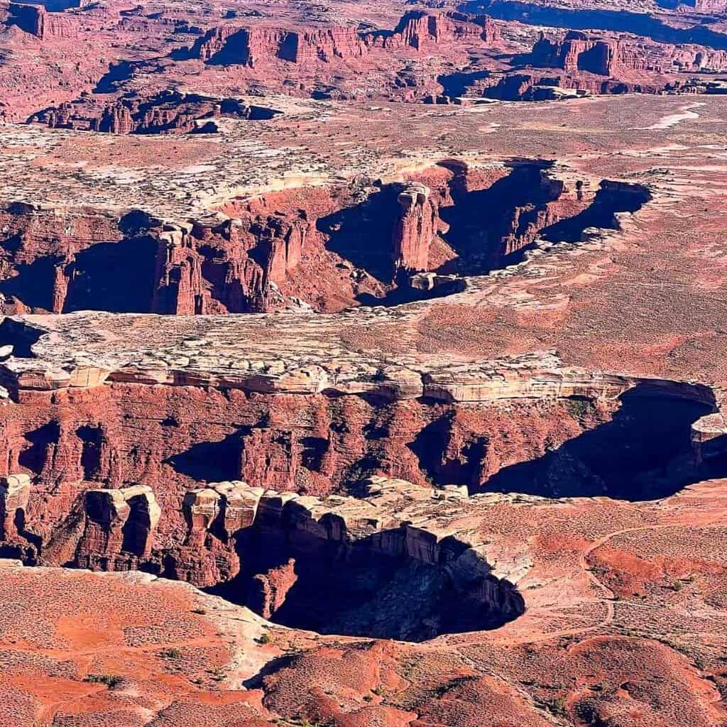
DAY 7: CANYONLANDS NATIONAL PARK — STILL BASED IN MOAB
Canyonlands sits right down the road from Arches. Same general neighborhood, totally different animal. But don’t be fooled by that. The two parks can be as different from each other as they are. It’s huge. Like, stand at the edge and just feel tiny, kind of huge. It’ll humble you fast.
There are three parts to the park, and we opted for Island in the Sky, which was around 40 minutes away from Moab and surely the most accessible one.
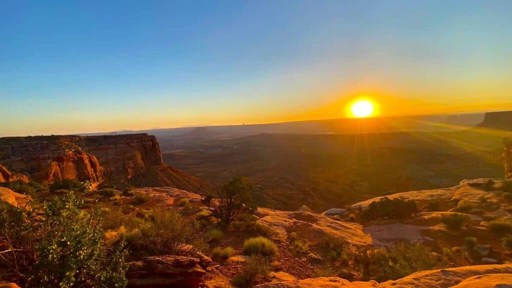
- Mesa Arch Trail: A short 0.5-mile loop to one of the most photographed arches in Utah. We hiked it at sunrise, and the way the light comes through the arch and illuminates the canyon below is almost unfair in how beautiful it is.
- Grand View Point Trail: A 2-mile out-and-back to the southernmost point of the Island in the Sky mesa with sweeping canyon panoramas.
- White Rim Trail: A 100-mile loop for mountain bikers and 4×4 vehicles. Multi-day permits are required. Not something to take lightly.
- River Rafting: The Colorado and Green Rivers run through Canyonlands and can be explored via guided rafting trips departing from Moab.
PRO TIP: The Needles District and The Maze are also part of Canyonlands but require significantly more time and, in the case of The Maze, a high-clearance 4WD vehicle and serious backcountry experience. Flag them for a dedicated return trip.
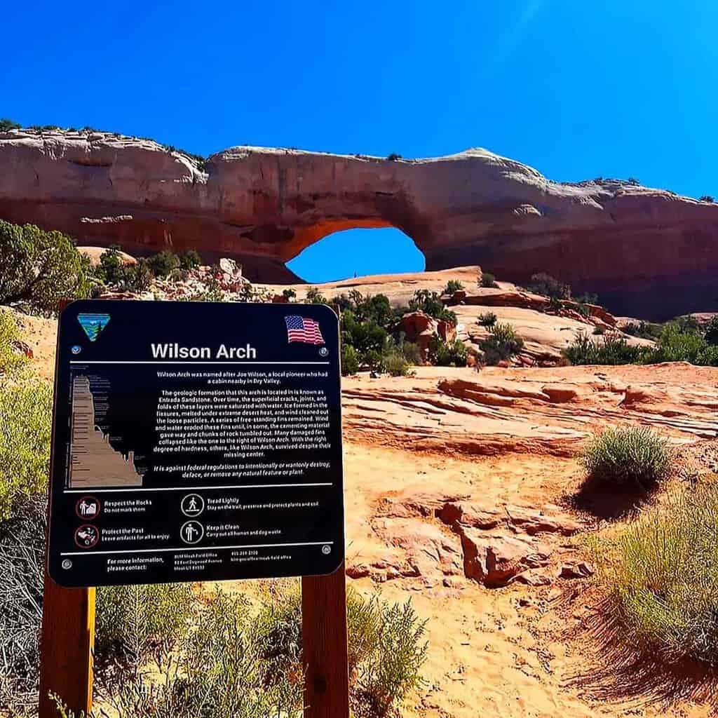
DAY 8: MOAB TO MONUMENT VALLEY TRIBAL PARK
Today’s drive is around two and a half to three hours, heading south on US-191 from Moab. Before you get too far, pull over at Wilson Arch. It sits right beside US-191, and you will spot it before you even have time to slow down. We pulled over, climbed up, snapped some photos, and were back on the road before anyone had time to complain about stopping.
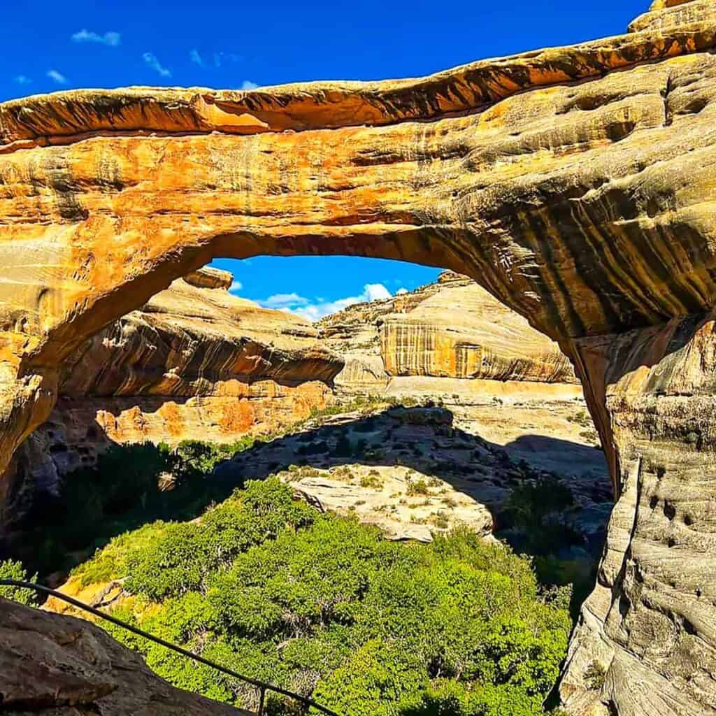
Now, if you’ve got a little extra time, here’s a better way: detour through Natural Bridges National Monument, then take UT-261 south toward Mexican Hat. Stop at the San Juan River overlook before hopping on US-163 down into Monument Valley. It takes longer, sure. But worth it? Absolutely.
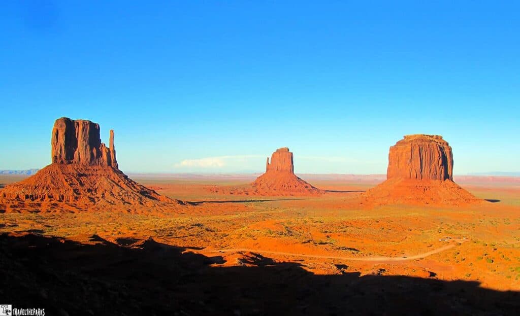
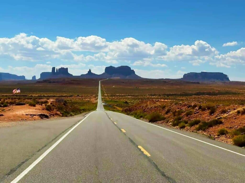
Monument Valley Navajo Tribal Park: Where the West Became the Movies
We love Monument Valley for two reasons. First, the movies. John Wayne, John Ford, all those old Hollywood westerns—they put these buttes and mesas on the map. But here’s what really gets us: the Navajo people have lived here for centuries. Way before the cameras showed up. And you feel both of those things the whole time you’re there. It’s kind of moving, honestly.
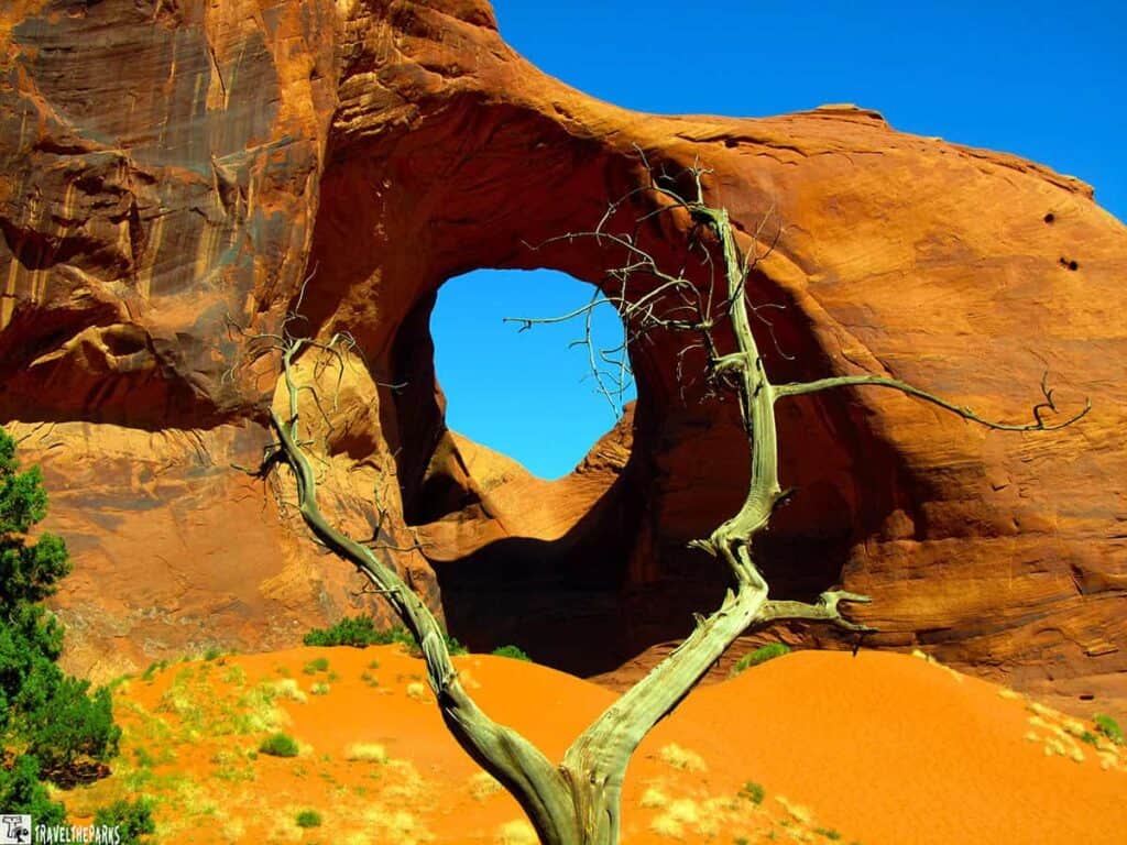
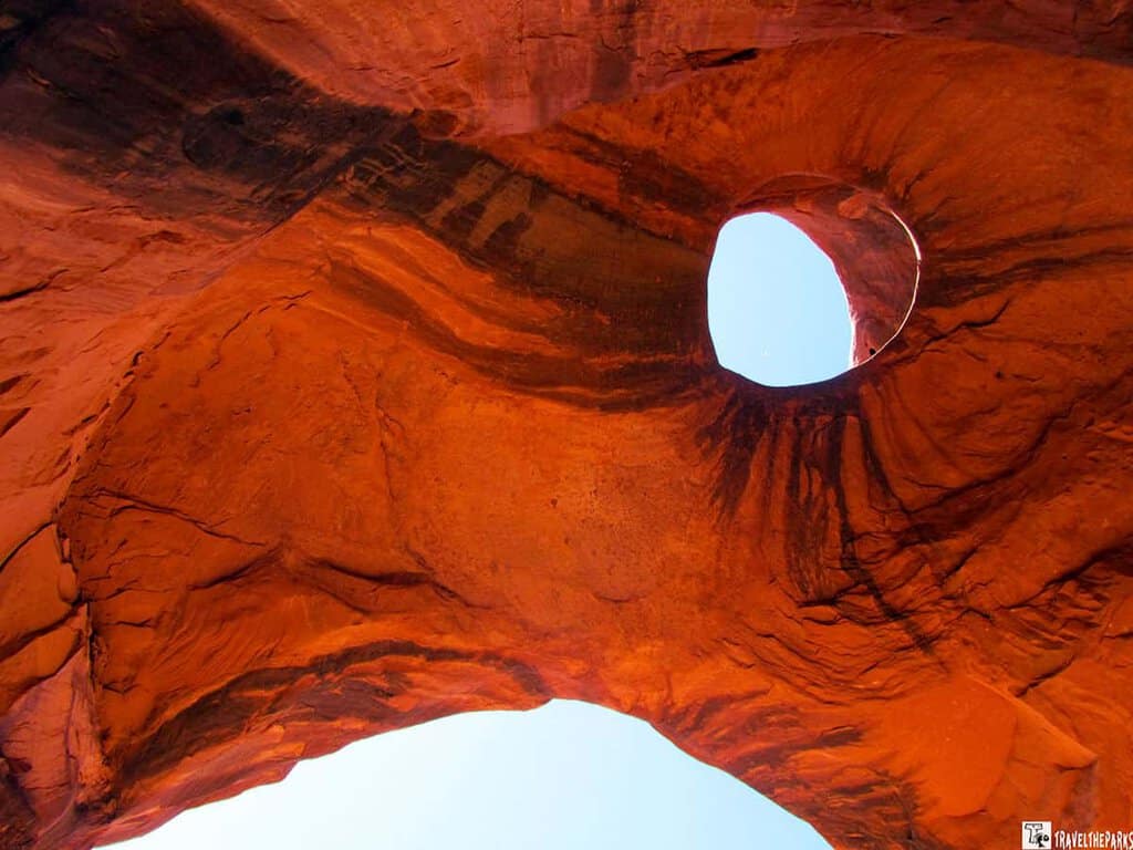
Of course, the 17-Mile Drive through the park in one’s own car is what the majority do, but it just shows the basics. However, we booked ourselves an escorted tour by Navajo Spirit Tours, and it was something else entirely! Our guide took us to some of the areas of the park where no ordinary cars could go. Every formation had its unique story to tell, and he told us all about them. At Big Hogan, the amphitheater created by nature itself—he suddenly started playing his flute. It was truly unexpected!
NOTE: Arizona does not observe daylight saving time, but the Navajo Nation—which spans into Arizona—does. Keep this in mind when planning schedules around Monument Valley.
What to Do at Monument Valley
- Drive the 17-mile self-guided loop to see the Mittens, Merrick Butte, and John Ford Point.
- Book a Navajo-guided tour for backcountry access and cultural context.
- Photograph the Mittens at sunrise from the balcony of The View Hotel—it is the quintessential image of the American Southwest.
- Watch the sunset over the buttes from Forrest Gump Point on US-163 (south of the park entrance).
Where to Stay in Monument Valley
We splurged on The View Hotel.inside the Tribal Park, and we would do it again without hesitation. Waking up to the Mittens framed in your window at sunrise is worth every penny. Goulding’s Resort, just outside the park, is a solid alternative with more amenities and a good campground for RV travelers on this Grand Circle self-drive tour.
DAY 9: MONUMENT VALLEY TO PAGE, ARIZONA
So the drive from Monument Valley down to Page? About two and a half, maybe three hours. You’ll take US-163 south, hop on US-160 west through Kayenta, then head north on US-89 into Page. Nothing complicated.
Kayenta is where you stop. The Navajo Code Talkers Exhibit is small, but it hits hard. These are the Navajo soldiers whose language essentially helped turn the tide of World War II—and the country didn’t officially acknowledge them until the 1990s. We walked out pretty quiet.
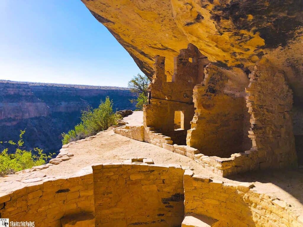
Navajo National Monument is right off the route, too. Just sitting there. Ancient cliff houses are found inside the canyon walls, as if they have just been built. If you’ve got any time at all, pull-off. You won’t regret it.
Page, Arizona: The Gateway to Glen Canyon and the Grand Circle
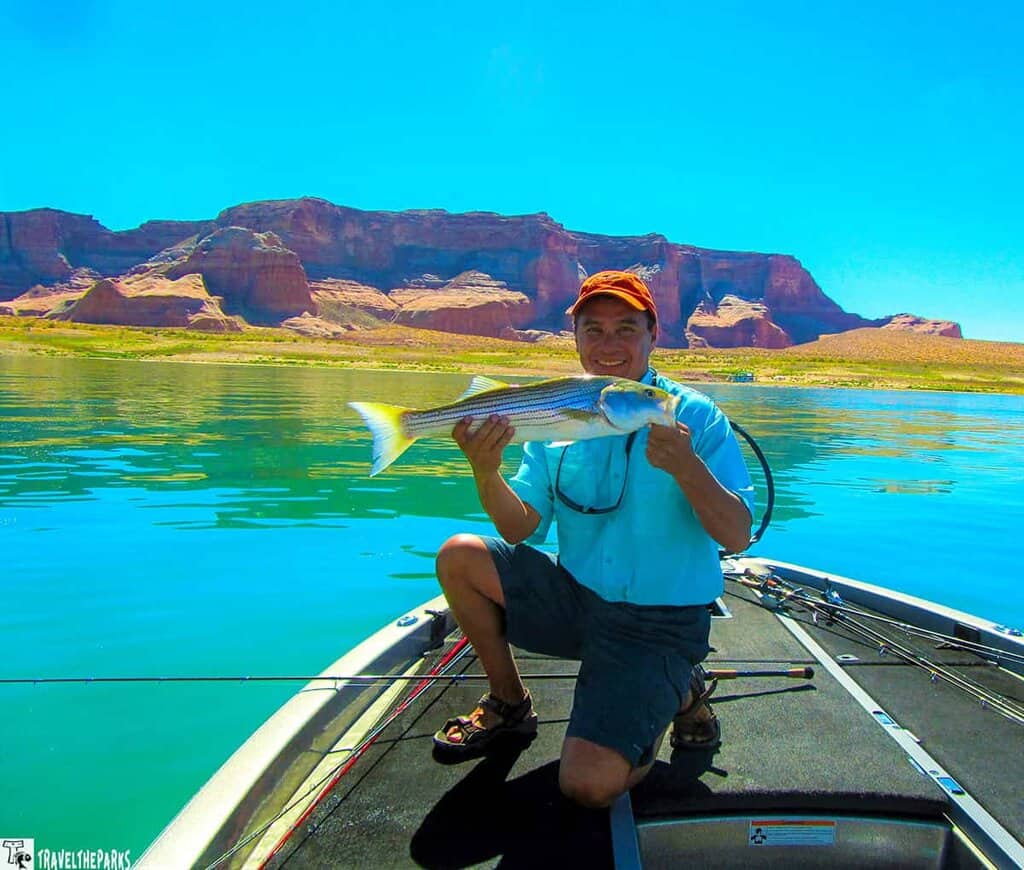
The town of Page is tiny, but it keeps surprising you. Lake Powell is right there, Horseshoe Bend is ten minutes down the road, and Antelope Canyon tours leave from here. That’s already a lot. But one trip, we did something that wasn’t in any guidebook—hired a local fishing guide and spent the morning on Lake Powell. Smallmouth bass and stripers, in water so calm it looked like glass, canyon walls doubling in the reflection. Then our guide just… took us through Antelope Canyon by boat on the way back. No tour group. No line. Just the canyon walls closing in around us and the sound of the water.
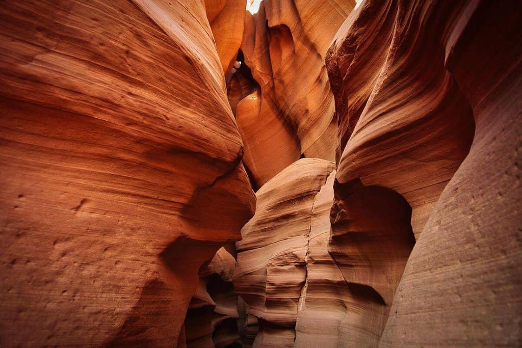
Antelope Canyon
Antelope Canyon sits on Navajo land just outside Page. You can’t just show up and walk in—a Navajo guide is required, no exceptions.
The reason everyone freaks out about this place? The light beams. Late morning, the sun filters down through those narrow sandstone walls, and it’s every photographer’s dream. And the colors? Orange, red, purple. Swirling all around you.
You won’t see anything else like it on this whole road trip. One thing, though—book your tour way ahead of time. Like, weeks. They fill up fast, and they’re not kidding about it.
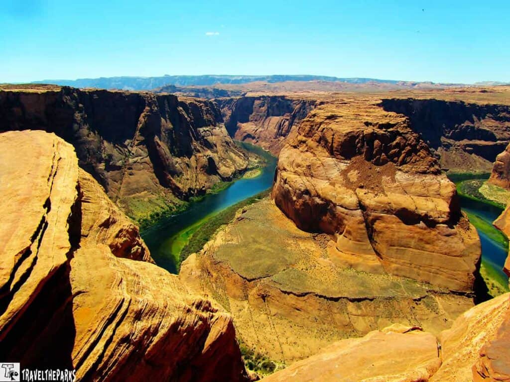
Horseshoe Bend
Five miles downstream from the Glen Canyon Dam, the Colorado River makes this perfect horseshoe curve a thousand feet below the rim. You have seen the photos of Horseshoe Bend. They do not do it justice.
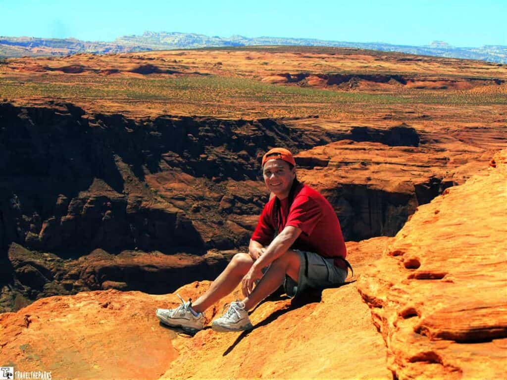
A few things have changed since our first visit. Page charges $10 for parking now, and they’ve built this platform that juts out over the canyon for the best views. Back when we first went? There was no platform. People just sat on the edge with their feet dangling over. Terrifying. Wonderful. Honestly, both.
The new platform is way safer. Probably a good thing. But man, I still think about those feet.
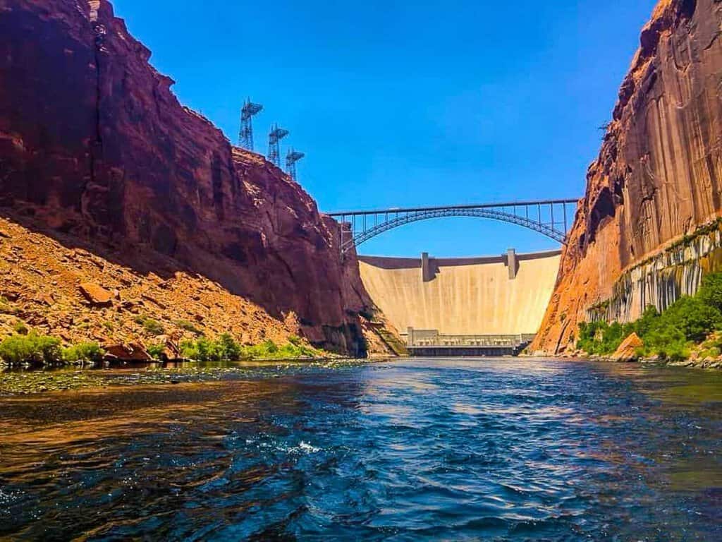
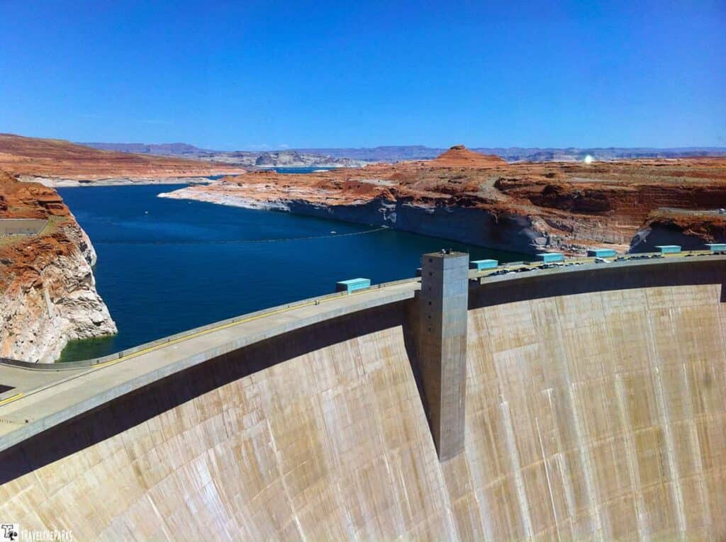
Glen Canyon Dam and Lake Powell
The Glen Canyon Dam tour is worth the $10 fee—our Navajo guide was excellent and the scale of the structure is genuinely staggering. Lake Powell’s 1,960 miles of shoreline within the Glen Canyon National Recreation Area also offer boating, kayaking, fishing, and hiking for anyone who wants to extend their time in this section of the Grand Circle national parks region.
Where to Stay in Page
The Best Western Plus at Lake Powell is where we have had consistently good stays. Lake Powell Resort is the premium option with direct lake access and views. The Courtyard by Marriott and Hyatt Place are solid mid-range choices with pools—a genuine amenity after a long day on this Arizona—Utah road trip.
DAY 10: PAGE TO THE GRAND CANYON SOUTH RIM
Page to the Grand Canyon South Rim is two, maybe three hours. US-89 south to Flagstaff, then AZ-64 north and you’re there. At some point on the drive, you hit an invisible wall where your surroundings change from desert plateau to the rim of one of the world’s most bizarre geological formations.
Cameron Trading Post was supposed to be a bathroom stop. Forty-five minutes later, we were still in there. The gift shop pulls you in, and the Navajo taco we grabbed on the way out was something we still bring up randomly. Just go in knowing that you will not leave quickly.
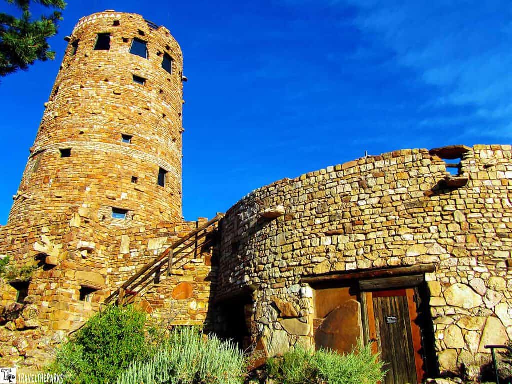
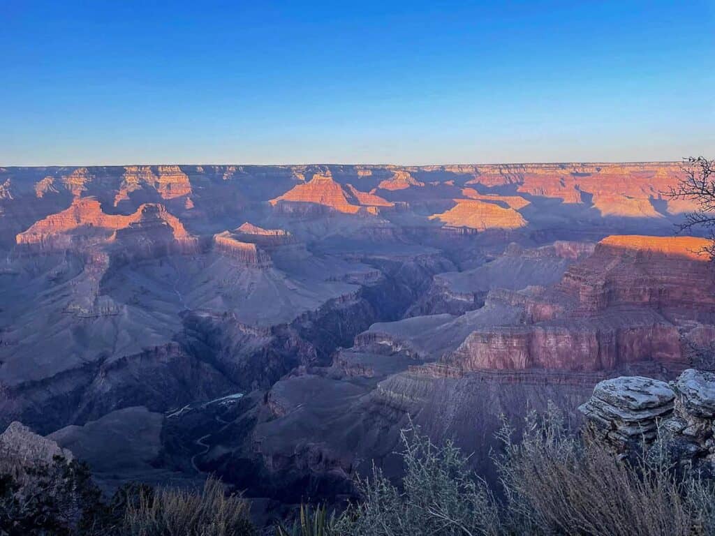
Coming in from Page, you’ll hit the East Entrance first, which means the Desert View Watchtower is where it happens for you. That first look. We have been there multiple times now, and it still does the same thing every single time. It knocks the air out of you a little. No description gets it right. No photo comes close. You just have to stand there and let it land.
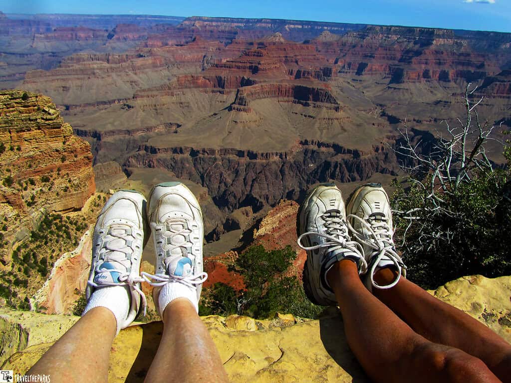
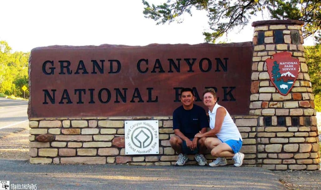
Grand Canyon National Park — South Rim: The Park That Needs No Introduction
The Grand Canyon. Yeah, it’s the anchor of any Southwest parks trip, and honestly? It earns it. We’ve stood on that rim more times than I can count now, and it still stops us cold every single time.
It’s the scale. 277 miles long. Up to 18 miles wide. Over a mile deep. Your brain just… doesn’t want to process it. Like it’s too big to actually be real.
PRO TIP: Hiking into the canyon is deceptively challenging. Going down is easy. Coming back up—in the heat, at altitude—is when hikers get into trouble. Carry at least 2 liters of water, per person, wear sun protection, and turn around before you feel tired, not after.
What to Do at the Grand Canyon South Rim
- Desert View Drive: Running 25 miles along the South Rim, this road connects a series of overlooks that each offer a completely different perspective on the canyon. Do it in both directions if you have the time.
- Bright Angel Trail: The most popular rim-to-river trail. Even going down just a mile or two gives a very different view of the canyon than standing at the rim.
- South Kaibab Trail: Steeper and more exposed than Bright Angel, but the ridge-top views are extraordinary. Great for fit hikers who want a serious workout.
- Rim Trail: Paved and accessible, this trail runs 13 miles along the rim and connects the major viewpoints. Shuttle buses stop along the route.
- Mule Rides: A classic Grand Canyon experience. Book well in advance—sometimes months.
- Ranger Programs: Free, informative, and genuinely excellent. We always attend at least one.
Where to Stay at the Grand Canyon South Rim
Where do we usually stay? Bright Angel Lodge. On our first visit there, we stayed in one of their small cabins and woke up early in the morning to hear the elk bugle calls from the edge of the cliff. Unbelievable!
One thing, though—book early. Like, six months early if you can. Everything at the South Rim fills up fast.
FINAL DAY: GRAND CANYON TO LAS VEGAS — AND THE ROAD HOME
The mornings are the best part of being in the canyon. Really. Get there before everyone else does. One of our favorite walks is from the Rim Trail to the old train station depot because the light in the mornings is stunning, and most times we end up seeing elk and mule deer roam around the village.
The quickest route back to Las Vegas from the South Rim is a four-and-a-half-hour drive: AZ-64 east to US-89 south to Flagstaff, then I-40 west to Kingman, then US-93 north to Las Vegas. While traveling, you may want to take detours on the historic Route 66 via Kingman or the town of Williams for lunch.
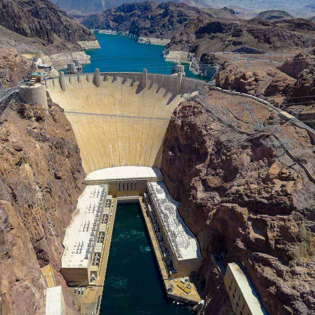
Bonus Stop: Hoover Dam
In order to include the Hoover Dam in your Grand Circle Southwest road trip itinerary when you are backtracking to Las Vegas from Lake Mead, make sure you exit US-93 at Exit 48 for the Hoover Dam. The overlook at Pat Tillman Memorial Bridge is completely free, and the view from here is great of both the Hoover Dam and the canyon carved by the Colorado River.
The Hoover Dam lies some 120 miles away from the South Rim of the Grand Canyon. The proximity to the end of the circle makes this an ideal destination to close the circuit that has been traversed, making the Hoover Dam the perfect ending point for a journey through nature.
Final Thoughts on Planning Your Southwest Grand Circle Road Trip Itinerary
And that’s why Southwest Grand Circle? Well, to be honest, it is one of the greatest road trips you can take. No doubt about it. From Utah’s Five National Parks, Monument Valley, Antelope Canyon, Horseshoe Bend, and even the Grand Canyon—the whole thing all rolled into one epic 1,400-mile route.
We have been there once before. And I’ll tell you what—I can’t wait to go back.
Everyone’s Grand Circle trip ends up looking a little different. Some people get stuck in Zion and never make it out on schedule. Some build the whole thing around Antelope Canyon or spend extra days in Moab just chasing trails. That’s the thing about this Arizona—Utah road trip—there’s room to make it yours.
But here’s what we always tell first-timers: don’t rush it. I know the distances make you want to keep moving. But the good stuff? The genuine stuff? It lives in the slower moments. The sunrise over the Mittens. The petroglyphs at Lower Calf Creek. A flute echoing inside a natural rock amphitheater. A Navajo taco at Cameron Trading Post that you’ll still be thinking about six months later. I promise.
Plan ahead. Stay flexible. And enjoy every single mile. Hope this guide helps get you out there.
Have you completed any portion of the Grand Circle national parks loop? Which park surprised you most? Drop your experiences in the comments below—we genuinely love hearing about other travelers’ time on this route.