We imagined a road trip full of southern charm where we could enjoy rich history and amazing experiences. No matter if you travel a lot or this is your first road trip, the southern United States has a special charm. For us, it’s an ideal place for an adventure. Traveling in our reliable travel trailer, we have put together a guide to the essential places. It includes the best activities to enjoy on your road trip through the South. Our ultimate guide offers everything you need for an amazing trip. From visiting interesting historical places to experience beautiful natural sights.
This post may contain affiliate links, meaning if you purchase something through one of these links, we may earn a small commission at no extra cost to you! Read the full disclosure policy here.

Table of Contents
Important to Know Before You Go on Your Epic Southern Road Trip
Planning a road trip through the South’s hidden gems—Hot Springs, Natchez, Vicksburg, Poverty Point, Crater of Diamonds, and Moro Bay State Park—is thrilling, but for us, we find little prep goes a long way!
- Road Readiness: Rural roads can be narrow, especially around Poverty Point and Crater of Diamonds. Check your rig’s clearance and download offline maps.
- Fuel Up! Gas stations thin out in more remote areas, so top off in towns such as Natchez or Hot Springs
- Weather Wisdom: Summer = thunderstorms. Have the NOAA weather app with you, but never hike on exposed trails during lightning storms.
- Best Time to Go: Avoid Peak Summer: Temps soar in Mississippi/Louisiana-think 95°F+, and Crater of Diamonds turns into a sizzling sandbox. Spring–March to May: Wildflowers and mild temps, and far fewer people. But pack rain gear-Southern showers are real! Fall-Sept to Nov: Cool weather and fall foliage in Arkansas’ Ouachitas, with no swampy summer heat.
- Don’t forget to pack: reusable water bottles, and a National Geographic Southern USA map (for retro vibes and cell-service-free navigation). Bug spray (Louisiana mosquitoes are relentless) and a garden trowel (for diamond hunting!). Comfy hiking shoes—you’ll need them for Hot Springs’ trails and Poverty Point’s mounds.


Kicking Off Our Road Trip Adventure (Day 1)
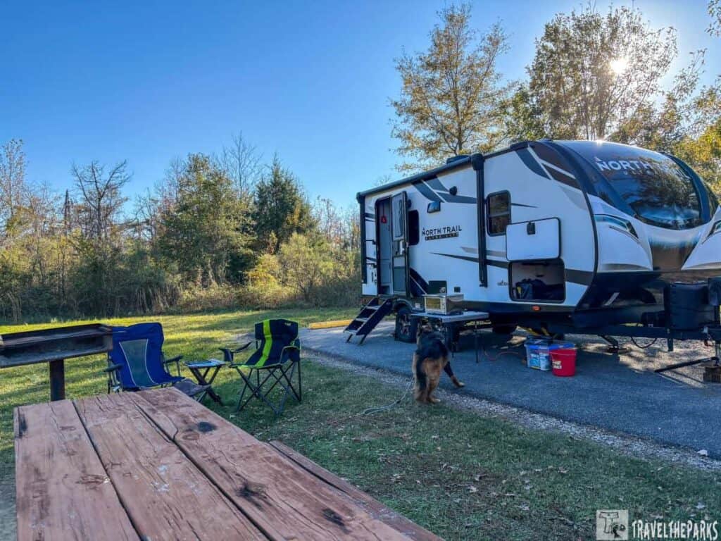
One of the greatest things for us when traveling in a travel trailer. It gives us the freedom to go at our own speed. From our experience, we’ve found that our best trips happen when we follow a simple rule: we only drive for 3 to 4 hours each day, staying under 300 miles in distance. This lets us have fun on our trip without feeling stressed about traveling far each day.
There’s no hurry to reach our next stop, so we can take our time to enjoy the beautiful scenery. We can take breaks from the highway to check out nearby towns and walk our dog, Sage. Additionally, it helps reduce the stress of long drives, allowing us more time to relax and recharge.

Our First Stop: Newport Campground
We started our highway adventure by driving from the Orlando area to Newport, Florida, driving along the nature coast. Once we got comfortable at Newport Campground, we enjoyed two relaxing days, taking in the sights and sounds around us. The campground was an ideal place to set up our travel trailer. It had a calm atmosphere and was close to some of Florida’s most amazing natural and historical attractions. With lots of time to relax, we headed out every day to discover nearby treasures. This included stops at St. Marks National Wildlife Refuge, Wakulla Springs State Park and San Marcos de Apalache Historic State Park.

Day 2: Wakulla Springs State Park: A Step Back in Time
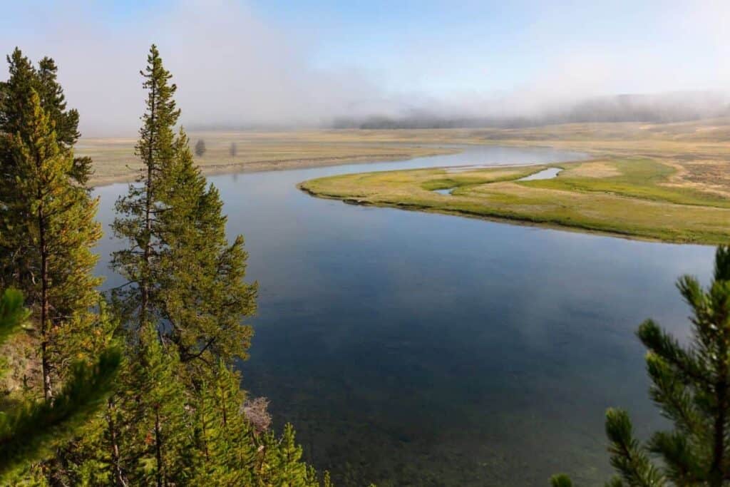
Our next stop was at Edward Ball Wakulla Springs State Park. This spring houses Florida’s largest and deepest freshwater spring. The waters at Wakulla Springs are clear, with an appealing sight and carrying lots of interesting history. We enjoyed a boat ride along the Wakulla River, whereby we could see manatees, alligators, and different wetland birds. With such beautiful surroundings, this park creates an unforgettable experience.

It’s almost like being in a Hollywood movie. Maybe that is because this park was used to film a few classic films, including the 1954 movie, “The Creature from the Black Lagoon.” Swimming in the spring where the water stays a nice 70°F all year is great on a warm day. Today, the weather is a tad cool, but a few kids seem to be enjoying the spring waters, anyway. Kids never seem to mind the cold. Getting hungry, we decided to have lunch at the historic lodge. It had a pleasant restaurant and an ole time soda fountain. We opted for the fancy diner, which has been receiving guests since the 1930s.

Day 3: St. Marks National Wildlife Refuge: A Birdwatcher’s Paradise
Just across the highway from the campground is the St. Marks National Wildlife Refuge. It’s a protected area dedicated to preserving wildlife and their natural habitats. This 68,000-acre sanctuary plays a crucial role in conservation efforts. It also provides a haven for various species of animals, plants, and ecosystems. It’s an ideal spot for nature lovers, offering plenty of opportunities for hiking, birdwatching, and simply enjoying the great outdoors.
We kicked off our morning by touring the visitor center. Here, a knowledgeable ranger told us about the refuge’s history and the diverse wildlife that calls it home. The center provided valuable insights into the area’s ecological importance, making our visit even more meaningful. Whether you’re an avid birdwatcher or just looking to explore the beauty of nature, this refuge is a must-see destination.
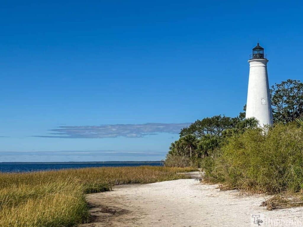
Exploring the Historic St. Marks Lighthouse: A Beacon of Florida’s Coastal Beauty
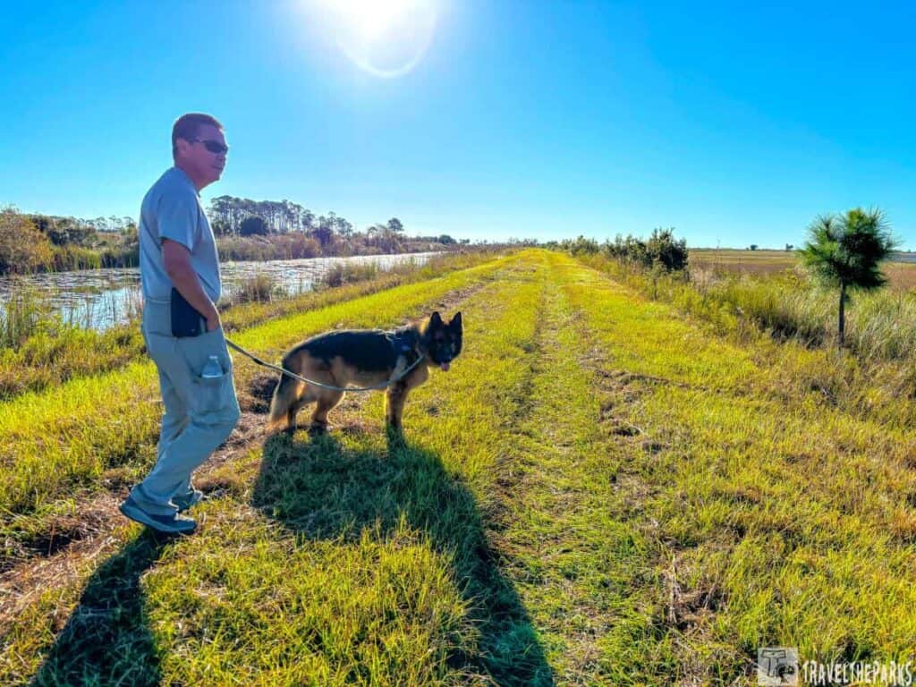
A must-do is the scenic 7-mile drive to the St. Marks Lighthouse. We also made a few extra stops to go hiking and fish a few of the canals. This park welcomes dogs, so we took our dog Sage along to have a fun day with us. While hiking on the trails, the spotted egrets, herons and osprey. The variety of habitats, such as salt marshes and pine forests, makes this place ideal for birdwatching and taking photos. There are several hidden treasures that you must check out here. Once you get to the end of the road, be sure to hike the Lighthouse Trail. This trail took us along the shoreline, passing the old lighthouse. The trail gave us amazing views of the nearby wetlands and the Gulf of Mexico. Watch for alligators, turtles and many migratory birds while you explore the refuge.

Day 3: San Marcos de Apalache Historic State Park: History Meets Nature
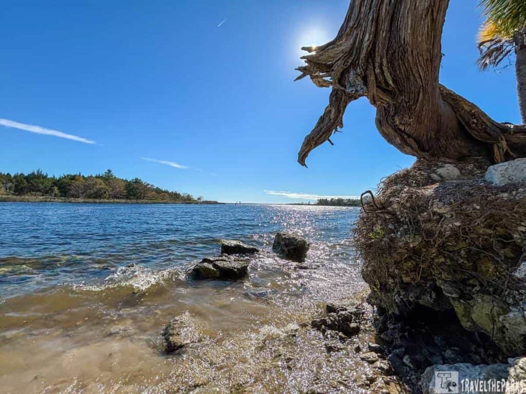
We ended our day at San Marcos de Apalache Historic State Park, another scenic location along the Florida’s Forgotten Coast. The museum provided a deeper understanding of the area’s colonial history and the fort’s significant role in Florida’s past. This is where we explored the rich history of Spanish, British, and American rule in the region. Our first stop was a small museum. Inside there are good exhibits showcasing a collection of authentic artifacts. They tell the story of the fort and the native Apalachee people. The Spanish built the historic San Marcos de Apalache fort in the 17th century. It stands as a testament to the area’s turbulent past.

Exploring the well-preserved ruins, it was easy to imagine how challenging it must have been to eke out an existence here. Sage especially enjoyed strolling along the nature trails that wind through the park. At the end is the confluence of the St. Marks and Wakulla Rivers. The point offers breathtaking views.
Why We Loved Newport Campground
Newport Campground was ideal. It featured electric and water hookups and clean restrooms. The campground was also relaxing after a long day. Despite being close to the highway, it was quiet. Newport Campground is a good place to stay for easy access to St. Marks, Sopchoppy, the Crooked River Lighthouse in Carrabelle and Wakulla on the Forgotten Coast.

Day 4 & 5 on our Southern Road Trip Guide: Camping Fort Pickens in Gulf Shores National Seashore
Our next stop leads us back to the beloved Fort Pickens Campground in Gulf Shores National Park—a place so memorable during our last trip that we’ve added three extra days. Once again, we’ll settle into Loop A, where the Gulf of Mexico sunsets paint the sky each evening. We made a quick tour of Fort Pickens before settling in for the evening.
This time, our adventure blends camaraderie with historic exploration of Florida’s Emerald Coast. On day 5, we joined our good friends in Pensacola for a Thanksgiving celebration. Good company, great conversation and excellent food made this holiday memorable.
Day 6 on our Southern Road Trip Itinerary: Exploration of Pensacola
Day 6 of our southern road trip took us deeper into the history of this region. We explored Fort Barrancas, a Gulf Islands National Seashore site. It was a former military base. We missed it during our last Fort Pickens visit. This time, we were excited to see this gem. It was worth the wait.
Afterward, we climbed the famous Pensacola Lighthouse. Its museum had many cool old things. But the view from the top was even better. Even though it was crowded, the shoreline views were amazing. We could even see Fort Pickens far across the bay on Santa Rosa Island.

Our day continued as we visited the National Naval Aviation Museum. The museum amazed us. We saw many airplanes and cool displays. They showed the story and progress of naval aviation. It was a great experience.

Our days blend discovery with peaceful rest. We stroll on the beach at our own pace and spend our evenings unwinding by the crackling campfire. We simply enjoyed the pretty sunsets that took our breath away. This stop will be a great memory of our trip.

Day 7 of Your Southern Road Trip Guide: Exploring Alabama and Mississippi
No southern road trip would be complete without exploring the rich landscapes of Alabama and Mississippi. Today (Day 7) is a travel day as we head to Wendy Oaks RV Park in Florence, Mississippi, where we’ll be staying for one night before continuing our southern adventure. We paused at the USS Alabama Battleship Memorial Park by Mobile Bay. Here, you can go aboard both the USS Alabama and the USS Drum. The park has many displays of planes and military tools. It is a wonderful spot to learn about naval history just off I-10.

The drive through Alabama was pleasant. The perfect weather made the scenic drive even more beautiful. We passed through Hattiesburg, making good time getting into Mississippi before stopping at the campground for an enjoyable evening. Our site faces the private pond. An ideal location for fishing and walking, Sage. Even though the park is close to the highway, we found it an idyllic spot to stop for the night.

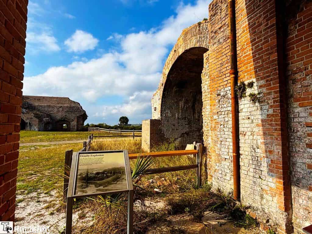
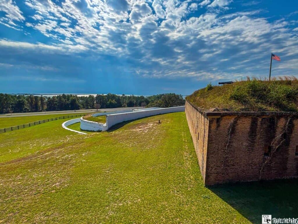
Day 8 on our Southern Road Trip Itinerary: Step Back in Time at Vicksburg National Military Park, Mississippi
Today, our final overnight destination is only a short two-hour drive. If you’re a history enthusiast, Vicksburg National Military Park in Mississippi is a must-visit. When planning this trip, I really wanted this stop to be a part of our itinerary. This Civil War battlefield is a powerful way to connect with the South’s history. It definitely exceeded our expectations. The park honors the important Battle of Vicksburg from the Civil War. It’s a place where visitors can think deeply about history while learning about the Cicil War battle.
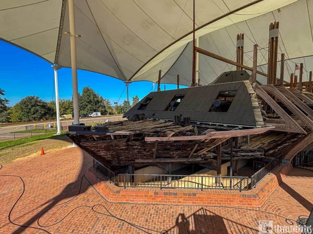
Driving through the park on a self-guided tour with a travel trailer was challenging. However, we made it work. Luckily, the park was not busy, which gave us a lot of time to appreciate the well-kept battlefields and impressive monuments (Illinois Monument-WOW!). These monuments share the story of this important time in American history. The part I liked best was our visit to the USS Cairo Gunboat & Museum. Exploring the restored USS Cairo ship was impressive, and it truly made history come alive. The exhibits in the museum make it a great place to learn more about the ironclad warships. I loved that this park is dog-friendly, giving us plenty of opportunities to stretch our legs, allowing Sage to join us.

Day 8: Overnight Camping Poverty Point Reservoir State Park
With just a few hours of daylight remaining, we headed back onto I-20 to our overnight at Poverty Point Reservoir State Park in Louisiana. This is a magnificent spot for people who love camping. Situated beside the lovely Poverty Point Reservoir, this beautiful area is great for fishing, hiking, or just enjoying some time by the water. Our campsite here was large and offered a lot of privacy. There are hiking path that leads to the nearby visitor center. Poverty Point World Heritage Park, our destination tomorrow morning, is a 15-minute drive from here.
Day 9 on our Southern Road Trip Itinerary: Poverty Point World Heritage Site: A Journey into Ancient Times
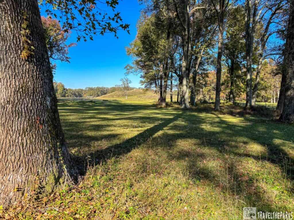
After a big breakfast in the early morning, we arrived at Poverty Point Heritage Site. It’s a remarkable ancient archaeological site. This site, which is now recognized as a UNESCO World Heritage Site, displays an old Native American civilization that existed here over 3000 years ago. We started at the visitor center. They have a wide range of displays that help you learn about the culture of the people who created Poverty Point. Later, during our walking tour, the large earth structures that form this ancient site amazed us. Today we have the entire park all to ourselves. This national park location does not receive much notice. We believe that it’s worthwhile adding this park as part of any road trip in the south..
Day 10 on our Southern Road Trip Itinerary: Camping at Moro Bay State Park, Arkansas
Leaving the Poverty Point World Heritage Site, we made our way back to the campground. This state park allows late checkout, so we took our time packing up the trailer before continuing on our southern road trip itinerary. Our next destination is Moro Bay State Park, tucked away in the heart of Arkansas. It’s a bit off the beaten path, but it’s the perfect midpoint of our journey, offering a peaceful stop before we continue further on our adventure.

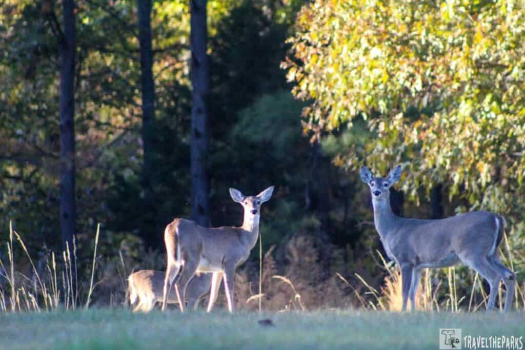
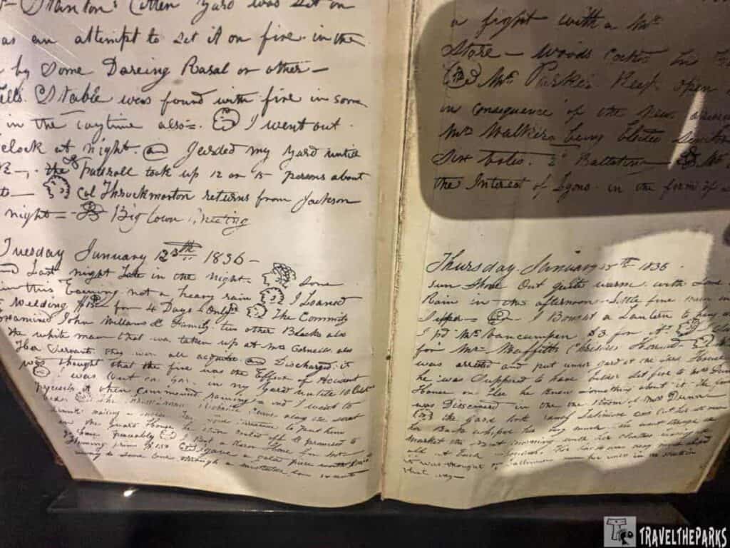
Moro Bay State Park was such a pleasant surprise! After navigating the windy backroads with the trailer, we were a bit on edge. However, that stress disappeared when we checked into the visitor center and a herd of deer greeted us. They were so calm, even when we walked the dog later—they didn’t seem to mind our presence at all. It was a pretty quiet evening, as the campground only had three other campers around. As the sun was setting, we walked Sage down to the river’s edge. A fascinating display detailing the history of the area’s ferry system before the bridge was built caught our attention. The story behind it was interesting, and it made me appreciate the park’s history even more.
Day 11 on our Southern Road Trip Itinerary: Unearth a Southern Treasure at Crater of Diamonds, Arkansas
We headed to Crater of Diamonds State Park for a quirky experience in the South. If you’ve ever wanted to search for your own diamonds, this is the perfect treasure hunt where you could really hit the jackpot! Picture yourself digging in the diamond search area where lots of visitors have found striking stones. The park is the only place in the world where you can look through a 37-acre dirt field for diamonds and keep what you find.

The campground is just a quick stroll away. We swung by the visitor center to check in before getting our travel trailer all set up. After that, we went for a brief hike on the 1.2-mile paved nature trail that leads to the Little Missouri River. Sage was super excited to be on the lookout for squirrels once more.

The following morning, we visited the chilly, overcast Diamond Discovery Center to explore its fascinating history and diamond-hunting allure. Despite the cold, we spent an hour sifting through dirt and gravel with a rented digging kit, eagerly searching for the elusive hidden gems. Though we found no treasure, the excitement of the hunt itself proved enjoyable – until the frigid water forced us to cut our quest short, leaving Barry’s hands numb. Heading back to camp, we packed up and headed to our next road trip adventure in Hot Springs, our next stop for 3 days.

Day 12 on our Southern Road Trip Itinerary: A Return Adventure to Hot Springs National Park, Arkansas
During our three days in Hot Springs, we set up our camp at Gulpha Gorge Campground. Being close to hiking trails and having a creek right behind our location was perfect. We visited Hot Springs National Park for the second time, and this time we wanted to spend more time hiking the trails and exploring the area.
Afternoon Hiking Gulpha Gorge Trails
We spent our first day exploring the various trails. The hardest trail for us was the Gulpha Gorge Trail.It only goes up 438 feet in elevation, but it had us huffing and puffing. It’s a 0.6-mile out and back trail connecting the Gulpha Gorge Campground to the park’s extensive network of trails. As we climbed this steep path, we encountered a grade of 21%. The terrain is a mix of pine and hardwood trees. Along the way, we got some marvellous views of the gorge below. Sage seemed to enjoy climbing the mountain. At one point, I just let him drag me up the switchbacks, as I was a little winded.

Approximately 0.3 miles into our hike, we came across a fork in the path. This was where the Goat Rock Trail began. This trail is 1.1 miles eventually ending at the North Mountain Overlook. Our favorite part of this trail is definitely on the Goat Rock’s Overlook. You can reach it by climbing about 40 stone steps up a small incline. At the top, it offers spectacular views of the gorge below.

Day 13 on our Southern Road Trip Itinerary: Soak in the Magical Springs
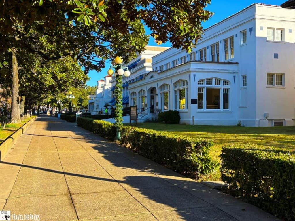
It’s a chilly morning, only 26 degrees. Last night, we had to disconnect our water supply. The gorge is cold, but there’s no frost. I’m happy we’re going for our Signature Spa Private Getaway package at Quapaw Spa today. Beforehand our appointment, we walked along the Grand Promenade and Bathhouse Row. This time, we had very few visitors to contend with.
Soak in the Magic: Exploring Enchanted Hot Springs
The Quapaw staff greeted us kindly. We took our time picking a bath scent. Lavender, eucalyptus, and honey oatmeal all smelled great! Honey oatmeal was our ultimate choice. Next, we went to the spa’s bottom floor. It was time to change into soft, warm robes.

The private aromatherapy mineral bath is a luxurious private soak in a large whirlpool tub designed for two. Mineral-rich thermal water from the hot springs fills the tub. This water naturally possesses relaxing and healing properties, easing tension and promoting relaxation. The staff set up our bath with our chosen scent, enhancing the sensory experience.
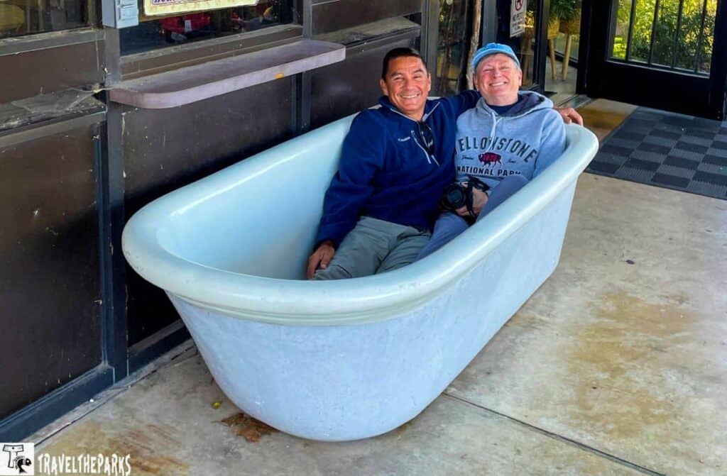
After soaking for around 20 minutes, we rinse off in the shower before heading to the massage room. The post-bath pampering included a warm towel wrap, foot massage, and a 50 -minute Swedish massage. Needless to say, it was such a delight. The Quapaw Spa’s signature couple’s bath is such a beautiful experience—it’s incredible how the hot springs soothe your body against the cold weather.

Savoring Southern Hospitality
We passed the afternoon on Main Street. We soaked in Central Avenue’s Southern charm. The street had old-fashioned shops and bright awnings. It felt very inviting. Soon, our hunger led us to the Superior Brew House. The smell of food pulled us inside. I ordered a local cider from the Brew House’s impressive craft beverage selection. The crisp, slightly sweet brew complemented my hearty meal perfectly.

Day 14 on our Southern Road Trip Itinerary: Lake Catherine State Park
We started our day early, arriving at Lake Catherine State Park just as the morning mist was lifting off the glassy surface of the lake. The sight of the sun glistening on the tranquil water was nothing short of magical. Eager to begin our adventure, we hiked the Falls Branch Trail – a moderate 2-mile loop that would wind us through a pine forest, across wooden footbridges spanning the creek, and ultimately to the delicate waterfall. The well-marked trail proved wonderful for our canine companion, Sage, though he was not a fan of the swinging suspension bridge. Despite everything, he did enjoy climbing the rocky Ouachita Mountains.

The Slunger Creek Nature Trail is a true hidden gem. It’s an easy 1.25-mile loop. The woods were still this cool morning. Only the running water of the creek and the leaves underfoot broke the silence. Then, I saw them: frost flowers. Nature’s artwork appeared in delicate winter forms. These uncommon ice formations appear on plants as their stems break open from freezing. Water leaks out and makes ribbons of soft ice. They shone in the light. The fragile shapes looked like art along the path. Each frost flower was unique. It’s a brief wonder that would melt later. The frost flowers made the trail even more extraordinary.

Day 15 & 16 on our Southern Road Trip Itinerary: The Mississippi Southern Charm of Natchez
Our next leg of the journey on this Southern road trip brought us to Natchez, a town known for its Southern charm. The scenic road trip between Hot Springs and Natchez is a journey through the heart of the South. Driving through the Ouachita National Forest, the trees seemed to go on for miles. Small rivers and calm lakes dot the land. As we head south, the hills flatten out. The terrain moves from mountains to the flat plains near the Mississippi River. Crossing into Louisiana, the landscape becomes more open and flat, dotted with marshlands, bayous, and small farm towns. Tonight we are camping at River View RV Park & Resort. It is conveniently located across the river in Vidalia. Just a mile from downtown Natchez.

Discovering the Wonders of Natchez National Historical Park.
Natchez is a Southern town with a fascinating past, drawing many visitors. Today, we explored its historic landmarks. We toured impressive antebellum mansions. Some mansions are open to the public. These homes reveal the lives of rich planters. They show the fancy lifestyle of the early 1800s. Each building shared a story and gave us a look at the past. We began our day at the visitor’s depot for maps and guides. Then we visited the Natchez National Historical Park sites.

Our first stop was Fort Rosalie. It is an important historic spot. The grass park marks where a French fort stood in the early 1700s. It was key in the fight for the Mississippi River. The French, British, Spanish, and Native Americans all wanted control. Later, we walked through Natchez’s old district. We saw pretty homes like Stanton House and Rosalie Mansion. There were also pleasant garden courtyards and tree-lined streets.

The William Johnson House, built around 1792, is a few blocks from Fort Rosalie. The building in the downtown historic district is a fine example of early Federal architecture. This house now serves as a museum, open for tours by the National Park Service. It inside details the story of William Johnson, a free Black man in the mid-1800s. He was a successful barber and business owner. His diaries reveal much about the Natchez social and political climate.
Antebellum Splendor of the Deep South
The last stop was Melrose Estate. We made a quick stop at the Forks in the Road. It was the location of one of the domestic slave markets in the Deep South. It’s worth the detour to see. The Melrose Estate stands out as the best part of the Natchez National Historical Park. It is a beautiful example of an old Southern home. Built in the 1840s, this Greek Revival house shows how rich people lived before the Civil War. We did the self-guided walk of all the building on the grounds. Interesting learning about the family’s history.

Exploring the Under-the-Hill Historic Area in Natchez
We strolled through Bluff Park, heading to the Under-the-Hill historic area. It sits along the Mississippi Riverfront. In the 19th century, Under-the-Hill was a bustling hub of activity, frequented by riverboat travelers, merchants, and even outlaws. Today, it retains many of its historical traits.

For lunch, we chose the Magnolia Grill. Locals love this spot. It’s known for Southern food and river views. We savored gumbo, crawfish etouffee, and pan-fried redfish. These dishes gave us a real taste of the South. As evening arrived, we walked back up the hill to the Natchez Bluff. Watch the sunset over the Mississippi River. The view is remarkable. Golden light bounces off the water as the riverboat barges float by.

Must-do Destination in Natchez
- St. Mary Basilica, built in the 1840s, has the most amazing Gothic Revival design. Admire the stained glass, the pipe organ, and the beautifully designed interior. It is one of Mississippi’s oldest Catholic churches.
- The Natchez City Cemetery (1822) has impressive headstones and tombs. Antebellum owners and Civil War soldiers rest here. It shows the area’s history, much of it before the Civil War.
- The Grand Village of the Natchez Indians shows where Native Americans lived long ago. See markers, a center, and mounds. It teaches about the people before settlers came.
Day 16 on our Southern Road Trip Itinerary: Davis Bayou Gulf Islands National Seashore
On Day 16 of your Southern Road Trip, we drive from Natchez to Davis Bayou, which is close to Ocean Springs, Mississippi. It’s foggy and rainy as we head south through the lovely countryside of Mississippi, moving through little towns and beautiful farms. Arriving at Davis Bayou, the road curves through the beautiful Gulf Islands National Seashore where you can see the green bayou scenery and marshy lands that define the region. This part of the Gulf Islands is clearly different from the Fort Pickens area. The most striking difference is the coastal marsh bayou replacing the sugary white sand beaches.

After checking in at the park’s entrance station—where friendly rangers gave us a quick rundown of camp rules—we headed straight to our campsite. After we got set up, we took a few moments to explore. If there’s one stop we never skip, it’s the park visitor center. Inside the William M. Colmer Visitor Center, there are displays about local animal ecosystems and history. It highlights the significance of bayous and wetlands. The displays were really impressive.

When we walk out onto the observation deck, it begins to rain heavily. It doesn’t dampen our spirits; we only have one day here, and we plan to make the most of our afternoon. We walked from the Visitor Center to the Davis Bayou Fishing Pier. Before dinner, we took a walk on the Nature Way Trail and the Civilian Conservation Corps Spur Trail. We went out tonight, following a long drive here today. RibCrib BBQ is exactly what we’re looking for. It’s margarita night, hooray! The food is tasty as well!

Day 17 & 18 on our Southern Road Trip Itinerary: Florida Caverns State Park
This morning our road trip takes us to Florida Caverns State Park. Traveling I-10, we left the gulf coast behind. Crossing into the Florida Panhandle, the landscape gradually changes. The forests in the Florida Panhandle have thick pine trees and hilly landscapes, which take the place of the flat land found along the coast. The last part of the journey takes us through the small town of Marianna before we turn onto the road that leads into the park. In Florida Caverns State Park, the land becomes rockier, and limestone formations, the park’s trademark, become apparent. Unfortunately, the strong winds from Hurricane Michael in October 2018 knocked down many trees in the park. This led to a lot of trees being cut down, changing the park’s natural scenery by 90%.

Camping at Florida Caverns State Park
Florida Caverns State Park has 32 campsites, and each one provides full hookups for RVs. Every location has picnic tables, fire pits and grills. We stayed at Site #32, which was great because it was near the 1.5-mile trail that circles around and brings you to the park’s famous Blue Hole Spring.

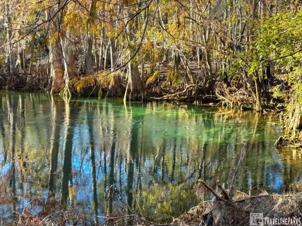
You may be curious about what the Blue Hole Spring really is. It’s a beautiful sinkhole that gets its water from a spring, and it’s well-known for its bright deep blue water. Its deep blue water, resulting from the spring water’s high purity, gives it its name. The color looks especially beautiful on sunny days, which makes it a favorite place to take pictures. The Blue Hole is very deep, with some parts going down as much as 25 feet. Many people love to swim there during the summer.

Exploring Florida’s Unique Caverns
We chose to make this special stop on our trip to the south because of the caverns. Discovering the park’s main highlight: Florida’s only public caves. Tours last for 45 minutes and are offered every day from 9:00 AM to 4:00 PM CST. Groups leave every half hour. On our last day at the park, we got to the visitor center early in the morning to buy our tickets. They are available on a first-come, first-served basis.

The cave tour starts with a walk. It’s 350 feet from the visitor center to the cave. Our group descended 35 steps, holding the rail, to enter the cave. Inside, we could see cool limestone stalactites and stalagmites. Some pathways are slippery; we had to crouch and duck as the ceilings lowered unexpectedly. The pathways twisted and turned as we descended, and they were so narrow in some spots. There are many unique features in the chambers. Our guide pointed out the flowstones, soda straws, and cave popcorn. The Wedding Room was special for me as a bat slept in a crack just above us. This cave isn’t as big as Carlsbad Caverns, Mammoth Caves, or Jewel Cave. Yet, it was still worth visiting this special wonder in Florida.

Pro Tip: Wear sturdy shoes and a light jacket—the caves stay a cool 65°F year-round. ear sturdy shoes and bring a light jacket—cave temps hover around 65°F year-round. Photography is allowed (no tripods/flash), but focus on soaking in the surreal beauty!
Discover Florida Caverns, Fishing Adventures
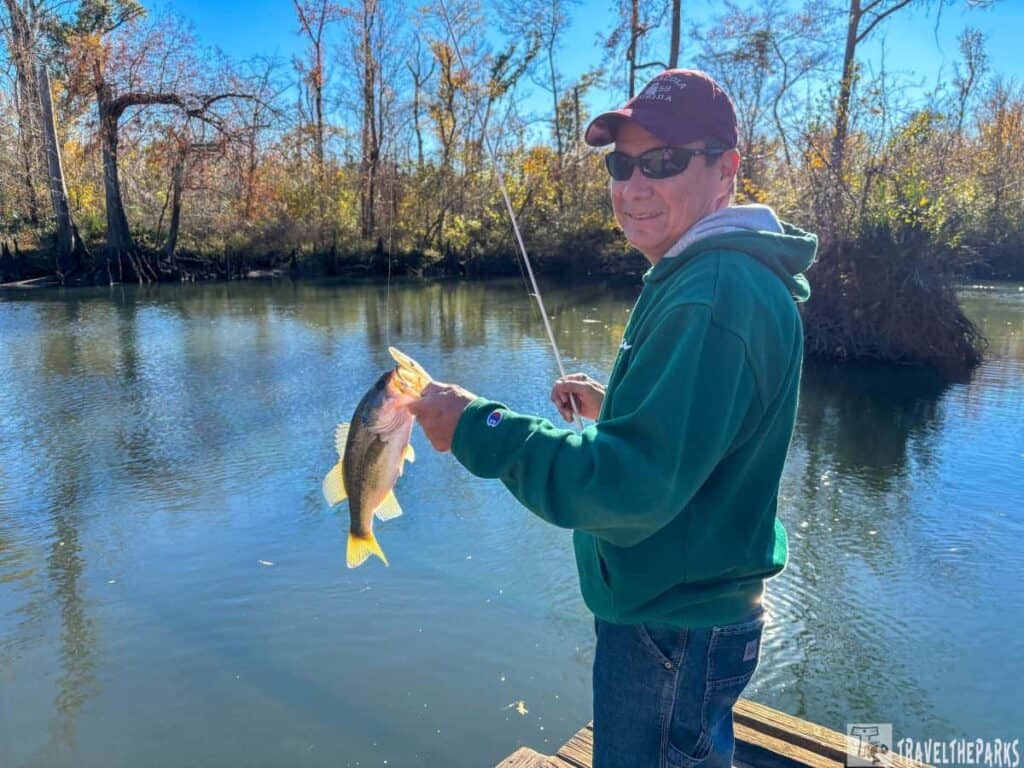
On our way back from the cave tour, we stopped at the boat ramp (Yancy’s Bridge) on Blue Hole Drive by the Chipola River. This river has interesting geological features, including a spot where the Chipola River goes underground and then reappears further down. The river sink is a unique natural feature where the Chipola River drops 90 feet below the ground.

The Chipola River is a fantastic spot to catch bass, bream, or catfish. These clear blue waters have many places where fish can hide. On this chilly morning, our first fishing attempt catches a small largemouth bass. We believe this means positive things are ahead. It doesn’t occur. The river teems with big bowfins. We catch many of these toothy fish one after another. That’s not what we are trying to catch. After about an hour, we decide to stop for the day and go back to the campground.
Day 19 on our Southern Road Trip Itinerary: Manatee Springs State Park
We took a beautiful drive on backroads with hilly landscapes and thick forests until we reached Manatee Springs State Park. It is one of the prettiest natural springs in Florida, a place that felt like being inside a postcard. They named the park after the friendly manatees that often visit the spring. When we arrived at the campground, a single white-tailed deer welcomed us by standing next to the road. We knew we were in for a special day.

The Manatee Springs campground is well-maintained. It has features like picnic tables, fire rings and clean restrooms that include hot showers. Once we set up our trailer and took out our equipment, we headed out to check the spring. This spring flows into the Suwannee River. This first-magnitude spring pumps out an astonishing 100 million gallons of crystal-clear water every day. Much like Blue Springs State Park, it forms a bright blue oasis surrounded by lush green plants. We strolled along the boardwalk that goes through the cypress swamp, amazed by how clear the water was and the colorful fish and plants underneath.

Meeting the Manatees in the Springs
As we headed to the spring run, we were excited to see a few manatees gently swimming near the top of the water. From November to March, manatees move to the warmer waters of the springs. This makes it one of the best spots in Florida to see these gentle giants up close. These beautiful animals, commonly known as “sea cows, ” are very elegant when they swim in the water. We watched in amazement as they glided through the springs, coming up now and then to breathe. Seeing these endangered animals in their natural homes was a very eye-opening experience. We felt thankful for the efforts made to keep them safe.

Kayaking on the Suwannee River
After visiting the springs, we checked out how the park connects to the Suwannee River. We rented kayaks from the park’s snack shop and paddled down the river surrounded by tall trees. The river was quiet, showing a new view of the park’s beauty. During our journey, we saw turtles sunning themselves on logs, herons standing in the shallow water, and lots of oversized mullet.
On our return, we grabbed some ice cream at the concession for dessert. This is our last evening on the road. Before turning in for the night, we took a short walk to the spring under the cover of darkness. The water shimmered under the moonlight, and the park was eerily quiet—a stark contrast to the lively atmosphere of the day. It was the perfect way to end our time at Manatee Springs.

Tips for an Epic Southern Road Trip in a Travel Trailer
- Plan Your Route: The Southern road trip has many incredible places to visit. To ensure you discover all the hidden treasures, it’s a good idea to plan your route ahead of time. Look for campgrounds and RV parks that fit with your use on your trip!
- Be Ready for Anything: The weather in the South can change quickly, so bring clothes for all types of weather! Be prepared for anything, whether it’s bright sunny weather or a sudden rainstorm.
- Explore Local Food: The South is famous for its delicious food, so be sure to taste traditional dishes like gumbo, fried chicken and beignets at nearby restaurants. Your taste buds will appreciate it!
- Enjoy the journey: take in the sights and experiences of a road trip. Don’t just speed to your destination. Take your time and appreciate the scenery, talk to friendly locals and explore the charm of small towns as you travel.
- Essentials for a Southern road trip, pack light, breathable clothing for humid weather, along with a light jacket for cooler evenings. Bring comfortable walking shoes, sunglasses, sunscreen, and a wide-brimmed hat for strong sun. Carry plenty of water, snacks, a cooler, and a reusable bottle for long stretches between stops. Keep essentials like a phone charger, car mount, offline maps, and a roadside emergency kit (jumper cables, tire gauge, flashlight) in the car. Insect repellent is a must, especially in coastal or wooded areas. Add a small first-aid kit, toiletries, cash for rural stops, and a portable power bank. If you’ll visit beaches or springs, pack swimwear, towels, and waterproof bags.

Final Thoughts: Our Complete Guide To An Epic Southern Road Trip
This Southern road trip has been an unforgettable experience for us. We not only appreciated the tranquility of Moro Bay, but we also really liked the historic charm of Natchez. The South has a lot to offer. Including these places and activities in your Southern road trip plan will make your trip exciting. This guide is full of history, that appreciation of nature’s beauty. Every stop within this guide had something unique to offer, making this journey one we’ll remember with stories to tell for many years! These trips create memories you’ll look back on forever. I am fortunate that we could go on this trip. I can’t wait for more adventures ahead!
Have you explored the South? We’d love to hear about your journey—share your favorite stops, tips, or stories in the comments below!