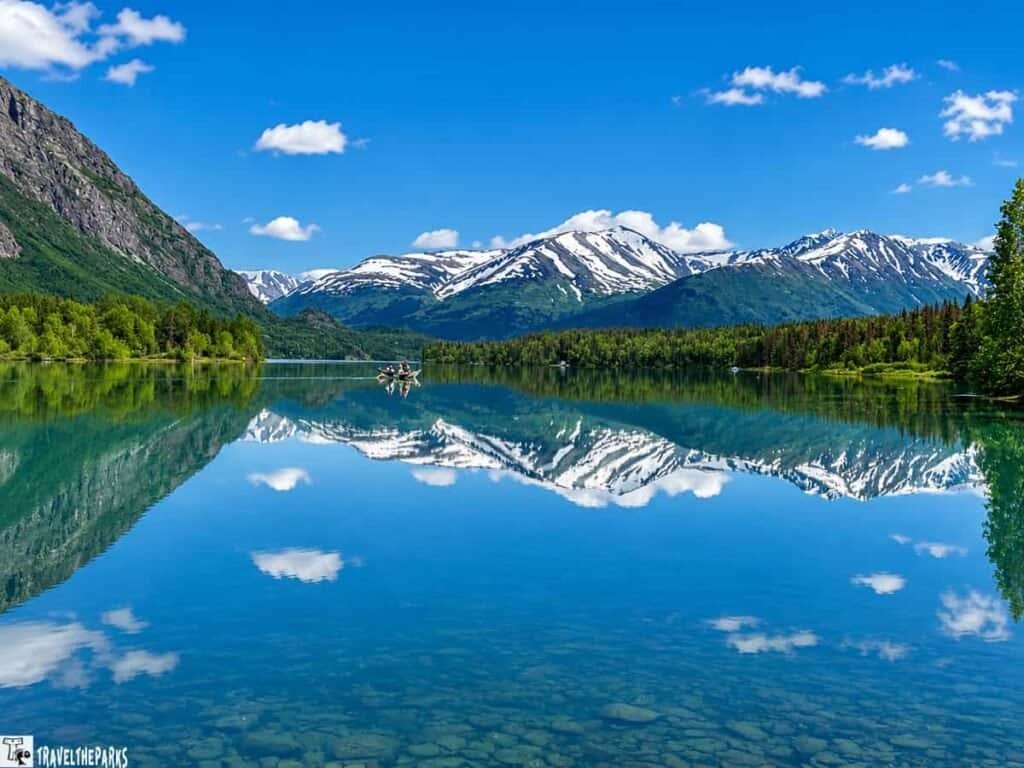
There are few Alaska road trips where the journey is just as memorable as the destination. Driving the Richardson Highway from Valdez to Fairbanks is one of them. Along the way, the highway winds through towering mountains, glacial valleys, rushing rivers, historic roadhouses, and some of the most spectacular scenery in Interior Alaska.
We first traveled the northern portion of the Richardson Highway from Gakona to Fairbanks as part of a larger Alaska road trip itinerary that took us from Wrangell-St. Elias National Park toward Denali National Park. At the time, we explored many of the stops between Gakona and Delta Junction. Since then, we’ve returned to Alaska and completed the entire drive from Valdez to Fairbanks.
From waterfalls and Worthington Glacier near Valdez to the Copper River Valley, Alaska Range, Isabel Pass, and the historic communities around Delta Junction, the Richardson Highway offers something worth stopping for around nearly every bend.
This guide brings together our favorite Richardson Highway stops and attractions, along with the hikes, wildlife encounters, scenic viewpoints, and historic sites that made this one of our favorite Alaska road trips.

This post may contain affiliate links, meaning if you purchase something through one of these links, we may earn a small commission at no extra cost to you! Read the full disclosure policy here
Table of Contents
Valdez to Glennallen: The Scenic Southern Richardson Highway
The southern end of the Richardson Highway begins in Valdez, where the road immediately becomes a scenic adventure. As the highway climbs away from Prince William Sound, it passes through towering mountains, cascading waterfalls, glaciers, and the rugged landscape of the Chugach Mountains before entering the Copper River Valley.
We spent time exploring this section on our return to Alaska, finally completing the portion of the Richardson Highway we had missed on our earlier trip. Some of the most memorable stops are clustered between Valdez and Thompson Pass, making this one of the most scenic sections of the entire highway.
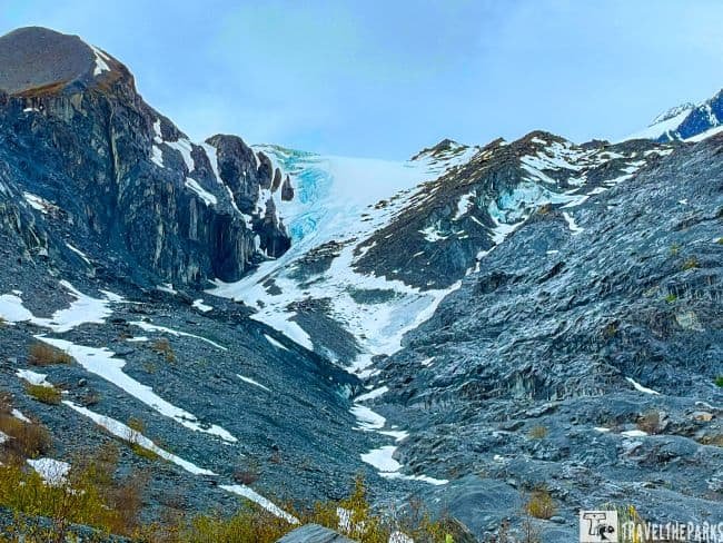
Worthington Glacier
Worthington Glacier is one of the easiest glaciers to experience along the Richardson Highway. The recreation site sits just off the highway, with a viewing area and a trail leading toward the glacier. When we visited, snow still covered much of the trail, and we had the place almost entirely to ourselves.
Thompson Pass
From Worthington Glacier, the highway climbs toward Thompson Pass, one of the highest points on the Richardson Highway. The pass is famous for its incredible snowfall and dramatic mountain scenery. Even in late spring, we found plenty of snow remaining at the higher elevations.
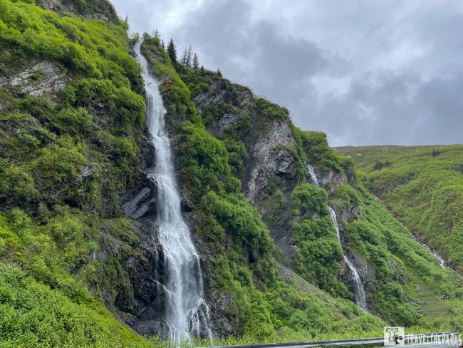
Keystone Canyon
The drive through Keystone Canyon is another highlight. Towering cliffs surround the highway while waterfalls cascade down the mountainsides, particularly during the spring snowmelt. We stopped at both Bridal Veil Falls and Horsetail Falls, two of the most impressive roadside waterfalls along this stretch.
The canyon also has an interesting connection to Alaska’s early transportation history, including the old railroad tunnel near the Lowe River. It’s an easy stop that adds a little history to an already spectacular drive.
Want to explore Valdez in more detail? Our One Day in Valdez itinerary covers Worthington Glacier, Thompson Pass, Keystone Canyon, Bridal Veil Falls, Horsetail Falls, the Old Railroad Tunnel, and more.
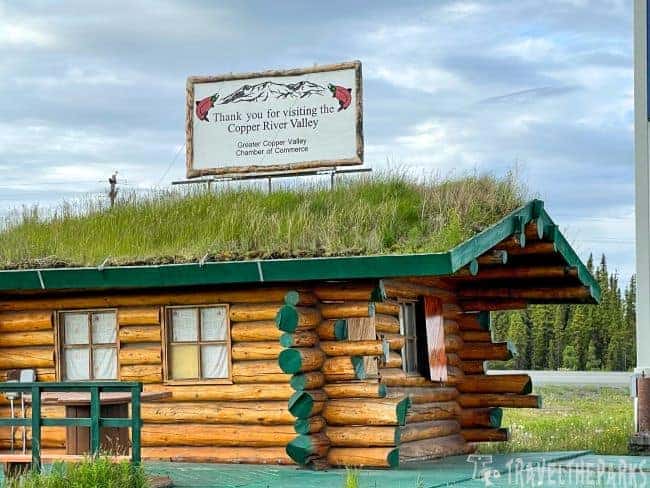
The highway continues north from Keystone Canyon, leaving the steep walls and waterfalls behind as the landscape gradually opens into the Copper River Valley. The dramatic Wrangell Mountains begin to dominate the horizon, and the road takes on a different character as you move farther into Interior Alaska.
Copper River Valley
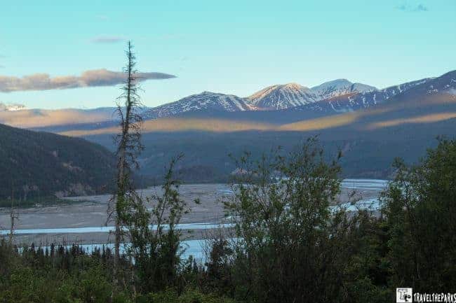
The Copper River is one of the defining features of this region. Its broad, braided channels wind through the valley, creating important habitat for salmon and other wildlife. The river also played a major role in Alaska’s early transportation and mining history.
We continued through the valley toward Glennallen, stopping along the way to take in the mountain views. Even with overcast skies, the landscape was impressive. The combination of wide-open valleys, rushing rivers, and distant snow-covered peaks made this one of our favorite stretches of the highway.
Glennallen: Gateway to Wrangell-St. Elias
Glennallen is an important crossroads on the Richardson Highway and a convenient place to refuel and stock up before continuing north. It’s also a gateway to Wrangell-St. Elias National Park and Preserve, the largest national park in the United States.
The Glenn Highway meets the Richardson Highway here, while the Edgerton Highway leads toward Chitina and the McCarthy Road into Wrangell-St. Elias. We included the park in our Alaska road trip and quickly realized that this enormous wilderness deserves several days rather than a quick stop.
Read our complete Wrangell-St. Elias National Park guide for more on exploring this incredible part of Alaska.
The Richardson Highway eventually reaches Glennallen, where it meets the Glenn Highway. This is an important crossroads for an Alaska road trip, with travelers able to continue north toward Fairbanks or west toward Anchorage. Check out our Glenn Highway guide if you’re continuing west from Glennallen.

Gakona to Paxson: Rivers, Wildlife and Wilderness
Leaving Glennallen, the Richardson Highway continues north through a landscape of lowland forests, wetlands, rivers, and open valleys. This is where the road begins to feel increasingly remote, with plenty of opportunities to watch for moose and other wildlife along the way.
Gulkana River
The Gulkana River is one of the highlights of this section of the Richardson Highway. Known for its clear water and excellent fishing, the river supports rainbow trout, Arctic grayling, and several species of salmon.
We stopped at the Gulkana River to try our luck fishing, but the water was running high and fast during our visit. After a few casts, we decided the conditions weren’t ideal and continued north. Even without catching a fish, it was worth getting out of the RV and spending a little time beside this beautiful river.
For anglers, wildlife watchers, and anyone who enjoys getting off the highway for a while, the Gulkana River is worth adding to your itinerary.
Wildlife tip: This is remote Alaska, and bears are part of the landscape. If you’re hiking or fishing, follow safe wildlife practices and consider carrying bear spray.
Gakona and the Gulkana River on the Richardson Highway
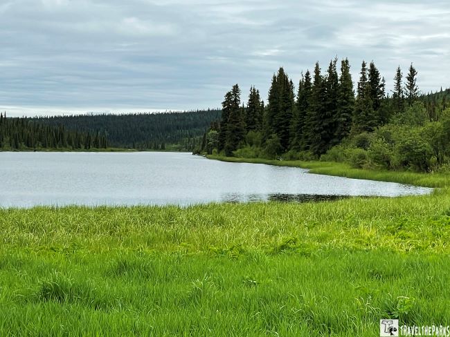
As we approached Gakona, the landscape changed from the broad Copper River Valley to dense black spruce, willow, alder, and dwarf birch. These lowland areas are prime moose habitat, and we spotted several along the highway early that morning, feeding on the grasses, sedges, and shrubs.
Gakona sits at the junction of the Richardson Highway and the Tok Cutoff, making it an important crossroads for travelers exploring this part of Alaska. The Gulkana River is the area’s biggest attraction. Designated a National Wild and Scenic River above the Sourdough area, it is one of Alaska’s popular sportfishing rivers, with salmon returning to its clear waters each year.
The short 0.5-mile Gulkana River Trail is an easy way to stretch your legs and get a closer look at the river. We found the water remarkably clear, with the river winding through the surrounding lowland valley. If you stop here during summer, bring plenty of bug spray. The mosquitoes were thriving on the cloudy day we visited!

Sourdough and Meier’s Lake
Continuing north, we reached Sourdough, where the Gulkana River narrows into a rugged canyon with Class III-IV rapids. The canyon is a popular stretch for rafting, with trips running through the rapids for those looking for a more adventurous way to experience the river.
We watched rafters making their way downstream as we continued along the Richardson Highway. Whitewater rafting is still on our Alaska bucket list, so this was one of those stops that made us think about coming back and giving it a try.
Farther north, we stopped at Meier’s Lake, another opportunity to stretch our legs and enjoy the scenery. The historic Meier’s Lake Roadhouse was one of the original roadhouses along this route, dating to the early 1900s, although it was closed when we visited.
We walked down toward the lake and immediately noticed rainbow trout and Arctic grayling rising to feed on insects along the surface. With more time, we would have stayed to fish, but we still had plenty of Richardson Highway ahead of us.

Paxson Junction and Summit Lake
Paxson Junction marks an important crossroads on the Richardson Highway, where travelers can turn onto the remote Denali Highway. From here, the landscape becomes increasingly wild as the road continues toward the Alaska Range.
The Gulkana River has its headwaters near Summit Lake before flowing south through the Copper River Valley. As we continued north, the Alaska Range remained in view while tundra grasses, small kettle ponds, and wetlands stretched across the landscape. Many of the ponds provide habitat for trumpeter swans. We spotted several during our drive, although they kept their distance and refused to pose for a photograph.
Gulkana River Salmon Spawning Viewpoint
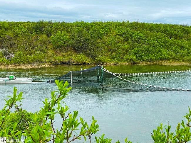
The Gulkana River Salmon Spawning Viewpoint is an easy roadside stop with a viewing platform, informational signs, and restrooms. We stopped here for a snack and enjoyed the views across the river toward the surrounding mountains.
The Trans-Alaska Pipeline parallels the Richardson Highway through this area, providing another reminder of the importance of this remote corridor to Alaska’s history and economy. Ground squirrels were everywhere around the alders, providing plenty of entertainment as they chased one another around the viewpoint.
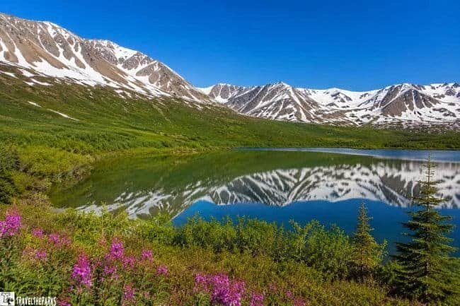
Summit Lake
The highway continues around Summit Lake, surrounded by the rugged landscape of the Alaska Range. The area is best known for its dramatic winter scenery and the annual Arctic Man snowmobile competition, which attracts competitors and spectators to the region.
For us, the real attraction was simply being surrounded by such a vast, remote landscape. From here, the Richardson Highway continues toward some of the most spectacular scenery of the entire drive, including Isabel Pass and the Alaska Range.
Richardson Highway Crossing the Alaska Range
From Summit Lake, the Richardson Highway climbs toward Isabel Pass, where the road crosses the Alaska Range. The scenery becomes even more dramatic here, with rugged peaks, glaciers, and broad alpine landscapes surrounding the highway.
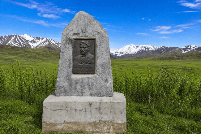
Richardson Monument
We stopped at the Richardson Monument, which honors Captain Wilds P. Richardson, an early director of the Alaska Road Commission who played an important role in developing Alaska’s transportation routes.
The monument also provides outstanding views toward Gulkana Glacier and the surrounding Alaska Range. Interpretive signs tell the stories of the early travelers who crossed Isabel Pass, including women who made the difficult journey north during Alaska’s gold rush era.

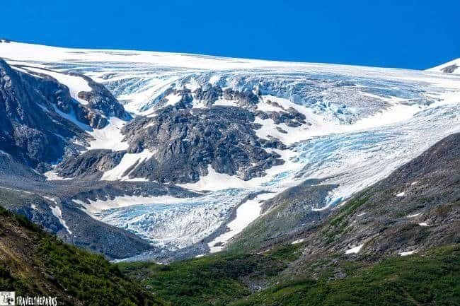
Gulkana Glacier
For a closer look at the glacier, we took the turnoff to the Gulkana Glacier trailhead. The access road is gravel, and the trail begins after crossing a suspension bridge over Phelan Creek.
We didn’t complete the entire hike. After about 1.5 miles, we turned around because the trail was muddy and covered with loose scree. The bridge was also a little unnerving, so we took our time crossing it.
Even though we didn’t reach the glacier’s toe, the views were worth the effort. The icy blue and white glacier stood out against the rugged mountains and green landscape, creating one of the most memorable views of our drive.
If you plan to hike this trail, come prepared for changing conditions. Waterproof hiking boots and trekking poles would be useful, especially when the trail is muddy or covered with loose rock.
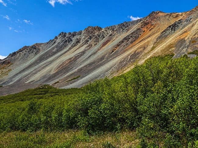
Rainbow Ridge
Just north of Isabel Pass, Rainbow Ridge was one of the most striking stretches of scenery we encountered along the Richardson Highway. The colorful mountainsides rise dramatically beside the road, with bands of reds, greens, yellows, and softer pastel shades creating a landscape that almost doesn’t look real.
The ridge reaches roughly 6,000 feet and gets its name from the vivid colors displayed across its slopes. The combination of volcanic rock, siltstone, and sandstone creates the unusual patterns and colors that make this such a memorable stretch of the drive.
There isn’t much to do here beyond stopping to admire the scenery, but that’s exactly the point. Slow down, take in the views, and have your camera ready. Rainbow Ridge is one of those Richardson Highway sights you won’t want to rush past.
Denali Fault and Pipeline Viewpoint
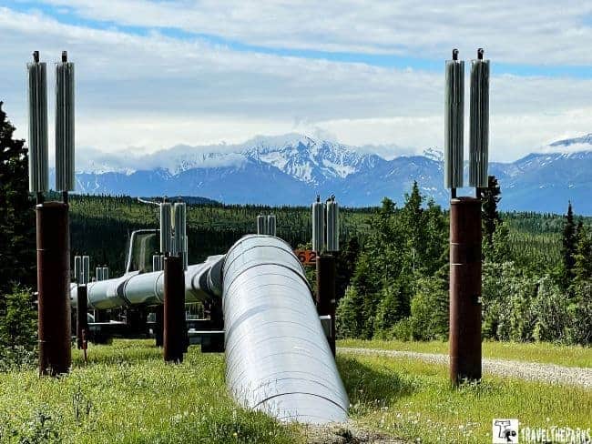
Just north of Rainbow Ridge, the Denali Fault and Pipeline Viewpoint offers another reason to pull off the Richardson Highway. The Trans-Alaska Pipeline System stretches roughly 800 miles from Prudhoe Bay on Alaska’s North Slope to the ice-free port of Valdez.
The viewpoint combines spectacular views of the Alaska Range with an interesting look at the engineering behind this massive project. Interpretive displays explain how the pipeline was constructed, including the system designed to allow the pipeline to withstand earthquakes and shifting ground. Standing beside the pipeline, it is hard not to appreciate the scale of the project and the challenges involved in building it across such remote terrain.
From here, the Richardson Highway gradually descends toward the Delta River, an important tributary of the Tanana River. The rugged peaks of the Alaska Range begin to give way to broader valleys as we continue toward Delta Junction.
Fort Greely
We passed Fort Greely, a U.S. Army installation established during World War II as a cold-weather training and testing facility. Named for Major General Adolphus Greely, the installation continues to support cold-weather military testing and training today.
For travelers driving the Richardson Highway, Fort Greely is primarily a landmark along the route rather than a typical sightseeing stop. Its presence, however, is another reminder of how important this remote stretch of Alaska has been for transportation, military operations, and Arctic research.
Explore Delta Junction: Historic Stops Along the Richardson Highway
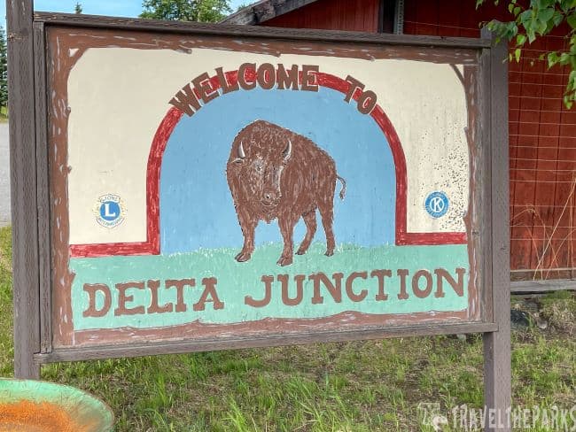
After crossing the Alaska Range, Delta Junction was the perfect place for a break. Located at the junction of the Richardson and Alaska highways, this small Interior Alaska community has a fascinating history and several worthwhile stops.
Delta Junction Visitor Center
Our first stop was the Delta Junction Visitor Center, where we found information about the area’s history, agriculture, and surrounding communities. The town sits within the fertile Delta River floodplain, which supports agriculture despite the region’s harsh climate.
Outside the visitor center, interpretive displays highlight local history, along with some fun roadside attractions, including giant mosquito sculptures and a cutout representing the Trans-Alaska Pipeline.
Inside, the visitor center has a small gift shop and knowledgeable staff who can provide maps, brochures, and information about things to see in the area. It’s a worthwhile first stop if you’re exploring Delta Junction or continuing north toward Fairbanks.
Alaska Highway Terminus
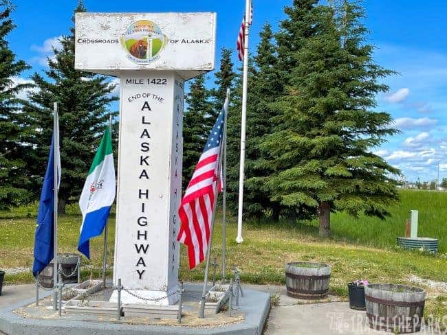
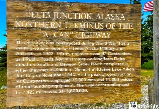
One of the most recognizable stops in Delta Junction is the Alaska Highway Terminus, marking the official end of the historic Alaska Highway. The highway was constructed by the U.S. Army during World War II as a vital supply route connecting the continental United States with Alaska.
The original route stretches roughly 1,400 miles from Dawson Creek, British Columbia, to Delta Junction. From this point, travelers continuing north head toward Fairbanks, while the Richardson Highway leads south toward Valdez.
The monument is a popular photo stop and a fun milestone for anyone who has driven the Alaska Highway. If you’ve completed the journey from Dawson Creek to Delta Junction, you can even get a certificate commemorating the drive.

Sullivan Roadhouse Historical Museum
If you’re interested in Alaska’s early history, the Sullivan Roadhouse Historical Museum is one of the best stops in Delta Junction. Listed on the National Register of Historic Places, the restored roadhouse offers a glimpse into the difficult life of travelers along the old Valdez-Fairbanks Trail.
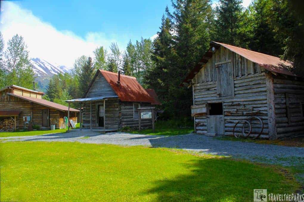
John and Florence Sullivan built the original roadhouse in 1905 along Delta Creek. In those days, roadhouses were essential stops for travelers, stagecoach drivers, prospectors, and others making the long journey into Interior Alaska. They provided food, lodging, warmth, and a place to share news and stories along the trail.
When the trail was rerouted, the Sullivans moved the entire roadhouse several miles to a new location. The building eventually fell into disrepair after automobiles and the railroad made the old trail less important. During World War II, the property became part of the Fort Greely area, which helped preserve some of the original furnishings and artifacts.
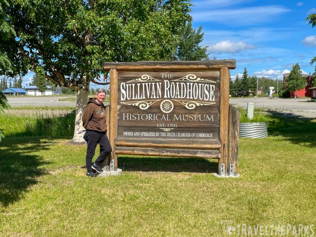
The roadhouse was eventually restored and moved to its present location, where it now serves as a museum. Inside, authentic artifacts, documents, and personal letters help tell the story of the people who lived and traveled along this early Alaska route.
For us, the personal letters were what really brought the history to life. They made it easier to imagine what everyday life was like for the pioneers who traveled through this remote part of Alaska. The docent was also wonderful and offered recommendations for other places to visit during our trip.
The Sullivan Roadhouse has survived an incredible history and is well worth the time if you’re exploring Delta Junction. Best of all, admission is free.
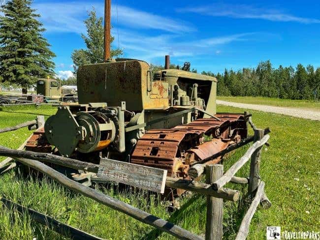
Grab Lunch at Buffalo Center Drive-In
After visiting the Sullivan Roadhouse, we stopped at the Buffalo Center Drive-In, a classic summer drive-in just down the road. It was exactly the kind of roadside stop we love finding on an Alaska road trip.
You order at the window, then your food is brought out to your table or car. The menu features classic burgers, sandwiches, and ice cream, but we went with the Alaska halibut fish and chips. We ate outside and enjoyed both the food and the old-fashioned drive-in atmosphere.
If you’re looking for a casual lunch while exploring Delta Junction, this is a fun stop that feels like a step back into the classic roadside America of the 1950s.
Big Delta State Historical Park
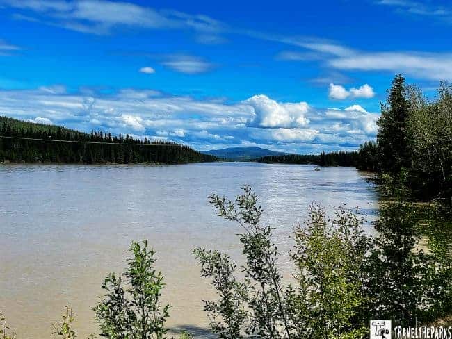
About eight miles north of Delta Junction, Big Delta State Historical Park sits along the Tanana River on the historic Valdez-to-Fairbanks trail. The park offers a fascinating glimpse into the isolation and challenges faced by the travelers, traders, and prospectors who made their way toward the Interior Alaska goldfields.
The 10-acre park includes historic buildings, rustic structures, hiking trails, a picnic area, and an RV campground. We spent about an hour following the self-guided walking tour, which made it easy to explore the historic buildings at our own pace.

One of our favorite stops was the Telegraph Building, constructed in 1907 as part of the Washington-Alaska Military Cable and Telegraph System. The building offered an interesting glimpse into the early communication network that connected this remote part of Alaska with the outside world.
The large barn was another favorite, filled with historic blacksmith tools, horse tack, dog harnesses, sleds, and other artifacts that helped tell the story of life along the old trail.
If you’re traveling the Richardson Highway by RV, the park is especially worth noting because it also offers camping. It’s an easy place to combine history with a short walk and a break from the highway.

Rika’s Roadhouse
Another fascinating piece of the Richardson Highway’s history is Rika’s Roadhouse, located within Big Delta State Historical Park. The original trading post was established along the Valdez-to-Fairbanks trail in the early 1900s, when roadhouses were essential stops for travelers making their way through the remote Interior.
John Hajdukovich purchased the trading post and built a new roadhouse in 1913. He also operated a ferry across the Tanana River, helping travelers continue their journey along the trail. In 1917, he hired Rika Wallen, a Swedish immigrant, to manage the roadhouse. She eventually purchased the property in 1923 and gave it the name it carries today.
Rika’s operated until 1940, serving travelers during a period when the Richardson Highway was still very different from the modern road we drive today. The building was restored in the 1970s and retains much of its historic character. Today, visitors can explore the roadhouse and learn more about the people who depended on these remote stopping places.
Continuing Toward Fairbanks
Leaving Big Delta State Historical Park, the Richardson Highway crosses the Big Delta Bridge and passes beneath the Trans-Alaska Pipeline, which crosses the Tanana River on its own dedicated bridge.
From here, the highway continues north toward Fairbanks, with several recreation areas along the way. Quartz Lake State Recreation Area, Birch Lake State Recreation Site, and Salcha River State Recreation Site all offer opportunities for camping, fishing, boating, and enjoying the outdoors.
For us, the scenery and history gradually gave way to the anticipation of reaching Fairbanks, the northern end of our Richardson Highway journey.

Richardson Highway from Delta Junction to Fairbanks
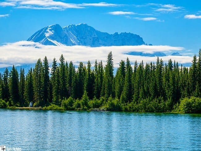
The final stretch of the Richardson Highway carries us north through the broad interior valleys toward Fairbanks. After the rugged mountains and historic communities farther south, the landscape gradually becomes more open as we approach Alaska’s second-largest city.
Eielson Air Force Base
About 25 miles south of Fairbanks, the Richardson Highway passes near Eielson Air Force Base, a major military installation with a long history of cold-weather operations.
Established in 1943 during World War II, the base later played an important role during the Cold War, including supporting aerial refueling operations for B-52 bombers. Today, Eielson remains an important center for Arctic and cold-weather military training and is home to the Air Force’s 354th Fighter Wing.
For travelers, this is primarily a landmark along the highway rather than a sightseeing stop, but its history provides an interesting glimpse into Alaska’s strategic importance.
Chena Lake Recreation Area
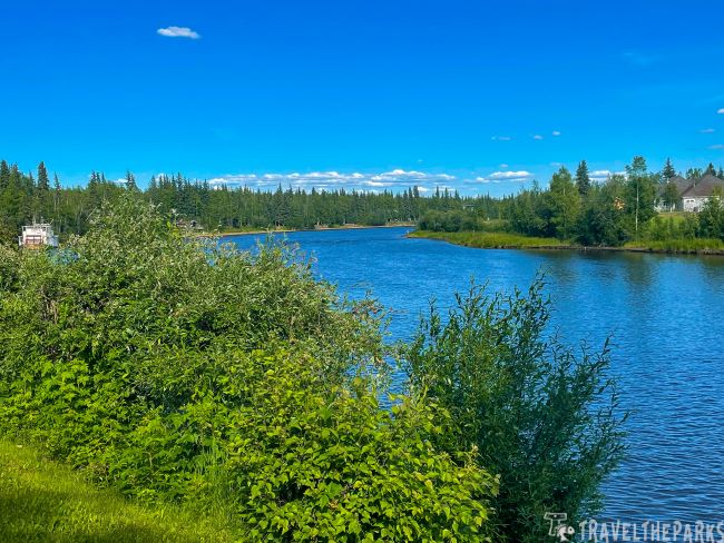
The Chena Lake Recreation Area offers a welcome opportunity to get outdoors before reaching Fairbanks. The area includes lakes, trails, picnic areas, and opportunities for fishing and boating during the summer.
We particularly enjoyed our time fishing for Arctic grayling in the Chena River, which was one of our favorite outdoor experiences around Fairbanks. If you have extra time on your Richardson Highway road trip, this is a good place to slow down and enjoy some of Interior Alaska’s scenery.
Arriving in Fairbanks
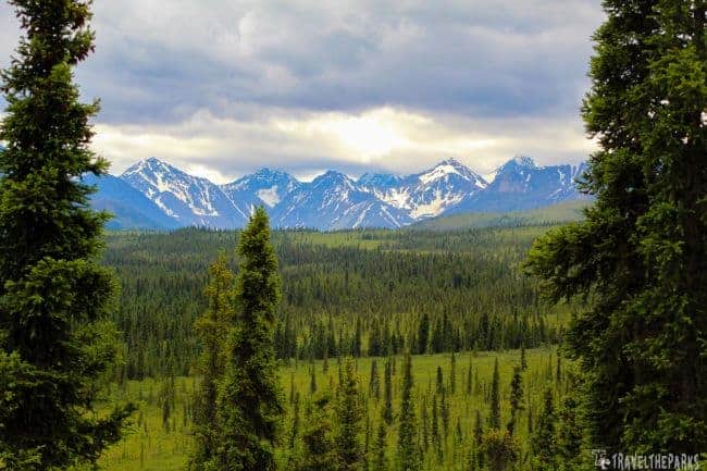
Eventually, the Richardson Highway reaches Fairbanks, marking the northern end of this 368-mile highway journey from Valdez.
For us, arriving in Fairbanks wasn’t the end of our Alaska adventure. It was another jumping-off point for exploring Interior Alaska. From here, travelers can continue toward Denali National Park, head north toward the Dalton Highway, or spend several days exploring Fairbanks and the surrounding area.
After traveling the entire Richardson Highway from Valdez to Fairbanks, we came away with a new appreciation for how much this road has to offer. The glaciers and waterfalls around Valdez, the Copper River Valley, the Alaska Range, historic roadhouses, and the wide-open landscapes of Interior Alaska make this one of the most memorable road trips we’ve taken.

Final Thoughts on the Richardson Highway from Valdez to Fairbanks
After traveling the entire Richardson Highway from Valdez to Fairbanks, we can honestly say the journey is just as memorable as the destinations along the way. From the waterfalls and glaciers surrounding Valdez to the Copper River Valley, the rugged Alaska Range, historic roadhouses, and wide-open landscapes around Delta Junction, there’s something worth stopping for nearly the entire 368-mile drive.
Our first trip covered the northern portion of the highway from Gakona to Fairbanks. When we returned to Alaska and finally drove the southern section from Valdez to Glennallen, it completed the journey and gave us a much better appreciation for the highway as a whole.
The Richardson Highway isn’t simply a road connecting two Alaska cities. It is a journey through some of the state’s most dramatic landscapes and an important part of Alaska’s history. Take your time, get out of the RV, explore the roadside stops, and leave room in your itinerary for the unexpected.
If you’re planning a larger Alaska road trip, be sure to check out our 10-Day Alaska Road Trip Itinerary, where we bring together the routes, national parks, scenic highways, and stops that can help you plan your own adventure.
Have you traveled the Richardson Highway from Valdez to Fairbanks? Which stop was your favorite? Share your experience in the comments below!